From Saturday 24 August till 15 September, 3319.1 kilometers will separate Vilanova de Arousa from Madrid, the city the peloton will reach in 21 stages in the Vuelta a España 2013. As usual, velowire.com allows you to discover in detail the race route of this last Grand Tour of the year, on Google Maps/Google Earth.
With the information in this article you'll get to know all towns and cities which will be visited by this Tour of Spain and it will thus allow you to prepare your visit of this race or simply to better understand the race!
A little bit of preliminary information ...
In this article you'll find all the details of the Tour of Spain 2013, with the race route on Google Maps, the time- and route schedules and the stage profiles, as well as information about the climbs, the sprints, the feeding zones, the exact locations of fictive starts and the "km 0" of each of the stages and the roads the riders will follow in-between and some further useful information to better understand the race route of this Vuelta a España 2013 which will most probably deliver a climber as its winner based on the overall profile of the race!Some housekeeping before you get to discover all details of the different stages of the Vuelta a España 2013:
- as for all contents on velowire.com, its reproduction or any other copy in any form is forbidden, as lined out on the copyright page. Please respect the time spent on the preparation of contents like these!
- due to a lack of time the stage profiles have not -as usual- been generated automatically based on altitude information available for the places the race visits as available in the Google Maps files but they were taken from what the race organisor provides; please let me know in a comment if you'd prefer to see the automatically generated versions in order to check whether they correspond to the official profiles of the race!
The race route of the Vuelta a España 2013 on Google Maps
Let's now discover all details of the Vuelta a España 2013 race route, stage by stage:CONTINUE READING AFTER THIS ADVERTISEMENT
1/ Saturday 24 August 2013 - Vilanova de Arousa > Sanxenxo - team time trial - 27.4 km
As usual, this Tour of Spain starts off with a team time trial and this will take place at night since the first team will leave at 6.48PM while the last one will get off the start ramp close to the sea at 8.12PM for a little bit under half an hour of racing against the clock.The flat race route will bring the different teams in the area just north of Portugal from Vilanova de Arousa to Sanxenxo a bit further south, in 27.4 kilometers.
Hereunder you'll find the time- and route schedule, the profile and the race route of this stage on Google Maps. Click on the images to open them. For each of these maps you can click on every icon shown on the map to see further details about the selected point (climbs, sprints, feeding zones, starts, finishes).


2/ Sunday 25 August 2013 - Pontevedra > Baiona - Alto do Monte da Groba - 177.7 km
The second stage of the Vuelta a España 2013 will start in Pontevedra and follow the coast line southwards down to A Ramallosa, via Vigo, where they'll go a bit more landinwards to go find the first climb of this race, the Alto de San Cosme, of the 3rd category and the sprint in Ponteareas. Direction south from there, down to the border with Portugal, which the riders will follow towards the most south-western part of Spain where they'll find the sprint in A Guarda. From there, they will again follow the coast line up to Baiona where they go back north for the climb towards the finish on top of the Alto do Monte da Groba, first 1st category climb of this race.Hereunder you'll find the time- and route schedule, the profile and the race route of this stage on Google Maps. Click on the images to open them.


3/ Monday 26 August 2013 - Vigo > Mirador de Lobeira / Valagarcía de Arousa - 184.8 km
While the riders already visited Vigo in the previous stage, they'll start from there in this 3rd stage, for almost 185 kilometers towards Valagarcía de Arousa, close to the initial team time trial, where the finish will be on top of Mirador de Lobeira, 3rd category climb.Two sprints will bring some variation in the pretty flat part of this 3rd stage, one in A Escusa and the other one in a small detour on the Illa de Arousa.
Hereunder you'll find the time- and route schedule, the profile and the race route of this stage on Google Maps. Click on the images to open them.


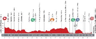
4/ Tuesday 27 August 2013 - Lalín / A Estrada > Fisterra - La etapa del fin del mundo - 189 km
This 4th stage is nicknamed the end of the world stage due to the place where it will finish in Fisterra on the landslide which is often the final destination of pelgrims who visit Santiago de Compostela.The start of this stage will be in Lalín and the riders will also go off to Santiago de Compostela. To get there, they do a little detour via A Estrada, which allowed this city's name to be part of the stage title, before they battle for the first sprint in Vedra. Once they get in Santiago, they'll continue their trip in the same direction, towards Mazaricos and via the feeding zone of this stage, before they go on in south-western direction where they'll find the coast close to Quilmas where they'll battle for the second intermediate sprint.
They'll then first follow the coast line before they go landinwards to climb up Mirador de Ézaro, 3rd category climb. Direction Fisterra from there where they'll battle for the stage win.
Hereunder you'll find the time- and route schedule, the profile and the race route of this stage on Google Maps. Click on the images to open them.


CONTINUE READING AFTER THIS ADVERTISEMENT
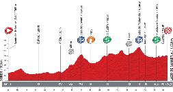
5/ Wednesday 28 August 2013 - Sober > Lago de Sanabria - 174,3 km
After the start from Sober, this 5th stage starts flat down to A Rua where the riders will go south for a more hilly part, with the climb of the Alto do Covelo (3rd category), via the feeding zone and the sprint in Puebla de Sanabria. The race will then continue east, via the Alto de Padornelo, also 3rd category.After the sprint in Puebla de Sanabria, the riders will go up further north, towards the finish next to a lake, the Lago de Sanabria.
Hereunder you'll find the time- and route schedule, the profile and the race route of this stage on Google Maps. Click on the images to open them.


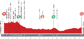
6/ Thursday 29 August 2013 - Guijuelo > Cáceres - 175 km
The 6th stage will be more suited for the sprinters between Guijuelo and Cáceres over a distance of 175 kilometers. These sprinters will already have had the opportunity to measure their forces in the intermediate sprints in Puerto de Béjar and in Grimaldo.Hereunder you'll find the time- and route schedule, the profile and the race route of this stage on Google Maps. Click on the images to open them.


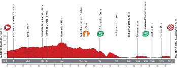
7/ Friday 30 August 2013 - Almendralejo > Mairena del Aljarafe - 205.9 km
A bit further south, this 7th stage, between Almendralejo and Mairena del Aljarafe forms an almost straight line which is no less than almost 206 kilometers long!Its profile is not much different from the one for the previous stage and it again contains two intermediate sprints: in El Ronquillo and in Mairena del Aljarafe at the first crossing of the finish line, which will be followed by a short circuit which visits Sevilla.
Hereunder you'll find the time- and route schedule, the profile and the race route of this stage on Google Maps. Click on the images to open them.


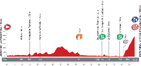
8/ Saturday 31 August 2013 - Jerez de la Frontera > Estepona - Alto de Peñas Blancas - 166.6 km
This second weekend of the Vuelta a España 2013 will start with a stage which has a quite flat profile, but which finishes on top of a 1st category climb.After the start in Jerez de la Frontera, the riders will first go towards Arcos de la Frontera, east, before they continue south-east towards the coast line where they'll dispute the two intermediate sprints of this stage, in San Enrique de Guadiaro and in Estepona.
This city gave its name to the finish of this stage, but after this sprint the riders will rapidly get on the final climb towards the finish on top of the Alto de Peñas Blancas.
Hereunder you'll find the time- and route schedule, the profile and the race route of this stage on Google Maps. Click on the images to open them.


CONTINUE READING AFTER THIS ADVERTISEMENT
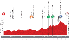
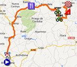
9/ Sunday 1er September 2013 - Antequera > Valdepeñas de Jaén - 163.7 km
On this first day of September the stage will have an easier profile in the Tour of Spain 2013, starting in Antequera.Two intermediate sprints, quite close to each other and not that far from the stage finish, will take place in Castillo de Locubín and in Alcalá la Real, followed by the only climb of this stage, the Alto de los Frailes, of the 2nd category. The finish will be in Valdepeñas de Jaén.
Hereunder you'll find the time- and route schedule, the profile and the race route of this stage on Google Maps. Click on the images to open them.

10/ Monday 2 September 2013 - Torredelcampo > Güéjar Sierra - Alto de Hazallanas - 186.8 km
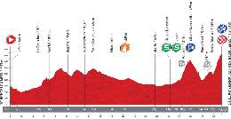
Even though the weekend is over and the TV audience thus goes back down to its weekday level, this 10th stage on Monday 2 September offers a more interesting profile in the final part of the stage.Indeed, while the first 3 quarters of the stage will not be exceptional, it's only after the two sprints (Granada and a bit further) that the riders will start the climb of the Alto de Monachil, of the first category, of which the descent will be followed by the first signs of the final climb of the Alto de Hazallanas, outside category climb where they'll get via Güéjar Sierra.
Hereunder you'll find the time- and route schedule, the profile and the race route of this stage on Google Maps. Click on the images to open them.


R1/ Tuesday 3 September 2013
After these 10 stages, the riders will finally have the chance to get their first rest day. The day before they have a big transfer on the programme however since they'll come from almost the extreme south of Spain and will have to go up to the north of the country to get closer to the start of the 11th stage.11/ Wednesday 4 September 2013 - Tarazona > Tarazona - individual time trial - 38.8 km
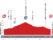
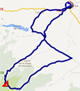
The first and last individual time trial of this Tour of Spain will start and finish in Tarazona.Halfway this individual effort, each rider will get on a 3rd category climb, the Alto del Mocayo.
Hereunder you'll find the time- and route schedule, the profile and the race route of this stage on Google Maps. Click on the images to open them.

CONTINUE READING AFTER THIS ADVERTISEMENT
12/ Thursday 5 September 2013 - Maella > Tarragona - 164.2 km
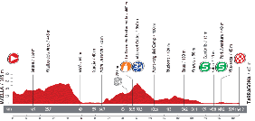
The 12th stage, starting in Maella, will contain only one difficulty, of the 3rd category, the Alto del Collet, and the two usual intermediate sprints, at the end of the stage, in Cambrils and in Port Aventura.Rapidly after that, the riders will find the finish line in Tarragona, where it could again be a sprinter who celebrates his victory!
Hereunder you'll find the time- and route schedule, the profile and the race route of this stage on Google Maps. Click on the images to open them.


13/ Friday 6 September 2013 - Valls > Castelldefels - 169 km
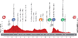
The climbers will again show up in front in this 13th stage between Valls and Castelldefels beecause this stage immediately starts off with a 3rd category climb, the Coll de la Torreta, before the start -at the 115th kilometer (and after having crossed the finish city)- the climb of the Alto del Rat Peñat, 1st category climb.In the loop around the finish city we'll not only find this climb but also the two intermediate sprints, in Les Botigues de Sitges and in Sant Pere de Ribes. At the end of this loop, the finish will be on the Plaça del Castell in Castelledefels, at the foot of the castle.
Hereunder you'll find the time- and route schedule, the profile and the race route of this stage on Google Maps. Click on the images to open them.

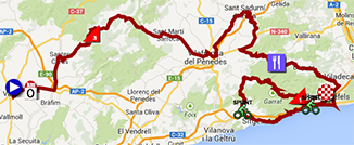
14/ Saturday 7 September 2013 - Bagà > Andorra - Collada de la Gallina - 155.7 km
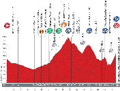
This 3rd Saturday a heavy stage will be on the programme of this Vuelta a España 2013, between Bagà and the Collada de la Gallina in Andorra: once the riders get to Andorra they'll have quite some climbing to do. First of all the Port de Envalira, outside category, after which the riders will go in opposite direction for the descent towards the foot of the Coll de Ordino followed by the Alto de la Comella, both 2nd category. At the south-western limit of Andorra, the riders will then climb towards the finish on top of the Collada de la Gallina, 1st category.Hereunder you'll find the time- and route schedule, the profile and the race route of this stage on Google Maps. Click on the images to open them.

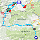
15/ Sunday 8 September 2013 - Andorra > Peyragudes - 224.9 km
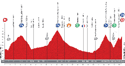
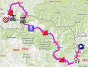
The second stage of this weekend will not be easy either because in Spain, after the start from Andorra, the riders will climb the Puerto del Cantó and the Puerto de la Bonaigua, both 1st category, before they continue with some further climbs in France!Indeed, after having crossed the border, they'll get on the Col du Port de Balès (1st category), followed by the final climb towards Peyragudes (also 1st category), finish location which was chosen to honour the 100th edition of the Tour de France which took place this year.
Hereunder you'll find the time- and route schedule, the profile and the race route of this stage on Google Maps. Click on the images to open them.

CONTINUE READING AFTER THIS ADVERTISEMENT
16/ Monday 9 September 2013 - Graus > Sallent de Gállego - Aramón Formigal - 146.8 km
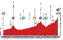
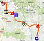
This 16th stage, first one of the last week of the Vuelta a España 2013 is short but that doesn't mean it's easy. Indeed, after the start from Graus, the riders will have to climb the Puento de la Foradada, a 3rd category climb which will have its summit after 26.2 kilometers, and in the second half of the stage the Puerto de Cotéfablo of the 2nd category and finally the mountain top finish, on top of the Aramón Formigal, 1st category climb close to Sallent de Gállego.Hereunder you'll find the time- and route schedule, the profile and the race route of this stage on Google Maps. Click on the images to open them.

R2/ Tuesday 10 September 2013
After this stage, the riders will enjoy the second rest day, again with a transfer towards a place close to Tarazona, the place where the individual time trial took place a week before.17/ Wednesday 11 September 2013 - Calahorra > Burgos - 189 km
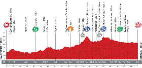
That's because this 17th stage will start in Calahorra, a little bit north of Tarazona. It'll be a calm comeback to racing after this second rest day, with a sprint in Logroño, two 3rd category climbs in the second half of the stage, the Alto de Pradilla and the Alto de Valmala, before the second intermediate sprint, in Ibeas de Juarros, not far from the finish in Burgos.Hereunder you'll find the time- and route schedule, the profile and the race route of this stage on Google Maps. Click on the images to open them.


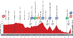
18/ Thursday 12 September 2013 - Burgos > Peña Cabarga - 186.5 km
Even though we're getting closer to the end of this Vuelta, that doesn't mean that the stages will get any easier. Three 3rd category climbs, the Alto de Bocos, the Alto Estacas de Trueba and the Puerto de la Braguía, one 2nd category climb, the Alto del Caracol and the final climb towards the mountain top finish on Peña Cabarga, 1st category climb.Hereunder you'll find the time- and route schedule, the profile and the race route of this stage on Google Maps. Click on the images to open them.


CONTINUE READING AFTER THIS ADVERTISEMENT
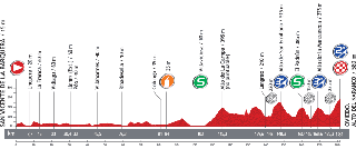
19/ Friday 13 September 2013 - San Vicente de la Barquera > Oviedo - Alto del Naranco - 181 km
The first half of this 19th stage is flat, from the start in San Vicente de la Barquera till the sprint in Villaviciosa. The riders will then climb the Alto de la Campa which will not give any points for the King of the Mountains classification.43 kilometers further they'll climb the Alto de San Emiliano, of the 3rd category, followed by the sprint in El Padrún and the climb of the Alto de la Manzaneda, also 3rd category. The finish in Oviedo will again be a mountain top finish, on the Alto del Naranco, of the 2nd category.
Hereunder you'll find the time- and route schedule, the profile and the race route of this stage on Google Maps. Click on the images to open them.

20/ Saturday 14 September 2013 - Avilés > Alto de l'Angliru - 142.2 km
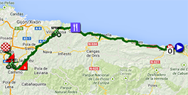
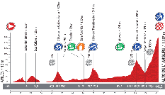
Pretty much come the short forelast stage of the Tour de France 2013 with a mountain top finish on top of the Mont Semnoz close to Annecy, this forelast stage of the Tour of Spain will also be short and will end on the very difficult Alto de l'Angliru (12.2 km at 10.2%), outside category climb.Before that climb, the riders will start in Avilés and climb the Alto de la Cabruñana of the 3rd category which will have its summit after a bit over 45 kilometers, followed by the sprint in Trubia and by the climb of the Alto de Tenebredo of the 2nd category. After the sprint in Mieres, the final part of this stage will not only contain the difficult climb towards the finish line but also, just before that, the Alto del Cordal of the 1st category!
Hereunder you'll find the time- and route schedule, the profile and the race route of this stage on Google Maps. Click on the images to open them.

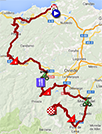
21/ Sunday 15 September 2013 - Leganés > Madrid - 109.6 km
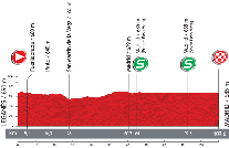
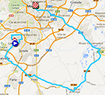
The last stage which finishes in Madrid is always a bit particular. Everyone's happy that it comes to an end but the next day it will give a strange feeling anyway that there's no new stage start. The riders will celebrate the end of the Tour of Spain on the roads of this last stage, with a glass of champagne in their hands! This year, the stage is not even 110 kilometers long, including the 9 laps on the final circuit. The start of this stage will be in Leganés.Hereunder you'll find the time- and route schedule, the profile and the race route of this stage on Google Maps. Click on the images to open them.

The Tour of Spain 2013 race route in Google Earth
Do you prefer to see the complete race route of the Vuelta a España 2013 on one single map? Or would you like to do a virtual fly-over of one of more of the stages of this Tour of Spain? That's possible by downloading the KML file below and opening it with Google Earth:>> Download the race route of all stages of the Tour of Spain 2013 in Google Earth

Vond u dit artikel interessant? Laat het uw vrienden op Facebook weten door op de buttons hieronder te klikken!
9 comments | 35522 views
this publication is published in: OpenStreetMap/Google Maps/Google Earth | Vuelta a España | Vuelta a España 2013


 by Dany45 over
Merci et bravo, encore du très bon boulot. Bonne Vuelta à tous.
salut je peux aller voire 2 etape de se tour d espagne
samedi 7 septembre 2013 - Bagà > Andorra - Collada de la Gallina - 155,7 km
dimanche 8 septembre 2013 - Andorra > Peyragudes - 224,9 km
Bonjour Thomas et merci pour cette présentation,
Sans doute une question stupide mais à quoi correspondent les pastilles en gris avec 'CP' inscrit dedans?
Concernant le parcours, on aime ou on aime pas, mais une chose est sure, la course promet d'etre animée.
Super, cette présentation ! Du beau boulot de PRO.
Merci Thomas.
@marc & Dom & Pierre CROLAIS, ça fait plaisir de lire vos remerciements :). Surtout que je vous avoue avoir eu des doutes un moment sur ma capacité à publier le tout à temps ;-).
@philou : vous en avez de la chance :-)
@Dom : il n'y a pas de questions stupides, il n'y a que des réponses stupides ! Les pastilles en gris avec "CP" inscrit dedans correspondent au début des montées, le CP correspondant à -si je ne me trompe pas, mon espagnol n'est malheureusement pas au niveau de mon français :-(- comienzo puerto, donc début de montée. Dans les itinéraires horaires on retrouve la mention correspondante, "C. Pto.".
Personnellement je trouve ça très bien de mentionner ces informations dans les itinéraires horaires et dans les profils puisqu'au moins ça permet de comprendre à partir d'où on commence à compter la longueur et la pente d'un col ou d'une côte.
@ Thomas : En effet, ça parait évident. Mais une fois qu'on le sait!
Autre question! : les sprints intermédiaires (S en en vert) comptent pour le classement du maillot vert ou pour un maillot spécifique?
Bonjour Thomas,
que penses de l'étape empruntant le port Envalira dans le même sens pour la montée et la descente. Après la comédie du pont coupé en 2 d'aujourd'hui, je me demande si on ne risque pas d'avoir un chassé croisé dans ce col. La boucle du sommet est elle assez longue pour empêcher ce type de problème?
Désolé de ne vous répondre que maintenant, n'ayant pas eu le temps de le faire pendant le Tour Poitou-Charentes.
@Dom : les sprints intermédiaires attribuent des points pour le classement par points (4/2/1 points au sprint intermédiaire alors qu'à l'arrivée de l'étape c'est 25/20/16/14/12/10/9/8/7/6/.... points) et donc pour le maillot vert. Par ailleurs, ces sprints intermédiaires attribuent des bonifications (3/2/1 secondes).
@Olivier73 : j'y ai pensé effectivement en dessinant la carte, d'autant plus que la voie du retour se fait en descente et sera donc beaucoup plus rapide que la montée et que les routes se croisent assez vite. Soit l'organisateur coupe la route en deux, avec une voie aller et une voie retour, soit ça risque effectivement de poser des problèmes !
La route fait trois voies, elle semble suffisamment large effectivement pour une coupure en deux. Mais je me dis qu'entre le passage au sommet, le début de descente, le passage dans le tunnel, il va s'écouler une bonne dizaine de minutes, pour que les coureurs reviennent sur leur pas.
De surcroit, du côté andorran, entre la bifurcation avec le tunnel et le sommet il y a environ 4km, 3km de descente puis 3km de tunnel, on peut tabler entre 17 et 20 minutes en tout pour revenir à ce point de bifurcation initial, cela devrait le faire ;)