While the French cycling season is starting up again in March (after some first races in February) Paris-Nice or "the race to the sun" is on the programme starting this Sunday 8 and going on until Sunday 15 March 2020. 8 stages, including one individual time trial halfway the week, will bring the 136 riders of 17 teams from Plaisir to Nice in about 1220 kilometers traveling all the way from Paris down to the south of France.
As usual, velowire.com allows you to discover the race route on extremely detailed maps, based on Open Street Maps but also available for download in Google Earth, so you can do - if you want to - a virtual fly-over on one or several stages of Paris-Nice 2020.
The organisation of Paris-Nice is a bit disturbed this year due to the COVID19 / coronavirus health situation. Therefore, several mesures will be taken in order to limit the propagation risk of the virus related to the race. For example, the hotel booking have completely been rearranged the past few days, in order to host a maximum of two teams at the same hotel. The procedures at the start have also been modified in order to allow the riders to stay longer in the team buses, which will no longer be accessible by the public (more barriers, no interview with the race speaker, etc.). Also, the ceremony during which the different jerseys are being handed out will be reduced to a minimum and the daily press conference after each stage has been cancelled.
A.S.O. thus applies the recommendations from the French Sports Ministry and of the National professional Cycling League (Ligue Nationale de Cyclisme or LNC) which it has published on its social networks:
The Paris-Nice 2020 race route on Open Street Maps
Let's now discover all the details of the Paris-Nice 2020 race route, the 78th edition of Paris-Nice, stage by stage:CONTINUE READING AFTER THIS ADVERTISEMENT
1/ Sunday 8 March 2020 - Plaisir > Plaisir - 154 km
The first stage of Paris-Nice 2020 will start ... but also finish in Plaisir in the Yvelines department. Indeed, it's already the 11th time in row that Paris-Nice starts from the Yvelines, thanks to a partnership which was recently resigned between the organisor of the race, Amaury Sport Organisation (A.S.O.), and the Yvelines department. Even without this partnership, for this 78th edition of the race, it would have been a good idea to start here, because this department in France has the official number (for postal codes and so on) .. 78!From Plaisir, the riders will go slightly south and get onto the Côte des Mesnuls and then go up north again in order to discover the Yvelines department towards the west. Close to Houdan they'll change directions and go on north towards Septeuil, where they'll turn again, this time towards the east.
Via Neauphle-le-Château and the 3rd category climb with the same name, the Côté de Neauphle-le-Château, they'll go back towards Plaisir but they'll turn left instead of directly going to the finish line. They'll get into the feeding zone in Plaisir and continue north till Bazemont.
They'll continue this loop getting close to the routes which they previously took to get back to Plaisir, via the intermediate sprint in Montainville and another one in Beynes before they get back on the race route they previously followed, just before another climb of the Côte de Neauphle-le-Château. Back in Plaisir, they'll this time turn right, towards the finish line which will be drawn in the Avenue Marc Laurent.
Hereunder you'll find the time- and route schedule, the stage profile and the detailed map on Open Street Maps for this stage. Click on the images to open them.


2/ Monday 9 March 2020 - Chevreuse > Chalette-sur-Loing - 166,5 km
The second stage will start in "the place-to-be" for Parisian cyclists (due to the presence of some more important altitude differences than elsewhere around Paris), Chevreuse. After having visited the Regional Natural Park of the Chevreuse Valley, the riders continue their trip direction north-east and some upfollowing climbs, starting with the Côte des Loges, the intermediate sprint in Marchais and, after turning around the city of Etampes, two other 3rd category climbs, the Côte de Bouville and the Côte du Pressoir, before they get in the feeding zone in Milly-la-Forêt.A bit further they'll find the second intermediate sprint, in Puiselet, close to Nemours. They'll then go on towards the finish in Chalette-sur-Loing.
Hereunder you'll find the time- and route schedule, the stage profile and the detailed map on Open Street Maps for this stage. Click on the images to open them.


3/ Tuesday 10 March 2020 - Chalette-sur-Loing > La Châtre - 214 km
In the finish city of the previous stage, Chalette-sur-Loing, we'll also see the start of the the third stage, direction north-west this time. After the sprint in Châtillon-Coligny, the race will go on to the Cher department, where the riders will climb the Côte de la Chapelotte and get some new energy in the feeding zone in La Chapelotte, before they'll go around the city of Bourges on the west side.Once they get in the Indre department, the riders will be close to the finish in La Châtre, after having disputed the final intermediate sprint of this stage, in Saint-Août.
Hereunder you'll find the time- and route schedule, the stage profile and the detailed map on Open Street Maps for this stage. Click on the images to open them.


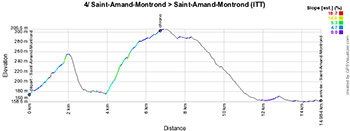
4/ Wednesday 11 March 2020 - Saint-Amand-Montrond > Saint-Amand-Montrond - individual time trial - 15.5 km
In the Nièvre department there will be a 15.5 kilometers long individual time trial around Saint-Amand-Montrond on the programme of Paris-Nice. The stage presents a quite technical race route in terms of bends and the roads the riders will be on, but the stage profile is relatively flat. The intermediate timing point will be set up on the highest point of the race anyway, in La Tour.Hereunder you'll find the time- and route schedule, the stage profile and the detailed map on Open Street Maps for this stage. Click on the images to open them.


CONTINUE READING AFTER THIS ADVERTISEMENT
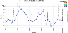
5/ Thursday 12 March 2020 - Gannat > La Côte Saint-André - 227 km
After this time trial, a hilly stage will be on the programme of this 78th edition of Paris-Nice.Starting in Gannat, the riders will already start climbing the Côte de Busset after a few kilometers, and they'll go on to the Côte de Cheval-Rigon. The climb then continues towards the highest point of the stage, where they'll battle for the intermediate sprint and the Col du Beaulouis will thus not count for the King of the Mountains classification.
After the feeding zone in Poncins and a quick visit of Saint-Symphorien-sur-Coise, the riders will have to climb two 3rd category climbs, the Côte de Trèves and the Côte de Saint-Prim. After that, they'll only have the intermediate sprint of Saint-Julien-de-l'Herms left before the finish in La Côte-Saint-André.
Hereunder you'll find the time- and route schedule, the stage profile and the detailed map on Open Street Maps for this stage. Click on the images to open them.


6/ Friday 13 March 2020 - Sorgues > Apt - 161.5 km
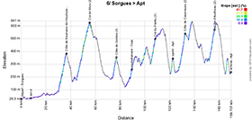
After a transfert to the south of France, the 6th stage will start in Sorgues, south of Orange. This stage will have quite a particular race route, which goes off to find some upfollowing climbs with the Côte de Saumane-de-Vaucluse, the longer Col de Murs and the Côte de Gordes.After the feeding zone in Tinel, the riders will again find some climbs, starting with the Col du Pointu and, once they get on the final circuit of the race in Saignon where they'll turn left towards the intermediate sprint in Apt (the finish city), the Côte de Caseneuve. On the way back towards the finish in Apt they'll have to climb the Côte d'Auribeau.
Hereunder you'll find the time- and route schedule, the stage profile and the detailed map on Open Street Maps for this stage. Click on the images to open them.


7/ Saturday 14 March 2020 - Nice > Valdeblore La Colmiane - 166,5 km
Arrived in Nice, the two last stages will take place in the countryside above Nice, as usual these past few years in Paris-Nice.This time however, the terrain the riders will be on is a bit different and more on the west side than other years when the Col d'Eze usually appeared on the race route.
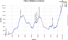
In this forelast stage, the riders will first climb the first out of the three climbs of the first category of this edition of the race, the Col de Vence. After the descent towards La Roque-en-Provence, they'll successively climb the Col de la Sigale and the Côte de Saint-Antonin, knowing that between these two, they can get some energy in the feeding zone in La Penne.
A little bit less climbing follows, via the sprint in Tournefort, before they get on the final climb of La Colmiane in Valdeblore, on which they'll find another intermediate sprint in La Roche.
Hereunder you'll find the time- and route schedule, the stage profile and the detailed map on Open Street Maps for this stage. Click on the images to open them.


8/ Sunday 15 March 2020 - Nice > Nice - 113.5 km
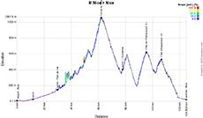
The last stage of Paris-Nice 2020, starting and finishing in Nice, is relatively short, but certainly not easy.Indeed, even though the stage starts without much difficulties, via the sprint in Plan-du-Var, there will be 4 climbs following up on each other which will await the riders before we get to know the winner of this 78th edition of the race to the sun. First of all the Col de la Porte of the first category and, after the sprint in L'Escarène, the Côte de Berre-les-Alpes, the Côte de Châteauneuf (the last climb of the first category) and the Côte d'Aspremont, before they go back to Nice downhill, to the Allianz Rivièra stadium, where the 3rd stage of the Tour de France 2020 will start.
Hereunder you'll find the time- and route schedule, the stage profile and the detailed map on Open Street Maps for this stage. Click on the images to open them.


The Paris-Nice 2020 race route in Google Earth
Do you prefer to see the Paris-Nice 2020 race route on one single map? Or would you like to do a virtual fly-over of the race route of one of the stages of this 78th edition of Paris-Nice? That's all possible, if you download the KML file below and open it in Google Earth! ATTENTION - copyright: despite the fact that this KML file is provided here for your own use, you should keep in mind that it is strictly forbidden to reproduce the contents of this KML file or of any other file (including maps, stage profiles, KML files and others) which make up the Paris-Nice 2020 race route. Indeed, these contents are protected by copyright and I ask you to pay respect for the huge amount of time it takes to create these. This protection covers the reproduction of these maps and other elements in any way (as a map, as a video flying over the maps or any other creation based on the contents as published on velowire.com).
>> Download the race route of all Paris-Nice 2020 stages in Google Earth (KML file)

Vond u dit artikel interessant? Laat het uw vrienden op Facebook weten door op de buttons hieronder te klikken!
no comments yet | 9405 views
this publication is published in: Paris-Nice | Paris-Nice 2020 | OpenStreetMap/Google Maps/Google Earth


 by marco1988 over