Friday 01 March 2024 at 18h16
One of the most recent classics is the Strade Bianche, a large quarter of which takes place on dirt roads in Italy. Despite its young age, it has already become a true classic, recognized in the world of pro cycling and attracting leading riders (for example, names such as Tadej Pogacar, Tom Pidcock, Christophe Laporte, Marc Hirschi, Simon Yates, Matej Mohoric, Sepp Kuss and Neilson Powless are on the entry list for the 2024 edition of the Strade Bianche).
In this article you'll find the detailed route of the Strade Bianche 2024, which takes place tomorrow, Saturday, March 2, 2024, with detailed information on the 15 sectors of white roads (the strade bianche precisely).
CONTINUE READING AFTER THIS ADVERTISEMENT
The Strade Bianche 2024 route on Open Street Maps
As always, the Strade Bianche 2024 will start and finish in Siena, Tuscany, but this year's route features the addition of a loop to the north of Siena, bringing the total distance of the Strade Bianche in 2024 to 215 kilometers, including 71.2 kilometers of white roads. With this new route, the race exceeds 200 kilometers for the first time, making it even tougher, and this change has already caused quite a stir, as not everyone is happy about it!After setting off from Siena, the race heads south-west towards its airport, and after bypassing it, it's from Stigliano that the riders land on the first white sector, that of Vidritta (2.1 km, with the lowest level of difficulty, subsequently expressed in stars, in this case one star: *). Heading south-east, 3 more sectors follow: Bagnaia (5.8 km, ***), Radi (4.4 km, **) and La Piana (6.4 km, **).
At Ponte d'Arbia and Buonconvento, riders enter the first circuit towards the southernmost point of the race, Montalcino, and on the way back find the next two white sectors, among the longest and most difficult: Lucignano d'Asso (11.9 km, ****) and Pieve a Salti (8 km, ****).
The section shown in orange on the map then ends, with the return journey northwards, first on a larger road to Monteroni d'Arbia, where the race turns back to the white roads and heads eastwards, starting with sector number 7, San Martino in Grania (9.5 km, *****). A little further on comes one of the longest sectors at 11.5 km, and the most difficult with its 5 stars, Monte Sante Marie.
They then head back towards Siena, and after sector number 9 of Monteaperti (600 m, **), they arrive on the new circuit, added to the north of Siena, which includes two white sectors on their usual route to the finish: Colle Pinzuto (10th, 2.4 km, ****) and Le Tolfe (11th, 1.1 km, ****).
Turning right to continue this additional loop, the Strada del Castagno sector (1.3 km, ***), the 12th of the race, comes into view, and at the point where this loop began, the 13th sector, Montechiaro (3.3 km, **), awaits the riders.
The last part of the route is marked out in fluorescent pink/purple. They then pass the 10th and 11th sectors again, which become the 14th and 15th sectors, and then it's on to Siena (Siena), where the finish will take place at the usual location on the Il Campo place in front of the town hall.
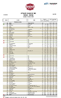
Below you'll find the Strade Bianche 2024 route on Open Street Maps, as well as the profile and time- and route schedule of the race:


The Strade Bianche 2024 route in Google Earth
Do you prefer to see the Strade Bianche 2024 route in Google Earth, for example, to take a virtual flight over it? You can, by downloading the KML file below:>> Download the Strade Bianche 2024 route in Google Earthdoor Thomas Vergouwen
Vond u dit artikel interessant? Laat het uw vrienden op Facebook weten door op de buttons hieronder te klikken!
no comments yet | 15326 views
this publication is published in: Classics | OpenStreetMap/Google Maps/Google Earth


 by marco1988 over