




Here we are, it’s end of June / early July, and the Tour de France is fast approaching—and it will be in Barcelona 🇪🇸 that the 113th edition of the Grande Boucle, the Tour de France 2026, will kick off, for three weeks on Spanish and French roads. After last year’s 100% French Tour de France, this edition will indeed begin on Spanish roads, with two full stages and a large portion of the third stage taking place there.
The total distance of the Tour de France 2026 will be 3,321.2 km.
You’ve probably been eagerly awaiting this: the release of OpenStreetMap maps (the equivalent of Google Maps) showing the routes for all stages of the Tour de France 2026, which you can zoom in on as much as you like, along with the stage schedules and elevation profiles. And of course, the file (KML / KMZ) that you can open in Google Earth to view the entire Grand Tour or take a virtual tour of the stages, as if you were right there! You’ll once again be able to discover all the details of the stages awaiting the riders competing for the Yellow Jersey of the Tour de France.
The time has come — velowire.com once again invites you to explore all the finer details of the Tour de France route, which will wind through the countryside and see the world’s best cyclists compete for three weeks!
The maps of the 2026 Tour de France stages are even better in the velowire app!
It was during the Tour de France that velowire introduced a beta version of its mobile app last year, and it was officially launched early 2026!Below, you’ll of course find the stage maps for the Tour de France 2026, but if you really want to dive into these maps ... they’re even better in the velowire app! And as usual, they were available there as a sneak peek before being published here!
Whether you’re heading to the race — either to support one of the participating teams, to help with the organization, to work with one of its partners, or simply as a cycling enthusiast cheering from the roadside — or if you just want to explore the maps of the Tour de France 2026 in a different way, velowire invites you to explore them in the Maps section of the velowire app for added convenience. That way, you’ll always have them with you, and as a little bonus: you can view them in full-screen mode, and if you’re on the go, display your location on the map and move the map along with you — making it easier than ever to find your way there!
So don’t wait any longer — join the thousands of users of the app by downloading the velowire app from the app stores:
 |
| 
Copyright Notice
All content in this article (maps, route schedules, descriptions, KML/KMZ files, and more) is — like all content on velowire.com — protected by copyright. Consequently, its reuse or reproduction in any other form is prohibited, as specified on the copyright page. Please respect the time spent preparing content like this! If you like this content, please promote it rather than reposting it illegally!The Schedule for the Grand Départ of the 2026 Tour de France in Barcelona
As you know, the Grand Départ of the Tour de France 2026 will take place in Barcelona, Spain 🇪🇸, and the surrounding area. Here are the key dates for the Grand Départ of the Tour de France 2026:numerous festivities are being organized for the general public around the Grand Départ between June 26 and July 5, under the name La festa del Tour.There will also be the Tour de France Fan Park, which will be set up on Passeig de Lluís Companys from July 2 to 5.
Detailed maps of all the stages of the 2026 Tour de France on OpenStreetMap, stage schedules, and stage profiles
Alright, enough preliminary information — let’s dive into the different stages of the Tour de France 2026 to discover the detailed route on an OpenStreetMap map (similar to Google Maps), the stage profiles, and the schedule itineraries so you can find out what time the caravan and the race will pass through the location of your choice. But also the finer details, such as the precise location of the intermediate sprint, the mountain passes and climbs along the route, as well as the departments crossed and the major cities visited. Whether you’re cheering from the roadside or relaxing on your couch in front of the TV, there’s no excuse not to know the route of the Tour de France 2026.CONTINUE READING AFTER THIS ADVERTISEMENT
1/ Saturday, July 4, 2026 - Barcelona 🇪🇸 > Barcelona 🇪🇸 - team time trial - 19.6 km
The Tour de France 2026 will kick off in Barcelona 🇪🇸 with a 19.6 km team time trial. Although the last team time trial in the Tour de France took place in 2019 in Brussels, this time trial will still mark the 50th in the history of the Tour de France.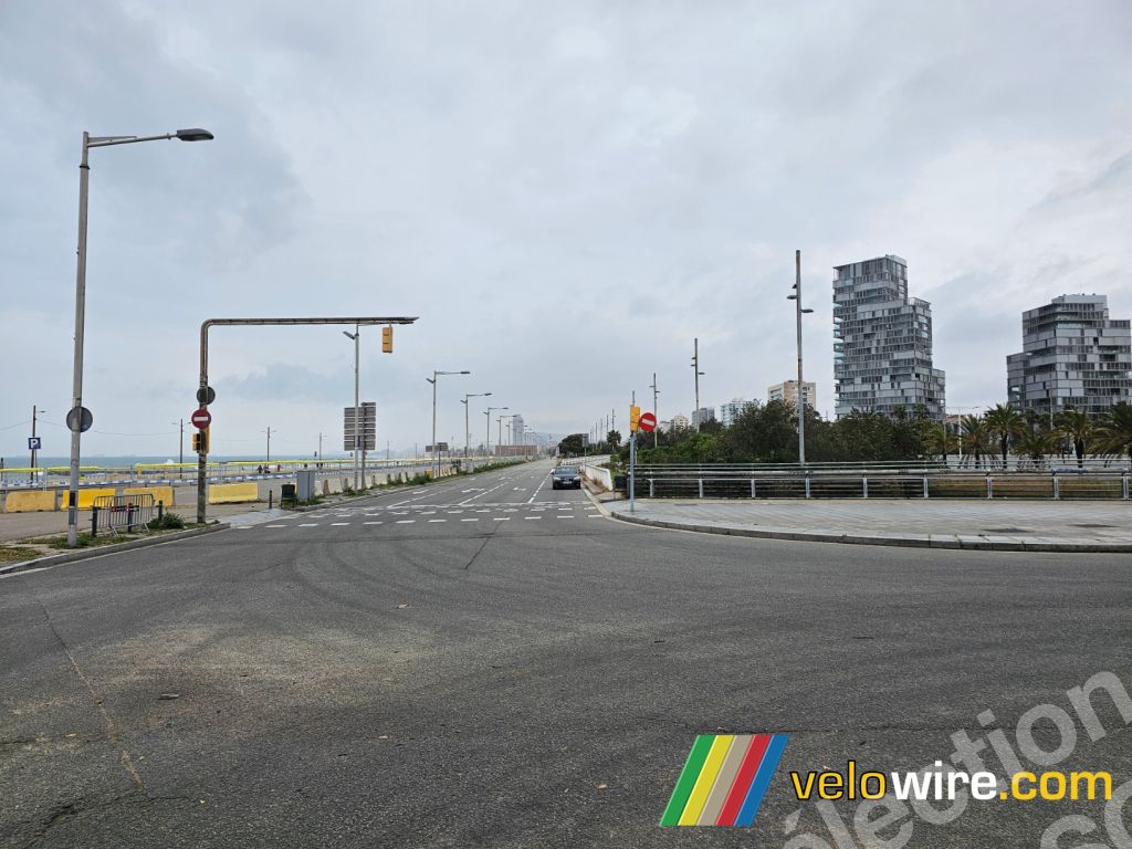
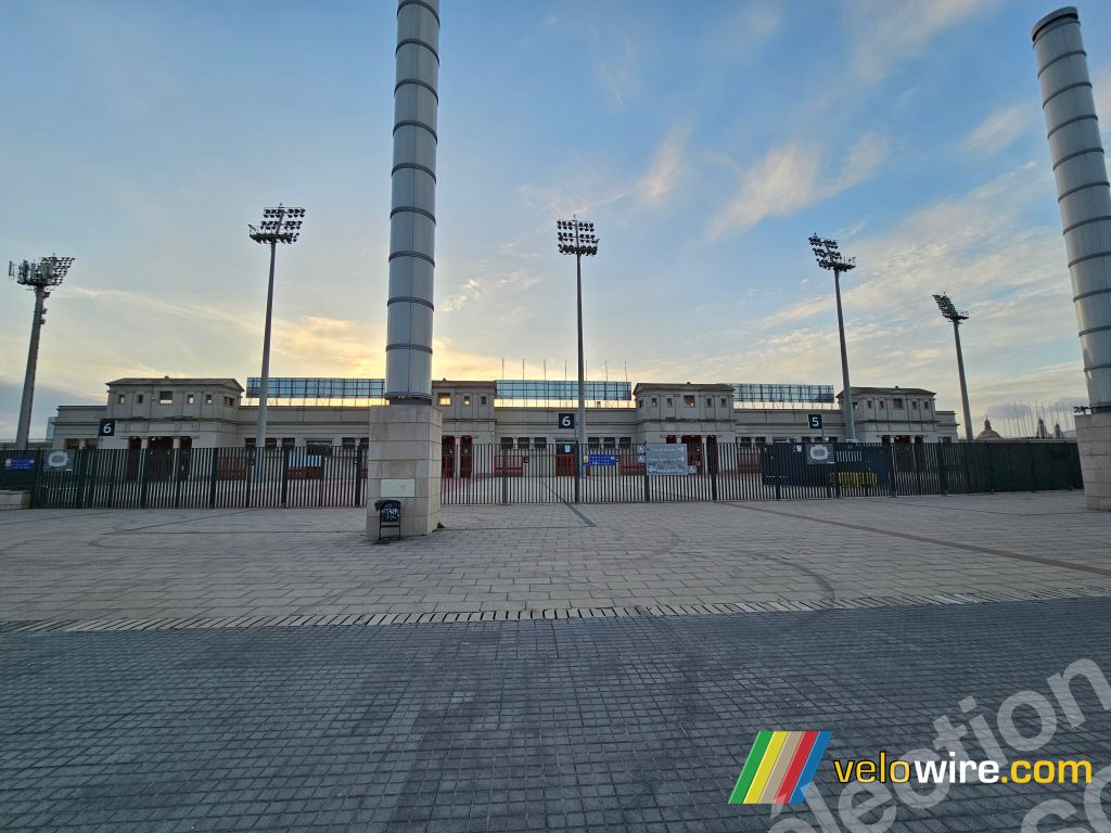
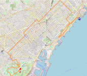
After following the coast from the start at Parc del Fòrum, the teams will retrace their steps along a parallel road before entering the city and heading north again, passing in front of the Sagrada Família and continuing on to Plaça Espanya. From there, the climb up the famous Côte de Montjuïc begins (1.1 km at 5.1%). Two kilometers after that, they begin the final climb of this stage, heading toward the finish at the top of the Côte du Stade Olympique (800 m at 7%).
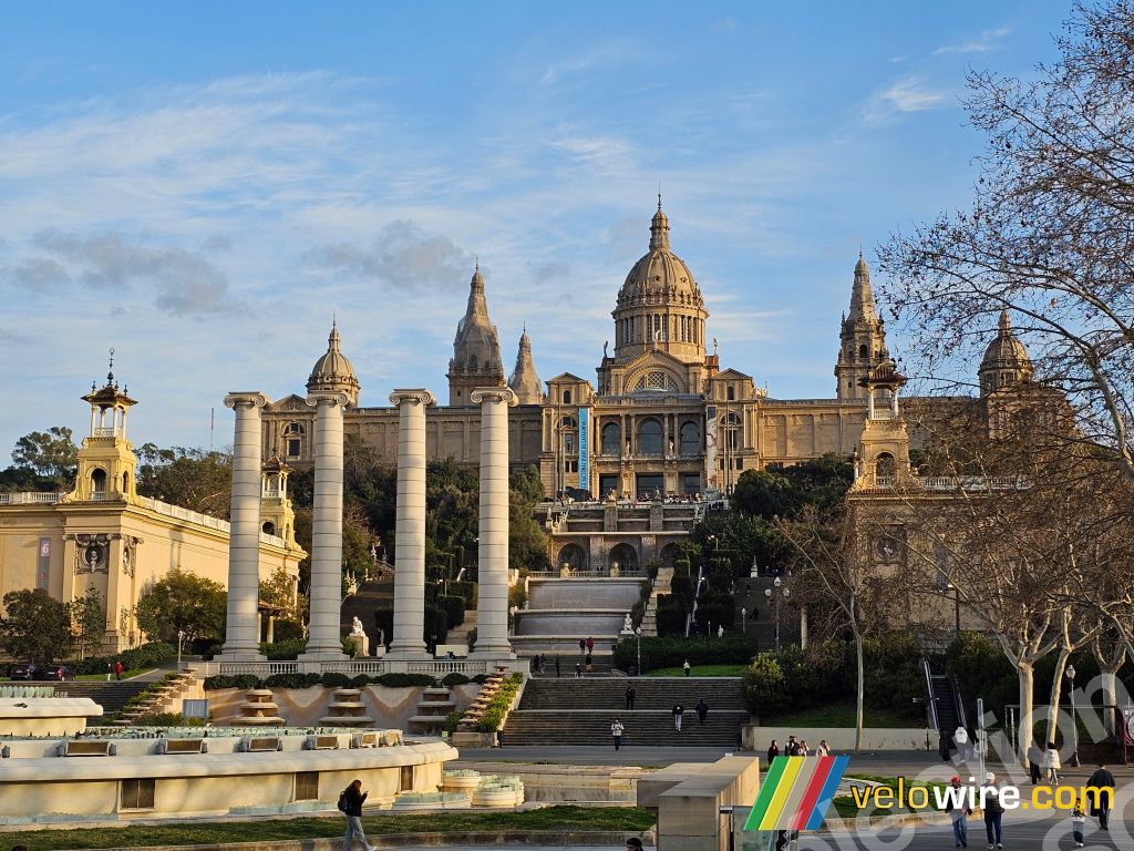
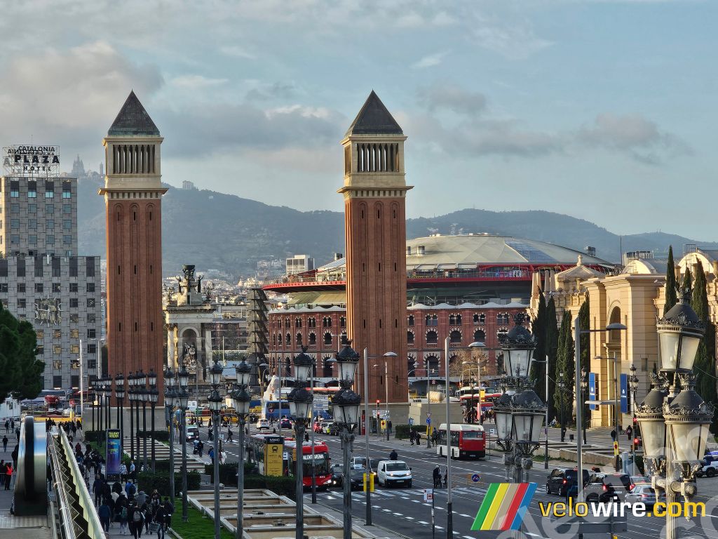
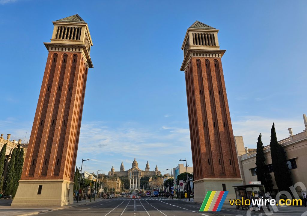
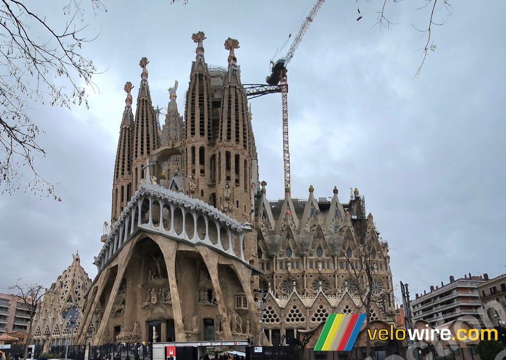
This is a somewhat unusual course for a team time trial given these challenges, which could potentially leave some teams waiting to find out their times if the timing were based on the fifth rider’s time, as is often the case. On this stage of the Tour de France 2026, however, the logic will be entirely different, since the teams’ times for the stage classification will be based on the first rider to cross the finish line… whereas for the general classification, it will be the individual times of each rider that count. They’ll therefore have to choose between the strength of the team as a whole, with its collective effort, and the interests of the leaders in the general classification.

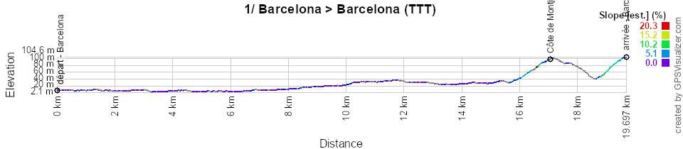
Below you will find the schedule, profile, and OpenStreetMap map of the route for the first stage of the Tour de France 2026. Click on the images to enlarge them.

- Start:
- The start will take place at Parc del Fòrum in Barcelona 🇪🇸 (first start at 5:05 p.m., last start at 7:16 p.m., with starts every 5 minutes)
- Elevation gain: 200 m, with 1.9 km of challenging terrain
Mountain passes and climbs—uncategorized:- Montjuïc Climb at km 17 - ^ 100 m / 1.1 km at 5.1%
- Olympic Stadium Climb at km 19.6 - ^ 104 m / 800 m at 7%
- Finish: Olympic Stadium Climb in Barcelona, at the end of a final 850-meter straight stretch / 6 meters wide (around 7:16 p.m. for the last team)
- Major cities: Barcelona
2/ Sunday, July 5, 2026 - Tarragona 🇪🇸 > Barcelona 🇪🇸 - 168.5 km
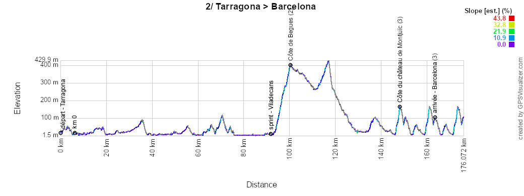
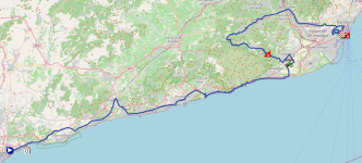
The second stage of the Tour de France 2026 will also head toward Barcelona, but will start much further west, in Tarragona 🇪🇸.Until about halfway through the stage, the course will be completely flat, following the coastline with only a brief detour through El Vendrell. However, as the route heads inland at Castelldefels and after the sprint in Viladecans, things will get more challenging.
The riders will climb the Côte de Begues and then head due east for a short stretch through Molins de Rei before heading toward Barcelona 🇪🇸. In the final part of the stage, they’ll encounter the same sequence of climbs as the day before during the team time trial (though not exactly the same way, since they’ll approach each climb from the opposite side compared to the previous day), including the Montjuïc Castle Climb and the Olympic Stadium Climb (700 m at 7%, uncategorized) ... except that this time these climbs are part of a final circuit that the riders will complete twice in full, meaning they’ll have to climb both three times! As on the previous day, however, the finish line is at the top of the final climb. So, once again, a rather demanding stage for this Grand Départ!
Below you’ll find the schedule, profile, and OpenStreetMap map of the route for the second stage of the Tour de France 2026. Click on the images to enlarge them.
- Start:
- The start will take place on Rambla President Francesc Macià in Tarragona (1:45 p.m.)
- The actual start is scheduled on the N-340 / Via Augusta, 6.1 km from the assembly point (1:55 p.m.)
- Elevation gain: 2,500 m, with 10.9 km of categorized climbs
Mountain passes and climbs:- Begues Climb (2nd category) at km 94.2 – ^ 399 m / 6.1 km at 6.5%
- Côte du Château de Montjuïc (3rd category) three times: at km 141.6, km 153.8, and km 166 - ^ 163 m / 1.6 km at 9.3%
- Intermediate sprint: Avinguda de la Generalitat in Viladecans at km 85.6
- Finish: Passeig Olímpic, Sants-Montjuïc in Barcelona, at the end of a 700-meter final straight and at the top of a 700-meter climb at 7% / width 6 m
- Provinces crossed: Province of Tarragona from km 0 to km 35.6, Province of Barcelona from km 38.1 to km 168.5
- Major cities: Tarragona, Vilanova i la Geltrú, Sitges, Castelldefels, Viladecans, and Barcelona
3/ Monday, July 6, 2026 - Granollers 🇪🇸 > Les Angles - 195.9 km
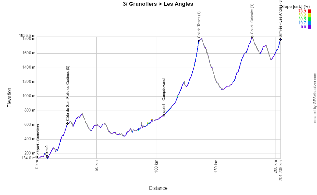
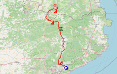
The third stage of the Tour de France 2026 will be the final stage of the Grand Départ for this 113th Tour de France, starting in Spain — in Granollers 🇪🇸, to be precise. After just ten kilometers, the riders will climb the Côte de Sant Feliu de Codines, and as they head north, the race will remain on a plateau until the intermediate sprint in Campdevànol, before turning west and tackling the much more impressive climb up the Col de Toses.It is then between Puigcerdà and Ur that the race crosses the border and enters France for good. Via Font-Romeu, the Col du Calvaire, and Mont-Louis, the race passes north of Lake Matemale before returning to the Les Angles ski resort.
Below you will find the schedule, profile, and OpenStreetMap map of the route for the third stage of the Tour de France 2026. Click on the images to enlarge them.
- Start:
- The start will take place on Camí Ramon Llull in Granollers (12:10 p.m.)
- The actual start is scheduled on the C-1415b, 8.5 km from the assembly point (12:20 p.m.)
- Elevation gain: 3,850 m, with 30 km of categorized climbs
Mountain passes and climbs:- Sant Feliu de Codines Climb (3rd category) at km 17.2 - ^ 622 m / 7.6 km at 4.5%
- Col de Toses (1st category) at km 127.7 - ^ 1,778 m / 9.3 km at 6.5%
- Col du Calvaire (3rd category) at km 169.8 - ^ 1,836 m / 11.4 km at 4.1%
- Les Angles (3rd category) at km 195.9 - ^ 1,794 m / 1.7 km at 6.5%
- Intermediate sprint: N-260 in Campdevànol at km 98.4
- Finish: Parking Lot P, Pla del Mir Road in Les Angles, at the end of an 80-meter-long final straight / width 5.50 meters
- Provinces and departments crossed: Province of Barcelona from km 0 to km 83.2, Province of Girona from km 84.7 to km 151.5, Pyrénées-Orientales (66) from km 156.2 to km 195.9
- Major cities: Granollers, Caldes de Montbui, Vic, Puigcerdà, Font-Romeu, and Les Angles
4/ Tuesday, July 7, 2026 - Carcassonne > Foix - 181.9 km
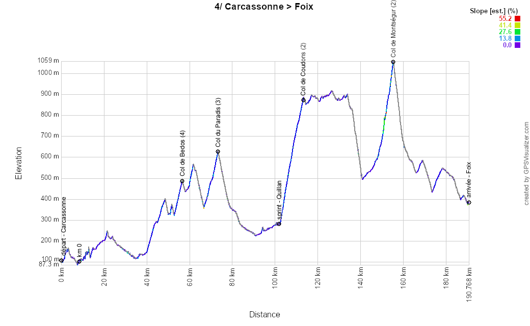
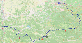
The fourth stage of this Tour de France will be the first to take place entirely on French soil and will start in Carcassonne. From the medieval city, the race heads south first, through Lagrasse and the Col de Bedos, before turning west. The riders will then climb the Col du Paradis and continue on to the intermediate sprint in Quillan before ascending the Col de Coudons.They then pass through Bélesta and, instead of heading directly to Lavelanet, they turn left to tackle the climb up the Col de Montségur before returning to Lavelanet and rejoining the direct route to the finish in Foix.
Below you will find the schedule, profile, and OpenStreetMap map for the fourth stage of the Tour de France 2026. Click on the images to enlarge them.
- Start:
- The start will take place at Place du Général de Gaulle in Carcassonne (1:10 p.m.)
- The actual start is scheduled on the D3 in Trèbes, 8.8 km from the assembly point (1:25 p.m.)
- Elevation gain: 2,700 m, with 26.7 km of categorized climbs
Mountain passes and climbs:- Col de Bedous (4th category) at km 48.2 - ^ 485 m / 3.3 km at 4.4%
- Col du Paradis (3rd category) at km 64.9 - ^ 622 m / 5.8 km at 4.1%
- Col de Coudons (2nd category) at km 104.9 - ^ 883 m / 10.7 km at 5.5%
- Col de Montségur (2nd category) at km 146.7 - ^ 1,059 m / 6.9 km at 6.6%
- Intermediate sprint: Avenue François Mitterrand in Quillan at km 93.4
- Finish: Cours Gabriel Fauré in Foix, at the end of a 300-meter-long final straight with a clear view / 6 meters wide
- Departments crossed: Aude (11) from km 0 to km 120.3 and Ariège (09) from km 125.4 to km 181.9
- Major cities: Carcassonne, Lagrasse, Quillan, Bélesta, Lavelanet, Foix
CONTINUE READING AFTER THIS ADVERTISEMENT
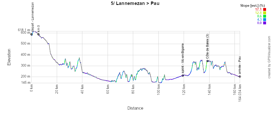
5/ Wednesday, July 8, 2026 - Lannemezan > Pau - 158.3 km
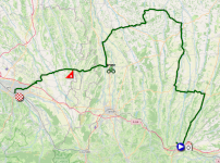
The 5th stage of the Tour de France 2026 will be much less hilly than the previous ones, starting from Lannemezan. The race heads north through Castelnau-Magnoac and Trie-sur-Baïse, which are familiar from the Tour de France as the starting cities for the 19th stage of the 2022 Tour de France and the 18th stage of the 2018 Tour de France, respectively. The stage then continues north, passing through Mirande and reaching its northernmost point at Montesquiou. Via Marciac, Maubourguet, and the intermediate sprint in Vic-en-Bigorre, the riders then head southwest before continuing westward through the Côte de Baleix toward the finish in Pau, which will likely come down to a sprint!Below you will find the schedule, profile, and OpenStreetMap map of the route for the fifth stage of the Tour de France 2026. Click on the images to enlarge them.
- Start:
- The start will take place at Place de la République in Lannemezan (2:05 p.m.)
- The actual start is scheduled on the D929, 5.5 km from the assembly point (2:15 p.m.)
- Elevation gain: 1,600 m, with 1 km of categorized climbing
Mountain passes and climbs:- Côte de Baleix (3rd category) at km 132.7 – ^ 348 m / 1 km at 8.8%
- Intermediate sprint: Avenue Jacques Fourcade in Vic-en-Bigorre at km 113.5
- Finish: Rue du Maquis Le Béarn in Pau, at the end of a 560-meter-long, unobstructed home stretch / width 6.5 meters
- Departments crossed: Hautes-Pyrénées (65) from km 0 to km 37.7 and from km 98.5 to km 118.7, Gers (32) from km 40.1 to km 97.4, and Pyrénées-Atlantiques (64) from km 119.9 to km 158.3
- Main towns: Lannemezan, Castelnau-Magnoac, Trie-sur-Baïse, Mirande, Montesquiou, Marciac, Maubourguet, Vic-en-Bigorre, Pau
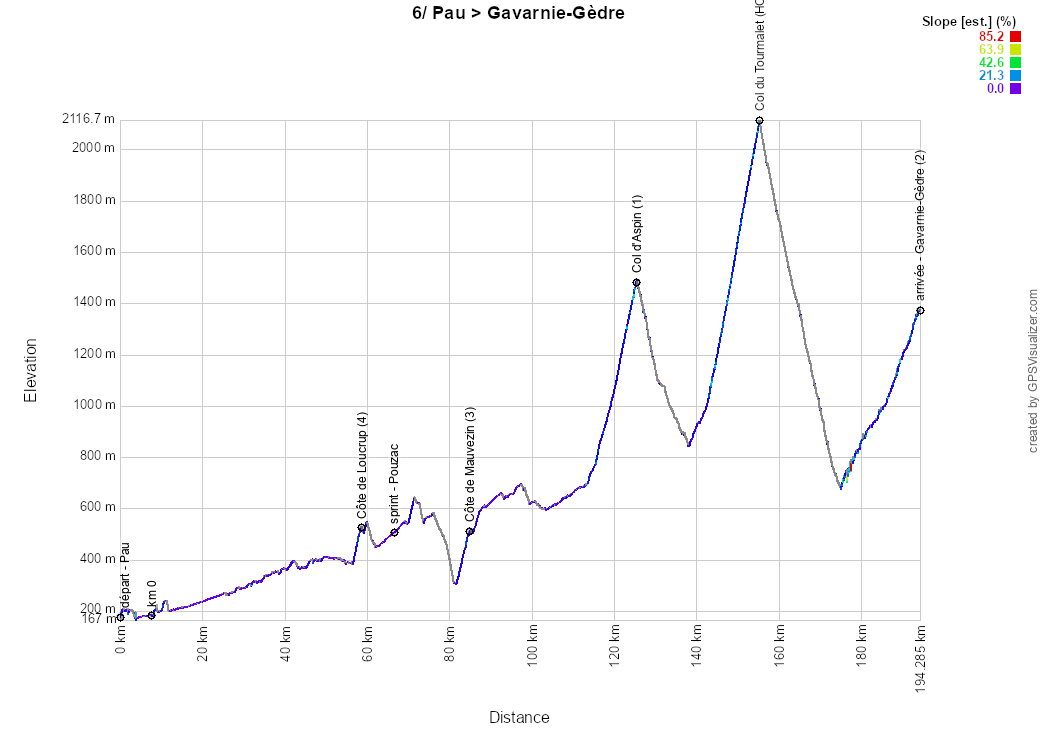
6/ Thursday, July 9, 2026 - Pau > Gavarnie-Gèdre - 186.2 km
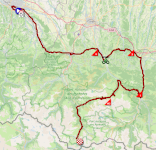
Starting from Pau, this sixth stage of the Tour de France 2026 on Thursday, July 9, will be a completely different kind of stage—a true mountain stage. The route heads southeast initially to Saint-Pé-de-Bigorre, before turning eastward, passing through Lourdes, the Côte de Loucrup, the intermediate sprint in Pouzac, Bagnères-de-Bigorre, and the Côte de Mauvezin, before skirting Lannemezan to the south and heading south toward Arreau, where the climb up the Col d’Aspin begins. This isn’t the only major challenge of the day, because after the descent to Sainte-Marie-de-Campan, an even tougher climb awaits: the Col du Tourmalet. The descent ends in Luz-Saint-Sauveur, and as the riders pass through Gèdre, they continue climbing all the way to the summit finish in Gavarnie-Gèdre.Below you will find the schedule, profile, and OpenStreetMap map for the route of the sixth stage of the Tour de France 2026. Click on the images to enlarge them.
- Start:
- The start will take place on Avenue Gaston Lacoste in Pau (12:25 p.m.)
- The actual start is scheduled on the D802, 7.7 km from the assembly point (12:40 p.m.)
- Elevation gain: 4,100 m, with 52.7 km of categorized climbs
Mountain passes and climbs:- Côte de Loucrup (4th category) at km 50.9 - ^ 528 m / 1.9 km at 7.1%
- Côte de Mauvezin (3rd category) at km 77.3 – 518 m climb / 3 km at 6.8%
- Col d’Aspin (1st category) at km 118.1 – elevation gain 1,489 m / 12 km at 6.5%
- Col du Tourmalet (hors catégorie) at km 147.8 - ^ 2,115 m / 17.1 km at 7.3%
- Gavarnie-Gèdre (2nd category) at km 186.2 - ^ 1,380 m / 18.7 km at 3.7%
- Intermediate sprint: Avenue de la Mongie in Pouzac at km 59.1
- Finish: D128 / Route des Espécières in Gavarnie-Gèdre, at the end of a 40-meter-long final straight with clear visibility / 5 meters wide
- Departments crossed: Pyrénées-Atlantiques (64) from km 0 to km 24.5, Hautes-Pyrénées (65) from km 27.1 to km 186.2
- Major cities: Pau, Saint-Pé-de-Bigorre, Lourdes, Bagnères-de-Bigorre, Capvern, Arreau, Luz-Saint-Sauveur, Gavarnie-Gèdre
7/ Friday, July 10, 2026 - Hagetmau > Bordeaux - 175.1 km
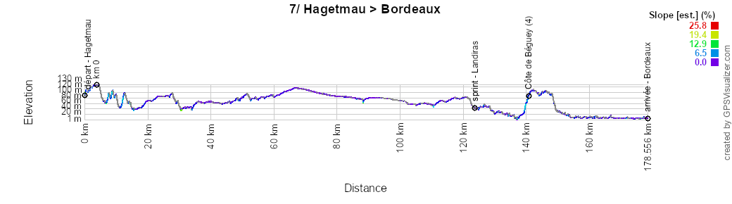
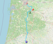
The 7th stage of the Tour de France 2026 this Friday, July 10, will be much less eventful, with a nearly flat route starting from Hagetmau. The race heads north, passing through Mont-de-Marsan, Saint-Symphorien, and the intermediate sprint in Landiras, before veering slightly toward Cadillac-sur-Garonne and the Côte de Béguey, then entering the Bordeaux metropolitan area via Latresne, Bouliac, and Floirac.Below you will find the schedule, profile, and OpenStreetMap map for the seventh stage of the Tour de France 2026. Click on the images to enlarge them.
- Start:
- The start will take place on Avenue du Docteur Édouard Castera in Hagetmau (1:15 p.m.)
- The actual start is scheduled on the D933 S, 3.8 km from the assembly point (1:25 p.m.)
- Elevation gain: 850 m, with 1.2 km of categorized climbs
Mountain passes and climbs:- Côte de Béguey (4th category) at km 137.3 – 84 m climb / 1.2 km at 4.4%
- Intermediate sprint: Route de Guillos in Landiras at km 120.2
- Finish: Quai Louis XVIII in Bordeaux, at the end of a 560-meter-long final straight / 6 meters wide
- Departments crossed: Landes (40) from km 0 to km 84 and Gironde (33) from km 98.3 to km 175.1
- Major cities: Hagetmau, Mont-de-Marsan, Saint-Symphorien, Cadillac-sur-Garonne, Floirac, and Bordeaux
8/ Saturday, July 11, 2026 - Périgueux > Bergerac - 180.4 km
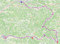
On the first day of this second weekend of the Tour de France 2026, the riders will gather at the start in Périgueux, and this 8th stage will once again be a relatively flat route. The race heads peacefully toward Montignac-Lascaux and its cave, before continuing through Les Eyzies toward Sarlat-la-Canéda. Over the next 50 kilometers, the riders will encounter two small climbs—the Côte de Domme and the Côte du Buisson-de-Cadouin—with the intermediate sprint in Saint-Cyprien in between. Another 40 kilometers or so of flat terrain then awaits them before, most likely, a bunch sprint at the finish in Bergerac.Below you will find the schedule, profile, and OpenStreetMap map of the route for the eighth stage of the Tour de France 2026. Click on the images to enlarge them.

- Start:
- The start will take place on Cours Tourny in Périgueux (1:15 p.m.)
- The actual start is scheduled on the N221 in Boulazac, 6.2 km from the assembly point (1:25 p.m.)
- Elevation gain: 1,150 m, with 5.9 km of categorized climbs
Mountain passes and climbs:- Côte de Domme (4th category) at km 102.6 - ^ 216 m / 3.7 km at 3.3%
- Côte du Buisson-de-Cadouin (4th category) at km 140.4 - ^ 200 m / 2.2 km at 5.6%
- Intermediate sprint: Voie de la Vallée in Saint-Cyprien at km 122.8
- Finish: Picquecailloux Playground / Allée Lucien Videau in Bergerac, at the end of a 500-meter final straight / 6 meters wide
- Departments crossed: Dordogne (24) from km 0 to km 180.4
- Major towns: Périgueux, Montignac-Lascaux, Sarla-la-Canéda, Saint-Cyprien, and Bergerac
CONTINUE READING AFTER THIS ADVERTISEMENT
9/ Sunday, July 12, 2026 - Malemort > Ussel - 185.5 km
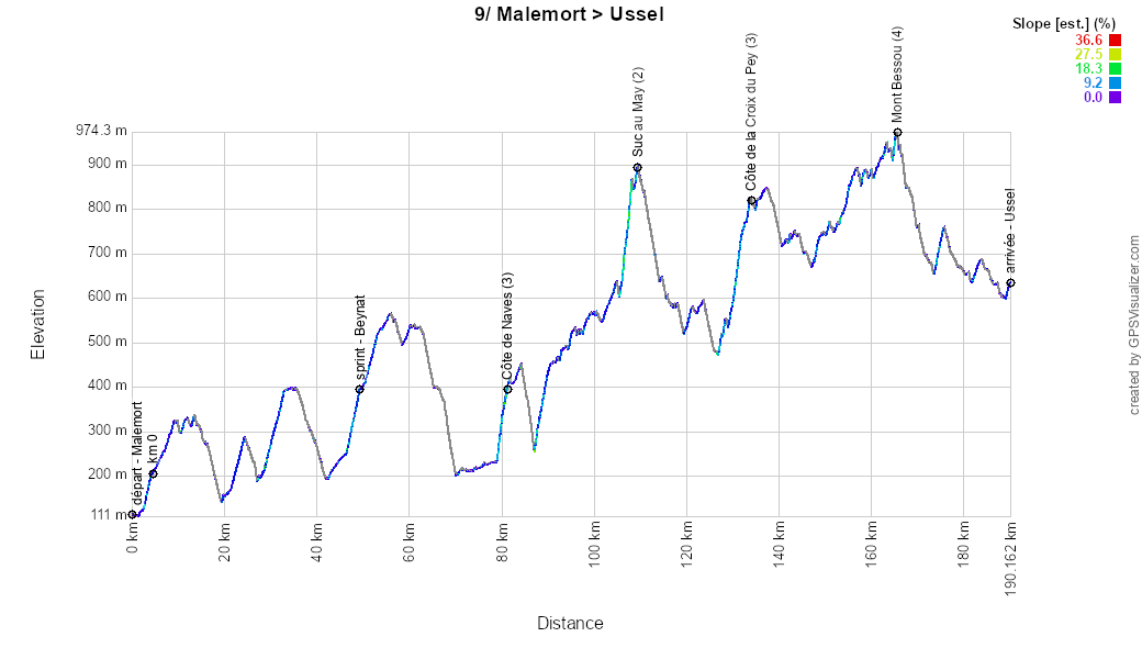
For the second stage of this weekend, the route starting from Malemort is slightly more undulating, but still features more than twice the elevation gain of the previous day’s stage, with 4 mountain passes and climbs, particularly beyond the first third of the stage.The riders will compete for the intermediate sprint in Beynat before heading north through Tulle, then up the Côte de Naves, followed a little further on by the climb up to Suc au May and a detour westward for a descent, before climbing again toward the Côte de la Croix du Pey. As they then head east toward the finish, they will still have to climb Mont Bessou before crossing the finish line in Ussel.
Below you will find the schedule, profile, and OpenStreetMap map of the route for the ninth stage of the Tour de France 2026. Click on the images to enlarge them.
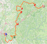
- Start:
- The start will take place on Avenue de la Riante Borie in Malemort (1:35 p.m.)
- The actual start is scheduled on the D38 in Brive-la-Gaillarde, 4.6 km from the assembly point (1:45 p.m.)
- Elevation gain: 3,300 m, with 11.8 km of categorized climbs
Mountain passes and climbs:- Côte de Naves (3rd category) at km 77 - ^ 410 m / 2.3 km at 7.4%
- Suc au May (2nd category) at km 105 - ^ 903 m / 3.8 km at 7.7%
- Côte de la Croix du Pey (3rd category) at km 129.4 - ^ 817 m / 4.8 km at 6%
- Mont Bessou (4th category) at km 161 - ^ 977 m / 900 m at 7.3%
- Intermediate sprint: Route de Brive to Beynat at km 44.9
- Finish: Avenue Thiers in Ussel, at the end of a 500-meter-long final straight / width 5.5 meters
- Departments crossed: Corrèze (19) from km 0 to km 185.5
- Major towns: Malemort, Tulle, Treignac, and Ussel
R1/ Monday, July 13, 2026 – rest day – Cantal
After these 9 stages and a fairly intense race since the start in Barcelona, the riders and support staff of the Tour de France 2026 will then be able to rest in the department of Cantal on Monday, July 13, before beginning to think about what lies ahead—particularly the Alps, which will bring this 113th edition of the Grande Boucle to a close.10/ Tuesday, July 14, 2026 - Aurillac > Le Lioran - 166.6 km
The day after the first rest day, the small world of the Tour de France 2026 gathers in Aurillac for the start of a hilly stage featuring seven mountain passes and climbs, including two first-category climbs.The riders first head south toward the intermediate sprint in Lacapelle-del-Fraisse, before heading northeast to Murat, passing through the Côte de Pailherols and, a little further on, the succession of the Col de la Griffoul and the Col de Prat de Bouc. After Murat, they continue northwest, passing through the Côte de Murat before turning slightly to the left—and thus northwest—toward a challenging sequence of climbs: the Puy Mary, the Pas de Peyrol, and then the Col de Perthus.
In Saint-Jacques-des-Blats, there is a final change in direction as the route turns left toward the climb up the Col de Font de Cère and the finish at Le Lioran.
Below you will find the schedule, elevation profile, and OpenStreetMap map for the route of the tenth stage of the Tour de France 2026. Click on the images to enlarge them.
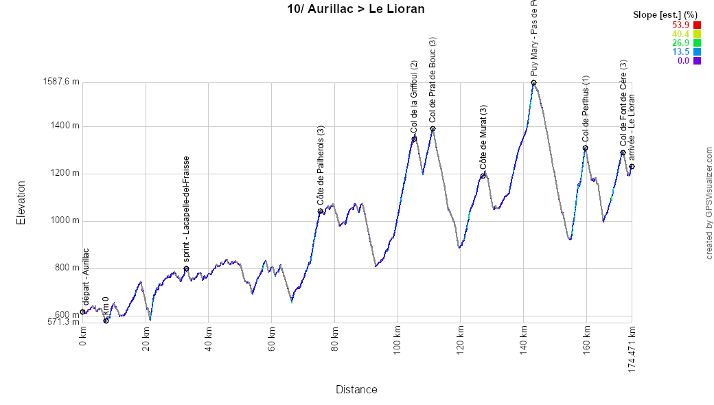
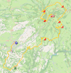
- Start:
- The start will take place on Avenue Gambetta in Aurillac (1:10 p.m.)
- The actual start is scheduled on the D617, 7.4 km from the assembly point (1:25 p.m.)
- Elevation gain: 3,800 m, with 32.5 km of categorized climbs
Mountain passes and climbs:- Côte de Pailherols (3rd category) at km 68 - ^ 1,043 m / 3 km at 7.2%
- Col de la Griffoul (2nd category) at km 97.3 – elevation gain: 1,336 m / 5.9 km at 6.7%
- Col de Prat de Bouc (3rd category) at km 103.8 - elevation gain 1,392 m / 3.1 km at 6.5%
- Côte de Murat (3rd category) at km 118.8 - ^ 1,193 m / 5.2 km at 5.3%
- Puy Mary - Pas de Peyrol (1st category) at km 135.7 - ^ 1,589 m / 7.8 km at 6%
- Col de Pertus (1st category) at km 152.1 - ^ 1,309 m / 4.4 km at 8.5%
- Col de Font de Cère (3rd category) at km 163.9 - ^ 1,294 m / 3.1 km at 5.8%
- Intermediate sprint: Rue des Frênes in Lacapelle-del-Fraisse at km 25.5
- Finish: D67 in Le Lioran, at the end of a 160-meter-long final straight with clear visibility / width 5.5 meters
- Departments crossed: Cantal (15) from km 0 to km 73.4 and from km 76.1 to km 166.6, and Aveyron (12) at km 74.5
- Major cities: Aurillac, Murat, and Le Lioran
11/ Wednesday, July 15, 2026 - Vichy > Nevers - 161.3 km
The day after Bastille Day, the 11th stage will start in Vichy. It will be a flat stage, passing through Saint-Pourçain-sur-Sioule—the site of the intermediate sprint—followed by a short climb, the Côte de Billonnière, and then Moulins, Saint-Léger-des-Vignes, and La Machine, before another climb, the Côte de Billy-Chevannes. The race then heads toward Nevers, where the sprinters will have another chance to shine!Below you will find the schedule, profile, and OpenStreetMap map of the route for the eleventh stage of the Tour de France 2026. Click on the images to enlarge them.
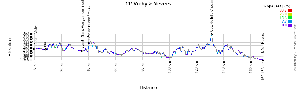
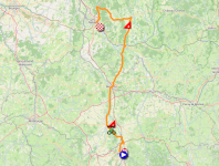
- Start:
- The start will take place at the Parc Omnisports Auvergne-Rhône-Alpes Vichy near Vichy (1:50 p.m.)
- The actual start is scheduled on the D174 in Creuzier-le-Vieux, 8 km from the assembly point (2:05 p.m.)
- Elevation gain: 1,400 m, with 2.4 km of categorized climbs
Mountain passes and climbs:- Côte de Billonnière (4th category) at km 32.9 - ^ 300 m / 1 km at 5.8%
- Côte de Billy-Chevannes (4th category) at km 123.4 – 360 m climb over 1.4 km at 5%
- Intermediate sprint: Boulevard Ledru-Rollin in Saint-Pourçain-sur-Sioule at km 27.8
- Finish: Rue de l’Amiral Jacquinot in Nevers, at the end of a 1-km final straight, including 500 m in full view / width 6 m
- Departments crossed: Allier (03) from km 0 to km 75.1 and Nièvre (58) from km 77.7 to km 161.3
- Major cities: Vichy, Saint-Pourçain-sur-Sioule, Moulins, Saint-Léger-des-Vignes, La Machine, and Nevers
CONTINUE READING AFTER THIS ADVERTISEMENT
12/ Thursday, July 16, 2026 - Nevers Magny-Cours Circuit > Chalon-sur-Saône - 179.1 km
Following the finish in Nevers the previous day, the Tour de France 2026 will set off from the local racetrack south of the city—the Nevers Magny-Cours Circuit—on Thursday, July 16, for a transition stage. The stage will head east, passing through the intermediate sprint in Decize, then Lanty and its namesake climb, followed by Cuzy and its namesake climb, before continuing on to Montceau-les-Mines. Passing through Montchanin-le-Haut and the Côte de Montagny-lès-Buxy, the riders will then head toward the finish in Chalon-sur-Saône.Below you will find the schedule, profile, and OpenStreetMap map of the route for the twelfth stage of the Tour de France 2026. Click on the images to enlarge them.
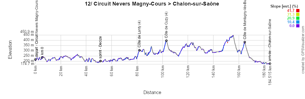
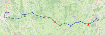
- Start:
- The start will take place at the circuit’s starting line (1:30 p.m.)
- The actual start is scheduled on the D58, 5.5 km from the assembly point (1:40 p.m.)
- Elevation gain: 1,800 m, with 7 km of categorized climbs
Mountain passes and climbs:- Côte de Lanty (4th category) at km 76.5 - ^ 308 m / 2 km at 4%
- Côte de Cuzy (4th category) at km 97.8 - ^ 398 m / 2.4 km at 4.5%
- Montagny-les-Buxy Climb (4th category) at km 159.4 - ^ 391 m / 2.6 km at 4.3%
- Intermediate sprint: Avenue de Verdun in Decize at km 45.8
- Finish: Quai Saint-Cosme in Chalon-sur-Saône, at the end of a 1.6 km final straight, including 500 m in full view / width 6 m
- Departments crossed: Nièvre (58) from km 0 to km 86.4 and Saône-et-Loire from km 93.9 to km 179.1
- Major cities: Magny-Cours, Montceau-les-Mines, Montchanin, and Chalon-sur-Saône
13/ Friday, July 17, 2026 - Dole > Belfort - 205.8 km
The 13th stage, starting in Dole, will be entirely flat for three-quarters of its distance, passing north of Besançon and through Lure, with an intermediate sprint in Mélisey. In the final 50 kilometers, the riders will first face a short climb, the Col des Croix, before moving on fairly quickly to the much tougher Ballon d’Alsace. At the summit of the Ballon d’Alsace, they will be just 30 kilometers from the finish in Belfort, which they will reach via the descent from the pass and then a slightly downhill road to the finish line.Below you will find the schedule, profile, and OpenStreetMap map of the route for the thirteenth stage of the Tour de France 2026. Click on the images to enlarge them.
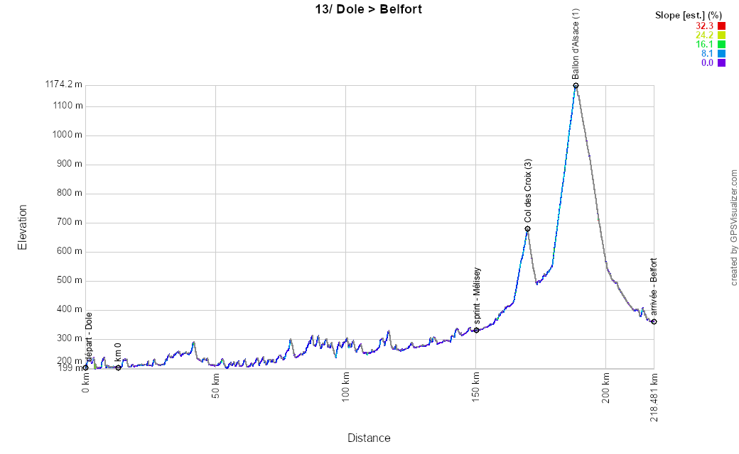
- Start:
- The start will take place at the Champ de Fêtes esplanade in Dole (1:00 p.m.)
- The actual start is scheduled on the D244, 12.5 km from the assembly point (1:20 p.m.)
- Elevation gain: 2,400 m, with 14 km of categorized climbs
Mountain passes and climbs:- Col des Croix (3rd category) at km 157.4 - ^ 678 m / 5.1 km at 4.8%
- Ballon d’Alsace (1st category) at km 175.9 – 1,173 m climb / 8.9 km at 6.9%
- Intermediate sprint: Route de Lure in Mélisey at km 137.8
- Finish: Boulevard du Maréchal Joffre in Belfort, at the end of a 420-meter final straight, 280 meters of which are in full view / width 6 meters
- Departments crossed: Jura (39) from km 0 to km 23, Doubs (25) from km 25 to km 40.8 and from km 93.9 to km 105.4, Haute-Saône (70) from km 41.8 to km 92.7 and from km 106.5 to km 157.4, Vosges (88) from km 160.1 to km 175.9, and Territoire de Belfort (90) from km 177 to km 205.8
- Major cities: Dole, Lures, Le Thillot, Fresse-sur-Moselle, Saint-Maurice-sur-Moselle, and Belfort
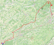
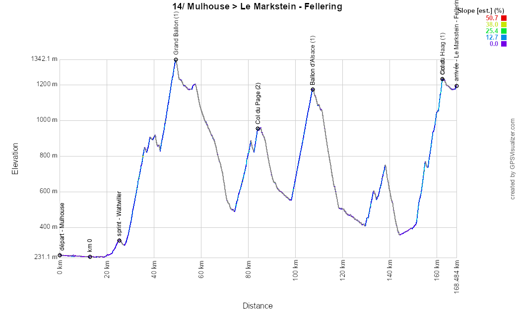
14/ Saturday, July 18, 2026 - Mulhouse > Le Markstein (Fellering) - 155.3 km
Starting in Mulhouse, this compact and challenging 14th stage is on the schedule for the Tour de France 2026 this Saturday, July 18. In fact, over the course of 155 kilometers, the route features no fewer than three first-category climbs (in addition to one second-category climb).After a flat stretch leading up to the intermediate sprint in Wattwiller, the riders will quickly reach the climb up the Grand Ballon before crossing the finish line for the first time. On the subsequent loop, the riders will then have to climb the Col du Page and the Ballon d’Alsace. Passing through Masevaux, Bitschwiller-lès-Thann, and Saint-Amarin, they will return to the starting point of this circuit, but they will still have to tackle the climb up the Col du Haag to reach the finish line a little further on, at Markstein (Fellering).
Below you will find the schedule, profile, and OpenStreetMap map for the route of the fourteenth stage of the Tour de France 2026. Click on the images to enlarge them.
- Start:
- The start will take place on Rue de l’Illberg in Mulhouse (1:10 p.m.)
- The actual start is scheduled on the D429 in Wittenheim, 12.5 km from the assembly point (1:30 p.m.)
- Elevation gain: 3,800 m, with 51.4 km of categorized climbs
Mountain passes and climbs:- Grand Ballon (1st category) at km 36.6 - ^ 1,336 m / 21.5 km at 4.8%
- Col du Page (2nd category) at km 71.3 - ^ 959 m / 9.8 km at 4.7%
- Ballon d’Alsace (1st category) at km 94.4 – elevation gain 1,173 m / 8.9 km at 6.9%
- Col du Haag (1st category) at km 149.4 - ^ 1,233 m / 11.2 km at 7.3%
- Intermediate sprint: Rue de Guebwiller in Wattwiller at km 12.6
- Finish: D27 in Le Markstein (Fellering), at the end of a 170-meter-long, unobstructed final straight / 6 meters wide
- Departments crossed: Haut-Rhin (68) from km 0 to km 68.3 and from km 97.7 to km 155.3, Vosges (88) from km 69.7 to km 94.4, and Territoire de Belfort (90) from km 95.6 to km 96.7
- Major cities: Mulhouse
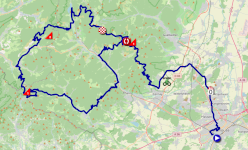
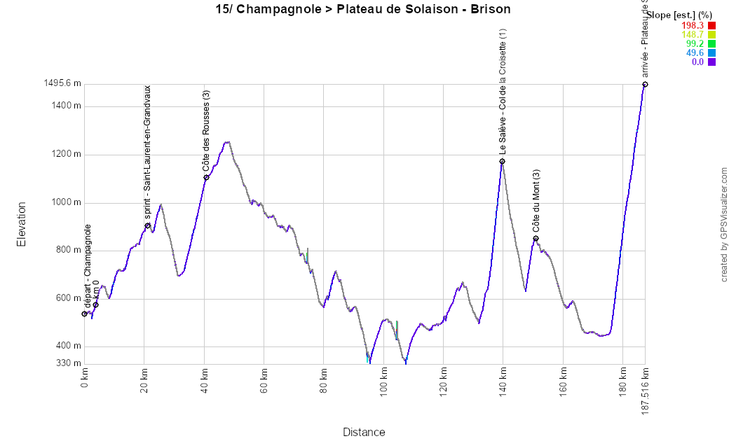
15/ Sunday, July 19, 2026 - Champagnole > Plateau de Solaison (Brison) - 183.9 km
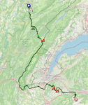
After the start in Champagnole, the riders will quickly battle for the intermediate sprint in Saint-Laurent-en-Grandvaux and climb the Côte des Rousses near the Swiss border, followed by a relatively easier stretch of about 80 kilometers.In the final part of the stage, after skirting around Switzerland and Geneva, things get tougher, starting with the climb up Le Salève – Col de la Croisette, immediately followed by the easier Côte du Mont. Passing through La Roche-sur-Foron (the main base for the 2027 Super World Championships in France) and Bonneville, the riders then tackle the final climb toward the Plateau de Solaison–Brison.
Below you will find the schedule, profile, and OpenStreetMap map of the route for the fifteenth stage of the Tour de France 2026. Click on the images to enlarge them.
- Start:
- The start will take place on Avenue de la République in Champagnole (1:10 p.m.)
- The actual start is scheduled on the N5, 3.9 km from the assembly point (1:20 p.m.)
- Elevation gain: 3,950 m, with 24.7 km of categorized climbs
Mountain passes and climbs:- Côte des Rousses (3rd category) at km 36.8 - ^ 1,097 m / 6.6 km at 5.1%
- Le Salève - Col de la Croisette (1st category) at km 136 - ^ 1,175 m / 4.7 km at 11.2%
- Côte du Mont (3rd category) at km 147.7 - ^ 823 m / 2.1 km at 8.3%
- Plateau de Solaison (hors catégorie) at km 183.9 - ^ 1,508 m / 11.3 km at 9%
- Intermediate sprint: Rue de Paris in Saint-Laurent-en-Grandvaux at km 17.3
- Finish: D186 A / Route de Solaison in Brison / Plateau de Solaison, at the end of a 150-meter-long final straight with a clear view / width 5 m
- Departments crossed: Jura (39) from km 0 to km 46.4, Ain (01) from km 52.3 to km 102.6, and Haute-Savoie (74) from km 106.1 to km 183.9
- Major towns: Champagnole, Les Rousses, Valserhône, La Roche-sur-Foron, and Bonneville
CONTINUE READING AFTER THIS ADVERTISEMENT
R2/ Monday, July 20, 2026 – rest day – Haute-Savoie
After this eventful second week of the Tour de France 2026, it will once again be time for the riders to rest, this time in the Haute-Savoie department. This will be an opportunity to prepare for the final week of the Tour de France 2026, which will take place mainly in the French Alps.Tuesday, July 21, 2026 – Évian-les-Bains > Thonon-les-Bains – Individual time trial – 26.1 km
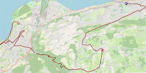
The day after the second rest day, competition resumes on the Tour de France 2026 with an individual time trial. Starting from Évian-les-Bains, each rider will begin with a climb to the summit of the Côte de Larringes, which will also serve as the second intermediate timing point of this time trial. From there, the route descends to the next timing point in Thonon-les-Bains on the banks of the Dranse River, before continuing on flat terrain to the finish in Thonon-les-Bains.Below you will find the schedule, profile, and OpenStreetMap map of the route for the sixteenth stage of the Tour de France 2026. Click on the images to enlarge them.
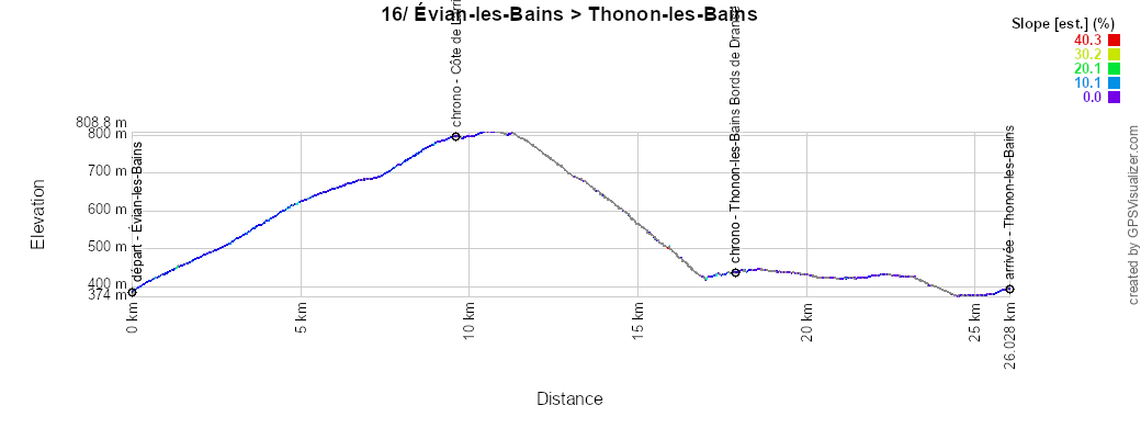
- Start:
- The start will take place at Place de la Libération in Évian-les-Bains
- Riders will start at one-minute intervals for the first group, then every 1'30", and finally every two minutes, between 1:00 PM for the first rider and 5:15 PM for the last
- Elevation gain: 500 m, with 9.7 km of categorized climbs
Mountain passes and climbs:- Côte de Larringes (2nd category) at km 9.7 – ^ 799 m / 9.7 km at 4.3%
- Finish: Avenue de la Ripaille in Thonon-les-Bains, at the end of a 200-meter-long, unobstructed final straight / width 5.5 m
- Departments crossed: Haute-Savoie (74) from km 0 to km 26.1
- Major cities: Évian-les-Bains and Thonon-les-Bains
17/ Wednesday, July 22, 2026 - Chambéry > Voiron - 174.7 km
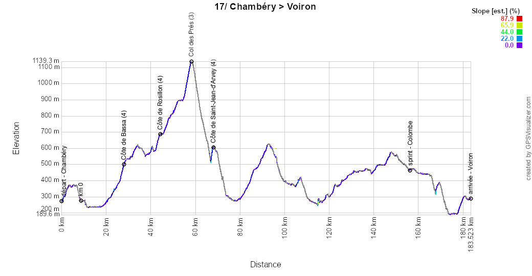
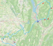
In the middle of the final week of the Tour de France 2026, this stage concentrates its challenges (four in total) into a loop at the start of the stage north of the starting city of Chambéry. Very soon after passing through Aix-les-Bains, the riders will climb the Côte de Bassa, and after a very short descent, they will continue on to the Côte de Rossillon, which flows seamlessly into the climb up the Col des Prés. The descent from the Col des Prés will be interrupted once again by an uphill section of road, the Côte de Saint-Jean d’Arvey. The gentler gradients of the road later in the stage do not qualify as a climb for the King of the Mountains classification.They then return to Chambéry, where they pass by the start line, before leaving the mountainous area via Les Echelles and Le Pont-de-Beauvoisin, then heading toward the intermediate sprint in Colombe, before proceeding to the finish in Voiron.
Below you will find the schedule, profile, and OpenStreetMap map of the route for the seventeenth stage of the Tour de France 2026. Click on the images to enlarge them.
- Start:
- The start will take place at Place du Centenaire in Chambéry (1:20 p.m.)
- The actual start is scheduled on the D991, 8.8 km from the assembly point (1:35 p.m.)
- Elevation gain: 2,200 m, with 7.8 km of categorized climbs
Mountain passes and climbs:- Côte de Bassa (4th category) at km 19.2 - ^ 481 m / 1.5 km at 5.5%
- Côte de Rossillon (4th category) at km 35.5 - ^ 686 m / 1.7 km at 5.3%
- Col des Prés (3rd category) at km 49.6 - ^ 1,142 m / 3.5 km at 6.8%
- Côte de Saint-Jean d’Arvey (4th category) at km 59.5 – ^ 611 m / 1.1 km at 5.7%
- Intermediate sprint: Route du Tram in Colombe at km 147.5
- Finish: Cours Sénozan in Voiron, at the end of a 350-meter-long final straight / 6 meters wide
- Departments crossed: Savoie (73) from km 0 to km 19.2 and from km 32.1 to km 105.2, Haute-Savoie (74) from km 20.7 to km 29.8, and Isère (38) from km 106.7 to km 174.7
- Major cities: Chambéry, Aix-les-Bains, Le Pont-de-Beauvoisin, Le Grand-Lemps, and Voiron
18/ Thursday, July 23, 2026 - Voiron > Orcières-Merlette - 185.2 km
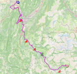
The following day, the 18th stage will also start from Voiron, marking a mountain stage with the main challenges at the very beginning and very end of the stage.From Voiron, the stage heads southeast, and very quickly the riders will face the climb up the Côte d’Engins. After the descent and a short stretch through the valley, they will then climb the Côte de Monteynard. Staying on the plateau and then beginning a short descent from La Mure, they will find themselves at the foot of the next climb, the Côte des Terrasses. After the intermediate sprint in Corps.
As they head toward the finish, they will climb the Côte de Saint-Léger-les-Mélèzes once more before beginning the final climb toward Orcières-Merlette.
Below you will find the schedule, profile, and OpenStreetMap map of the route for the eighteenth stage of the Tour de France 2026. Click on the images to enlarge them.

- Start:
- The start will take place on Avenue Raymond Tézier in Voiron (12:35 p.m.)
- The actual start is scheduled on the D1093 in Vourey, 10.6 km from the assembly point (12:50 p.m.)
- Elevation gain: 3,900 m, with 34.1 km of categorized climbs
Mountain passes and climbs:- Côte d’Engins (1st category) at km 36.7 – 854 m climb / 11.4 km at 5.4%
- Côte de Monteynard (2nd category) at km 92.2 - 844 m climb / 9.7 km at 5%
CONTINUE READING AFTER THIS ADVERTISEMENT
19/ Friday, July 24, 2026 - Gap > Alpe d’Huez - 127.9 km
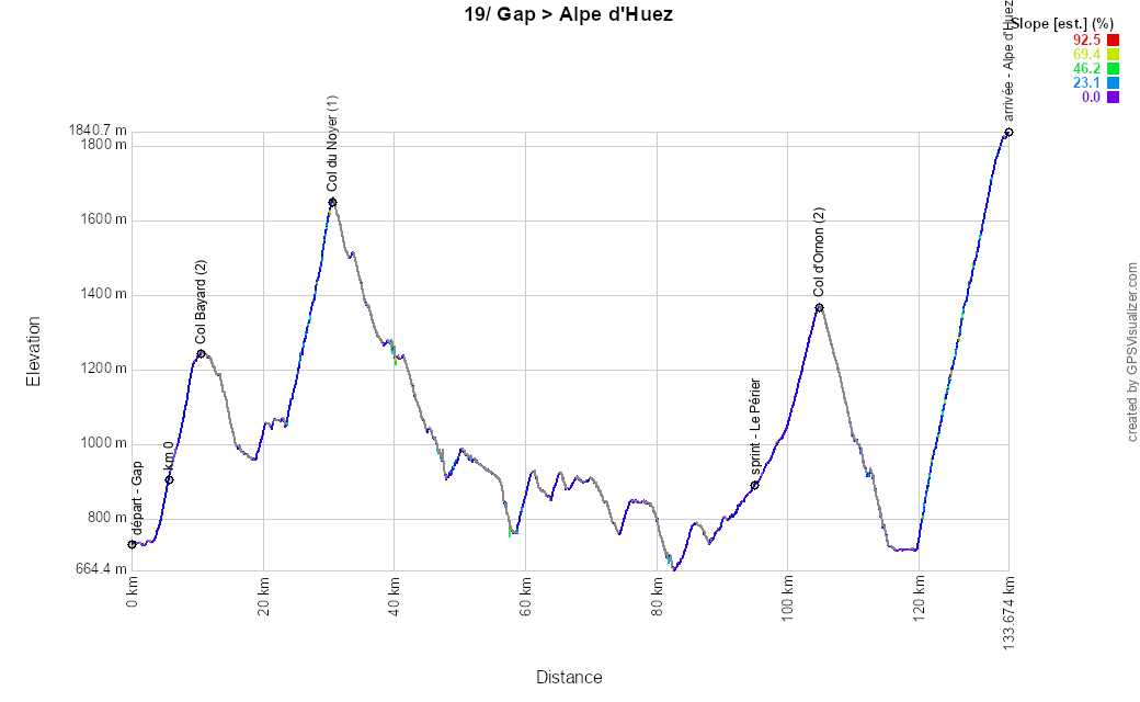
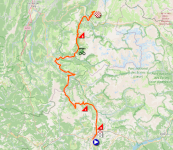
On the eve of the final weekend of the Tour de France 2026, a dense and compact stage awaits the riders, starting from Gap. Very soon, the riders will climb the Col Bayard, and shortly thereafter, they’ll tackle the Col du Noyer, followed by a long descent and a stretch through the valley via La Salle-en-Beaumont and Valbonnais. They will then compete for the intermediate sprint at Le Périer-Col d’Ornon.Descending toward Le Bourg d’Oisans, they will reach the foot of the final climb: the famous 21 bends of Alpe d’Huez.
Below you will find the schedule, profile, and OpenStreetMap map of the route for the nineteenth stage of the Tour de France 2026. Click on the images to enlarge them.
- Start:
- The start will take place on Avenue de Traunstein in Gap (2:00 p.m.)
- The actual start is scheduled on the N85, 5.7 km from the assembly point (2:15 p.m.)
- Elevation gain: 3,500 m, with 31.1 km of categorized climbs
Mountain passes and climbs:- Col Bayard (2nd category) at km 4.8 - ^ 1,246 m / 4.7 km at 7.2%
- Col du Noyer (1st category) at km 32.4 - ^ 1,664 m / 7.2 km at 8.5%
- Col d’Ornon (2nd category) at km 99.2 – elevation gain 1,371 m / 5.4 km at 6.4%
- Alpe d’Huez (hors catégorie) at km 127.9 – ^ 1,850 m / 13.8 km at 8.1%
- Intermediate sprint: Route du Col at Le Périer (Chantepérier) at km 89.4
- Finish: Avenue du Rif Nel in Alpe d’Huez, at the end of a 220-meter-long final straight / 6 meters wide
- Departments crossed: Hautes-Alpes (05) from km 0 to km 41.9 and Isère (38) from km 42.4 to km 127.9
- Major cities: Gap, Le Bourg d’Oisans, and Alpe d’Huez
20/ Saturday, July 25, 2026 - Le Bourg d’Oisans > Alpe d’Huez - 170.9 km
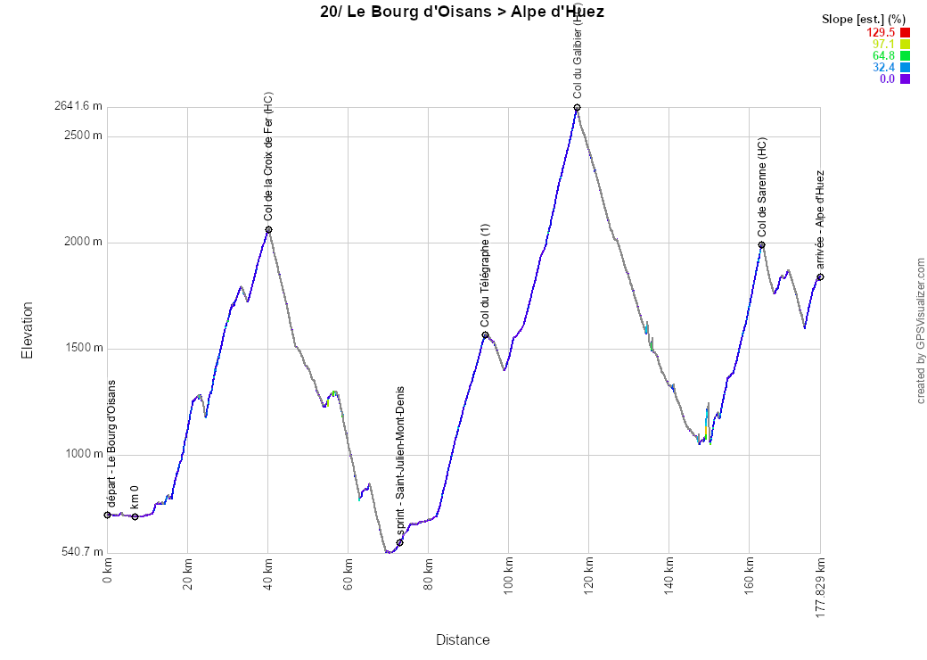
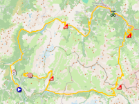
L’Alpe d’Huez? Yes, twice over! Indeed, this penultimate stage, starting from Le Bourg d’Oisans, will also end with the famous climb featuring 21 hairpin turns—but without actually climbing it via those 21 turns! And it will be a serious mountain stage to close out the Tour de France 2026, with no less than 5,450 m of elevation gain.The stage takes the form of a quasi-circuit, following a clockwise route. Passing through Allemond and Lac du Verney, the race climbs toward Lac de Grand-Maison and the Col de la Croix de Fer. After the descent to Saint-Jean-de-Maurienne, the riders will compete for the intermediate sprint in Saint-Julien-Mont-Denis. Through Saint-Michel-de-Maurienne, they then tackle the climb up the Col du Télégraphe… and after a short descent, they continue on to the Col du Galibier.
The descent to Mizoën then brings them to the foot of the Col de Sarenne, which this time will serve as the approach to Alpe d’Huez, the finish line—the same location as the previous day.
Below you will find the schedule, profile, and OpenStreetMap map for the route of the twentieth stage of the Tour de France 2026. Click on the images to enlarge them.
- Start:
- The start will take place on Avenue de la République in Bourg d’Oisans (11:20 a.m.)
- The actual start is scheduled on the D1091, 6.7 km from the assembly point (11:30 a.m.)
- Elevation gain: 5,450 m, with 66.4 km of categorized climbs
Mountain passes and climbs:- Col de la Croix de Fer (hors catégorie) at km 33.7 - ^ 2,067 m / 24 km at 5.2%
- Col du Télégraphe (1st category) at km 87.6 - ^ 1,566 m / 11.9 km at 7.1%
- Col du Galibier (hors catégorie) at km 110.5 - ^ 2,642 m / 17.7 km at 6.9%
- Col de Sarenne (Hors Catégorie) at km 156.5 - ^ 1,999 m / 12.8 km at 7.3%
- intermediate sprint: D1006 in Saint-Julien-Mont-Denis at km 66.5
- Finish: Avenue du Rif Nel in L’Alpe d’Huez, at the end of a 220-meter-long final straight in full view, following a 3.7-kilometer climb at 6.2% / width 6 m
- Departments crossed: Isère (38) from km 0 to km 24.8 and from km 142.5 to km 170.9, Savoie (73) from km 27.6 to km 110.5, and Hautes-Alpes (05) from km 111.4 to km 134.4
- Major towns: Le Bourg d’Oisans, Allemond, Saint-Jean-de-Maurienne, Saint-Michel-de-Maurienne, Valloire, Mizoën, and l’Alpe d’Huez
21/ Sunday, July 26, 2026 - Thoiry > Paris Champs-Élysées - 133 km
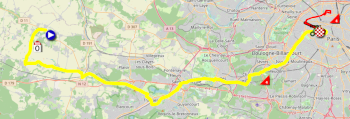
After a long transfer, the riders will set off from Thoiry for this final stage of the Tour de France 2026, specifically from the Thoiry Zoo Park. This is surprising, given that the Beauval Zoo is part of the Tour de France caravan. But then again, without being an official partner, it can’t claim any exclusivity.From Thoiry and then Garancières, the riders will head west on this final stage, passing through Neauphle-le-Vieux, Trappes, Saint-Cyr-l’École, Versailles, the Côte du Pavé des Gardes, and Issy-les-Moulineaux, on their way to Paris.
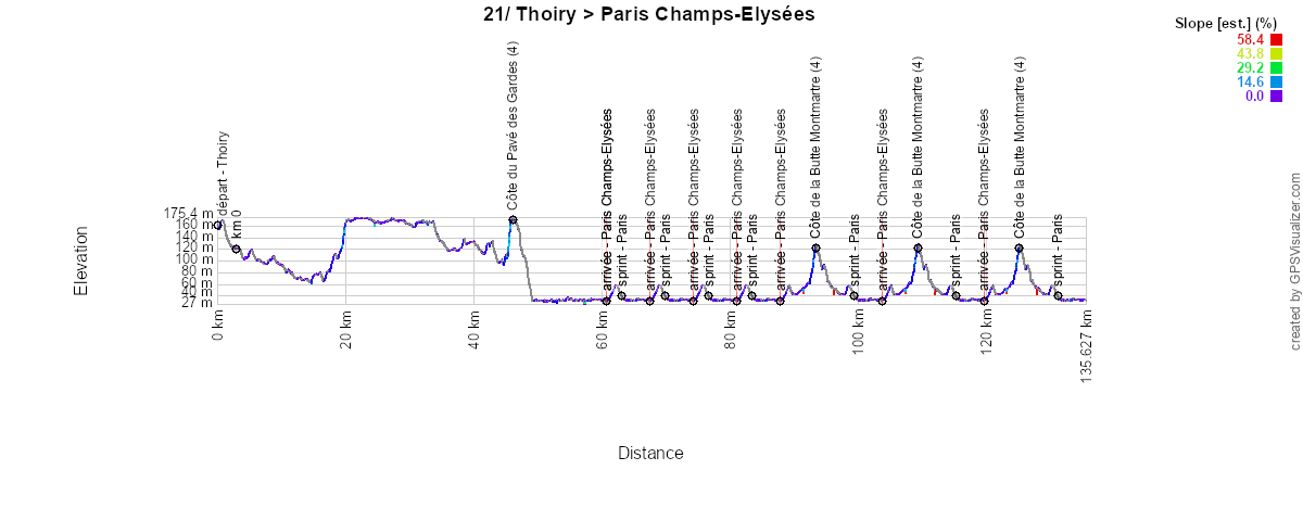
Upon arriving in the capital, they pass in front of the Louvre (without going through the Cour Carrée this time) and head along the Rue de Rivoli and the Place de la Concorde toward the finish line on the Champs-Élysées. This marks the end of the yellow section of the route shown on the map below. They then complete three laps of the usual circuit up to the top of the Champs-Élysées and back via the Place de la Concorde, then along the quays and through the tunnel that leads them to the Rue de Rivoli, returning via the Place de la Concorde to the finish line (black circuit), competing for the intermediate sprint on the third lap—not at the finish line but at the top of the Champs-Élysées. They then continue—this time all the way to the top of the Champs-Élysées and the Place de l’Étoile—before turning east (instead of taking the Rue Royale and the Madeleine as they did last year) and take the circuit inherited from the 2024 Paris Olympic Games, which passes through the Côte de la Butte Montmartre
Below you will find the schedule, profile, and OpenStreetMap map of the route for the twenty-first stage of the Tour de France 2026. Click on the images to enlarge them.
- Start:
- The start will take place on Rue du Pavillon de Montreuil at Wow Safari in Thoiry (4:15 p.m.)
- The actual start is scheduled on Route de Garancières, 3.1 km from the assembly point (4:25 p.m.)
- Elevation gain: 1,000 m, with 3.7 km of categorized climbs
Mountain passes and climbs:- Côte du Pavé des Gardes (4th category) at km 43.1 - ^ 180 m / 700 m at 9.7%
- Côte de la Butte Montmartre (4th category) at km 90.8, km 106.7, and km 122.7 - ^ 128 m / 1 km at 6.5%
- Intermediate sprint: Top of the Champs-Élysées in Paris at km 72.2, on the 3rd pass
- Finish: Champs-Élysées in Paris, at the end of a 700 m final straight / 8 m wide
- Departments crossed: Yvelines (78) from km 0 to km 40.4, Hauts-de-Seine (92) from km 41.4 to km 48.8, and Paris (75) from km 49 to km 133
- Major towns: Thoiry, Garancières, Jouars-Pontchartrain, Trappes, Saint-Cyr-l’Ecole, Versailles, Viroflay, Issy-les-Moulineaux, and Paris
Dive into the maps of the 2026 Tour de France route with the velowire app!
For several weeks now, maps of all the stages have been available in the velowire mobile app (in the Maps section)! This is now always the case, since it’s easier to publish the maps there as they become available than on the website.In the velowire app, which works on both mobile phones and tablets, you’ll also have the opportunity to fully immerse yourself in the experience, with the option to view the map in full-screen mode (by tapping the icon at the top right of the map) and display your location on it. You can enable “geolocation tracking” mode (by tapping the icon at the top left of the map) to help you find your way to the stage route as easily as possible! It’s never been easier to see exactly where the race is taking place.
| The 2026 Tour de France Route in Google Earth
Would you like to take a virtual flight over the map of one of the stages? Or would you like to see the entire route at a glance? You can do this by downloading the KMZ file (a zipped KML file) that lets you open the Tour de France 2026 route in Google Earth:>> Download the complete 2026 Tour de France route in Google Earth (KMZ file, 2.5 MB)
 PLEASE NOTE: As indicated above, you are not authorized to reproduce the contents of this KMZ file or any other part of this publication’s content, whether in its original form or in a derivative form. You can find more details on the copyright page, which explains that all content published on velowire.com is protected by copyright!door Thomas Vergouwen
Vond u dit artikel interessant? Laat het uw vrienden op Facebook weten door op de buttons hieronder te klikken!
4 comments | 21691 views
this publication is published in: Tour de France | Tour de France 2026 | OpenStreetMap/Google Maps/Google Earth
 by arbisman over
The riders will parade along a 900-meter route from the Recinte Modernista de Sant Pau, along Avinguda de Gaudí, to Plaça de Gaudí, and will then be officially presented to the public —team by team— on the plaza in front of the Sagrada Família