This weekend the Tour of Switzerland will start in Lugano with a 7.6 kilometer long time trial.
For this 9 days stage race, chosen by riders like Lance Armstrong (Team Radioshack), the Schleck brothers, Fabian Cancellara (Team Saxo Bank), Robbie McEwen (Katusha Team), Luis Léon Sanchez (Caisse d'Epargne), Oscar Pereiro Sio (Astana), Robert Gesink (Rabobank) or Mark Cavendish (HTC-Columbia) and George Hincapie (BMC Racing Team) as their preparation race for the Tour de France 2010, I propose you, as usual now for the different cycling races, the official route on Google Maps/Google Earth.
The Tour of Switzerland will take place from Saturday 12 till Sunday 20 June between Lugano and Liestal. The queen stage will be on Thursday 17 June between Meiringen and La Punt. During this stage, the riders will climb the Sustenpass (HC), the Oberallpass (1st category) and the Albulapass before the short descent towards the finish in La Punt.
The stages of the Tour of Switzerland 2010
Below you'll find a table with the 9 stages of the Tour of Switzerland 2010, a UCI ProTour race. Click on each of the stages to access a short description of the stage, the stage profile, the route map on Google Maps and the route and time schedules which indicate the time at which the riders of this 74th edition of the Tour of Switzerland pass through the different cities and villages.| # | type | date | start | finish | distance |
|---|---|---|---|---|---|
| 1 | individual time trial | Sa. 12 June 2010 | Lugano | Lugano | 7.6 km |
| 2 | in line | Su. 13 June 2010 | Ascona | Sierre | 177 km |
| 3 | in line | Mo. 14 June 2010 | Sierre | Schwarzenburg | 196.6 km |
| 4 | in line | Tu. 15 June 2010 | Schwarzenburg | Wettingen | 192.2 km |
| 5 | in line | We. 16 June 2010 | Wettingen | Frutingen | 172.5 km |
| 6 | in line | Th. 17 June 2010 | Meiringen | La Punt | 213.3 km |
| 7 | in line | Fr. 18 June 2010 | Savognin | Wetzikon | 204.1 km |
| 8 | in line | Sa. 19 June 2010 | Wetzikon | Liestal | 172.4 km |
| 9 | individual time trial | Su. 20 June 2010 | Liestal | Liestal | 26.9 km |
The route on Google Maps, the stage profiles and the time and route schedules for the stages of the Tour of Switzerland 2010
CONTINUE READING AFTER THIS ADVERTISEMENT
1/ Lugano > Lugano - 7.6 km
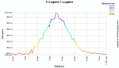
The first stage of the Tour of Switzerland 2010 is an individual time trial, which is the main target for Fabian Cancellara (Team Saxo Bank). It will take place in the streets of Lugano and contains a short climb with a 139 meters height difference.Below you'll find the time and route schedule, the stage profile and the route on Google Maps for this stage. Click on each of the images to open it.


2/ Ascona > Sierre - 167.5 km
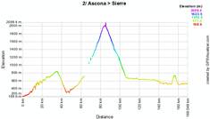
To connect Ascona with Sierre in 167.5 kilometers, the riders will go west after the start from the Via G. Motta and the Via Locarno, passing through Italy and climbing the Simplonpass (1st category) in the middle of the stage and a shorter climb in Valençon (3rd category).The first intermediate sprint is already at the 7th kilometer close to Corcapolo while two other intermediate sprints allow the riders to win some points at the end of the stage: at the first visit of the finish city in Sierre and on the circuit around this city in Réchy. The feeding zone will be in the climb of the Simplonpass in Simplon Dorf.
The stage finish will be on the Route de la Plaine.
Below you'll find the time and route schedule, the stage profile and the route on Google Maps for this stage. Click on each of the images to open it.


3/ Sierre > Schwarzenburg - 196.6 km
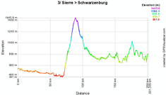
The 3rd stage of this 74th edition of the Tour of Switzerland will be run between Sierre and Schwarzenburg over a distance of 196.6 kilometers.After a slightly downhill start of the stage, the riders will start climbing in Aigle (the city where the International Cycling Union, UCI, is based) the Col des Mosses of the 1st category. After the descent, the rest of the stage is a bit hilly with at the end a 3rd category climb in Kalchstätten.
The two intermediate sprints of the stage are located around this climb, in Heitenried and in Alterswil while the feeding zone will be after the descent of the Col des Mosses, in Rossinière. In Schwarzenburg, the finish line will be drawn in the Freiburgstrasse.
Below you'll find the time and route schedule, the stage profile and the route on Google Maps for this stage. Click on each of the images to open it.


4/ Schwarzenburg > Wettingen - 192.2 km
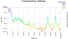
Direction nord-west this Tuesday to connect Schwarzenburg with Wettingen in 192 kilometers. The stage will be slightly hilly with in the last third of the stage two climbs of the Regensberg (3rd) in a circuit around the finish city. In the middle of the stage the riders will first battle in the intermediate sprint in Oftringen, followed 3 kilometers further by the feeding zone in Safenwil. In the loop around the finish city, two other intermediate sprints are programmed: in Otelfingen and in Niederweningen, at 11 kilometers from the finish in the Tägerhardstrasse in Wettingen.Below you'll find the time and route schedule, the stage profile and the route on Google Maps for this stage. Click on each of the images to open it.


CONTINUE READING AFTER THIS ADVERTISEMENT
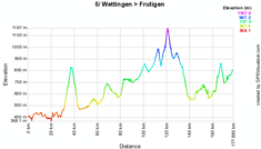
5/ Wettingen > Frutigen - 172.5 km
This 5th stage takes the riders back south, following a route which is almost parallel to the previous one but in the other direction. The start will be at the same place as the previous day's finish in Wettingen.After about 30 kilometers, the riders will be on the top of the Hämikon Berg, which does not award points for the King of the Mountains classification. A hilly part of the stage follows -with the feeding zone in the middle of the stage in Eschholzmatt- which ends with the climb of the Schallenberg (2nd category). After the descent 3 intermediate sprints are quite close, in Uetendorf, Amsoldingen and in Spiez, followed by the climb to Aeschi (3rd). After the descent of this last climb, the road towards the finish in Frutigen will be slightly uphill.
Below you'll find the time and route schedule, the stage profile and the route on Google Maps for this stage. Click on each of the images to open it.


6/ Meiringen > La Punt - 213.3 km
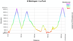
On Thursday 17 June 2010 the queen stage of this Tour of Switzerland 2010 is planned, both for its length (with 213.3 kilometers it's the longest stage of this Tour of Switzerland) and for its stage profile, with the climb of the Sustenpass (out of category) which has its top in the first 30 kilometers of the stage, immediately followed by the climb of the Oberalppass (1st category, 16.1 kilometers for a 942 meters height difference and thus an average gradient of 5.9%) and at the end of the stage the Albulapass (out of category) before a short descent towards the finish on the Via Chamuera in La Punt.The feeding zone will be at the foot of the first pass, in Distentis / Mustér.
Below you'll find the time and route schedule, the stage profile and the route on Google Maps for this stage. Click on each of the images to open it.


7/ Savognin > Wetzikon - 204.1 km
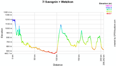
The next day, the riders of the Tour of Switzerland 2010 will find a stage which will probably be less difficult, downhill in the first half and with 3 climbs in the second half: in Wildhaus (2nd), Hulftegg (3rd) and finally in Vorderbetswill in the circuit around the finish city Wetzikon where the finish line will be drawn in the Rapperswilerstrasse.A first intermediate sprint after about 50 kilometers will be in Chur while the two others will be at the end of the stage: at the first crossing of the finish line in Wetzikon and the last one in Maiwinkel just after the climb of Vorderbetswill. The feeding zone will be just before the mountaineous part of the stage, in Oberräfis close to Buchs.
Below you'll find the time and route schedule, the stage profile and the route on Google Maps for this stage. Click on each of the images to open it.


8/ Wetzikon > Liestal - 172.4 km
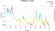
The forelast day of the Tour of Switzerland 2010 the riders will do a 172.4 kilometer long stage between Wetzikon and the final destination of this stage race, Liestal. During this stage they will have 4 3rd category climbs which award points for the King of the Mountains classification: Siglistorfer Höhe, Wittnauer Höhe, Wintersinger Höhe and finally in the circuit around the finish city the Windenthaler Höhe.The feeding zone will be in the middle of the stage in Leuggern while 3 intermediate sprints are on the route at the start of the stage in Winterthur, just before the first crossing of the finish line in the Fraumattstrasse in Liestal and finally between Arisdorf and Olsberg in the circuit around the city.
Below you'll find the time and route schedule, the stage profile and the route on Google Maps for this stage. Click on each of the images to open it.


CONTINUE READING AFTER THIS ADVERTISEMENT
9/ Liestal > Liestal - 26.9 km
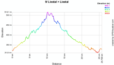
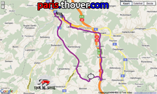
The Tour of Switzerland 2010 finishes with an individual time trial of 26.9 kilometers around the city of Liestal in the north of Switzerland. The first 11.4 kilometers will be slightly uphill and quite naturally the intermediate time registration will thus be on the "top". Close to the end of the stage the riders will have to do a little extra final effort in this individual performance to climb towards the finish line where the Tour of Switzerland 2010 ends for them and where we'll know the overall general classification of this stage race.Below you'll find the time and route schedule, the stage profile and the route on Google Maps for this stage. Click on each of the images to open it.

The Tour of Switzerland 2010 route downloadable in Google Earth
Above you have discovered all details of the stages of this 74th Tour of Switzerland including the time- and route schedules and the stage profiles and for each of them the route on Google Maps.If you would like to see the full Tour of Switzerland 2010 route, I invite you to download the file below to open it in Google Earth.
>> Download the Tour of Switzerland 2010 route in Google Earth

This file not only allows you to see the complete route in Google Earth but also to make a virtual fly-over of one or more stages. door Thomas Vergouwen
Vond u dit artikel interessant? Laat het uw vrienden op Facebook weten door op de buttons hieronder te klikken!
3 comments | 28806 views
this publication is published in: Tour of Switzerland | Tour of Switzerland 2010 | UCI ProTour | OpenStreetMap/Google Maps/Google Earth


 by marco1988 over
http://www.cyclisme-roltiss-over.com/article-le-parcours-du-tour-de-suisse-2010-sur-google-maps-google-earth-52081273.html
Thomas bedankt om de Tour de Suisse zo snel op goole maps te zetten ook de Dauphiné heb ik gedownload mooi om volgen kaart op pc en dan op TV volgen groetjes Yvan
bonjour et amicales saluttions