This Saturday, the 96th Giro d'Italia, the Tour of Italy 2013, will start in Naples for 21 stages and a total distance of 3454.8 km.
As usual, I allow you to discover all the details of the race route, in Google Maps/Google Earth, but also with the official time- and route schedules and the profiles of all stages. Finally, you'll find a KML file which you can open in Google Earth and which allows you to go discover the different stages, with a virtual fly-over for example!
The Tour of Italy 2013 will be a bit longer even than what was initially announced since the recognition of the different stages and local constraints always lead to quite some changes in this first Grand Tour of the year.
This Giro will have 2 individual time trials (54.8 and 20.6 km) of which the second will be uphill, 1 team time trial (17.4 km), 7 sprinters stages, 5 medium mountain stages (including 1 with mountain top finish) and 5 high mountain stages, all with mountain top finish.
Some housekeeping before you get to discover all details of the stages of the Giro d'Italia 2013:
- as for all contents on velowire.com, its reproduction or any other copy in any form is forbidden, as lined out on the copyright page. Please respect the time spent on the preparation of contents like these!
- the race routes of the different stages have been drawn as precisely as possible, but there might be some small differences with the real race route, because of some unprecise information in the time- and route schedules and non detailed maps as provided by the organisor of the race; if you plan to go see the race on the side of the road, please ask locally to make sure you're at the right place
- the stage profiles have been generated automatically, based on altitude information available for the places the race visits; there are some differences with the real profiles as well (at some places, the generated profile shows a 40% steepness for example), but the gloabl profile is always correct!
The Giro d'Italia 2013 race route on Google Maps
CONTINUE READING AFTER THIS ADVERTISEMENT
1/ Saturday 4 May 2013 - Napoli > Napoli - 130 km
The first stage will be a loop around Naples since the coast city will be both start and finish city of this stage.This will be a flat stage on a double circuit: a first 16.3 kilometer long circuit which the riders will do 4 times and a second circuit of 8.05 kilometers, which they'll do 8 times. After the start from the Piazza Plebiscito, the riders will rapidly get to km 0 of this stage when they enter the first circuit, which partially follows the coast line and then goes up a short climb at Possilippo which counts for the King of the Mountains classification at the 2nd and 3rd crossing on top.
On the short circuit, the riders will find an intermediate sprint on the finish line, when they cross it for the 9th time. This finish line will be drawn in the via Caracciolo.
You'll find below the time- and route schedule, the stage profile and the race route on Google Maps for this stage. Click on the images to open them.


2/ Sunday 5 May 2013 - Isola d'Ischia - team time trial - 17.4 km
For the second stage, this Sunday, the Giro d'Italia 2013 will visit the Ischia island north of the gulf of Naples, for a team time trial between the harbour of Ischia and Forio, over a distance of 17.4 kilometers. The stage will be almost completely flat and will allow the expert teams of this discipline to make the difference.You'll find below the time- and route schedule, the stage profile and the race route on Google Maps for this stage. Click on the images to open them.


3/ Monday 6 May 2013 - Sorrento > Marina di Ascea - 222 km
Back on the main land, the riders will start in Sorrento for a medium mountain stage of 222 kilometers which follows the coast line down to Agropoli before it goes landinwards to go find the climbs of San Mauro Cilento and Sella di Catona which is close to the finish in Marina di Ascea, back on the coast.You'll find below the time- and route schedule, the stage profile and the race route on Google Maps for this stage. Click on the images to open them.


4/ Tuesday 7 May 2013 - Policastro Bussentino > Serra San Bruno - 246 km
The next day, the 4th stage will again be a medium mountain stage and with its 246 kilometer distance it's one of the longest stages of this Giro d'Italia 2013, between Policastro Bussentino and Serra San Bruno. Between those two cities, the riders will see a quite flat first part of the stage (over about 185 kilometers) following the coast line from north to south towards the point of the foot of Italy, before they get landinwards and find the climbs of Vibo Valentia and the Croce Ferrata at less than 7 kilometers from the finish.You'll find below the time- and route schedule, the stage profile and the race route on Google Maps for this stage. Click on the images to open them.


CONTINUE READING AFTER THIS ADVERTISEMENT
5/ Wednesday 8 May 2013 - Cosenza > Matera - 203 km
A transfer of 120 kilometers further, the 5th stage will start in Cosenza for a flat stage over 203 kilometers. It does contain 2 climbs for the KOM classification though and a small other climb. The two climbs are quite far away from each other: Cipolletto after 37.2 kilometers in the race and Montescaglioso 145.5 kilometers further. Nothing important enough though to prevent the sprinters to get a chance to cross the finish line in Matera first.You'll find below the time- and route schedule, the stage profile and the race route on Google Maps for this stage. Click on the images to open them.


6/ Thursday 9 May 2013 - Mola di Bari > Margherita di Savoia - 169 km
The 6th stage is again a flat stage which will start on the coast in Mola di Bari.The stage will follow the coast line until Barletta where it'll go landinwards via Andria and Canosa di Puglia before it gets back to the coast and the finish in Margherita di Savoia. The finish line will be drawn close to the beach but the riders will still have a 16.6 kilometer loop around the city which they'll do twice.
No difficulties are referenced for this stage and it's thus most probable that this stage will again finish in a sprint ... except if a breakaway goes on until the finish?
You'll find below the time- and route schedule, the stage profile and the race route on Google Maps for this stage. Click on the images to open them.


7/ Friday 10 May 2013 - Marina di San Salvo > Pescara - 177 km
After the 6th stage the riders and followers of the Tour of Italy 2013 will do a 170 kilometer long transfer and get back together in Marina di San Salvo for the start of the 7th stage which will bring back the medium mountains.Indeed, this stage is hilly from the start till the finish but only in the last third of the stage, the riders will go find points for the KOM classification on no less than 4 referenced climbs in only 40 kilometers, with a total height gain of 2,600 meters. These climbs are Villamagna, Chieti-Pietragrossa, Chieti-Tricalle, Santa Maria de Criptis and finally San Silvestro. The finish will be in Pescara at about 7 kilometers from the top of the last mentioned climb.
You'll find below the time- and route schedule, the stage profile and the race route on Google Maps for this stage. Click on the images to open them.


8/ Saturday 11 May 2013 - Gabicce Mare > Saltara - individual time trial - 54.8 km
On Saturday 11 May, after a transfer of no less than 215 kilometers, an individual time trial in on the programme of this 96th edition of the Giro d'Italia. The race route for this stage will be quite flat between Gabicce Mare and Saltara. The distance of 54.8 kilometers will give the time trial specialists a little bit over an hour to gain back some precious seconds on their competitors in the general classification.They can compare their time to the one of their competitors when they get to Pesaro.
You'll find below the time- and route schedule, the stage profile and the race route on Google Maps for this stage. Click on the images to open them.


CONTINUE READING AFTER THIS ADVERTISEMENT
9/ Sunday 12 May 2013 - Sansepolcro > Firenze - 170 km
After this solo effort, a transfer of 110 kilometers is necessary to get to the start of this 9th stage in Sansepolcro. This 9th stage is a medium mountain stage, over a distance of 170 kilometers, which will include the Passo della Consuma, the climb of Vallombrosa, of Vetta le Croci and finally of Fiesoli. Less than eleven kilometers after the top of the last mentioned climb, the finish line will be drawn in Firenze.You'll find below the time- and route schedule, the stage profile and the race route on Google Maps for this stage. Click on the images to open them.


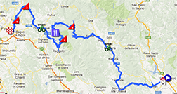
R1/ Monday 13 May 2013 - rest day in Cordenons
Before they attack the high mountains the next day, the riders can - after 9 stages - get some rest in Cordenons, at more than 330 kilometers from the finish the day before!10/ Tuesday 14 May 2013 - Cordenons > Altopiano del Montasio - 167 km
The first high mountains stage, which will have - like all high mountains stages of this Giro - a mountain top finish, will start almost easily after the start from Cordenons, with a gradual climb towards the foot of the Passo Cason di Lanza which will be at 102.6 kilometers from the start and which top will be 14.8 kilometers further (907 meters height difference with an average steepness of 8.5% and a maximum of 16%).The descent of this climb goes on in the final climb towards the top of the Altopiano del Montasio, a 10.95 kilometer long climb with a height difference of 841 meters and an average steepness of 7.8% with a maximum of 20%! This stage, and more specifically this climb, will this year be the fans stage of the Giro, based on the presence of the Italian race on the social networks. Indeed, 200 fan tweets will be printed on the road of the Montasio and encourage the riders until the finish of the stage.
You'll find below the time- and route schedule, the stage profile and the race route on Google Maps for this stage. Click on the images to open them.


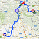
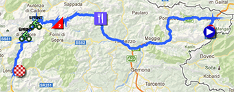
11/ Wednesday 15 May 2013 - Tarvisio (Cave del Predil) > Vajont 1963/2013 (Erto e Casso) - 182 km
The 11th stage will start in Tarvisio and it will be a medium mountain stage over a distance of 182 kilometers which starts going down for 88 kilometers where the climb of the Sella Campigotto will start at the exit of the feeding zone in Ovaro.The difficulties won't end there though because this stage has a mountain top finish, in Vajont, and this finish will commemorate the landslide which took place on 9 October 1963 there.
You'll find below the time- and route schedule, the stage profile and the race route on Google Maps for this stage. Click on the images to open them.


CONTINUE READING AFTER THIS ADVERTISEMENT
12/ Thursday 16 May 2013 - Longarone > Treviso - 134 km
After these quite difficult stages, this 12th stage will be flat and short, between Longarone and Treviso.Two hills will be climbed during this stage: the Muro di Ca' del Poggio and the Montello Santa Maria della Vittoria, at 41 kilometers from the finish.
You'll find below the time- and route schedule, the stage profile and the race route on Google Maps for this stage. Click on the images to open them.


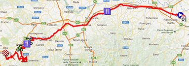
13/ Friday 17 May 2013 - Busseto > Cherasco - 254 km
After a transfer of 180 kilometers, the riders will get to the start of the 13th stage on this Friday 17 May 2013 in Busseto for a new flat stage, a long one this time with its 254 kilometer distance which is more than the usual maximum distance of a stage in a Grand Tour and this is the longest stage of this Giro d'Italia 2013.This stage starts completely flat for 210 kilometers until the short climb of Tre Cuni. The end of this stage is a bit hilly until the finish in Cherasco.
You'll find below the time- and route schedule, the stage profile and the race route on Google Maps for this stage. Click on the images to open them.


14/ Saturday 18 May 2013 - Cervere > Bardonecchia - 168 km
The 3rd weekend of the Giro d'Italia 2013 will see two high mountain stages, starting with the one between Cervere and Bardonecchia (Jafferau). After 87 kilometers the riders will start the climb of Sestrière where they'll get on top after 125 kilometers in the race, at an altitude of 2035 meters.After the descent of this climb, the final climb will start at 8.6 kilometers from the finish and will bring the riders 627 meters higher with an average steepness of 9% and a maximum of 14%. The finish will be on a sand road.
You'll find below the time- and route schedule, the stage profile and the race route on Google Maps for this stage. Click on the images to open them.


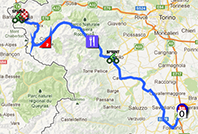
15/ Sunday 19 May 2013 - Cesane Torinese > Col du Galibier (FR)
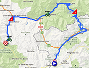
The 15th stage will mainly take place in France because after 50 kilometers, in the climb to the top of the Col du Mont Cenis, the riders will cross the border.After the descent of the Mont Cenis via Modane (interrupted by a short climb towards the sprint in Aussois), the riders will go on with the upfollowing Col du Télégraphe and Col du Galibier known from the Tour de France and the finish will be
Après négociations entre rcs et la préfecture il n y à plus de risque d avalanche au montcenis ni au galibier ! #aquelprix
— jerome pineau (@jejeroule44) May 18, 2013
This stage is one of the hardest of this Tour of Italy 2013!
You'll find below the time- and route schedule, the stage profile and the race route on Google Maps for this stage. Click on the images to open them.


CONTINUE READING AFTER THIS ADVERTISEMENT
R2/ Monday 20 May 2013 - rest day in Valloire (FR)
After these two difficult stages, it's time to get some rest in France, in Valloire.16/ Tuesday 21 May 2013 - Valloire (FR) > Ivrea - 238 km
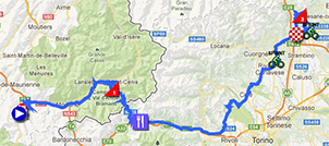
The day after the second rest day, the stage start will also be in Valloire.The riders won't stay long in France though because they'll start with a short part of the climb of the Col du Télégraphe and redescend to Saint-Michel-de-Maurienne so they can go via Modane to the climb of the Col du Mont Cenis. In the descent of the Mont Cenis they'll get back in Italy and the rest of the stage is quite flat until about twenty kilometer from the finish where a short but steep climb towards Andrate is on the programme before the finish in Ivrea.
You'll find below the time- and route schedule, the stage profile and the race route on Google Maps for this stage. Click on the images to open them.


17/ Wednesday 22 May 2013 - Caravaggio > Vicenza - 214 km
The 17th stage will bring back a flat stage and that's definitely the case here because after the start in Caravaggio the race route will be as flat as a pancake for at least 180 kilometers.A short climb in Crosara will have it's highest point at 16 kilometers from the finish in Vicenza.
You'll find below the time- and route schedule, the stage profile and the race route on Google Maps for this stage. Click on the images to open them.


18/ Thursday 23 May 2013 - Mori > Polsa - individual mountain time trial - 20.6 km
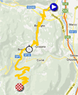
This Thursday will see a new individual time trial in this Giro. It'll however not just be a time trial because it's what the Italians call a cronoscalata, a mountain time trial.The race route will be 20.6 kilometers long and will start climbing 1.6 km after the start from the velodrome in Mori, with a regular climb at 6% until the intermediate timing point in Brentonico, followed by an easier part before it continues the climb at an average of 6.8% - and a maximum of 10% - until the finish in Polsa.
You'll find below the time- and route schedule, the stage profile and the race route on Google Maps for this stage. Click on the images to open them.


CONTINUE READING AFTER THIS ADVERTISEMENT
19/ Friday 24 May 2013 - Ponte di Legno > Val Martello/Martelltal - 139 km
Even though this stage is only 139 kilometers long starting in Ponte di Legno, it still is one of the hardest stages of this Giro d'Italia 2013 with the successive climbs of the Passo di Gavia (16.5 km for a 1320 meter height difference and thus an average steepness of 8% going up to 16% maximum), the Passo dello Stelvio (21.7 km for a height difference of 1553 meters and thus an average steepness of 6.9% going up to 12% maximum) and the final climb towards Val Martello, 22.35 kilometers long for a height difference of 1422 meters and thus an average steepness of 6.4% going up to 14% maximum.You'll find below the time- and route schedule, the stage profile and the race route on Google Maps for this stage. Click on the images to open them.


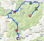
20/ Saturday 25 May 2013 - Silandro/Schlanders > Tre Cime di Lavaredo (Auronzo di Cadore) - 203 km
The stage the day before the final finish of this Giro d'Italia 2013 is again a high mountain stage, which starts in Silandro.After 65 kilometers pretty much going down, the riders will start the successive climbs of the Passo Costalunga (Karerpass) and the Passo di San Pellegrino (11.8 km for a height difference of 753 meters and thus an average steepness of 6.4% going up to 14% maximum).
A bit further, the next climb will be the Passo Giau (15.65 km for a height difference of 1259 meters and thus an average steepness of 8% going up to 14% maximum) and the successive climbs of the Passo Tre Croci (7.95 km for a height difference of 580 meters and thus an average steepness of 7.3% going up to 12% maximum) and the final climb towards Tre Cime di Lavaredo (Auronzo di Cadore) (7.1 km for a height difference of 607 meters and thus an average steepness of 8.6% going up to 18% maximum!) which will most probably give some nice TV images everywhere around the world!
You'll find below the time- and route schedule, the stage profile and the race route on Google Maps for this stage. Click on the images to open them.


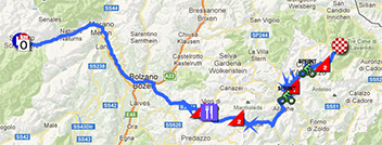
21/ Sunday 26 May 2013 - Riese Pio X > Brescia - 197 km
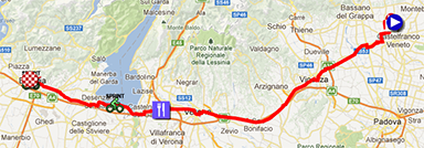
The last stage is completely flat between Riese Pio X and Brescia. The riders will cross the finish line for the first time after 163.7 kilometers but they'll still have to do 7 laps on a circuit of 4.2 kilometers before they cross the finish line for the last time and we'll know the name of the winner of this stage, most probably a sprinter. The overall winner of the general classification of this Giro d'Italia 2013 will indeed most probably be known before the start of the stage and be the rider who wears the pink jersey at the end of the previous stage!You'll find below the time- and route schedule, the stage profile and the race route on Google Maps for this stage. Click on the images to open them.


The Giro d'Italia 2013 race route in Google Earth
Would you like to see all stages of the Tour of Italy 2013 on one single map? Or go discover these 21 stages with a virtual fly-over for example? Download the KML file below and open it in Google Earth to do so:>> Download the Giro d'Italia 2013 race route in Google Earth

Vond u dit artikel interessant? Laat het uw vrienden op Facebook weten door op de buttons hieronder te klikken!
9 comments | 35450 views
this publication is published in: Giro d Italia | Giro d'Italia 2013 | OpenStreetMap/Google Maps/Google Earth


 by marco1988 over
La dernière semaine va donner, avec 4 superbes étapes de montagne (14,15,19 et 20) plus un chrono en altitude!
Quel(s) Français voyez-vous en mesure de rivaliser avec les meilleurs (-> les têtes d'affiche le plus fréquemment pronostiquées)... pour accéder au podium ?
"P 22"
Thomas
Mettra-tu un lien pour suivre la course en live comme l'année dernière (et comme pour les 4 jours de Dunkerque) ?
Bonjour à Tous,
Pierre, les chances françaises pour un top 10 reposent sur Jeannesson (pas trop en vu depuis le début de saison), un top 20 sur Casar et Dupont (s'il sont de retour en forme), des victoires d'étapes pour ces derniers et sur Mourey et Bouhanni principalement.
Bapt, j'espère que Thomas mettre également un lien, mais avec le rachat par beinsport, il faudra aller regarder sur eurosport english 2, malheureusement, la gazetta ne diffuse plus.
bonne journée
@Pierre, comme le dit Aurélien, je ne pense pas qu'il faille vraiment compter sur un coureur Français pour accéder au podium. En effet, parmi ceux présents, Julien Berard, Guillaume Bonnafond, Hubert Dupont, Sylvain Georges, Nacer Bouhanni, Sandy Casar, Arnold Jeannesson, Johan Le Bon, Francis Mourey, Laurent Pichon, Anthony Roux, Jérôme Pineau, Thomas Damuseau, il y a probablement plus de chances de victoires d'étape qu'une place sur le podium final !
@bapt77 : je ne propose sur mon site que des flux légaux*. Jusqu'à l'année dernière le Giro proposait un flux en libre accès et non géo-bloqué sur son site officiel qui pouvait être repris ici. Ce n'est plus le cas cette année et je ne peux donc malheureusement plus l'intégrer :-(.
* il y a suffisamment de sites qui mettent en avant des flux illégaux et de mon côté je respecte les droits des autres comme j'aimerais qu'on respecte les miens ;-).
Toutes ces réponses ou explications me satisfont (elles sont en totale concordance avec ma "vision des choses".
Merci à tous.
"P 22"
Désolé Bapt et Aurélien ! Il fallait juste (re)trouver le site de la RAI pour avoir un flux officiel, légal et non géo-bloqué :-). Le live est donc maintenant mis en avant au même niveau que celui des 4JDK !
Merci Thomas, j'étais justement en train de chercher un lien.
Bonsoir.
C'est vrai qu'il y a intéret à disposer d'un très large "bouquet" de chaines pour en dégotter une (pas deux) retransmettant le Tour d'Italie en direct.
Peu importe la langue ! Temps superbe dans la baie de Naples.
Je suis en désaccord avec la classification des étapes dans le cadre d'une très belle présentation.
Le Giro 2013 concentre selon moi 4 étapes de haute montagne : Jafferau, Galibier, Paradiso del Cevedale, et Tre Cime di Lavaredo.
Je l'ai déjà mentionné, j'aurais préféré une arrivée en descente.
Vu l'espace entre le Stelvio et la montée finale irrégulière et assez dure du Val Martello, j'aurais fixé la ligne blanche à Trafoi en intégrant deux cols avant le mythique tandem Gavia-Stelvio.
Les étapes de l'Altopiano Montasio et du Vajont ne sont ni de haute montagne ni de moyenne montagne, meme si je suis persuadé que l'arrivée au sommet sur les hauteurs de la sella Nevea devrait avoir plus d'impact.
Je retiens 3 "trips" de moyenne montagne : Serra San Bruno (qui m'inspire peu), Florence et Ivrea avec des cols plutot pentus qui pourraient surprendre. Quel contraste avec les exercices qu'ASO (sauf Porrentruy 2012) propose "minablement" en montagne intermédiaire.
Bombarder moyenne montagne l'étape vers la station balnéaire d'Ascea ne s'explique pas.
Etape accidentée, comme le très beau découpage vers Pescara.
Il serait également judicieux qu'à l'avenir, les "caciques" d'Issy-les-Moulineaux se "calquent" sur ce genre de parcours : Sheffield 2014 ?
Un dernier mot sur les chronos : bien mieux "répartis" et "porteurs" que les choix "inconséquents et "déséquilibrés inversément" des Tours 2012 et 2013.
Buona notte.