As usual, velowire.com offers you, a few days before the start of the Tour de France 2013, to discover all details of the race route of this 100th edition of the Grande Boucle, on Google Maps/Google Earth.
With the information in this article you'll exactly know where, in which cities and villages the Tour will go and thus prepare your visit or simply better understand the race!
Some preliminary information ...
Some of you might already have discovered the Google Maps of the race route published by the organisor of the Tour de France on the official website of the race.velowire.com could thus have simply set up a link to that website or integrated the maps as published on letour.fr. When you look a little bit closer however you quickly realise that these maps are not very detailed (the lines don't really follow the roads correctly) and they also contain mistakes at some places. Furthermore, you wouldn't have been able to discover the race route in Google Earth and thus for example do a virtual fly-over of the stages of the Tour de France 2013.
That's why you'll find in this article, as usual for a big number of cycling races, all information about the race route of the 100th Tour, including Google Maps, the time- and route schedules and the profiles, but also detailed information about the visited cities, the departments which are visited by each of the stages, the climbs, the sprints, the feeding zones, the roads followed between start and km 0 and all other information which might be useful to understand the race route of this Tour de France completely made in France!
Some housekeeping before you get to discover all details of the stages of the Tour de France 2013:
- as for all contents on velowire.com, its reproduction or any other copy in any form is forbidden, as lined out on the copyright page. Please respect the time spent on the preparation of contents like these!
- the stage profiles have been generated automatically, based on altitude information available for the places the race visits; there might be some differences with the real profiles, but the global profile is always correct!
The Tour de France 2013 race route on Google Maps
Now let's discover all these details of the Tour de France 2013 race route, stage by stage:CONTINUE READING AFTER THIS ADVERTISEMENT
1/ Saturday 29 June 2013 - Porto-Vecchio > Bastia - 213 km
For the first time in its history, that is 110 years, the Tour de France goes to Corsica for quite an exceptional Grand Départ.The first stage will start in Porto-Vecchio, being saluted by the Patrouille de France and the Equipe de de voltige of the army who will realise acrobatic figures in the air above Porto-Vecchio, for a 213 kilometer long stage which first goes off to Bonifacio to offer some nice images of the race and Corsica (this stage will be broadcasted from start till end by France Télévisions) and then goes back to Porto-Vecchio via the Côte de Sotta and then follow the coast to the north of Corsica and the city Bastia.
Hereunder you'll find the time- and route schedule, the profile and the race route of this stage on Google Maps. Click on the images to open them.


- start: once the riders are gathered at the Port de Plaisance for the signature between 10.40AM and 11.40AM, followed by the official start ceremony at 11.45AM, the start will be at 12.00PM and the riders will then follow the rue Commandant l’Herminier, rue Maréchal June, rue Jean Jaurès, avenue Maréchal Leclerc, rue Guidice di Cinarca, rue Vicentellu d’Istria, rue des Turriccioli, rocade, N198 where the real start will be at 12.15AM at 8 km from the initial start
- climbs: Côte de Sotta of the 4th category at km 45.5 (1.1 km @ 5.9%)
- feeding zone: Solaro at km 100
- intermediate sprint: San-Giuliano at km 150
- finish: route de l'Arinellea in Bastia, after a final straight part of 380 m (last turn at 2000 m), width 6.5 m
- visited departments: Corse-du-Sud (2A) from km 0 till km 100, Haute-Corse (2B) from km 100 till km 213
- main cities: Porto-Vecchio, Bonifacio (close), Ghisonaccia, Aléria, Bastia
2/ Sunday 30 June 2013 - Bastia > Ajaccio - 156 km
The second stage of the Tour de France 2013 will start in Bastia and cross the island diagonally towards Ajaccio. At the center of the island the riders will have to go up 3 climbs and they'll find another difficulty closer to the finish on the Pointe de Parata in Ajaccio, looking at the Îles Sanguinaires. Yet again some nice images for the TV broadcast which will again be from start to finish.Hereunder you'll find the time- and route schedule, the profile and the race route of this stage on Google Maps. Click on the images to open them.


- start: once the riders are gathered sur la Place Saint-Nicolas for the signature between 12.15AM à 13.15AM, the start will be at 1.25PM and the riders will then follow the avenue Maréchal sebastiani, boulevard Paoli, boulevard Auguste Gaudin, cours Favale, place Vincetti, rue César Vezzani, avenue de la Libération, avenue sampiero Corso, N193 where the real start will be at 13.40AM at 6.5 km from the initial start
- climbs: Col de Bellagranajo of the 3rd category at km 70 (6.6 km @ 4.6%), Col de la Serra of the 3rd category at km 85 (5.2 km @ 6.9%), Col de Vizzavona of the 2nd category at km 95.5 (4.6 km @ 6.5%), Côte du Salario of the 3rd category (1 km @ 8.9%)
- feeding zone: Vivario at km 87
- intermediate sprint: Castello-di-Rostino at km 33
- finish: route des Sanguinaires (Pointe de la Parata) in Ajaccio, after a final straight part of 340 m, width 6 m
- visited departments: Haute-Corse (2B) from km 0 till km 101, Corse-du-Sud (2A) from km 101 till km 156
- main cities: Bastia, Corte, Ajaccio
3/ Monday 1st July 2013 - Ajaccio > Calvi - 145,5 km
Following almost all the time the coast road between Ajaccio and Calvi, the riders of the Tour de France 2013 will get up 4 climbs during this stage, including the Côte de Porto where they'll visit the magnificent calanques de Piana.Hereunder you'll find the time- and route schedule, the profile and the race route of this stage on Google Maps. Click on the images to open them.


- start: once the riders are gathered on the Place Miot for the signature between 11.25AM till 12.25PM, the start will be at 12.35PM and the riders will then follow the boulevard Albert 1er, boulevard Pugliesi Conti, boulevard Scamaroni, rue Miss Campbell, cours Général Leclerc, cours Grandval, avenue de Paris, cours Napoléon, montée saint-Jean, rue Biancamaria, route d’Atala, boulevard Abbé Recco, boulevard sebastianu Costa, boulevard Louis Campi, N194, Mezzavia, D81 where the real start will be at 12.55PM at 8.7 km from the initial start
- climbs: Col de San Bastiano of the 4th category at km 12 (3.4 km @ 4.6%), Col de San Martino of the 3rd category (7.5 km @ 5.4%), Côte de Porto of the 3rd category (2 km @ 6.4%) and Col de Marsolino of the 2nd category (3.3 km @ 8.1%)
- feeding zone: Serriera at km 78.5
- intermediate sprint: Sagone at km 28.5
- finish: route de Calenzana in Calvi, after a final straight part of 200 m (last turn at 450 m), width 6.5 m
- visited departments: Corse-du-Sud (2A) from km 0 till km 117.5, Haute-Corse (2B) from km 116.5 till km 145.5
- main cities: Ajaccio, Cargèse, Piana, Partinello, Osani, Calvi
4/ Tuesday 2 July 2013 - Nice > Nice (team time trial) - 25 km
The 4th stage of the Tour de France will see the comeback of the team time trial since 2011 and the stage around Les Essarts in the Vendée region. The teams will start close to the Place Masséna in Nice and will follow the coast down to the airport and then turn right for a short loop north-west of Nice before the teams return via the same roads towards the Promenade des Anglais in Nice.Hereunder you'll find the time- and route schedule, the profile and the race route of this stage on Google Maps. Click on the images to open them.


- start: once they arrive on the Place Masséna, each of the teams will start from the start ramp in the Avenue de Verdun, each 4 minutes from 3.15PM; the last team should start at 4.39PM
- climbs: none
- feeding zone: none
- intermediate sprint: none
- finish: Promenade des Anglais in Nice, after a final straight part of 3,000 m, width 6 m
- visited departments: Alpes-Maritimes (06) from km 0 till km 25
- main cities: Nice
CONTINUE READING AFTER THIS ADVERTISEMENT
5/ Wednesday 3 July 2013 - Cagnes-sur-Mer > Marseille - 228.5 km
From one hippodrome to another. That's what the riders will do between the start in Cagnes-sur-Mer and the finish in Marseille, followed a quite logical route to connect the two cities. 4 difficulties will be part of this stage but they won't be that hard and the last one will be at 40 kilometers from the finish. This should allow the sprinters to come back to the head of the race to battle for victory in this year's European cultural capital.Hereunder you'll find the time- and route schedule, the profile and the race route of this stage on Google Maps. Click on the images to open them.


- start: once the riders are gathered on the Promenade de l'Hippodrome for the signature between 10.35AM till 11.35AM, the start will be at 11.45AM and the riders will then follow the promenade de l’hippodrome, enceinte de l’hippodrome, avenue de Cannes, boulevard du Maréchal June, avenue Frédéric Mistral, avenue Auguste Renoir, avenue de la Gare, D136, avenue de Cannes, D6007 where the real start will be at 12.00PM at 7.9 km from the initial start
- climbs: Côte de Châteauneuf-Grasse of the 3rd category at km 22 (1.4 km @ 8.4%), Col de l'Ange of the 4th category at km 93 (1.6 km @ 4.1%), Côte de la Roquebrusanne of the 4th category at km 154 (3.5 km @ 4.2%), Côte des Bastides of the 4th category at km 198 (5.7 km @ 3.1%)
- feeding zone: Entrecasteaux at km 112.5
- intermediate sprint: Lorgues at km 102.5
- finish: avenue Pierre Mendès France in Marseille, after a final straight part of 500 m, width 7 m
- visited departments: Alpes-Maritimes (06) from km 0 till km 54, Var (83) from km 54 till km 189.5, Bouches-du-Rhône (13) from km 189.5 till km 228.5
- main cities: Cagnes-sur-Mer, Grasse, Draguignan, Brignoles, Marseille
6/ Thursday 4 July 2013 - Aix-en-Provence > Montpellier - 176.5 km
A transition stage, dedicated to sprinters, between Aix-en-Provence and Montpellier.Hereunder you'll find the time- and route schedule, the profile and the race route of this stage on Google Maps. Click on the images to open them.


- start: once the riders are gathered at the Quartier Jas de Bouffan for the signature between 11.50AM till 12.50PM, the start will be at 1.00PM and the riders will then follow the route de Galice, cours des Minimes, place Nelson Mandela, boulevard de la République, avenue Napoléon Bonaparte, avenue Victor Hugo, boulevard du Roi René, boulevard Carnot, cours Saint-Louis, boulevard Aristide Briand, avenue Jean Jaurès, rue de la Molle, avenue Maréchal de Lattre de Tassigny, avenue Marius Jouveau, avenue Jean Dalmas, route d’Éguilles, D17 where the real start will be at 1.20PM at 9.9 km from the initial start
- climbs: Col de la Vayède of the 4th category at km 68 (700 m @ 7%)
- feeding zone: Beaucaire at km 90
- intermediate sprint: Maussane-les-Alpilles at km 63
- finish: Avenue de Vanières in Montpellier, after a final straight part of 100 m (last turn at 2 km), width 6 m
- visited departments: Bouches-du-Rhône (13) from km 0 till km 86.5, Gard (30) from km 86.5 till km 141.5, Hérault (34) from km 141.5 till km 176.5
- main cities: Aix-en-Provence, les Baux-de-Provence, Beaucaire, Vauvert, Lunel, Montpellier
7/ Friday 5 July 2013 - Montpellier > Albi - 205.5 km
This Friday 5 July, the riders will start in the city where they finished the day before, Montpellier. After a quite flat start of the stage, getting further landinwards the riders will have 4 difficulties to climb before they get on a downwards part towards the finish in Albi.Hereunder you'll find the time- and route schedule, the profile and the race route of this stage on Google Maps. Click on the images to open them.


- start: once the riders are gathered on the Place de la Comédie for the signature between 10.50AM and 11.50AM, the start will be at 12.00PM and the riders will then follow the rue de la Loge, rue Foch, rue de la Blottière, rue Pitot, rue Paladilhe, boulevard des Arceaux, avenue de l’École d’Agriculture, avenue du Professeur Louis Ravaz, rue Paul Rimbaud, rue Marius Carrieu, avenue des Garrats, avenue de la Récambale, route de Lavérune, D5 where the real start will be at 12.20PM at 9.9 km from the initial start
- climbs: Col des 13 Vents of the 3rd category at km 80 (6.9 km @ 5.6%), Col de la Croix de Mounis of the 2nd category at km 94.5 (6.7 km @ 6.5%), Côte de la Quintaine of the 3rd category at km 149 (6.5 km @ 4%), Côte de Teillet of the 4th category at km 171 (2.6 km @ 5%)
- feeding zone: Murat-sur-Vèbre at km 101
- intermediate sprint: Viane Pierre-Ségade at km 135
- finish: avenue Albert Thomas in Albi, after a final straight part of 1,400 m, width 6.5 m
- visited departments: Hérault (34) from km 0 till km 101, Tarn (81) from km 101 till km 205,5
- main cities: Montpellier, Cournonterral, Pézenas, Lacaune, Albi
8/ Saturday 6 July 2013 - Castres > Ax 3 Domaines - 195 km
This second weekend of the Tour de France 2013 gathers the two only Pyrenean stages of the race. Except for a short climb at about thirty kilometers from the start in Castres, we'll have to wait for kilometer 131 to see the road really go uphill, until the summit of the first hors category mountain of this Tour, the Col de Pailhères, with its 2,001 meters altitude the rooftop of the Tour. On top of this climb, the rider who arrives first on top will thus get the Souvenir Henri Desgranges. After the descent of this mountain the riders will start another climb, a bit shorter, until the finish at Ax 3 Domaines.Hereunder you'll find the time- and route schedule, the profile and the race route of this stage on Google Maps. Click on the images to open them.


- start: once the riders are gathered on the Place Alsace-Lorraine for the signature between 10.20AM and 11.20AM, the start will be at 11.35AM and the riders will then follow the avenue Émilie de Villeneuve, côte de Palique, route de Naves, D85 where the real start will be at 11.45AM at 4.1 km from the initial start
- climbs: Côte de Saint-Ferréol of the 4th category at km 26.5 (2.2 km @ 5.4%), Col de Pailhères hors category at km 166 (15.3 km @ 8%), Ax 3 Domaines, mountain top finish of the 1st category at km 193.5 (7.8 km @ 8.2%)
- feeding zone: Cournanel at km 93
- intermediate sprint: Quillan at km 119.5
- finish: Plate-forme Ax 3 Domaines, after a final straight part of 40 m and after a 7.8 km long climb @ 8.2%, width 6 m
- visited departments: Tarn (81) from km 0 till km 27, Haute-Garonne (31) from km 27 till km 39.5, Aude (11) from km 39.5 till km 150.5, Ariège (09) from km 150.5 till km 195
- main cities: Castres, Dourgne, Revel, Castelnaudary, Limoux, Espéraza, Quillan, Axat, Ax-les-Thermes, Ax 3 Domaines
CONTINUE READING AFTER THIS ADVERTISEMENT
9/ Sunday 7 July 2013 - Saint-Girons > Bagnères-de-Bigorre - 168.5 km
After the start in Saint-Girons, the second Pyrenean stage will be much more difficult with no less than 4 1st category climbs and one 2nd category climb. The finish in Bagnères-de-Bigorre will however not be uphill in this stage, contrary to the previous one.Hereunder you'll find the time- and route schedule, the profile and the race route of this stage on Google Maps. Click on the images to open them.


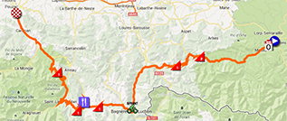
- start: once the riders are gathered in the Boulevard Frédéric Arnaud for the signature between 10.10AM and 11.10AM, the start will be at 11.20AM and the riders will then follow the boulevard Frédéric Arnaud, place Jean Jaurès, avenue François Camel, grande rue Villefranche, avenue Gallieni, boulevard Général de Gaulle, avenue Maréchal Foch, D618 where the real start will be at 11.30AM à 4,4 km from the initial start
- climbs: Col de Portet-d'Aspet of the 2nd category at km 28.5 (5.4 km @ 6.9%), Col de Menté of the 1st category at km 44 (7 km @ 7.7%), Col de Peyresourde of the 1st category at km 90 (13.2 km @ 7%), Col de Val Louron-Azet of the 1st category at km 110.5 (7.4 km @ 8.3%), La Hourquette d'Ancizan of the 1st category at km 138 (9.9 km @ 7.5%)
- feeding zone: Armenteule at km 99
- intermediate sprint: Bagnères-de-Luchon at km 73
- finish: Allée Jean Jaurès in Bagnères-de-Bigorre, after a final straight part of 140 m, width 6.5 m
- visited departments: Ariège (09) from km 0 till km 26, Haute-Garonne (31) from km 26 till km 95,5, Hautes-Pyrénées (65) from km 95.5 till km 168.5
- main cities: Saint-Girons, Cierp-Gaud, Bagnères-de-Luchon, Saint-Lary-Soulan, Campan, Bagnères-de-Bigorre
R1/ Monday 8 July 2013 - Saint-Nazaire / Loire-Atlantique
After the 9th stage, the riders will get to the airport of Tarbes-Lourdes-Pyrénées to take the plane towards the Loire-Atlantique area. The followers of the Tour will have to drive 690 kilometers to get to the location of the first rest day ...10/ Tuesday 9 July 2013 - Saint-Gildas-des-Bois > Saint-Malo - 197 km
After this well deserved rest day, a short incursion in Brittany is on the programme of the Tour de France 2013. The start of this 10th stage will be in the small town Saint-Gildas-des-Bois, which only has 3,400 inhabitants (called Gildasiens). After this start the stage will go up north towards the finish in Saint-Malo where the riders will arrive via Cancale, following the coast road for a magnificent stage finish following the Chaussée du Sillon for a stage finish in front of the Cité Vauban.Hereunder you'll find the time- and route schedule, the profile and the race route of this stage on Google Maps. Click on the images to open them.


- start: once the riders are gathered sur la Place de l'Eglise for the signature between 11.40AM à 12.40AM, the start will be at 12h50 and the riders will then follow the rue Jeanne d’Arc, rue de Bel Air, D2 where the real start will be at 12h55 à 2 km from the initial start
- climbs: une seule côte, la Côte de Dinan of the 4th category at km 142 (1 km à 4,2%)
- feeding zone: Saint-Méen-le-Grand at km 103
- intermediate sprint: Le Hinglé at km 127,5
- finish: Esplanade Saint-Vincent à Saint-Malo, after a final straight part of 130 m (last turn at 2.1 km), width 6.5 m
- visited departments: Loire-Atlantique (44) from km 0 till km 27.5, Ille-et-Vilaine (35) from km 27.5 till km 38.5 and from km 73.5 till km 84 and from km 92 till km 109.5 and from km 158.5 till km 197, Morbihan (56) from km 38.5 till km 73.5 and from km 84 till km 92, Côtes d'Armor (22) from km 109.5 till km 158.5
- main cities: Saint-Gildas-des-Bois, Redon, Carentoir, Guer, Paimpont, Gaël, Saint-Méen-le-Grand, Dinan, Pleudihen-sur-Rance, Cancale, Saint-Malo
11/ Wednesday 10 July 2013 - Avranches > Mont Saint-Michel - 33 km
The first individual time trial of the Tour de France will take place between Avranches and the magnificent Mont Saint-Michel. Once the riders get there, they'll turn around to finish the stage over about one kilometer in the opposite direction.Hereunder you'll find the time- and route schedule, the profile and the race route of this stage on Google Maps. Click on the images to open them.


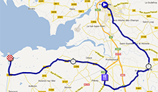
- start: the riders will come one by one to the Place Littré where they'll get on the start ramp every 2 and then every 3 minutes (for the last riders) from around 10.00AM (depending on the number of riders still in the race)
- climbs: none
- feeding zone: Précey at km 17.5
- intermediate timing points: Ducey at km 9.5 and Courtils at km 22
- intermediate sprint: none
- finish: Mont Saint-Michel, after a final straight part of 150 m (last turn at 500 m), width 6 m
- visited departments: Manche (50) du km 0 at km 33
- main cities: Avranches, Ducey, Mont Saint-Michel
CONTINUE READING AFTER THIS ADVERTISEMENT
12/ Thursday 11 July 2013 - Fougères > Tours - 218 km
A flat stage this Thursday 11 July between Fougères and Tours. The final part of the stage will visit some of the Loire castles.Hereunder you'll find the time- and route schedule, the profile and the race route of this stage on Google Maps. Click on the images to open them.


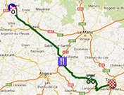
- start: once the riders are gathered at the Forum de la Gare for the signature between 10.40AM and 11.40AM, the start will be at 11.50AM and the riders will then follow the rue des Feuteries, rue Charles Malard, place Carnot, avenue du Général de Gaulle, boulevard Jean Jaurès, rue du Tribunal, place Gambetta, boulevard du Maréchal Leclerc, rue Baron, rue Durand, rue de la Forêt, avenue de la Verrerie, boulevard de Groslay, route d’Ernée, rue Branly, rue Colbert, rocade de l’Aumaillerie, D798 where the real start will be at 12.10PM at 9.4 km from the initial start
- climbs: none
- feeding zone: Durtal at km 112
- intermediate sprint: Savigné-sur-Lathan at km 166
- finish: Avenue Camille Chautemps in Tours, after a final straight part of 450 m, width 7 m
- visited departments: Ille-et-Vilaine (35) from km 0 till km 17.5, Mayenne from km 17.5 till km 85.5, Sarthe (72) from km 85.5 till km 109.5, Maine-et-Loire (49) from km 109.5 till km 161, Indre-et-Loire (37) from km 161 till km 218
- main cities: Fougères, Laval, Sablé-sur-Sarthe, Tours
13/ Friday 12 July 2013 - Tours > Saint-Amand-Montrond - 173 km
Starting in Tours, this 13th stage will also have a quite flat race route, with only one climb, towards the finish in Saint-Amand-Montrond, at the foot of its typical (but not very good looking) Cité de l'Or.Hereunder you'll find the time- and route schedule, the profile and the race route of this stage on Google Maps. Click on the images to open them.


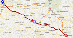
- start: once the riders are gathered on the Place Anatole France for the signature between 11.50AM and 12.50AM, the start will be at 1.00PM and the riders will then follow the avenue André Malraux,
rue Mirabeau, boulevard Heurteloup, boulevard Béranger, place Saint-Éloi, rue Giraudeau, rue Fromentel, rue Auguste Chevallier, D86, avenue de Pont, avenue Marcel Dassault, rue de l’Auberdière, avenue du Général Niessel, avenue Stendhal, avenue Georges Pompidou, SAINT-AVERTIN, avenue de Beaugaillard, avenue de la Branchoire, avenue de la République, D943 where the real start will be at 1.25PM at 14.3 km from the initial start - climbs: Côte de Crotz of the 4th category at km 77.5 (1.2 km @ 4%)
- feeding zone: Levroux at km 84.5
- intermediate sprint: Saint-Aoustrille at km 112.5
- finish: Rue Pelletier d'Oisy in Saint-Amand-Montrond, after a final straight part of 470 m, width 7 m
- visited departments: Indre-et-Loire (37) from km 0 till km 62.5, Indre (36) from km 62.5 till km 134, Cher from km 134 till km 173
- main cities: Tours, Truyes, Genillé, Ecueillé, Levroux, Issoudun, Châteauneuf-sur-Cher, Saint-Amand-Montrond
14/ Saturday 13 July 2013 - Saint-Pourçain-sur-Sioule > Lyon - 191 km
The stage between Saint-Pourçain-sur-Sioule and Lyon contains 5 climbs, in addition to the two 4th category climbs in the final part in Lyon, which will however probably not be enough to prevent this stage to finish in a sprint.Hereunder you'll find the time- and route schedule, the profile and the race route of this stage on Google Maps. Click on the images to open them.


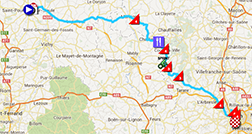
- start: once the riders are gathered in the Boulevard Ledru-Rollin for the signature between 11.20AM and 12.20AM, the start will be at 12.30PM and the riders will then follow the boulevard Ledru-Rollin, pont Charles-de-Gaulle, D2009, rue Faubourg Paluet, route de Varennes, D46 where the real start will be at 12.40PM at 3.5 km from the initial start
- climbs: Côte de Marcigny of the 4th category at km 66.5 (1.9 km @ 4.9%), Côte de la Croix Couverte of the 4th category at km 98.5 (2.6 km @ 5.3%), Côte de Thizy-les-Bourgs of the 3rd category at km 113 (1.7 km @ 8.2%), Col du Pilon of the 3rd category at km 126.5 (6.3 km @ 4.4%), Côte de Lozanne of the 4th category at km 161 (2.5 km @ 4%), Côte de la Duchère of the 4th category at km 176 (1.6 km @ 4.1%), Côte de la Croix-Rousse of the 4th category at km 181.5 (1.8 km @ 4.5%)
- feeding zone: Mars at km 94
- intermediate sprint: Thizy-les-Bourgs at km 109.5
- finish: Avenue Jean Jaurès in Lyon, after a final straight part of 2,100 m, width 7.5 m
- visited departments: Allier (03) from km 0 till km 50, Loire (42) from km 50 till km 60.5 and from km 84 till km 100.5, Saône-et-Loire from km 60.5 till km 84, Rhône (69) from km 100.5 till km 191
- main cities: Saint-Pourçain-sur-Sioule, (turning around Roanne, Tarare and l'Arbresle), Lyon
15/ Sunday 14 July 2013 - Givors > Mont Ventoux - 242.5 km
A long stage will take place this Sunday 14 July starting in Givors. Not only long but, in addition to the 3 climbs at the start of the stage and the climb halfway the stage, it will end with the hard hors category climb of the Mont Ventoux. The riders will thus have to look for all their forces the day before the second rest day!Hereunder you'll find the time- and route schedule, the profile and the race route of this stage on Google Maps. Click on the images to open them.


- start: once the riders are gathered on the Place de la Liberté for the signature between 9.25AM and 10.25AM, the start will be at 10.35AM and the riders will then follow the quai Georges Lévy, quai Robichon Malgontier, place Port du Bief, quai Julius et Ethel Rosenberg, avenue Anatole France, D386, to enter LOIRE-SUR-RHÔNE where the real start will be at 10.45AM at 4.5 km from the initial start
- climbs: Côte d'Eyzin-Pinet of the 4th category at km 20.5 (3.1 km @ 4.9%), Côte de Primarette of the 4th category at km 26.5 (2.6 km @ 4.1%), Côte de Lens-Lestang of the 4th category at km 44.5 (2.1 km @ 3.8%), Côte de Bourdeaux of the 3rd category at km 143 (4.2 km @ 5.7%), Mont Ventoux hors category at km 242.5 (20.8 km @ 7.5%)
- feeding zone: Crest at km 115.5
- intermediate sprint: Malaucène at km 208
- finish: D974 on the Mont Ventoux, after a final straight part of 80 m and after a final climb of 20.8 km @ 7.5%, width 5.5 m
- visited departments: Rhône (69) from km 0 till km 6, Isère (38) from km 6 till km 42, Drôme (26) from km 42 till km 198, Vaucluse (84) from km 198 till km 242.5
- main cities: Givors, Vienne, Romans-sur-Isère, Bourg-de-Péage
CONTINUE READING AFTER THIS ADVERTISEMENT
R2/ Monday 15 July 2013 - Vaucluse
After this stage, the riders will enjoy the second rest day, without a transfer this time, in the Vaucluse.16/ Tuesday 16 July 2013 - Vaison-la-Romaine > Gap - 168 km
This 16th stage, first one of the last week of the Tour de France 2013 will offer a middle mountain programme, with two climbs not far from the start in Vaison-la-Romaine and a climb in the loop around the finish city, Gap.Hereunder you'll find the time- and route schedule, the profile and the race route of this stage on Google Maps. Click on the images to open them.


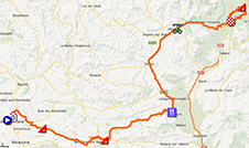
- start: once the riders are gathered in the Avenue François Mitterrand for the signature between 12.10PM and 1.10PM, the start will be at 1.15PM and the riders will then follow the avenue François Mitterrand, avenue des Choralies, avenue Marcel Pagnol, D938 where the real start will be at 1.25PM at 3.2 km from the initial start
- climbs: Côte de la Montagne de Bluye of the 3rd category at km 17.5 (5.7 km @ 5.6%), Col de Macuègne of the 2nd category at km 48 (7.6 km @ 5.2%), Col de Manse of the 2nd category at km 156.5 (9.5 km @ 5.2%)
- feeding zone: Châteauneuf-de-Chabre at km 84
- intermediate sprint: Veynes at km 123
- finish: Avenue Maréchal Foch in Gap, after a final straight part of 1,300 m, width 7 m
- visited departments: Vaucluse (84) from km 0 till km 11 and from km 22 till km 35.5, Drôme (26) from km 11 till km 22 and from km 35.5 till km 70, Hautes-Alpes (05) from km 70 till km 168
- main cities: Vaison-la-Romaine, Serres, Veynes, Gap
17/ Wednesday 17 July 2013 - Embrun > Chorges (CLM) - 32 km
This second individual time trial of the Tour de France 2013 is particularly difficult with two 2nd category climbs. Right from the start in Embrun, it will follow a part of the route of the Embrun Ironman and after descent almost down to the Lac de Serre-Ponçon it will get on the second climb followed by the final descent towards the finish in Chorges.Hereunder you'll find the time- and route schedule, the profile and the race route of this stage on Google Maps. Click on the images to open them.


- start: the riders will start one by one each two minutes (and then every 3 minutes for the last participants) starting around 10.15AM (depending on the number of riders still in the race); the start ramp will be at the Plan d'Eau
- climbs: Côte de Puy-Sanières of the 2nd category at km 6.5 (6.4 km @ 6%), Côte de Réallon of the 2nd category at km 20 (6.9 km @ 6.3%)
- feeding zone: Réallon at km 20
- intermediate sprint: none
- finish: in Chorges, after a final straight part of 380 m (last turn at 2,000 m), width 6.5 m
- visited departments: Hautes-Alpes (05) from km 0 till km 32
- main cities: Embrun, Puy-Sanières, Savines-le-Lac (close), Réallon, Saint-Apollinaire, Chorges
18/ Thursday 18 July 2013 - Gap > Alpe d'Huez - 172.5 km
After this individual comparison, this Thursday will see the comeback of the mountain stages, with one difficulty of the 3rd category, three of the 2nd category (including the Col de Manse, which will be climbed in the other direction compared to the one in the stage which arrived in Gap) and two hors category, the double climb of the Alpe d'Huez with the Col de Sarenne (one of the three difficulties of the 2nd category).Hereunder you'll find the time- and route schedule, the profile and the race route of this stage on Google Maps. Click on the images to open them.


- start: once the riders are gathered in the Avenue Maréchal Foch for the signature between 11.15AM and 12.15PM, the start will be at 12.20PM and the riders will then follow the avenue Maréchal Foch, avenue Émile Didier, avenue d’Embrun, N94 where the real start will be at 12.30PM at 4.8 km from the initial start
- climbs: Col de Manse of the 2nd category at km 13 (6.6 km @ 6.2%), Rampe du Motty of the 3rd category at km 45 (2.4 km @ 8%), Col d'Ornon of the 2nd category at km 95 (5.1 km @ 6.7%), Alpe d'Huez (1st climb) hors category at km 122.5 (12.3 km climb @ 8.4%), Col de Sarenne of the 2nd category at km 131.5 (3 km @ 7.8%), Alpe d'Huez (2nd climb) hors category at km 172.5 (13.8 km @ 8.1%) - the difference in length and percentage between the two climbs of the Alpe d'Huez is due to the fact that in the first climb, the race will go straight just before the tunnel to directly get on the road which goes on to the Col de Sarenne, as you can see on the map and as it had already been the case during the Critérium du Dauphiné 2013.
- feeding zone: Valbonnais at km 73
- intermediate sprint: Bourg d'Oisans at km 108
- finish: Avenue du Rif Nel at the Alpe d'Huez, after a final straight part of 200 m and after a final climb of 13.8 km @ 8.1%, width 6 m
- visited departments: Hautes-Alpes (05) from km 0 at km 46.5, Isère (38) from km 46.5 till km 172.5
- main cities: Gap, Corps, Bourg d'Oisans
CONTINUE READING AFTER THIS ADVERTISEMENT
19/ Friday 19 July 2013 - Bourg d'Oisans > Le Grand-Bornand - 204.5 km
Another mountain stage starting in Le Grand-Bornand.Hereunder you'll find the time- and route schedule, the profile and the race route of this stage on Google Maps. Click on the images to open them.


- start: once the riders are gathered at the Espace Romanche for the signature between 9.45AM and 10.45AM, the start will be at 10.50AM and the riders will then follow the avenue de la République, avenue de la Gare, D1091 where the real start will be at 11.00AM at 3.6 km from the initial start
- climbs: Col du Glandon hors category at km 33.5 (21.6 km @ 5.1%), Col de la Madeleine hors category at km 83.5 (19.2 km @ 7.9%), Col de Tamié of the 2nd category at km 143 (8.6 km @ 6.2%), Col de l'Épine of the 1st category at km 165, Col de la Croix Fry of the 1st category at km 191.5 (11.3 km @ 7%)
- feeding zone: La Bâthie at km 121
- intermediate sprint: Albertville at km 129.5
- finish: Route de l'Envers in Le Grand-Bornand, after a final straight part of 260 m, width 6 m
- visited departments: Isère (38) from km 0 till km 33.5, Savoie (73) from km 33.5 till km 148.5, Haute-Savoie (74) from km 148.5 till km 204.5
- main cities: Bourg d'Oisans, Saint-Etienne-de-Cuines, La Bâthie, Albertville, Gilly-sur-Isère, Faverges, La Clusaz, Le Grand-Bornand
20/ Saturday 20 July 2013 - Annecy > Annecy-Semnoz - 125 km
A short forelast stage, with almost a complete loop south of the city Annecy. Even though this city also gives its name to the finish of this stage, it'll simply be a mountain top finish on top of the Mont Semnoz which will precede the final finish on the Champs-Elysées in Paris the next day.Hereunder you'll find the time- and route schedule, the profile and the race route of this stage on Google Maps. Click on the images to open them.


- start: once the riders are gathered at the Pâquier for the signature between 12.20PM and 1.20PM, the start will be at 1.30PM and the riders will then follow the avenue d’Albigny, quai Eustache Chappuis, rue des Maquisats, route d’Albertville, SÉVRIER, D1508 where the real start will be at 1.40PM @ 3.6 km from the initial start
- climbs: Côte du Puget of the 2nd category at km 12.5 (5.4 km @ 5.9%), Col de Leschaux of the 3rd category at km 17.5 (3.6 km @ 6.1%), Côte d'Aillon-le-Vieux of the 3rd category at km 43 (6 km @ 4%), Col des Prés of the 3rd category at km 51 (3.4 km @ 6.9%), Mont Revard of the 1st category at km 78.5 (15.9 km @ 5.6%), Mont Semnoz hors category at km 125 (10.7 km @ 8.5%)
- feeding zone: none
- intermediate sprint: Le Châtelard at km 33.5
- finish: D41 on the Mont Semnoz, after a final straight part of 80 m and after a final climb of 10.7 km @ 8.5%, width 5.5 m
- visited departments: Haute-Savoie (74) from km 0 till km 26 and from km 101.5 till km 125, Savoie from km 26 till km 101.5
- main cities: Annecy
21/ Sunday 21 July 2013 - Versailles > Paris Champs-Elysées - 133.5 km
The last stage with its finish in Paris is always a bit particular. Everyone's happy to reach the end of the Tour but the next day it will be strange anyway to not go on. The riders celebrate the end of the Tour on the roads of this last stage, including a glass of champagne! This year, the organisor of the Tour decided to make it even more special: after a transfer in the morning from Annecy to Paris, the riders will get to the castle of Versailles where they'll start with a touristical and exceptional (the access is usually forbidden for bikes) ride in the garden of the castle. After this ride, they go off to the Vallée de Chevreuse to go climb the last few uphill parts of this Tour de France 2013 before going on to Paris and its famous Champs-Elysées, via Issy-les-Moulineaux of course. Exceptionally, the riders will go around the Arc de Triomphe in the 10 laps on the final circuit and the finish is planned around 9.45PM, and it will all end in a big firework on the most beautiful avenue in the world!Hereunder you'll find the time- and route schedule, the profile and the race route of this stage on Google Maps. Click on the images to open them.


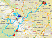
- start: once the riders are gathered in the Avenue de Paris for the signature between 4.35PM and 5.35PM, the start will be at 5.45PM and the riders will then follow the avenue de Paris, avenue Rockefeller, place Hoche, rue Hoche, rue de la Paroisse, place du Marché Notre-Dame, rue du Maréchal Foch, boulevard de la Reine, before they enter the garden of the castle via the grille de la Reine and in the gardens they'll follow the petite allée de Saint-Antoine, boulevard de Saint-Antoine, avenue de Trianon, allée des Mouchards, Fer à Cheval, allée de Bailly, allée de Fontenay, Étoile Royale, bras du Génie, allée de la Reine, allée des Matelots, where they leave the garden of the castle and follow the route de Saint-Cyr, rue de l’Orangerie, rue du Maréchal Joffre, avenue Clément Ader, route de la Minière, D91 where the real start will be at 6.15PM at 14.4 km from the initial start
- climbs: Côte de Saint-Rémy-lès-Chevreuse of the 4th category at km 29.5 (1 km @ 6.9%), Côte de Châteaufort of the 4th category at km 33.5 (900 m @ 4.7%)
- feeding zone: none
- intermediate sprint: Paris, on the Champs-Elysées at km 87
- finish: Avenue des Champs-Elysées in Paris, after a final straight part of 400 m, width 9 m
- visited departments: Yvelines (78) from km 0 till km 33.5 and from km 35 till km 46, Essonne (91) from km 33.5 till km 35, Hauts-de-Seine (92) from km 46 till km 56, Paris (75) from km 56 till km 133.5
- main cities: Versailles, Montigny-le-Bretonneux, Issy-les-Moulineaux, Paris
The Tour de France 2013 race route in Google Earth
Do you prefer to see the full Tour de France 2013 race route on a single map? Or would you like to do a virtual fly-over on the race route of one or more of the stages of this 100th edition of the Tour de France? That's possible, simply by downloading the KML file below and opening it in Google Earth:>> Download the race route of all Tour de France 2013 stages in Google Earth

Vond u dit artikel interessant? Laat het uw vrienden op Facebook weten door op de buttons hieronder te klikken!
12 comments | 66995 views
this publication is published in: Tour de France | Tour de France 2013 | OpenStreetMap/Google Maps/Google Earth


 by marco1988 over