Saturday 09 May 2015 at 03h08
Today, Saturday 9 May 2015, the Tour of Italy 2015 (or Giro d'Italia 2015) starts in San Lorenzo Al Mare with a team time trial which will mainly take place on ... a bike path! All the other details about the race routes, the roads the riders will follow, the time- and route schedules, the stage profiles and the race route on Google Maps/Google Earth are available in this article and will allow you to follow the fight for pink in the best possible circumstances with the knowledge of the race!
The Giro d'Italia 2015 race route on Google Maps
In total, 3,486 kilometers are on the programme, of which 77 kilometers in the time trials (1 team time trial of 17.6 km as the opening stage and an individual time trial over a distance of 59.4 km halfway the race): 19 stages will entirely take place in Italy and two stages will partially be in Switzerland with a finish in Lugano and a stage start the next day in Melide. In addition to the time trials, the stages are split up among 7 plain stages, 7 middle mountain stages and 5 high mountain stages. 7 stages will finish uphill.CONTINUE READING AFTER THIS ADVERTISEMENT
1/ Saturday 9 May 2015 - San Lorenzo al Mare > Sanremo - team time trial - 17.6 km
The Giro d'Italia 2015 will start in San Lorenzo al Mare. Traditionally, the Giro d'Italia starts with a team time trial and that's again the case in 2015.For this 98th edition of the Tour of Italy, the stage will almost entirely take place on a bike path not far from the coast and its profile is entirely flat.
Hereunder you'll find the race route on Google Maps, the profile and the time- and route schedule (with the times at which the race crosses the different cities and villages on the race route) of this stage of the Tour of Italy 2015. Click on the images to open them:


2/ Sunday 10 May 2015 - Albenga > Genova - 177 km
The 2nd stage of the Giro d'Italia 2015 is the first stage in line of this 98th edition and it'll start in the city of Albenga.During this stage, the riders will first go off to Marina di Andora south of the start, following the coast line, before they go more landinwards and come back to the start in order to go up north following the coast line via Finale Ligure, the feeding zone in Spotorno, the two intermediate sprints, in Savona and in Varazze and, with a short detour landinwards, the climb of the of the Pratozanino (Sciaborasca) (4th category). They'll again follow the coast down to Genova where they'll first turn left twice and cross the finish line followed by a short circuit a bit more east and finally they'll battle for the stage win when they cross the finish line for the second time!
Hereunder you'll find the race route on Google Maps, the profile and the time- and route schedule (with the times at which the race crosses the different cities and villages on the race route) of this stage of the Tour of Italy 2015. Click on the images to open them:


3/ Monday 11 May 2015 - Rapallo > Sestri Levante - 136 km
The 3rd stage will be a bit more hillier than the previous one - which is definitely one for the sprinters - between Rapallo and Sestri Levante.Between those two cities, the riders will find a first climb after about 25 kilometers, the Colle Caprile (3rd category) followed by a slightly hilly part with two intermediate sprints, in Torriglia and in Montebruno, and a second and last climb in Barbagelata (2nd category). After this climb the riders will continue in a descent towards the finish in Sestri Levante of this short stage of only 136 kilometers.
Hereunder you'll find the race route on Google Maps, the profile and the time- and route schedule (with the times at which the race crosses the different cities and villages on the race route) of this stage of the Tour of Italy 2015. Click on the images to open them:


4/ Tuesday 12 May 2015 - Chiavari > La Spezia - 150 km
Another relatively short stage will be on the programme starting in Chiavari. After having briefly followed the coast line towards Sestri Levante (the finish location of the previous stage), the peloton of the Tour of Italy 2015 will go a bit more landinwards, towards the Colla di Velva (3rd category) and come back to the coast with the two intermediate sprints, in Borghetto di Vara and in Levanto. They'll than climb the Passo del Termine (3rd category) and follow the coast road towards the finish. After the first crossing of the finish line in La Spezia they'll however continue and climb a 3rd category climb in Biassa just before the place where they entered the circuit. At the second crossing of the finish line the riders will battle for the stage victory.Hereunder you'll find the race route on Google Maps, the profile and the time- and route schedule (with the times at which the race crosses the different cities and villages on the race route) of this stage of the Tour of Italy 2015. Click on the images to open them:


CONTINUE READING AFTER THIS ADVERTISEMENT
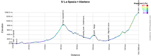
5/ Wednesday 13 May 2015 - La Spezia > Abetone - 152 km
The 5th stage will still not be very long with its 152 kilometers, starting in the city where the previous stage finished, La Spezia. Except for the 3rd category climb just before halfway of the stage, in Foce Carpinelli, this stage's result will mainly be influenced by its uphill finish in Abetone.The feeding zone will be in Castelnuovo di Garfagnana while the two intermediate sprints will be in Barga and in Bagni di Lucca.
Hereunder you'll find the race route on Google Maps, the profile and the time- and route schedule (with the times at which the race crosses the different cities and villages on the race route) of this stage of the Tour of Italy 2015. Click on the images to open them:


6/ Thursday 14 May 2015 - Montecatini Terme > Castiglione della Pescaia - 183 km
A bit longer stage, of 183 kilometers, will be on the programme this Thursday 14 May 2015, between Montecatini Terme and Castiglione della Pescaia. One single referenced difficulty référencée will be on the programme of this stage, in Pomararce, which will however be followed by a hilly part of the stage.The feeding zone will be just after this climb, in Larderello, while the first intermediate sprint will be after only about fifteen kilometers in the race in Altopascio and the second intermediate sprint will be in Ribolla, at the start of the final flat part of the stage.
Hereunder you'll find the race route on Google Maps, the profile and the time- and route schedule (with the times at which the race crosses the different cities and villages on the race route) of this stage of the Tour of Italy 2015. Click on the images to open them:


7/ Friday 15 May 2015 - Grosseto > Fiuggi - 264 km
The longuest stage of the Tour of Italy 2015 will start in Grosseto this Friday 15 May and will have a slightly hilly race route in the second half of the stage. The first feeding zone will be in Tuscania, after which the riders will pass north of Rome and battle in the first intermediate sprint close to the Autodromo di Vallelunga followed by a second feeding zone in Castelnuovo di Porto before the only referenced difficulty of the stage in Monterotondo (4th category) and finallly the second intermediate sprint close to the finish, in Cave, before the finish climbing up to Fiuggi.Hereunder you'll find the race route on Google Maps, the profile and the time- and route schedule (with the times at which the race crosses the different cities and villages on the race route) of this stage of the Tour of Italy 2015. Click on the images to open them:


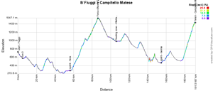
8/ Saturday 16 May 2015 - Fiuggi > Campitello Matese - 186 km
From Fiuggi, the peloton will continue this Saturday its progression to the south-east with a mountain stage of 186 kilometers. Indeed, after the intermediate sprint in Sora, the riders will attack the 2nd category climb of the Forca d'Acero. After the descent they'll be able to get some food in Villetta Barrea before they continue towards the intermediate sprint in Isernia and the final climb towards Campitello Matese, the first 1st category climb of this Giro d'Italia 2015.Hereunder you'll find the race route on Google Maps, the profile and the time- and route schedule (with the times at which the race crosses the different cities and villages on the race route) of this stage of the Tour of Italy 2015. Click on the images to open them:


CONTINUE READING AFTER THIS ADVERTISEMENT
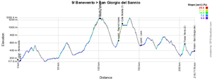
9/ Sunday 17 May 2015 - Benevento > San Giorgio del Sannio - 215 km
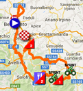
The day before the first rest day, a rather difficult stage will be on the programme this Sunday 17 May. Its race route is never really flat, going first up north before the riders come back to the start and start the descent to the south. After about one hundred kilometers, they'll get on top of the first difficulty, the Monte Terminio (2nd category) where they'll also find the feeding zone. After the descent, the first intermediate sprint will be early in the next climb, in Bagnoli Irpino, and they'll get on top of the Colle Molella (1st category).After the descent of this difficulty, the riders will battle for the intermediate sprint in Lioni and the race route will become a bit more hilly, or even mountaineous with the climb of the Passo Serra (2nd category) which will have its summit at about fifteen kilometers from the finish in San Giorgio del Sannio.
Hereunder you'll find the race route on Google Maps, the profile and the time- and route schedule (with the times at which the race crosses the different cities and villages on the race route) of this stage of the Tour of Italy 2015. Click on the images to open them:

R1/ Monday 18 May 2015 - rest day
The first rest day of this Giro d'Italia 2015 will allow the riders to recover not only from the first week of racing but also from the transfer towards Civitanova Marche, at about 360 kilometers from the finish of the 9th stage in San Giorgio del Sannio.10/ Tuesday 19 May 2015 - Civitanova Marche > Forlì - 200 km
After this rest day, the Giro riders and its followers will come back together in Civitanova Marche for a flat stage, towards Forlì. In this stage, the riders will find the feeding zone in Fano and a 4th category climb, the Monte di Bartolo, just afterwards. This climb will most probably not prevent the remaining sprinters from playing a role in the final of this stage in Forlì however. Before they get there, they still have two intermediate sprints, in Santarcangelo di Romagna and in Cesena.Hereunder you'll find the race route on Google Maps, the profile and the time- and route schedule (with the times at which the race crosses the different cities and villages on the race route) of this stage of the Tour of Italy 2015. Click on the images to open them:


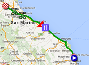
11/ Wednesday 20 May 2015 - Forlì > Imola - 153 km
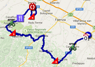
The 11th stage of the Giro d'Italia 2015 is a quite hilly stage which starts with an intermediate sprint in Castrocaro Terme, soouth-west of the start. Continuing their route towards the south-west they'll climb the Passo del Trebbio (3rd category) before they turn right and climb a 3rd category hill, Valico del Prugno.They'll again turn right and find the second intermediate sprint in Borgo Tossignano followed by the feeding zone in Codrignano. Before they arrive in Imola they'll turn right to enter a 15.4 kilometers long circuit which they'll do three times and which is partly on the Autodromo Enzo e Dino Ferrari which will give quite a particular finish to this stage. In this circuit, the riders will climb a 4th category climb at the most southern part of it in each lap, Tre Monti.
Hereunder you'll find the race route on Google Maps, the profile and the time- and route schedule (with the times at which the race crosses the different cities and villages on the race route) of this stage of the Tour of Italy 2015. Click on the images to open them:


CONTINUE READING AFTER THIS ADVERTISEMENT
12/ Thursday 21 May 2015 - Imola > Vicenza (Monte Berico) - 190 km
The 12th stage will start in the previous stage's finish cityt, Imola, for a race route which goes off straight north over 190 kilometers. The first three quarters of the stage will be on a completely flat race route with the first intermediate sprint halfway in the stage, in Rovigo, followed by the feeding zone in Boara Pisani.About 25 kilometers further, the riders will find the second intermediate sprint in Galzignano Terme which will be followed by the climb of the first difficulty of the day, in Castelnuovo (4th category). Another 25 kilometers further, the climb of Crosara is on the programme (3rd category) before the final climb (4th category) towards the finish in Vicenza (Monte Berico).
Hereunder you'll find the race route on Google Maps, the profile and the time- and route schedule (with the times at which the race crosses the different cities and villages on the race route) of this stage of the Tour of Italy 2015. Click on the images to open them:


13/ Friday 22 May 2015 - Montecchio Maggiore > Jesolo - 147 km
An extremely rolling stage, of 147 kilometers, awaits the riders at the start in Montecchio Maggiore, with no single difficulty and slightly going down in the first half of the stage. The first intermediate sprint will be in Santa Maria di Sala and the second one in Mestre before the finish on the sea side in Jesolo.Hereunder you'll find the race route on Google Maps, the profile and the time- and route schedule (with the times at which the race crosses the different cities and villages on the race route) of this stage of the Tour of Italy 2015. Click on the images to open them:


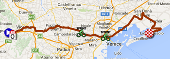
14/ Saturday 23 May 2015 - Treviso > Valdobbiadene - individual time trial - 59.4 km
The 14th stage will be an individual time trial starting in Treviso with a first half on a flat race route, followed by a 4th category climb, San Pietro di Feletto. The rest of the race route will be slightly hilly until the finish in Valdobbiadene.Hereunder you'll find the race route on Google Maps, the profile and the time- and route schedule (with the times at which the race crosses the different cities and villages on the race route) of this stage of the Tour of Italy 2015. Click on the images to open them:


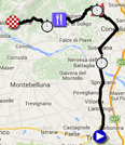
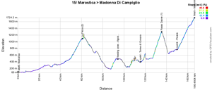
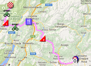
15/ Sunday 24 May 2015 - Marostica > Madonna di Campiglio - 165 km
The second day of this weekend a mountain stage awaits the riders, with a mountain top finish. After the start from Marostica, the race route will progressively go up and intensify to get to the first summit of the day in La Fricca (2nd category). In a less accidented part of the stage the riders will be able to get some food in Vigolo Baselga and they'll find an intermediate sprint in Terme di Comano before they attack a 1st category climb, the Passo Daone.After the descent, they'll find another sprint in Pinzolo in the very first part of the final climb towards Madonna di Campiglio (1st category).
Hereunder you'll find the race route on Google Maps, the profile and the time- and route schedule (with the times at which the race crosses the different cities and villages on the race route) of this stage of the Tour of Italy 2015. Click on the images to open them:

CONTINUE READING AFTER THIS ADVERTISEMENT
R2/ Monday 25 May 2015 - rest day
After this intense weekend and whole week of racing, the riders can again get some rest, on top of the Madonna di Campiglio, knowing that the start of the next day's stage will be only about fifteen kilometers away.16/ Tuesday 26 May 2015 - Pinzolo > Aprica - 174 km
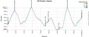
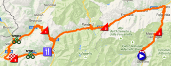
A real mountain stage awaits the riders on the Tuesday after this last rest day of this 98th Tour of Italy.Indeed, after the start from Pinzolo they'll immediately start the first climb of the stage, the Campo Carlo Magno (2nd category), and it'll be followed by the climb of the Passo del Tonale, also of the 2nd category. At the bottom of this "Passo", they'll find the feeding zone, in Edolo and the riders will then get on the final circuit of this stage, via the intermediate sprint in Corteno Colgi, the climb towards Aprica (3rd category), another sprint in Tirano and the 1st category climb of the famous Passo del Mortirolo. They'll end on the final climb of this stage, still 3rd category, towards the finish in Aprica.
Hereunder you'll find the race route on Google Maps, the profile and the time- and route schedule (with the times at which the race crosses the different cities and villages on the race route) of this stage of the Tour of Italy 2015. Click on the images to open them:

17/ Wednesday 27 May 2015 - Tirano > Lugano (CH) - 134 km
The next day, the stage will be shorter and easier, between Tirano and Lugano in Switzerland, which contains only one 3rd category climb early in the stage, in Teglio. The riders will also find two intermediate sprints, in Morbegno and in Menaggio, before they enter Switzerland for the finish close to the lake in Lugano.Hereunder you'll find the race route on Google Maps, the profile and the time- and route schedule (with the times at which the race crosses the different cities and villages on the race route) of this stage of the Tour of Italy 2015. Click on the images to open them:


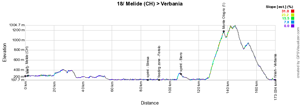
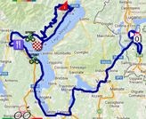
18/ Thursday 28 May 2015 - Melide (CH) > Verbania - 170 km
This Thursday there's again a real mountain stage on the programme starting in Melide in Switzerland. The start of this stage is completely flat and turns around the Lago Maggiore, with the first intermediate sprint in Stresa, the feeding zone in Feriolo and the second intermediate sprint in Bieno. The difficulty will be in the short circuit which first continues to follow the lake before it goes landinwards to climb the Monte Ologno (1st category) and comes back to Verbania.Hereunder you'll find the race route on Google Maps, the profile and the time- and route schedule (with the times at which the race crosses the different cities and villages on the race route) of this stage of the Tour of Italy 2015. Click on the images to open them:

CONTINUE READING AFTER THIS ADVERTISEMENT
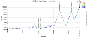
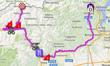
19/ Friday 29 May 2015 - Gravellona Toce > Cervinia - 236 km
Another mountain stage awaits the riders this last Friday of the Giro d'Italia 2015. The stage starts easily with the climb of the Croce Serra (3rd category) after about 80 kilometers, followed by the feeding zone in Settimo Vittone and the intermediate sprint in Pont-Saint-Martin which is not, as the name might indicate, in France!After the second intermediate sprint, in Fénis, the route becomes much harder, with the upfollowing climbs of Saint-Barthelémy and the Col Saint-Pantaléon, and the final climb towards Cervinia, all three of the 1st category.
Hereunder you'll find the race route on Google Maps, the profile and the time- and route schedule (with the times at which the race crosses the different cities and villages on the race route) of this stage of the Tour of Italy 2015. Click on the images to open them:

20/ Saturday 30 May 2015 - Saint-Vincent > Sestriere - 199 km
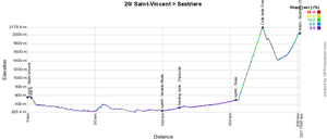
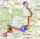
Starting in Saint-Vincent, the stage will start with 150 kilometers flat, with the intermediate sprint in Venaria Reale and the feeding zone in Pianezza. Just after the second intermediate sprint in Susa, the riders start the climb towards the rooftop of the Giro d'Italia 2015, the cima coppi: the Colle delle Finestre (18.5 km at 9.2% and a maximum of 14%) reaches an altitude of 2178 meters and is partly in gravel over the last 7.8 kilometers.They'll go on with the final climb which is only 9.2 kilometers long at 5,4%, to the mountain top finish in Sestriere.
Hereunder you'll find the race route on Google Maps, the profile and the time- and route schedule (with the times at which the race crosses the different cities and villages on the race route) of this stage of the Tour of Italy 2015. Click on the images to open them:

21/ Sunday 31 May 2015 - Turin > Milan - 178 km
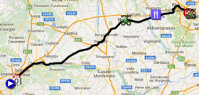
The last stage of the Giro d'Italia 2015 is more there for the show than for the sports interest. This'll be a flat stage starting in Torino. There'll be no single difficulty on the programme of this stage. When they arrive in Milano, the riders will do 7 laps on a 4.5 kilometers long circuit before they finally end off this Giro d'Italia 2015 and before we know who goes home with the pink jersey after Nairo Quintana last year!Hereunder you'll find the race route on Google Maps, the profile and the time- and route schedule (with the times at which the race crosses the different cities and villages on the race route) of this stage of the Tour of Italy 2015. Click on the images to open them:


The Giro d'Italia 2015 race route in Google Earth
Do you prefer to watch the race route of all stages of the Tour of Italy 2015 in one single view? Or would you like to do a virtual flyover of one or more of the stages? That's possible by downloading the following KMZ file (a zipped KML file, due to its big size) and open it in Google Earth. ATTENTION - copyright: despite the fact that this KMZ file is made available for your own use, you should note that it's strictly forbidden to reproduce the contents of this KMZ file or any other file (including the maps, the profiles, the KML files and others) which make up the race route of the Tour of Italy 2015. These contents are protected by copyright and I thus ask you to respect the huge amount of time spent on the creation of it.
>> Download the full Giro d'Italia 2015 race route in Google Earth (KMZ file, 279 kB)

Vond u dit artikel interessant? Laat het uw vrienden op Facebook weten door op de buttons hieronder te klikken!
10 comments | 42144 views
this publication is published in: Giro d Italia | Giro d'Italia 2015 | OpenStreetMap/Google Maps/Google Earth


 by marco1988 over
bj,que veule dire les petits carré de couleur differente a droite de chaque etape merci
Bonjour lanery
Si tu parles des petites cases colorées sur le côté des profils des étapes, il s'agit de la légende des couleurs : ça donne le pourcentage des pentes.
Bonjour lanery,
Vous parlez des carrés dans les itinéraires horaires ? Si c'est le cas, en voici l'explication :
- les carrés bleus dans la première colonne altim. : ils indiquent l'altitude de chaque endroit mentionné dans l'itinéraire horaire (en tournant la tête devant l'écran vous découvrirez donc en quelque sorte le profil de l'étape ;-))
- dans les 3 colonnes distance, ceux-ci permettent de visualiser la distance indiquée (colonnes distance entre points, distance totale parcourue et distance restant à parcourir)
- enfin, dans les trois dernières colonnes, sont indiqués les horaires de passage en fonction de la vitesse moyenne et les couleurs c'est juste un petit jeu avec le drapeau italien et la couleur rose du Giro !
Si jamais votre question ne concerne pas ces points, n'hésitez pas à la préciser :-).
Sauf la dernière étape, il n'y a quasiment jamais d'étape complètement à plat. Une ou deux exception ! Si ! Mais les profils topos montrent les difficultés de cette édition ... Pour finir 5 étapes alpestres et l'ascension de sestrière en conclusion !!! Des chutes à répétitions ... Ce sera dure ; je ne suis pas sur que Contador garde son maillot rose !!!
Thomas, quelle est la longueur maximale d'une étape de Tour ?
Je ne savais pas que l'on pouvait faire une étape de 265 km ... et pour finir un petite ascension (toute lègere !)
@laurent, désolé de ne pas avoir répondu plus tôt. Selon le règlement UCI, la distance maximale par étape est de 240 km (sachant que la distance journalière moyenne maximale [hors prologue] est de 180 km).
Néanmoins, sur dérogation spéciale du bureau exécutif ou, pour les épreuves de l'UCI WorldTour (comme c'est le cas pour le Giro), du Conseil du Cyclisme Professionnel, les organisateurs peuvent être autorisés à inclure dans les épreuves de 10 jours et plus pour hommes élite au maximum deux étapes de plus de 240 km. Il n'est alors fait aucune mention de limite à ne pas dépasser mais ces étapes comptent dans la moyenne qui est limitée.
Enfin, un autre critère pour cette question est la distance qui est limitée à 3500 km pour les grands tours.
merci !
Quelle belle étape de montagne hier .Mr< Contador > à démontré sa grande classe et fait payer cher à l'équipe Astana de l'avoir attaqué en profitant de sa crevaison.(pas très noble).Malgré sa faible équipe il a rétabli la situation en beauté ;ça mérite un grand coup de chapeau pour Alberto et quel plaisir d'avoir suivi cela en direct : encore merci Mr CONTADOR
Pas d'accord avec constantin, la course avait déjà commencé et les Astana étaient après les Katusha qui avaient tenté de se faire la malle.
Et puis je ne pense pas que Contador soit celui qui ait son mot à dire dans l'histoire, car je me souviens très bien d'une attaque sur Andy Schleck qui avait un problème de dérailleur, dans le Port de Balès en 2010.
Bonjour Freddy
Aujourd'hui Alberto a encore démontré sa grande classe en partant seul dans la montagne.Il domine ce Giro de la tête et des jambes ;il accentue encore son avance ,et tout cela à la pédale.
Amicalement.
Bonjour à tous.
Je me suis rendu dans le col delle Finestre Samedi. C'est étrange mais pour moi la partie non goudronnée n'avait rien à voir avec 2011. En 2011, j'avais le souvenir d'une route superbement préparée, lisse, magnifique. Samedi, c'était tout le contraire. Il y avait des trous, des cailloux de partout, c'était vraiment bien cabossé. Et je ne vous explique pas la descente!
J'ai du mal à voir le Tour de France passer par ce col (comme cela avait été évoqué pour une arrivée à Sestrières). Ou alors il faut interdire aux personnes de monter en vélo dès 10h du matin, car hier il y avait énormément de cyclistes, et c'était très dangereux de monter, tant les personnes roulaient n'importe comment, en zigzag, en montant tout doucement sur la gauche de la route, en discutant à 3 de front alors que la route n'est pas large,...