As usual, velowire.com offers you the detail of the race route of the 105th edition of the "Grande Boucle", with all the routes on Google Maps/Google Earth, at a little bit less than one week of the start of the Tour de France 2018.
With all the information you find in this article you'll know all small details, all cities and villages which will be visited by this Tour and it'll thus allow you to prepare your visit on the roads of the Tour if you get the chance to be part of the 12 millions of spectators on the side of the road, or simply get a better understanding of the race if you're not there!
A little bit of information ...
Let's first precise some information before we get to the details of all Tour de France 2018 stages:- as for all contents on velowire.com, it is strictly forbidden to copy or reproduce it in any form, as indicated on the copyright page. Please do respect the time it takes to prepare these kind of contents!
- the stage profiles have been generated automatically based on altitude information available for the locations where the race goes by; there might thus be some points where they are not precise but the global profile is correct!
- the information in this article and more precisely the tracks shown on the maps are based on the Tour de France 2018 roadbook and some other sources for the precise routes in cities and villages on local roads; the information provided here should thus be correct in most cases but there might always be a small error in it; therefore, please make sure to ask locally whether you're at the right location if you want to be sure to see the race :)
- furthermore, any possible last minute changes related to unaccessible roads or other reasons are not taken into account in this article, except if indicated otherwise
The programme of the Grand start of the Tour de France 2018
Here are the dates to keep in mind for the Grand start of the Tour de France 2018:- Wednesday 4 July 2018: inauguration of the "permanence" at the Vendéspace (Dojo) and the press room at the Vendéspace (salle sportive) in Mouilleron-le-Captif
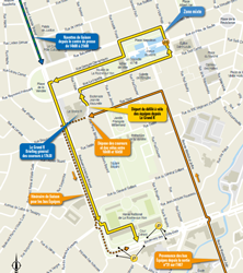
- Thursday 5 July 2018 between 6.30PM and 8PM: teams presentation for the Tour de France 2018 on the Place Napoléon in La Roche-sur-Yon: after the general briefing which will take place at 5.30PM at Le Grand R (not accessible for the general public), the riders will do a short bike which will first bring them to the place Napoléon. That's where they'll find the podium where they will be presented to the public one by one. The riders will get back on their bikes and go on to the place de la Vendée from where they'll continue to the boulevard des États-Unis where the ride will end in front of the Haras de la Vendée:
- Saturday 7 July 2018 : 1st stage - Noirmoutier-en-l'Île > Fontenay-le-Comte - 201 km
- Sunday 8 July 2018 : 2nd stage - Mouilleron-Saint-Germain > La Roche-sur-Yon - 182.5 km
- Monday 9 July 2018 : 3rd stage - Cholet > Cholet ; this will be a team time trial of 35.5 km
- Tuesday 10 July 2018 : 4th stage - La Baule > Sarzeau - 195 km ; after the start from La Baule, the race will leave the Pays de la Loire which is the area of the Grand start
The Tour de France 2018 race route on Google Maps
Let's now discover the details of the Tour de France 2018 race route, stage by stage:CONTINUE READING AFTER THIS ADVERTISEMENT
1/ Saturday 7 July 2018 - Noirmoutier-en-l'Île > Fontenay-le-Comte - 201 km
The first stage of the Tour de France 2018 will have a completely flat race route, the Côte de Vix of the 4th category being the only difficulty of the day.This first stage of the Tour de France 2018 will start on the Place de l'Ancien Moulin à Eau in Noirmoutier-en-l'Île. Contrary to what was initially planned, the race will not go over the Passage du Gois, simply because with the one week delay for the start of the Tour, this route will be under water. The riders will thus use the Pont de Noirmoutier towards Fromentine and La Barre-de-Monts to get on land. The kilometer zero will be even before they get there and the riders will follow the coast down to Les Sables-d'Olonne and the feeding zone in Saint-Vincent-sur-Jard, rapidly followed by the intermediate sprint of this stage, in La Tranche-sur-Mer. They'll then go a little bit more landinwards going east via Saint-Michel-en-l'Herm and Chaillé-les-Marais before they'll get on the only difficulty of the day. Just afterwards they'll discover something new created for this Tour de France, the bonus sprint: as we can read in race regulations of the Tour de France 2018 (scroll down to page 21 for the English version), 3, 2 and 1 seconds shall be awarded to the first three riders at the Bonus Point in each of the first nine stages (except for the stage 3 team time trial). This shall have no effect on the points classification.
The very first Bonus Point will be in Maillezais in the Rue du Champ de Foire. After that, the riders will continue north towards Fontenay-le-Comte where they'll cross the finish line on the Boulevard Duguesclin close to the Place de l'Ouillette.
Hereunder you'll find the time- and route schedule, the stage profile and the race route on Google Maps for this stage. Click on the images to open them.


- start : the start will be on the Place de l'Ancien Moulin à Eau in Noirmoutier-en-l'Île
- climbs : Côte de Vix (4th category) at km 173 - 700 m at 4.2%
- feeding zone : Saint-Vincent-sur-Jard
- intermediate sprint : on the D105B in La Tranche-sur-Mer
- Bonus Point : D15 / Rue du Champ de Foire in Maillezais
- finish : Boulevard Duguesclin in Fontenay-le-Comte
- visited departments : Vendée (85) from km 0 till km 201
- main cities : Noirmoutier-en-l'Île, Saint-Gilles-Croix-de-Vie, Les Sables d'Olonne, Chaillé-les-Marais and Fontenay-le-Comte
2/ Sunday 8 July 2018 - Mouilleron-Saint-Germain > La Roche-sur-Yon - 182.5 km
The second stage of the Tour de France 2018 will start in Mouilleron-Saint-Germain and after having visited La Châtaigneraie and Saint-Pierre-du-Chemin, the race continues direction north-west via the Côte de Pouzauges, Les Herbiers and Tiffauges where it'll turn south-west via the feeding zone of Boufféré and down to Palluau.Direction south from there, via the intermediate sprint in Beaulieu-sous-la-Roche before the final part of the race route towards the Bonus Point in Saint-Florent-des-Bois and the finish in La Roche-sur-Yon.
Hereunder you'll find the time- and route schedule, the stage profile and the race route on Google Maps for this stage. Click on the images to open them.


- start : in Mouilleron-Saint-Germain, the start line will be on the Place de La Poste
- climbs : Côte de Pouzauges (4th, 1 km at 3.9%) at km 28
- feeding zone : in Boufféré
- intermediate sprint : Rue de Nantes in Beaulieu-sous-la-Roche at km 132
- Bonus Point : Saint-Eugène in Saint-Florent-des-Bois at km 168,5
- finish : Boulevard d'Eylau in La Roche-sur-Yon
- visited departments : Vendée (85) from km 0 till km 182.5
- main cities : Mouilleron-Saint-Germain, Pouzauges, Les Herbiers, Tiffauges, Montaigu, Aizenay, Nieul-le-Dolent and La Roche-sur-Yon
3/ Monday 9 July 2018 - Cholet > Cholet - team time trial - 35.5 km
The 3rd stage will take place around Cholet which will be the start and finish location for a stage which will take place as a team time trial.This will be on a flat race route, in the west side of the city of Cholet.
Hereunder you'll find the time- and route schedule, the stage profile and the race route on Google Maps for this stage. Click on the images to open them.


- start : Boulevard Delhumeau Plessis in Cholet
- climbs : none
- feeding zone : none
- intermediate sprint : none
- Bonus Point : none
- intermediate timing points : Boulevard du Poitou in Saint-André-de-la-Marche and Rue du Sacré Coeur in La Séguinière
- finish : Avenue Anatole Manceau in Cholet
- visited departments : Maine-et-Loire (49) from km 0 till km 35.5
- main cities : Cholet
4/ Tuesday 10 July 2018 - La Baule > Sarzeau - 195 km
The 4th stage of the Tour de France 2018 will start in La Baule on the sea side and will cross the Parc Naturel Régional de Brière (a natural park). It'll again be a flat race route, with only difficulty, the Côte de Saint-Jean-la-Poterie.Before they get there, the riders will have went off east down to Derval where they'll find the intermediate sprint and their trip to the west start with the feeding zone in the same city. After the climb they'll get to the Bonus Point in Limerzel, on their road towards the finish in Sarzeau.
Hereunder you'll find the time- and route schedule, the stage profile and the race route on Google Maps for this stage. Click on the images to open them.


- start : Avenue des Floralies in La Baule ; kilometer zero on the D774 9.2 km further
- climbs : Côte de Saint-Jean-la-Poterie (4th, 800 m at 7.8%) at km 135,5
- feeding zone : Derval
- intermediate sprint : Route de Saint-Vincent in Derval
- Bonus Point : Rue de la Métairie in Limerzel
- finish : D780 in Sarzeau
- visited departments : Loire-Atlantique (44) from km 0 till km 130.5, Ille-et-Vilaine (35) at km 31.5, Morbihan (56) from km 134 till km 195
- main cities : La Baule, Pont-Château, Blain, Nozay, Derval, Guémené Penfao, Redon, Muzillac and Sarzeau
CONTINUE READING AFTER THIS ADVERTISEMENT
5/ Wednesday 11 July 2018 - Lorient > Quimper - 204.5 km
This 5th stage of the Tour de France 2018 will be a bit different from the others, because the second part of it contains a succession of short but difficult climbs which will animate the final part of the stage. From a geographical point of view, after having followed the coast line up to Concarneau, the race goes landinwards, to go find these famous climbs after the sprint in Roudouallec and the feeding zone just afterwards. The finish will also be uphill and it's thus most probably that this stage will be won by a puncher.Hereunder you'll find the time- and route schedule, the stage profile and the race route on Google Maps for this stage. Click on the images to open them.


- start : the start will be in the Avenue Anatole France in Lorient ; the kilometer zero will be on the D162 10 kilometers further
- climbs : Côte de Kaliforn (4th, 1.7 km at 7.1%) at km 106, Côte de Trimen (4th, 1.6 km at 5.6%) at km 113, Côte de la Roche du Feu (3rd, 1.9 km at 6.6%) at km 140,5, Côte de Menez Quelerc'h (3rd, 3 km at 6.2%) at km 159.5 and the Côte de la montagne de Locronan (3rd, 2.2 km at 5.9%) at km 181
- feeding zone : Kroaz Ti Fao (Saint-Goazec)
- intermediate sprint : Pont Moor in Roudouallec at km 92,5
- Bonus Point : Côte de la Chapelle de la Lorette at km 192.5
- finish : Rue de Stang Bihan in Quimper after a final climb of 1 km at 4.8%
- visited departments : Morbihan (56) from km 0 till km 12, Finistère (29) from km 18.5 till km 87.5 and from km 94 till km 204.5, Morbihan (56) at km 92.5
- main cities : Lorient, Guidel, Moëlan-sur-Mer, Pont-Aven, Trégunc, Concarneau, Châteaulin, Locronan, Quimper
6/ Thursday 12 July 2018 - Brest > Mûr-de-Bretagne Guerlédan - 181 km
The 6th stage starting in Brest will allow the race to leave the coastal area.After 50 kilometers flat, the riders will climb the Côte de Ploudiry and the Côte de Roc'h Trévézel. The feeding zone in Poullaouen will follow, as well as a visit of Carhaix-Plouguer (where the Tour de France had a stage start in 2011) and the sprint in Plouguernével, a final circuit of 16 kilometers around the finish line will allow the riders to cross the finish line twice and thus climb the côte in Mûr-de-Bretagne twice (3rd category ; 2 km at 6.9%). In this final circuit, the riders will also find the Bonus Point in Saint-Mayeux.
Hereunder you'll find the time- and route schedule, the stage profile and the race route on Google Maps for this stage. Click on the images to open them.


- start : Rampe d'accès au port in Brest ; kilometer zero on the D13 in Gouesnou 10 km further
- climbs : Côte de Ploudiry (3rd, 1.5 km at 7%) at km 44, Côte de Roc'h Trévézel (4th, 2.5 km at 3.5%) at km 68,5, Mûr-de-Bretagne (3rd, 2 km at 6.9%) and the finish on this same climb
- feeding zone : Poullaouen
- intermediate sprint : Route de Rostrenen in Plouguernével at km 135
- Bonus Point : D767 in Saint-Mayeux at km 168
- finish : D767 in Mûr-de-Bretagne
- visited departments : Finistère (29) from km 0 till km 106, Côtes d'Armor (22) from km 111 till km 146.5 and from km 160 till km 181, Morbihan (56) from km 148.5 till km 157.5
- main cities : Brest, Lesneven, Sizun, Carhaix-Plouguer, Maël-Carhaix, Gouarec and Mûr-de-Bretagne
7/ Friday 13 July 2018 - Fougères > Chartres - 231 km
The 7th stage does not present any notable difficulties between Fougères and Chartres, except maybe for the distance because with its 231 kilometers this will be the longest stage of this Tour de France 2018!Hereunder you'll find the time- and route schedule, the stage profile and the race route on Google Maps for this stage. Click on the images to open them.


- start : Place de la République in Fougères ; kilometer zero on the D17 8.6 km further
- climbs : Côte du Buisson de Perseigne (4th, 1.5 km at 3.9%) at km 120
- feeding zone : on the D315 in Héloup
- intermediate sprint : on the D955 in Berd'huis at km 168
- Bonus Point : Grande Rue (D30.2) in Nonvilliers-Grandhoux
- finish : Avenue Jean Mermoz in Chartres
- visited departments : Ille-et-Vilaine (35) from km 0 till km 5.5, Mayenne (53) from km 13 till km 86.5, Sarthe (72) from km 92.5 till km 98.5 and from km 112.5 till km 134.5, Orne (61) from km 102.5 till km 112.5 and from km 141.5 till km 168, Eure-et-Loir (28) from km 169.5 till km 231
- main cities : Fougères, Mayenne, Alençon, Mamers, Nogent-le-Rotrou and Chartres
8/ Saturday 14 July 2018 - Dreux > Amiens - 181 km
The 8th stage of the Tour de France 2018 will allow the race to start its way up north. Indeed, starting in Dreux the race goes straight north up to Andelys, before it slightly changes direction, going north-east up to the finish in Amiens. The two small 4th category climbs in the first half of the stage will definitely not prevent the sprinters from taking the stage victory because the stage will probably end in a bunch sprint.Hereunder you'll find the time- and route schedule, the stage profile and the race route on Google Maps for this stage. Click on the images to open them.


- start : Avenue Jean Hieaux in Dreux ; the kilometer zero will be on the D928 at 7 km from the start
- climbs : Côte de Pacy-sur-Eure (4th, 2 km at 4.3%) at km 35, Côte de Feuquerolles (4th, 2.3 km at 4.3%) at km 71.5
- feeding zone : on the D916 close to Montroty
- intermediate sprint : Route des Andelys in La Neuve-Grange at km 86.5
- Bonus Point : D210 in Loeuilly at km 160.5
- finish : Boulevard Faidherbe in Amiens
- visited departments : Eure-et-Loir (28) from km 0 till km 20, Eure (27) from km 20.5 till km 94, Seine-Maritime (76) from km 96.5 till km 107.5, Oise from km 112 till km 152, Somme from km 153 till km 181
- main cities : Dreux, Anet, Pacy-sur-Eure, Vernon, Les Andelys, Gournay-en-Bray, Crèvecoeur-le-Grand and Amiens
CONTINUE READING AFTER THIS ADVERTISEMENT
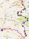
9/ Sunday 15 July 2018 - Arras > Roubaix - 156.5 km
The 9th stage of the Tour de France 2018 will bring back the cobble stones to the Tour race route, with a stage between the "citadelle" of Arras and the entrance of the "vélodrome" of Roubaix which will thus be some kind of a mini Paris-Roubaix with 21.7 kilometers of cobble stones, spread out over no less than 15 cobble stones sections, some of them being famous since they're part of the usual cobble stones race in April!Here are the 15 sections which are part of this stage: from Escaudoeuvres to Thun - 1600 m, from Eswars to Paillencourt - 1600 m, from Auberchicourt to Ecaillon - 900 m, from Warlaing to Brillon - 2000 m, from Tilloy to Sars-et-Rosières - 2400 m, from Beuvry to Orchies - 1400 m, from Auchy to Bersée - 2700 m, Mons-en-Pévèle - 900 m, from Mérignies to Avelin - 700 m, from Pont-Thibault to Ennevelin - 1400 m, Templeuve (Moulin de Vertain) - 500 m, from Cysoing to Bourghelles - 1300 m, from Bourghelles to Wannehain - 1100 m, Camphin-en-Pévèle - 1800 m and from Willems to Hem - 1400 m.
Hereunder you'll find the time- and route schedule, the stage profile and the race route on Google Maps for this stage. Click on the images to open them.


- start : Porte Royale in Arras ; the kilometer zero will be on the D258 at 7.6 km from there
- climbs : none
- feeding zone : on the D143 in Pecquencourt
- intermediate sprint : Rue du Pont-Rade in Wasnes-au-Bac at km 59
- Bonus Point : Rue de Camphin in Wannehain
- finish : Avenue Maxence van der Meersch in Roubaix
- visited departments : Pas-de-Calais (62) from km 0 till km 20.5 and from km 28 till km 36, Nord from km 23.5 till km 26 and from km 38 till km 156.5
- main cities : Arras, Cambrai, Marchiennes, Orchies, Hem and Roubaix
R1/ Monday 16 July 2018 - restv day in Annecy
After this stage finish in Roubaix, the riders can enjoy the first rest day of this Tour de France 2018 the next day in Annecy, while the followers of the race will drive all the kilometers down there ...10/ Tuesday 17 July 2018 - Annecy > Le Grand Bornand - 158.5 km
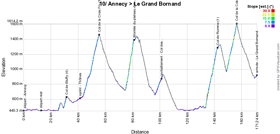
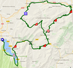
The day after the first rest day the start will be in Annecy as well. The way to Le Grand Bornand could be quite short but the riders of the Tour will of course not follow the shortest way!Indeed, this will be the first mountain stage and one can see that with no less than 3 1st category climbs and one outside category climb, the Montée du plateau des Glières (6 km at 11.2%), which will be followed by a stone path of 1800 meters, something which hasn't been on the programme of the modern Tour de France ever!
Hereunder you'll find the time- and route schedule, the stage profile and the race route on Google Maps for this stage. Click on the images to open them.

- start : Avenue d'Albigny in Annecy ; the kilometer zero will be on the D1508 at 12.7 km from the start
- climbs : Col de Bluffy (4th, 1.5 km at 5.6%) at km 19, Col de la Croix Fry (1st, 11.3 km at 7%) at km 43, Montée du plateau des Glières (HC, 6 km at 11.2%) at km 68.5, Col de Romme (1st, 8.8 km at 8.9%) at km 130 and Col de la Colombière (1st, 7.5 km at 8.5%) at km 144
- feeding zone : Col des Fleuries
- intermediate sprint : Route d'Annecy in Thônes at km 29
- finish : Route de la Patinoire in Le Grand Bornand
- visited departments : Haute-Savoie (74) from km 0 till km 158.5
- main cities : Annecy, Doussard, Talloires, Thônes, La Clusaz, La Roche-sur-Foron, Bonneville, Cluses and Le Grand Bornand
11/ Wednesday 18 July 2018 - Albertville > La Rosière (Espace San Bernardo) - 108.5 km
Another mountain stage, quite short this time with its 108.5 km starting in Albertville and animated by two outside category climbs (Montée de Bisanne and Col du Pré) as well as the mountain finish in La Rosière (Espace San Bernardo) of the first category, where the Critérium du Dauphiné also had a stage finish this year.Hereunder you'll find the time- and route schedule, the stage profile and the race route on Google Maps for this stage. Click on the images to open them.


- start : Cours de l'Hôtel de Ville in Albertville ; kilometer zero on the D925 at 1.7 km from there
- climbs : Montée de Bisanne (HC, 12.4 km at 8.2%) at km 26, Col du Pré (HC, 12.6 km at 7.7%) at km 57.5, Cormet de Roselend (2nd, 5.7 km at 6.5%) at km 70 and the finish in La Rosière (1st, 17.6 km at 5.8%) at km 108.5
- feeding zone : non applicable
- intermediate sprint : D925 in Villard-sur-Doron at km 11.5
- finish : D1090 in La Rosière
- visited departments : Savoie (73) from km 0 till km 108.5
- main cities : Albertville, Beaufort, Séez, Bourg-Saint-Maurice and La Rosière
CONTINUE READING AFTER THIS ADVERTISEMENT
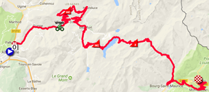
12/ Thursday 19 July 2018 - Bourg-Saint-Maurice > Alpe d'Huez - 175.5 km
Bourg-Saint-Maurice will be visited by the race during the stage the day before but today it will be the start location of the 12th stage: 175.5 kilometers towards the Alpe d'Huez. Before this final climb, the stage will be without any moment of rest because the Col de la Madeleine and the Col de la Croix de Fer will follow up on each other, before the final climb of this famous mountain with its 21 hairpin bends!Hereunder you'll find the time- and route schedule, the stage profile and the race route on Google Maps for this stage. Click on the images to open them.

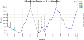
- start : Rue Capitaine Desserteaux in Bourg-Saint-Maurice ; the kilometer zero will be on the N90 at 8 km from the start
- climbs : Col de la Madeleine (HC, 25.3 km at 6.2%) at km 53.5, Lacets de Montvernier (2nd, 3.4 km at 8.2%) at km 83, Col de la Croix de Fer (HC, 29 km at 5.2%) at km 121 and the finish on the Alpe d'Huez (HC, 13.8 km at 8.1%) at km 175.5
- feeding zone : on the D1006 in Saint-Avre
- intermediate sprint : Rue de la Libération in Saint-Jean-de-Maurienne at km 91
- finish : Avenue du Rif Nel on the Alpe d'Huez
- visited departments : Savoie (73) from km 0 till km 126.5, Isère (38) from km 130 till km 175.5
- main cities : Bourg-Saint-Maurice, Aime, Moûtiers, Bourg d'Oisans, Alpe d'Huez
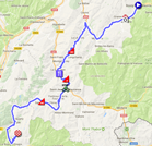
13/ Friday 20 July 2018 - Bourg d'Oisans > Valence - 169.5 km
The 13th stage of the Tour de France 2018 which will take place on Friday 20 July, will start at the foot of the Alpe d'Huez, in Bourg d'Oisans and finish in Valence, 169.5 kilometers further. This will be a transition stage after these 3 mountain stages.Hereunder you'll find the time- and route schedule, the stage profile and the race route on Google Maps for this stage. Click on the images to open them.

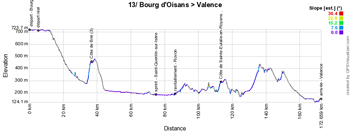
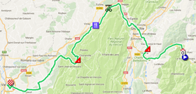
- start : Avenue de la République in Bourg d'Oisans ; the kilometer zero will be on the D1091 4.8 km further
- climbs : Côte de Brié (3rd, 2.4 km at 6.9%) at km 32.5, Côte de Sainte-Eulalie-en-Royans (4th, 1.5 km at 4.9%) at km 109.5
- feeding zone : Rovon
- intermediate sprint : D1532 in Saint-Quentin-sur-Isère at km 71
- finish : Avenue de Romans in Valence
- visited departments : Isère (38) from km 0 till km 106, Drôme (26) from km 108.5 till km 169.5
- main cities : Bourg d'Oisans, Vizille, Eybens, Grenoble, Fontaine, Sassenage, Pont-en-Royans, Chabeuil and Valence
14/ Saturday 21 July 2018 - Saint-Paul-Trois-Châteaux > Mende - 188 km
This 14th stage starting in Saint-Paul-Trois-Châteaux will start easily but will get harder in the second half with a 2nd category climb and a 3rd category climb before the final climb close to Mende!Hereunder you'll find the time- and route schedule, the stage profile and the race route on Google Maps for this stage. Click on the images to open them.

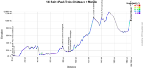

- start : Avenue du Général de Gaulle in Saint-Paul-Trois-Châteaux ; the kilometer zero will be on the D59 at 2.7 km from there
- climbs : Côte du Grand Chataignier (4th, 1 km at 7.4%) at km 81, La Croix de Berthel (2nd, 9.1 km at 5.3%) at km 129, Col du Pont sans Eau (3rd, 3.3 km at 6.3%) at km 142 and Côte de la Croix Neuve (2nd, 3 km at 10.2%) at km 186.5, at one kilometer and a half from the finish!
- feeding zone : on the D17 in Bessèges
- intermediate sprint : Avenue Alphonse Peyric in Bessèges at km 90
- finish : Aérodrome de Mende-Brenoux in Mende
- visited departments : Drôme (26) from km 0 till km 3.5, Ardèche (07) from km 9 till km 81, Gard (30) from km 83.5 till km 112, Lozère (48) from km 114.5 till km 188
- main cities : Saint-Paul-Trois-Châteaux, Pierrelatte, Bourg-Saint-Andéol, Vallon-Pont-d'Arc, Bessèges, Génolhac and Mende
15/ Sunday 22 July 2018 - Millau > Carcassonne - 181.5 km
The 15th stage will start in Millau, in the shadow of its famous viaduct. This stage will go south-west and will contain in the first half a 3rd category and a 2nd category climb but most importantly a 1st category climb in the second half, the Pic de Nore. The finish in Carcassonne will be flat but the field of contenders might thus reduce quite a lot in this last climb, even though its summit is at a bit over 40 kilometers from the finish.Hereunder you'll find the time- and route schedule, the stage profile and the race route on Google Maps for this stage. Click on the images to open them.

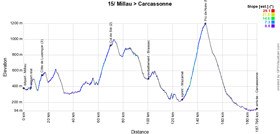

- start : Avenue Charles de Gaulle in Millau ; the kilometer zero will be on the D992 at 6 km from the start
- climbs : Côte de Luzençon (3rd, 3.1 km at 5.9%) at km 9, Col de Sié (2nd, 10.2 km at 4.9%) at km 64.5 and Pic de Nore (1st, 12.3 km at 6.3%) at km 140
- feeding zone : Brassac
- intermediate sprint : Avenue du Maréchal Foch in Mazamet at km 121.5
- finish : Boulevard Marcou in Carcassonne
- visited departments : Aveyron (12) from km 0 till km 50, Tarn (81) from km 64.5 till km 133.5, Aude (11) from km 140 till km 181.5
- main cities : Millau, Saint-Affrique, Lacaune-les-Bains, Carcassonne
CONTINUE READING AFTER THIS ADVERTISEMENT
R2/ Monday 23 July 2018 - Carcassonne
After this stage, the riders will get some rest in Carcassonne and will thus enjoy the second rest day without having to move to another location.16/ Tuesday 24 July 2018 - Carcassonne > Bagnères-de-Luchon - 218 km
After the rest day, the start of this 16th stage will also be in Carcassonne. This stage will go off towards Bagnères-de-Luchon and will start easily with only two 4th category climbs in the first half of the stage. It will get harder in the second half however with a 2nd and two 1st category climbs before the descent towards the finish. This will be the only stage of this Tour de France 2018 which will briefly visit another country, over about twenty kilometers on the Spanish territory to be more precise!Hereunder you'll find the time- and route schedule, the stage profile and the race route on Google Maps for this stage. Click on the images to open them.

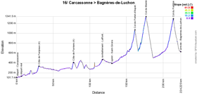
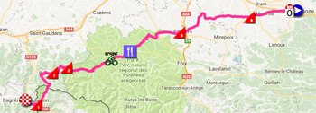
- start : Place du Général de Gaulle in Carcassonne ; the kilometer zero will be on the D119 at 6.4 km from the start
- climbs : Côte de Fanjeaux (4th, 2.4 km at 4.9%) at km 25, Côte de Pamiers (4th, 2.3 km at 5.8%) at km 72, Col de Portet-d'Aspet (2nd, 5.4 km at 7.1%) at km 155.5, Col de Menté (1st, 6.9 km at 8.1%) at km 171 and Col du Portillon (1st, 8.3 km at 7.1%) at km 208
- feeding zone : Lafont (Lescure)
- intermediate sprint : Boulevard Frédéric Arnaud in Saint-Girons at km 124
- finish : Boulevard Edmond Rostand in Bagnères-de-Luchon
- visited departments : Aude (11) from km 0 till km 52, Ariège (09) from km 60 till km 149.5, Haute-Garonne (31) from km 153 till km 186 et from km 215.5 till km 218, Province de Lérida, Spain from km 192.5 till km 208
- main cities : Carcassonne, Montréal, Belpech, Pamiers, Le Mas-d'Azil, Saint-Girons and Bagnères-de-Luchon
17/ Wednesday 25 July 2018 - Bagnères-de-Luchon > Saint-Lary-Soulan Col du Portet - 65 km
The start of the 17th stage the next day will also be in Bagnères-de-Luchon. This stage will be a bit particular because it's extremely short, only 65 kilometers, and it will be completely animated around the 3 climbs which will make up the race route: right from the start in Bagnères, the riders will climb the Montée de Peyragudes (1st category, 14.9 km at 6.7%) and after the descent from Peyragudes, they'll immediately go on with the climb of the Col de Val Louron-Azet (1st category, 7.4 km at 8.3%) and the same goes for the final climb towards the finish in Saint-Lary-Soulan on top of the Col du Portet (HC, 16 km at 8.7%). Between the two first difficulties the riders will have to battle for the intermediate sprint in Loudenvielle, but -due to the short distance of this stage- there won't be any feeding zone in this stage.The start of this stage will be a bit particular. Indeed, the kilometer zero will be right at the start of the stage in the city Bagnères-de-Luchon (on a road which allows to leave the city directly). A warm-up zone for the riders will be created over a distance of 900 meters, to allow them to spin the legs before they start the three successive climbs. The last particular thing in this start is maybe the most remarkable one: it will take place in the same way as a start of a Formula 1 race, with the riders being in 5 start zones, according to their position in the general classification at the finish of the previous day's stage: from 1st to 20th, from 21st to 40th, from 41st to 80th, from 81st to 120th and from 121st to the last one. The whole peloton will however start at the same time, as soon as the traffic light on the start line will turn green!
Hereunder you'll find the time- and route schedule, the stage profile and the race route on Google Maps for this stage. Click on the images to open them.

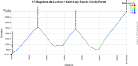

- start : Avenue Jean Moulin (D618) in Bagnères-de-Luchon ; due to the short distance of this stage, this will also be the kilometer zero, which will thus exceptionnally be in the city and from a stand still position, like in Formula 1 as described above
- climbs : Montée de Peyragudes (1st, 14.9 km at 6.7%) at km 15, Col de Val Louron-Azet (1st, 7.4 km at 8.3%) at km 37 and the finish on the Col du Portet (HC, 16 km at 8.7%) at km 65 which will be the rooftop of the Tour de France 2018 and on its summit the first rider finishing the stage will thus also receive the Souvenir Henri Desgrange
- feeding zone : none
- intermediate sprint : D25 in Loudenvielle at km 27.5
- finish : Col du Portet in Saint-Lary-Soulan
- visited departments : Haute-Garonne (31) from km 0 till km 13.5, Hautes-Pyrénées (65 ; like the number of kilometers of this stage) from km 14 till km 65
- main cities : Bagnères-de-Luchon, Loudenvielle, Saint-Lary-Soulan
18/ Thursday 26 July 2018 - Trie-sur-Baïse > Pau - 171 km
After this stage which is already a legendary stage on paper, a transition stage will be on the programme this Thursday 26 July in the Tour de France 2018. Indeed, starting in Trie-sur-Baïse, the riders will have 171 kilometers to ride up to the finish in Pau with only two 4th category climbs.Hereunder you'll find the time- and route schedule, the stage profile and the race route on Google Maps for this stage. Click on the images to open them.


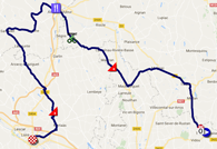
- start : Place de la Mairie in Trie-sur-Baïse ; kilometer zero on the D17 at 2.9 km from the start
- climbs : Côte de Madiran (4th, 1.2 km at 7%) at km 53.5 and Côte d'Anos (4th, 2.1 km at 4.6%) at km 152.5
- feeding zone : Aire-sur-l'Adour
- intermediate sprint : on the D22 in Aurensan at km 73.5
- finish : Rue du Maquis Le Béarn in Pau
- visited departments : Hautes-Pyrénées (65) at the start and at km 3 and from km 42 till km 56.5, Gers (32) at the start and from km 5.5 till km 36.5 and from km 67 till km 79.5, Landes (40) from km 83.5 till km 126, Pyrénées-Atlantiques (64) from km 130 till km 171
- main cities : Trie-sur-Baïse, Miélan, Marciac, Maubourguet, Madiran, Aire-sur-l'Adour, Geaune, Morlàas and Pau
CONTINUE READING AFTER THIS ADVERTISEMENT
19/ Friday 27 July 2018 - Lourdes > Laruns - 200,5 km
Back in the Pyrenees for a mountain stage, we'll see a start in the city Lourdes for 200.5 kilometers. This stage will mainly be animated by the climb of 3 mythical mountains of the Tour: the Col d'Aspin (1st, 12 km at 6.5%), the Col du Tourmalet (HC, 17.1 km at 7.3%) and the Col d'Aubisque (HC, 16.6 km at 4.9%). The stage will end at the foot of the descent of the last mentioned mountain. For some time, the final part of this stage was at doubt due to the bad weather mid-June which led to a landslide which took away part of the road over a distance of 50 meters, but if all goes according to the current plan, the roadworks should be terminated before the stage gets there and there will thus be a completely new route!Hereunder you'll find the time- and route schedule, the stage profile and the race route on Google Maps for this stage. Click on the images to open them.

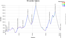
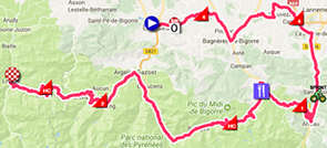
- start : Place Monseigneur Laurence in Lourdes ; kilometer zero on the D937 at 5.5 km from the start
- climbs : Côte de Loucrup (4th, 1.8 km at 7.2%) at km 7, Côte de Capvern-les-Bains (4th, 3.4 km at 5.1%) at km 40, Col d'Aspin (1st, 12 km at 6.5%) at km 78.5, Col du Tourmalet (HC, 17.1 km at 7.3%) at km 108, Col des Bordères (2nd, 8.6 km at 5.8%) at km 159.5 and Col d'Aubisque (HC, 16.6 km at 4.9%) at km 180.5
- feeding zone : Pas de la Barane at km 93.5
- intermediate sprint : Route d'Espagne in Sarrancolin at km 59.5
- finish : D240 in Laruns
- visited departments : Hautes-Pyrénées (65) from km 0 till km 171, Pyrénées-Atlantiques (64) from km 180.5 till km 200.5
- main cities : Lourdes, Bagnères-de-Bigorre, Capvern-les-Bains, Arreau, Luz-Saint-Sauveur, Argelès-Gazost, Laruns
20/ Saturday 28 July 2018 - Saint-Pée-sur-Nivelle > Espelette - individual time trial - 31 km
The forelast stage of the Tour de France 2018 will be an individual time trial in the Bask country, between Saint-Pée-sur-Nivelle, with the start, according to the Bask traditions, in front of the local "fronton", and Espelette, well known of its peppers. Even though no single difficulty is officially referenced for this stage, its race route will not be completely flat however. Indeed, at 3 kilometers from the finish for example, the riders will climb the Col de Pinodieta (900 m at 10.2%) during their solo effort, which could well prevent some riders to end in a good time and thus maybe bring some changes in the general classification if the gaps are sufficiently small!Hereunder you'll find the time- and route schedule, the stage profile and the race route on Google Maps for this stage. Click on the images to open them.


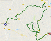
- start : Fronton in Saint-Pée-sur-Nivelle
- climbs : none
- feeding zone : non applicable
- intermediate sprint : non applicable
- intermediate timing points : Ustaritz and Souraïde (Chemin de Xurxurieta)
- finish : D918 in Espelette
- visited departments : Pyrénées-Atlantiques (64) from km 0 till km 31
- main cities : Saint-Pée-sur-Nivelle, Espelette
21/ Sunday 29 July 2018 - Houilles > Paris Champs-Elysées - 116 km
Once they arrive in Paris, the usual circuit on the Champs-Elysées will be on the programme with 8 crossings of the finish line.
Hereunder you'll find the time- and route schedule, the stage profile and the race route on Google Maps for this stage. Click on the images to open them.


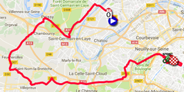
- start : Rue Gambetta in Houilles ; kilometer zero on the D308 at 2.6 km from the start
- climbs : none
- feeding zone : none
- intermediate sprint : Paris, on the Champs-Elysées at km 76 just after the 3rd crossing of the finish line
- finish : Avenue des Champs-Elysées in Paris
- visited departments : Yvelines (78) from km 0 till km 40.5, Hauts-de-Seine from km 42 till km 50, Paris (75) from km 50.5 till km 116
- main cities : Houilles, Sartrouville, Maisons-Laffitte, Saint-Germain-en-Laye, Poissy, Saint-Cloud, Suresnes, Paris
The Tour de France 2018 race route in Google Earth
Do you prefer to see the whole Tour de France 2018 race route on one single map? Or would you like to do a virtual fly-over over the race route of one or more stages of this 105th edition of the Tour de France? That's all possible, simply by downloading the KMZ (a zipped KML file, because of its big filesize) file hereunder and opening it in Google Earth! ATTENTION - copyright : despite the fact that this KMZ file is made available to you for your own use, you should keep in mind that it's stricly forbidden to reproduce the contents of this KMZ file or any other file (including the maps, the profiles, the KML files or anything else) which make up the Tour de France 2018 race route. Indeed, these contents are protected by copyright and I thus ask you to respect the huge amount of time it takes to create these. This protection thus applies to the reproduction of the maps and all other elements in any specific form (as a map, as a video which flies over the maps or any other creation based on the contents published at velowire.com).
>> Download the Tour de France 2018 race route with all of its stages in Google Earth (KMZ file, 351 kB)

Vond u dit artikel interessant? Laat het uw vrienden op Facebook weten door op de buttons hieronder te klikken!
10 comments | 42309 views
this publication is published in: Tour de France | Tour de France 2018 | OpenStreetMap/Google Maps/Google Earth


 by marco1988 over