July is fast approaching, and so is the 110th edition of the Grande Boucle. As usual, velowire.com offers you Open Street Maps/Google Earth views of the Tour de France 2023 stages, with all the details, as well as the official timetable and profile of each stage, and a KMZ file which can be opened in Google Earth to visualize the whole of this Grand Tour, or to fly over the stages.
With the information in this article, you'll know every little corner, every town and every village crossed by this Tour, over its 3399.7 km, and so be able to prepare your visit on the spot if you're one of the spectators at the side of the road, or simply understand the race better if you're not there!
A little bit of information ...
Before discovering the details of all the stages of the Tour de France 2023 let's have a look at some additional information:- as with all content on velowire.com, its reproduction in any other form is prohibited, as specified on the copyright page. Thank you for respecting the time spent on preparing content such as this!
- stage profiles have been generated automatically on the basis of known altitude information at race locations; there may therefore be some inaccuracies, but the overall profile is the correct one!
- feed zones for the Tour de France 2023 are closed to the public; they are therefore not shown on the maps or in the hourly itineraries.
The program for the Grand Départ of the Tour de France 2023
As you know, the Grand Départ of the Tour de France 2023 will take place in the Spanish Basque Country, in Bilbao to be precise. Here are the dates to remember for this Grand Départ of the Tour de France 2023The Tour de France 2023 route on Open Street Maps
Let's take a look at the route of the Tour de France 2023, stage by stage:CONTINUE READING AFTER THIS ADVERTISEMENT
1/ Saturday July 1 - Bilbao 🇪🇸 > Bilbao 🇪🇸 - 182 km
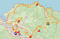
The first stage of the Tour de France 2023 will start and finish in Bilbao, in the Spanish Basque Country.After the actual start to the north of the city, the riders climb the Laukiz hill fairly quickly, before approaching the seaside, which they then follow, passing along the San Juan de Gaztelugatxe hill, after which they return inland a little to skirt around a marshy area before returning to the seaside and then back inland again to begin the return journey to the finish.
They then link up 3 difficulties, the Col de Morga, the Côte de Vivero and the Côte de Pike, which will be the first bonus point on this Tour de France 2023. As a reminder, at the "bonus point", of which there are 6 in this Tour de France (in this stage, the 2nd, 5th, 12th and 14th), the first 3 riders get a time bonus: respectively 8, 5 and 2 seconds for the first, second and third. The principle of these "bonus points" is to reward in time the riders who take the initiative to attack in these stages. After the Côte de Pike, the riders return to the same route they took to get to the actual start of the stage (see red arrows) to head for the finish, also in Bilbao!
Below you'll find the time itinerary, profile and Open Street Maps for this stage. Click on the images to open them.


- start:
- the start will take place on the Felipe Serrate Kalea in Bilbao (12:30 p.m.)
- the actual start is scheduled on the BI-704, after 11.3 km of the parade route (12:55 p.m.) - passes and climbs:
- Côte de Laukiz (3rd category) at km 13.8 - ^ 211 m / 2.2 km at 6.9%
- Côte de San Juan de Gaztelugatxe (3rd category) at km 67.8 - ^ 286 m / 3.5 km at 7.6%
- Col de Morga (4th category) at km 140,9 - ^ 307 m / 3.9 km at 4.1%
- Côte de Vivero (2nd category) at km 154.9 - ^ 361 m / 4.2 km at 7.3%
- Côte de Pike (3rd category) at km 140.9 - ^ 212 m / 2 km at 10%. - intermediate sprint: Carlos Gangoiti Kalea in Gernika-Lumo at km 88.2
- bonus sprint: Côte de Pike
- finish: Zumalacárregui Etorbidea / BI-625 in Bilbao at the end of a 150 m straight line at sight / width 6.5 m
- departments crossed: Vizcaya (Spain) from km 0 to km 182
- main towns: Bilbao, Getxo, Bermeo and Gernika-Lumo
2/ Sunday, July 2, 2023 - Vitoria-Gasteiz 🇪🇸 > San Sebastian 🇪🇸 - 208.9 km
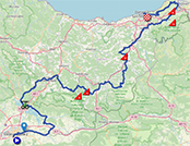
Stage 2 of the Tour de France 2023 will start south of Bilbao, in Vitoria-Gasteiz, and head northeast. The intermediate sprint at Legutio will soon be contested. They then descend into the Arrasate valley, before successively climbing the Col d'Udana and the Côte d'Aztiria.Fifty kilometers further on, the riders find another difficulty, the Côte d'Alkiza, and just over 30 kilometers further on they climb the easier Côte de Gurutze, before finding the most difficult climb of the stage after the U-turn at the French border, Jaizkibel, known as the main difficulty on the San Sebastian Classic (Donostia San Sebastian Klasikoa in Basque, or La Clásica San Sebastián in Spanish), at the summit of which they are 16.5 kilometers from the finish in San Sebastian. Jaizkibel will therefore also be the bonus point of this stage.
Below you'll find the hourly itinerary, profile and Open Street Maps for this stage. Click on the images to open them.


- start:
- the start will take place on theMendizabala Area in Vitoria-Gasteiz (12:15pm)
- the actual start is scheduled on the N-104, after 6.7km of the parade route (12:25pm) - passes and climbs:
- Col d'Udana (3rd category) at km 81.3 - ^ 515 m / 4.5 km at 5.1%
- Côte d'Aztiria (4th category) at km 87.6 - ^ 572 m / 2.7 km at 5.3%
- Côte d'Alkiza (3rd category) at km 140,9 - ^ 324 m / 4.2 km at 5.7%
- Gurutze hill (4th category) at km 174.2 - ^ 150 m / 2.6 km at 4.7%
- Jaizkibel (2nd category) at km 192.4 - ^ 455 m / 8.1 km at 5.3 - intermediate sprint: N-240 in Legutio at km 40.6
- bonus sprint: Jaizkibel
- finish: Zurriola Hiribidea in San Sebastian at the end of a final straight 550 m at sight / 6 m wide
- Departments crossed: Alava from km 0 to km 53.9, Gipuzcoa from km 58 to km 208.9
- main towns: Vitoria-Gasteiz, Irun, Hondarribia and San Sebastian
3/ Monday, July 3, 2023 - Amorebieta-Extano 🇪🇸 > Bayonne - 187.4 km
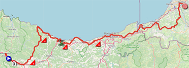
The third stage of the Tour de France 2023 will be the last of the Grand Départ and therefore the last to start in the Spanish Basque Country, at Amorebieta-Extano. Heading north towards the coast, the riders will immediately encounter two difficulties, the Côte de Trabukua and the Côte de Milloi.Once they reach the seaside, they'll follow it eastwards, passing the sprint at Deba, the Col d'Itziar and the Côte d'Orioko Benta before passing through the finish town of San Sebastian, before crossing the border into France at Irun / Hendaye and then, after passing through Saint-Jean-de-Luz, heading inland to the finish in Bayonne.
Below you'll find the itinerary, profile and Open Street Maps for this stage. Click on the images to open them.


- start:
- the start will take place on Nafarroa Kalea in Amorebieta-Extano (1:00 p.m.)
- the actual start is scheduled on the N-634, after 6.8 km of the parade route (1:15 p.m.) - passes and climbs:
- Côte de Trabukua (3rd category) at km 13.8 - ^ 369 m / 4.1 km at 5.4%
- Côte de Milloi (4th category) at km 32.8 - ^ 162 m / 2.3 km at 4.5%
- Col d'Itziar (3rd category) at km 70.9 - ^ 212 m / 5.1 km at 4.6%
- Côte d'Orioko Benta (3rd category) at km 102 - ^ 316 m / 4.6 km at 6.3 - intermediate sprint: Hondartza Kalea in Deba at km 65.8
- finish: Avenue de l'Aquitaine in Bayonne at the end of a 200 m straight line at sight / width 6.5 m
- Departments crossed: Biscaye from km 0 to km 53.8, Gipuzcoa from km 59 to km 128.8, Pyrénées-Atlantiques (64) from km 134.1 to km 187.4
- main towns: Amorebieta-Extano, Durango, Zarautz, San Sebastian, Errenteria, Irun, Hendaye, Saint-Jean-de-Luz and Bayonne
4/ Tuesday, July 4, 2023 - Dax > Nogarro - 181.8 km
The first 100% French stage, stage 4 of this Tour de France 2023, will start in Dax, the town of André Darrigade (22-time stage winner on the Tour de France), which was waiting for the return of the 2006 Tour.It will be a flat stage, with an intermediate sprint at Notre-Dame des Cyclistes, the former chapel of Géou, which Pope John XXIII declared the National Sanctuary of Cycling and Cyclotourism under the protection of the Virgin Mary on May 18, 1959.
It will reach its easternmost point at Vic-Fezensac, before heading back west via the Côte de Dému to the finish in Nogarro, which will take place north of the town on the Circuit Paul Armagnac.
Below you'll find the time schedule, profile and Open Street Maps for this stage. Click on the images to open them.


- start
- the start will take place on the Place de la Fontaine Chaude in Dax (1:10pm)
- the actual start is scheduled on the D32 / Route de Candresse, after 4.8 km of the parade route (1:20pm) - passes and climbs:
- Côte de Dému (4th category) at km 154.4 - ^ 218 m / 2 km at 3.5 - intermediate sprint: in front of Notre-Dame des Cyclistes at km 93.6
- finish: on the Circuit Paul Armagnac in Nogaro at the end of a 750 m / 9 m wide final straight
- departments crossed: Landes (40) from km 0 to km 93.6 and from km 98.9 to km 181.8, Gers (32) at km 98
- main towns: Dax, Eauze and Nogaro
CONTINUE READING AFTER THIS ADVERTISEMENT
5/ Wednesday, July 5, 2023 - Pau > Laruns - 162.7 km
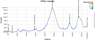
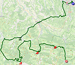
After the already tough opening stages, with this Grand Départ in the Spanish Basque Country, the Pyrenean stages begin right with this 5th stage!Starting in Pau (or should I say Pau l'incontournable, as it is stage town for the the 74th time?), the section up to the sprint at Lanne-en-Barétous is flat, up to around 70 km into the stage. The road then rises, and the riders first climb the Col de Soudet, which will be the day's biggest difficulty.
The Col d'Ichère will then be a little simpler, but the Col de Marie Blanque brings the riders back to the reality of the first French mountain stage of this Tour de France, and this climb will also be the bonus point of this stage, before a flat finish in Laruns.
Below you'll find the hourly itinerary, profile and Open Street Maps for this stage. Click on the images to open them.

- start:
- the start will take place in Rue Pierre Bordelongue in Pau (1:05pm)
- the actual start is scheduled on the D802, after 9.1 km of the parade route (1:25pm) - passes and climbs:
- Col de Soudet (hors catégorie) at km 87.5 - 15.2 km at 7.2%
- Col d'Ichère (3e catégorie) at km 124.8 - 4.2 km at 7%
- Col de Marie Blanque (1ère catégorie) at km 144.2 - 1.3 km at 5.8%. - intermediate sprint: D918 at Lanne-en-Barétous at km 48.8
- bonus sprint: Col de Marie Blanque
- finish: D934 at Laruns at the end of a 3.4 km final straight (including 800 m at sight) / width 5.5 m
- departments crossed: Pyrénées-Atlantiques (64) from km 0 to km 162.7
- main towns: Pau, Oloron-Sainte-Marie, Arette and Laruns
6/ Thursday, July 6, 2023 - Tarbes > Cauterets-Cambasque - 144.9 km
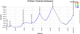
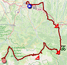
Stage 6 will be just as demanding as the previous one, if not more so, with its high altitude finish. Starting in Tarbes, the riders of the Tour de France 2023 will face a new mountain stage. It starts timidly with the Côte de Capvern-les-Bains after around 35 kilometers, but after the Sarrancolin sprint, it's on to the triptych Col d'Aspin, Col du Tourmalet and the high-altitude finish at Cauterets-Cambasque.Below you'll find the time schedule, profile and Open Street Maps for this stage. Click on the images to open them.

- start:
- the start will take place on Place Marcadieu in Tarbes (1:10pm)
- the actual start is scheduled on the D21, after 7.6km of the parade route (1:25pm) - passes and climbs:
- Côte de Capvern-les-Bains (3rd category) at km 29.9 - ^ 602 m / 5.6 km at 4.8%
- Col d'Aspin (1st category) at km 68.1 - ^ 1490 m / 12 km at 6.5%
- Col du Tourmalet (hors catégorie) at km 97.9 - ^ 2115 m / 17.1 km at 7.3%
- Cauterets-Cambasque (1st category) at km 144.9 - ^ 1355 m / 16 km at 5.4%. - intermediate sprint: D929 / Route d'Espagne in Sarrancolin at km 49.2
- finish: Route de Cambasque in Cauterets-Cambasque at the end of a final straight 50 m at sight / width 5 m
- departments crossed: Hautes-Pyrénées (65) from km 0 to km 144.9
- main towns: Tarbes, Arreau, Luz-Saint-Sauveur, Pierrefitte-Nestalas and Cauterets
7/ Friday, July 7, 2023 - Mont-de-Marsan > Bordeaux - 169.9 km
After a rather rocky start to the Tour de France 2023, this 7th stage will signal a return to calm.Between Mont-de-Marsan and Bordeaux, with an intermediate sprint in Grignols, it won't be the Côte de Béguey that will prevent the sprinters from shining as the Tour de France returns to Bordeaux after a 12-year gap that broke the rhythm of the Tour's increased presence in the city.
Below you'll find the hourly itinerary, profile and Open Street Maps for this stage. Click on the images to open them.


- start:
- the start will take place on Place Joseph Pancaut in Mont-de-Marsan (1:15pm)
- the actual start is scheduled on the D53, after 5.4 km of the parade route (1:30pm) - passes and climbs:
- Côte de Béguey (4th category) at km 131 - ^ 84 m / 1.2 km at 4.4 - intermediate sprint: Route des Landes in Grignols at km 88
- finish: Quai Louis XVIII in Bordeaux at the end of a 2 km final straight (including 400 m at sight) / width 6 m
- departments crossed: Landes (40) from km 0 to km 67.3, Gironde (33) from km 70.3 to km 169.9
- main towns: Mont-de-Marsan, Roquefort, Langon and Bordeaux
8/ Saturday, July 8, 2023 - Libourne > Limoges - 200.7 km
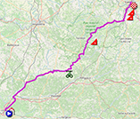
Stage 8 of the Tour de France 2023 won't be one of the toughest either. Starting in Libourne, which is already seeing the Tour return after the last visit in 2021, the route is all flat for around 3 quarters of the stage, passing through the Tocane-Saint-Apre sprint.On arrival in the Parc Naturel Régional Périgord Limousin, a slightly more hilly profile awaits the riders, with the climb up the Côte de Champs-Romain, before finding - much closer to the finish - the sequence of the Côte de Masmont and the Côte de Condat-sur-Vienne, before heading downhill towards the finish in Limoges.
Below you'll find the hourly itinerary, profile and Open Street Maps for this stage. Click on the images to open them.


- start:
- the start will take place in Rue Roudier in Libourne (12:30 p.m.)
- the actual start is scheduled on the D1089, after 4.8 km of the parade route (12:45 p.m.) - passes and climbs:
- Côte de Champs-Romain (3rd category) at km 130.4 - ^ 303 m / 2.8 km at 5.2%
- Côte de Masmont (4th category) at km 184.7 - ^ 353 m / 1.3 km at 5.5%
- Côte de Condat-sur-Vienne (4th category) at km 191.4 - ^ 289 m / 1.2 km at 5.4%. - intermediate sprint: Route de Royan in Tocane-Saint-Apre at km 79
- finish: Place Jourdan in Limoges at the end of an 800 m final straight (of which 200 m on sight) / width 6.5 m
- departments crossed: Gironde (33) from km 0 to km 30.4, Dordogne (24) from km 30.8 to km 137.2 and to km 145.4 and Haute-Vienne (87) from km 140.8 to km 145.3 and from km 147.4 to km 200.7
- main towns: Libourne, Ribérac and Limoges
CONTINUE READING AFTER THIS ADVERTISEMENT
9/ Sunday, July 9, 2023 - Saint-Leonard-de-Noblat > Puy de Dôme - 182.4 km
The return at last! Yes, the Puy de Dôme hasn't been climbed since 1988, so it's been 35 years since the Tour de France riders have been there. After the start from Saint-Léonard-de-Noblat, the riders climb quickly towards Lac de Vassivière, where the intermediate sprint of this stage will be held.3 short climbs will then punctuate this stage: Côte de Felletin, Côte de Pontcharraud and Côte de Pontaumur, but the real difficulty lies in the final climb, from around 370 to 1415 meters above sea level, that of the famous Puy de Dôme.
Below you'll find the hourly itinerary, profile and Open Street Maps for this stage. Click on the images to open them.

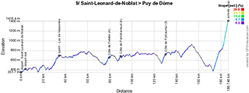

- start:
- the start will take place on theAvenue du Champ de Mars in Saint-Leonard-de-Noblat (1:30 pm)
- the actual start is scheduled on the D13, after 4.3 km of the parade route (1:45 pm) - passes and climbs:
- Côte de Felletin (4th category) at km 74.8 - ^ 660 m / 2.1 km at 5.2%
- Côte de Pontcharraud (4th category) at km 85.7 - ^ 692 m / 1.8 km at 4.6%
- Côte de Pontaumur (3rd category) at km 126.2 - ^ 734 m / 3.3 km at 5.3%
- Puy de Dôme (outside category) at km 182.4 - ^ 1415 m / 13.3 km at 7.7%. - intermediate sprint: D222 at Lac de Vassivière at km 30.4
- finish: at the summit of the Puy de Dôme at the end of a 10 m / 4 m wide final straight.
- departments crossed: Haute-Vienne (87) from km 0 to km 37, Creuse (23) from km 38.6 to km 105.1, Puy de Dôme (63) from km 107.9 to km 182.4
- main towns: Saint-Léonard-de-Noblat, Felletin and Clermont-Ferrand
R1/ Monday, July 10, 2023 - rest in Clermont-Ferrand
After the first 9 stages without any real rest, it's this Monday, July 10, that the riders will finally be able to rest, before starting the second week of this Tour de France 2023.10/ Tuesday, July 11, 2023 - Vulcania > Issoire - 167.2 km
In the land of volcanoes south of Clermont-Ferrand, in the Parc naturel régional des Volcans d'Auvergne, there's no shortage of difficulty. So it's hardly surprising that, after the start at Vulcania, the region's emblematic park, the riders quickly climb the Col de la Moréno, before moving on to the Col de Guéry. Up to the sprint at Le Mont-Dore, a slightly easier section awaits them - a section that riders who took part in this year's Critérium du Dauphiné will recognize - but the Col de la Croix Saint-Robert is immediately behind, followed by the smaller Côte de Saint-Victor-la-Rivière. This is followed by an easy, downhill section, before tackling the day's final difficulty, the Côte de la Chapelle-Marcousse.After another short climb, the riders head downhill to the finish in Issoire.
Below you'll find the time schedule, profile and Open Street Maps for this stage. Click on the images to open them.

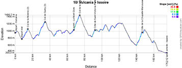
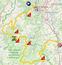
- start:
- the start will take place on the Vulcania parking lot (1:05pm)
- the actual start is scheduled on the D942, after 7.8 km of the parade route (1:20pm) - passes and climbs:
- Col de la Moréno (3rd category) at km 7 - ^ 1065 m / 4.8 km at 4.7%
- Col de Guéry (3rd category) at km 27.3 - ^ 1277 m / 7.8 km at 5%
- Col de la Croix Saint-Robert (2nd category) at km 66,6 - ^ 1451 m / 6 km at 6.3%
- Côte de Saint-Victor-la-Rivière (3rd category) at km 84.3 - ^ 1041 m / 3 km at 5.9%
- Côte de la Chapelle-Marcousse (3rd category) at km 138.6 - ^ 980 m / 6.5 km at 5.6 - intermediate sprint: Place Charles de Gaulle, Le Mont-Dore at km 59.9
- finish: Route de Saint-Germain / D716 in Issoire at the end of a 700 m / 6 m wide final straight.
- departments crossed: Puy-de-Dôme (63) from km 0 to km 167.2
- main towns: Murat-le-Quaire, Le Mont-Dore, Chambon-sur-Lac, Murol, Besse and Issoire
11/ Wednesday, July 12, 2023 - Clermont-Ferrand > Moulins - 179.8 km
Back in Clermont-Ferrand, the 11th stage of the Tour de France 2023 awaits the riders. Taking place to the north of the capital of the Puy-de-Dôme département, it is far less rugged than previous stages, offering a relatively quick succession of two 4th category climbs, the Côte de Chaptuzat-Haut and the Côte du Mercurol.After the sprint to Lapeyrouse and the passage through Montluçon, a final 4th category climb, the Côte de la Croix Blanche, will be on the program, before continuing almost flat until the finish in Moulins.
Below you'll find the time schedule, profile and Open Street Maps for this stage. Click on the images to open them.


- start:
- the start will take place on Boulevard Desaix in Clermont-Ferrand (1:05pm)
- the actual start is scheduled on the D210, after 10.3 km of the parade route (1:25pm) - passes and climbs:
- Côte de Chaptuzat-Haut (4th category) at km 31.8 - ^ 490 m / 1.9 km at 5%
- Côte du Mercurol (4th category) at km 49.5 - ^ 457 m / 2.9 km at 4.6%
- Côte de la Croix Blanche (4th category) at km 118.5 - ^ 292 m / 1.6 km at 5.4 - intermediate sprint: D998 at Lapeyrouse at km 70.5
- finish: Boulevard de Nomazy in Moulins at the end of a 1,300 m final straight (including 300 m at sight) / width 7 m
- departments crossed: Puy-de-Dôme (63) from km 0 to km 44.7 and from km 66.5 to km 74.3, Allier (03) from km 45.4 to km 64.5 and from km 76.5 to km 179.8
- main towns: Clermont-Ferrand, Aigueperse, Ébreuil, Commentry, Néris-les-Bains, Montluçon, Cosne-d'Alier and Moulins
CONTINUE READING AFTER THIS ADVERTISEMENT
12/ Thursday, July 13, 2023 - Roanne > Belleville-en-Beaujolais - 168.8 km
The 12th stage from Roanne offers a whole host of difficulties. The stage begins with the Côte de Thizy-les-Bourgs and Col des Écorbans.After reaching the most northeasterly point of the stage and a passage through the valley, the route makes a round trip to the west of the finish town. After the intermediate sprint at Régnié-Durette, on the flat, riders will find a demanding sequence of 3 cols: Col de la Casse Froide, Col de la Croix Montmain and Col de la Croix Rosier. The latter, 28.4 kilometers from the finish, will be another bonus point. The last part of the stage is downhill, until the finish in Belleville-en-Beaujolais.
Below you'll find the time schedule, profile and Open Street Maps for this stage. Click on the images to open them.


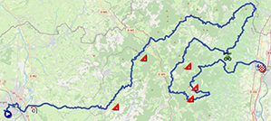
- start:
- the start will take place at the Parking du Scarabée in Roanne (1:05 pm)
- the actual start is scheduled on the Roanne, after 10.4 km of the parade route (1:20 pm) - passes and climbs:
- Côte de Thizy-les-Bourgs (3rd category) at km 20.5 - ^ 633 m / 4.3 km at 5.6%
- Col des Écorbans (3rd category) at km 37.9 - ^ 853 m / 2.1 km at 6.9%
- Col de la Casse Froide (3rd category) at km 109,9 - ^ 740 m / 5.2 km at 6.1%
- Col de la Croix Montmain (2nd category) at km 125 - ^ 737 m / 5.5 km at 6.1%
- Col de la Croix Rosier (2nd category) at km 140.4 - ^ 717 m / 5.3 km at 7.6 - intermediate sprint: Rue Chaussée d'Erpent in Régnié-Durette at km 93.3
- bonus sprint: Col de la Croix Rosier
- finish: Avenue de l'Europe / D306 à v at the end of a 400 m / 6 m wide final straight line
- departments crossed: Loire (42) from km 0 to km 13.2 and to km 38, Rhône (69) from km 15.1 to km 37.9 and from km 40.2 to km 76.9 and from km 78.7 to km 168.8, Saône-et-Loire (71) from km 77.8 to km 78.2
- main towns: Roanne, Bourg-de-Thizy, Régnié-Durette and Belleville-en-Beaujolais
13/ Friday, July 14, 2023 - Châtillon-sur-Chalaronne > Grand Colombier - 137.8 km
On Bastille Day, a two-part stage awaits the riders at the start of Châtillon-sur-Chalaronne: the first part on the flat, then a first hump that takes them to the intermediate sprint at Hauteville-Lompnes, then its descent and a short part on the flat before the impressive final climb to Grand Colombier.Below you'll find the time schedule, profile and Open Street Maps for this stage. Click on the images to open them.

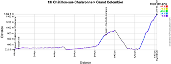
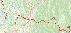
- start:
- the start will take place on Place de la République in Châtillon-sur-Chalaronne (1.45pm)
- the actual start is scheduled on the D2, after 4.3km of the parade route (1.55pm) - passes and climbs:
- Grand Colombier (out of category) at km 137.8 - ^ 1501 m / 17.4 km at 7.1 - intermediate sprint: Avenue de la Liberté in Hauteville-Lompnes at km 87.3
- finish: D120 at Grand Colombier at the end of a final straight 1400 m (including 400 m at sight) / width 5 m
- departments crossed: Ain (01) from km 0 to km 137.8
- main towns: Châtillon-sur-Chalaronne, Villars-les-Dombes, Ambérieu-en-Bugey, Hauteville-Lompnes and Culoz
14/ Saturday, July 15, 2023 - Annemasse > Morzine - 151.8 km
This third weekend of the Tour de France 2023 will see the race really enter the Alps, where it will stay for some time. After the start from Annemasse and the actual start of this stage, the riders will find after just over ten kilometers already a triptych of difficulties, with the Col de Saxel, the Col de Cou and the Col du Feu.After the sprint to the top of the Col de Jambaz, which does not count towards the king of the mountains classification, they descend to the foot of the Col de la Ramaz.
A descent and a passage through the valley later, and they're already at the foot of the Col de Joux Plane, whose summit is 12 kilometers from the finish, making it the perfect location for a new bonus point! Finally, it's downhill that the riders plunge towards the finish in Morzine.
Below you'll find the time itinerary, profile and Open Street Maps for this stage. Click on the images to open them.

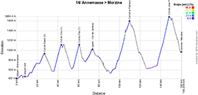
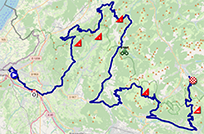
- start:
- the start will take place in the Rue des Amoureux in Annemasse (1:05pm)
- the actual start is scheduled on the D1205, after 8.3 km of the parade route (1:20pm) - passes and climbs:
- Col de Saxel (3rd category) at km 18.7 - ^ 944 m / 4.2 km at 4.6%
- Col de Cou (1st category) at km 35.3 - ^ 1116 m / 7 km at 7.4%
- Col du Feu (1st category) at km 52,7 - ^ 1117 m / 5.8 km at 7.8%
- Col de la Ramaz (1st category) at km 101.6 - ^ 1619 m / 13.9 km at 7.1%
- Col de Joux Plane (non-category) at km 139.8 - ^ 1691 m / 11.6 km at 8.5%. - intermediate sprint: Col de Jambaz (^ 1029 m) at km 65.5
- bonus sprint: Col de Joux Plane
- finish: Place de l'Office de Tourisme in Morzine at the end of a 50 m straight line at sight / width 5.50 m
- departments crossed: Haute-Savoie (74) from km 0 to km 151.8
- main towns: Annemasse, Saint-Jeoire, Taninges, Samoëns and Morzine
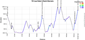
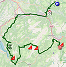
15/ Sunday, July 16, 2023 - Les Gets > Saint-Gervais Mont-Blanc - 179 km
This weekend's second alpine stage will be no simpler than the previous one, with its start in Les Gets and its series of difficulties.After the Col des Fleuries, which doesn't count towards the king of the mountains classification, the riders battle it out in the intermediate sprint at Bluffy before tackling the climb to the Col de la Forclaz de Montmin above the Lac d'Annecy. A little further on, they'll have to pass the demanding Col de la Croix Fry and the smaller Col des Aravis.
They then plunge towards Domancy, before tackling the double ascent of the Côte des Amerands and then the climb to Saint-Gervais Mont-Blanc.
Below you'll find the hourly itinerary, profile and Open Street Maps for this stage. Click on the images to open them.

- start:
- the start will take place in Rue du Centre in Les Gets (1:05pm)
- the actual start is scheduled on the D902, after 11.6km of the parade route (1:20pm) - passes and climbs:
- Col de la Forclaz de Montmin (1st category) at km 82.8 - ^ 1157 m / 7.2 km at 7.3%
- Col de la Croix Fry (1st category) at km 124.5 - ^ 1477 m / 11.3 km at 7%
- Col des Aravis (3rd category) at km 133,3- ^ 1487 m / 4.4 km at 5.8%
- Côte des Amerands (2nd category) at km 170.6 - ^ 888 m / 2.7 km at 10.9%
- Saint-Gervais Mont-Blanc (1st category) at km 179 - ^ 1372 m / 7 km at 7.7%. - intermediate sprint: Route de Thônes à Bluffy at km 72
- finish: Route du Bettex in Saint-Gervais Mont-Blanc at the end of a final straight 50 m at sight / width 5 m
- departments crossed: Haute-Savoie (74) from km 0 to km 133.3 and from km 148.5 to km 179, Savoie (73) from km 137.7 to km 147.4
- main towns: Les Gets, Cluses, Bonneville, La Roche-sur-Foron, Faverges, Praz-sur-Arly, Megève, Combloux and Saint-Gervais-les-Bains
CONTINUE READING AFTER THIS ADVERTISEMENT
R2/ Monday July 17, 2023 - rest in Saint-Gervais Mont-Blanc
After this 3rd weekend of the Tour de France 2023 and in the midst of the Alpine stages, the riders can once again take a break on this second rest day.16/ Tuesday, July 18, 2023 - Passy > Combloux - individual time trial - 22.4 km
The final week of the Tour de France 2023 begins with a time trial, and it will be the only one of this Tour. And it won't be a simple time trial, because after the start in Combloux. This time-trial could well put the overall classification in doubt, or allow the wearer of the yellow jersey to put it even more firmly on his shoulders.Below you'll find the schedule, profile and Open Street Maps for this stage. Click on the images to open them.


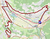
- start:
- the launch ramp will be in l'Avenue Joseph Thoret in Passy (the first rider will start at 1:05 p.m.; first minute by minute, then every 1'30" and finally 2 minutes by 2 minutes; the last start is scheduled for 5:00 p.m.) - timing points:
- Passy Chef-Lieu at km 7.1
- Domancy at km 16.1
- Côte de Domancy at km 18.9 - passes and climbs:
- Côte de Domancy (2nd category) at km 18.9 - Passy - finish: Route de Megève / D1212 in Combloux at the end of a 120 m straight final stretch on sight / width 5 m
- departments crossed: Haute-Savoie (74) from km 0 to km 22.4
- main towns: Passy, Sallanches and Combloux
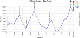
17/ Wednesday, July 19, 2023 - Saint-Gervais > Courchevel - 165.7 km
Saint-Gervais-les-Bains, at the foot of the finish line of Sunday's stage, is the final stage in the Alps on the program of this Tour de France 2023. 165 kilometers in length, there are no less than 4 major climbs. Firstly, the Col des Saisies, then after the sprint in Beaufort, the magnificent passage by the eponymous lake and the ascent of the Cormet de Roselend. A little further on, after passing through Bourg-Saint-Maurice, follows the smaller Côte de Longefoy, followed by the very irregular and difficult Col de la Loze, which made its appearance on the Tour de France route for the first time in 2020.The Col de la Loze, whose summit lies 6.6 kilometers from the finish, was chosen as the bonus point of this stage. In addition to being the bonus point, it will also be the roof of the Tour de France 2023, its highest point! After a descent, and then a short ascent to the altiport, at 18% (!), where the white line will be drawn, leads the riders to the finish in Courchevel.
Below you'll find the hourly itinerary, profile and Open Street Maps for this stage. Click on the images to open them.


- start:
- the start will take place at the Viaduc de Saint-Gervais in Saint-Gervais-les-Bains (12:20 p.m.)
- the actual start is scheduled on the D909, after 3.5 km of the parade route (12:30 p.m.) - passes and climbs:
- Col des Saisies (1st category) at km 28.4 - ^ 1650 m / 13.4 km at 5.1%
- Cormet de Roselend (1st category) at km 66.7 - ^ 1968 m / 19.9 km at 6%
- Côte de Longefoy (2nd category) at km 105.7 - ^ 1174 m / 6.6 km at 7.5%
- Col de la Loze (non-category) at km 159.1 - ^ 2304 m / 28.1 km at 6%. - intermediate sprint: Avenue des Sports in Beaufort at km 46
- bonus sprint: Col de la Loze
- finish: Altiport in Courchevel at the end of a 370 m final straight, 30 m of which on sight / width 7 m
- departments crossed: Haute-Savoie (74) from km 0 to km 9.9, Savoie (73) from km 13.4 to km 165.7
- main towns: Saint-Gervais-les-Bains, Megève, Bourg-Saint-Maurice, Moûtiers, Salins-les-Thermes, Bride-les-Bains, Méribel-les-Allues and Courchevel
18/ Thursday, July 20, 2023 - Moûtiers > Bourg-en-Bresse - 184.9 km
Leaving the Alps, it's from Moûtiers - where the Tour returns for the first time since 1994 - that the riders set off on a stage that should reward the few sprinters who have managed to get through the difficult stages beforehand and make it back on time on each of them. Indeed, after passing through Albertville, the mountains will be deliberately avoided on this stage, with just the Côte de Chambéry-le-Haut towards Chambéry and the Lac du Bourget, then the Côte de Boissieu and the intermediate sprint at Saint-Rambert-en-Bugey, and to please the sprinters, in the end there will be 750 meters of straight line to the finish line in Bourg-en-Bresse, in front of the site of the Monastère Royal de Brou.Below you'll find the time schedule, profile and Open Street Maps for this stage. Click on the images to open them.


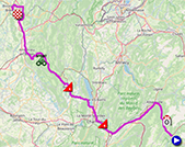
- start:
- the start will take place on the Square de la Liberté in Moûtiers (1:05pm)
- the actual start is scheduled on the D990, after 16.2 km of the parade route (1:35pm) - passes and climbs:
- Côte de Chambéry-le-Haut (4th category) at km 62.1 - ^ 349 m / 1.6 km at 4.1%
- Côte de Boissieu (4th category) at km 105.2 - ^ 362 m / 2.4 km at 4.7%. - intermediate sprint: Avenue de l'Europe in Saint-Rambert-en-Bugey at km 132.9
- finish: Boulevard Charles de Gaulle / D1075 in Bourg-en-Bresse at the end of a final 750 m straight at sight / width 6.5 m
- departments crossed: Savoie (73) from km 0 to km 89.2, Ain (01) from km 91.6 to km 184.9
- main towns: Moûtiers, Albertville, Chambéry, Belley, Ambérieu-en-Bugey and Bourg-en-Bresse
CONTINUE READING AFTER THIS ADVERTISEMENT
19/ Friday, July 21, 2023 - Moirans-en-Montagne > Poligny - 172.8 km
After a short transfer, the 19th stage will start this Friday in Moirans-en-Montagne - where the Tour had already visited in 2016 - and will take place entirely in the Jura department.It winds its way between the many lakes of the Jura and will not feature any major climbs, even if it is not all flat either. After the Côte du Bois de Lionge at the very start of the stage, the biggest difficulty will be the Côte d'Ivory, but this shouldn't stop the remaining sprinters from taking advantage of the final straight that's reserved for them, over a distance of no less than 7 kilometers! At the end of this long straight, the finish line will be drawn in Poligny, which will be hosting the Tour de France for the very first time.
Below you'll find the time schedule, profile and Open Street Maps for this stage. Click on the images to open them.


- start:
- the start will take place in Rue du Collège in Moirans-en-Montagne (1:15pm)
- the actual start is scheduled on the D470, after 7.7km of the parade route (1:30pm) - passes and climbs:
- Côte du Bois de Lionge (4th category) at km 23.7 - ^ 686 m / 1.9 km at 5.7%
- Côte d'Ivory (3rd category) at km 144.7 - ^ 602 m / 2.3 km at 5.9%. - intermediate sprint: Route de Champagnole in Ney at km 97.7
- finish: Route de Dole / D905 in Poligny at the end of a 7 km / 6.5 m wide final straight.
- departments crossed: Jura (39) from km 0 to km 172.8
- main towns: Moirans-en-Montagne, Arinthod, Orgelet, Pont-de-Poitte, Champagnole, Salins-les-Bains, Mesnay, Arbois and Poligny
20/ Saturday, July 22, 2023 - Belfort > Le Markstein - 135.5 km
After these two stages for sprinters, the penultimate stage of the Tour de France 2023 will this time not be a time-trial, but a mountainous stage, taking place mainly in the Vosges. Access to this stage will require a transfer of no less than 150 kilometers to the start of the stage in Belfort. At 135.5 km, this will be the shortest stage (apart from the Paris stage and the time trial), with no less than 3,600 metres of ascent, including the Ballon d'Alsace, the intermediate sprint at Fresse-sur-Moselle and, a little further on, the Col de la Croix des Moinats and the Col de Grosse Pierre.After the Col de la Schlucht and the descent to Munster, the riders attack the Petit Ballon and Col du Platzerwassel before the finish at Le Markstein.
Below you'll find the time schedule, profile and Open Street Maps for this stage. Click on the images to open them.

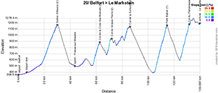

- start:
- the start will take place in Rue de l'Ancien Théatre in Belfort (1:30 pm)
- the actual start is scheduled on the D5, after 6.6 km of the parade route (1:45 pm) - passes and climbs:
- Ballon d'Alsace (2nd category) at km 24 - ^ 1173 m / 11.5 km at 5.2%
- Col de la Croix des Moinats (2nd category) at km 56.5 - ^ 891 m / 5.2 km at 7%
- Col de Grosse Pierre (2nd category) at km 64.9 - ^ 944 m / 3,2 km at 8%
- Col de la Schlucht (3rd category) at km 79.4 - ^ 1139 m / 4.3 km at 5.4%
- Petit Ballon (1st category) at km 108.2 - ^ 1163 m / 9.3 km at 8.1%
- Col du Platzerwasel (1st category) at km 125.3 - ^ 1193 m / 7.1 km at 8.4 - intermediate sprint: Rue d'Alsace in Fresse-sur-Moselle at km 37.2
- finish: D27 at Le Markstein at the end of a 170 m straight finish at sight / width 6 m
- departments crossed: Territoire de Belfort (90) from km 0 to km 24, Vosges (88) from km 33.1 to km 79.4, Haut-Rhin (68) from km 92.5 to km 133.5
- main towns: Belfort, Saint-Maurice-sur-Moselle, Fresse-sur-Moselle, Le Thillot, Cornimont, La Bresse, Munster and Sondernach
21/ Sunday, July 23, 2023 - Saint-Quentin-en-Yvelines > Paris Champs-Elysées - 133.5 km
After a transfer of around 500 km (which will be split in two for teams, sleeping over in Troyes), the very last stage of the Tour de France 2023 will, as usual, be more for the form than for the sporting feats, apart of course from winning the sprint.Indeed, between Saint-Quentin-en-Yvelines - where the start will take place at the Vélodrome national de Saint-Quentin-en-Yvelines, site of the track cycling events of the Paris 2024 Olympic Games - and the Champs-Elysées in Paris, the riders will be able to drink champagne and admire the sites dedicated to cycling for the Olympics (the Vélodrome for track cycling, the BMX stadium in Saint-Quentin-en-Yvelines, the hill of Elancourt for mountain biking and the Paris sites for road cycling). Olympic Games which will make the Tour de France avoid Paris next year.
The only difficulty of this stage will be the Côte du Pavé des Gardes near Chaville, and the intermediate sprint will take place on the 3rd passage at the top of the Champs-Elysées, in Paris.
Below you'll find the time itinerary, profile and Open Street Maps for this stage. Click on the images to open them.


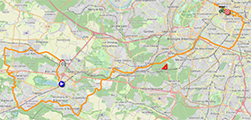
- start:
- the start will take place on the Place de la Paix Céleste, in front of the Vélodrome National de Saint-Quentin-en-Yvelines, in Saint-Quentin-en-Yvelines (in the commune of Montigny-le-Bretonneux) (4:30 p.m.)
- the actual start is scheduled on the D11, after 3 km of the parade route (4:40 p.m.) - passes and climbs:
- Côte du Pavé des Gardes (4th category) at km 42.8 - ^ 180 m / 1.3 km at 6.5 - intermediate sprint: top of the Champs-Elysées in Paris (3rd passage) at km 75.1
- finish: Champs-Elysées in Paris at the end of a 700 m / 8 m wide final straight line
- departments crossed: Yvelines (78) from km 0 to km 39.2, Hauts-de-Seine (92) from km 41.1 to km 43.6, Paris (75) from km 48.8 to km 115.1
- main towns: Montigny-le-Bretonneux (Saint-Quentin-en-Yvelines), Fontenay-le-Fleury, Les Clayes-sous-Bois, Plaisir, Élancourt, Montigny-le-Bretonneux, Voisins-le-Bretonneux, Guyancourt, Versailles, Viroflay, Chaville, Meudon, Issy-les-Moulineaux and Paris.
The Tour de France 2023 route in Google Earth
Would you prefer to see the entire route of the Tour de France 2023 on a single map? Or would you like to take a virtual flight over the route of one or more stages of this 110th edition of the Tour de France? All this is possible, by downloading the KMZ file (a zipped KML file, due to its large size) below and opening it in Google Earth (warning: make sure you're using the desktop version of Google Earth; if you open it in Google Earth in your browser, it won't work properly)! ATTENTION - copyright: although this KMZ/KML file is provided for your own use, please note that it is strictly forbidden to reproduce the content of this KMZ/KML file or any other file (including maps, profiles, KML files and others) that make up the Tour de France 2023 route provided by velowire.com. These contents are indeed protected by copyright and I ask you to respect the important time spent on their creation. This protection therefore concerns the reproduction of maps and other elements in any form whatsoever (in the form of maps, videos flying over the maps or any other creation based on the content published on velowire.com).
>> Download the route of all the stages of the Tour de France 2023 in Google Earth (KMZ file; IMPORTANT: if the download does not start, copy the link https://short.thover.com/?ID=853 and paste it into a new browser window, then press enter).

Vond u dit artikel interessant? Laat het uw vrienden op Facebook weten door op de buttons hieronder te klikken!
6 comments | 49667 views
this publication is published in: Tour de France | Tour de France 2023 | OpenStreetMap/Google Maps/Google Earth


 by marco1988 over
- from 12:00 pm to 8:00 pm : opening of the Fan Park at the Parque del Arenal in Bilbao - free admission
- from 6:30 pm to 8:00 pm : presentation of the Tour de France 2023 teams at the Guggenheim Museum, preceded by a 1.35 km bike parade which will take the riders from Abandoibarra etorbidea to the podium at the back of the Guggenheim Museum, before they come down from the stage and continue for 1 km on the bike path along the Ria de Bilbao, passing through the mixed zone (interviews) just after, before finishing the parade.