Thursday 20 May 2010 at 23h48
Originally published on Saturday 8 May 2010 at 0.10AM, regularly updated with new stages and finished including the possibility to download the route in Google Earth on 20 May 2010
Today, Saturday 8 May 2010, the Giro d'Italia 2010 will start from Amsterdam in The Netherlands. La Corsa Rosa will stay in The Netherlands for three days with each of the stages starting in Amsterdam.The Tour of Italy 2010 will finish in Verona on Sunday 30 May.
Unfortunately a bit later than planned, you can now discover the Giro d'Italia 2010 route on Google Maps/Google Earth, together with the the time- and route schedules and the stage profiles.
The Giro d'Italia 2010 in a few words
After a 8,4 kilometer time trial in Amsterdam, two other stages will start in Amsterdam: one towards Utrecht and one towards Middelburg in Zealand, the province which will also be visited during the Tour de France 2010. These stages will be followed by the first rest day with the transfer to Italy where a team time trial will be organised between Savigliano and Cuneo.After this typical start, 11 stages in line are programmed: 4 plain stages, 4 hilly stages and 3 high mountain stages. After the second rest day the climb from San Vigilio di Marebbe to the Plan de Corones / Kronplatz will be done as individual time trial before a hilly stage, a plain stage and two high mountain stages. The Giro 2010 finishes as usual with an individual time trial, this time in Verona over 15,3 kilometers.
In 3418 kilomètres the riders will have climbed the Monte Terminillo (16,1 km with a 1172 meter height difference and an average climb of 7,3% with a 12% part maximum), the very difficult Monte Zoncolan (10,1 km with a 1200 meter height difference and an average climb of 11,9% with 22% maximum), the Passo del Mortirolo (12,8 km with a 1317 meter height difference and an average slope of 10,3% and 18% maximum) and finally the impressive Passo di Gavia (Cima Coppi, the roof top of the Giro at 2618 meters; a 24,9 km climb with a 1399 meter height difference and a 5,6% gradient with 14% maximum).
5 of the Giro's stages will have a mountain top finish.
The Giro d'Italia 2010 route on Google Maps
CONTINUE READING AFTER THIS ADVERTISEMENT
01/ Saturday 8 May 2010 - individual time trial - Amsterdam > Amsterdam - 8.4 km
The very first stage will be an individual time trial connecting the Museumplein with the Stadionplein over a distance of 8.4 km and with a completely flat track.The first rider will start at 2PM and the last rider should have finished the 8.4 kilometers at about 5.45PM. At that time we'll know who will be the first rider to wear the pink leader's jersey. You can check out the start order and -times for this individual time trial here.
Below you'll find the time- and route schedule, the stage profile and the route on Google Maps for this stage. Click on each of the images to open them.


02/ Sunday 9 May 2010 - Amsterdam > Utrecht - 210 km
The second stage, first stage in line, will also start in Amsterdam and will visit the capital of Dutch television before entering a loop around Soesterberg, Driebergen, Amerongen, Rhenen, Wijk bij Duurstede, Houten and finally a loop around the finish city, Utrecht.The organisation managed to find two places in this stage where the first points for the king of the mountain classification will be awarded: in the Kaapse Bossen in the Amerongse Bos between Elst and Veenendaal.
The feed zone will be in Leersum while the very first intermediate sprint of this Giro will be in Houten.
Below you'll find the time- and route schedule, the stage profile and the route on Google Maps for this stage. Click on each of the images to open them.


03/ Monday 10 May 2010 - Amsterdam > Middelburg - 224 km
The third stage starting in Amsterdam will go to Middelburg and is the last stage in The Netherlands.With a completely flat track, the only difficulty the riders have to cope with is probably ... the wind! Indeed, after a visit to Rotterdam - where the Tour de France 2010 starts - this stage will follow - just like the first stage of its French brother - the coast line of the Zealand province and the wind will most probably lead to the creation of several groups in the peloton.
One sprint is planned in this stage, on the Afrikaweg in Zoetermeer and the feed zone is on the Stationsweg in Zuidland.
Below you'll find the time- and route schedule, the stage profile and the route on Google Maps for this stage. Click on each of the images to open them.


Tuesday 11 May 2010 - rest day
During this first rest day, the riders and followers of the Tour of Italy 2010 will transfer to Italy.CONTINUE READING AFTER THIS ADVERTISEMENT
04/ Wednesday 12 May 2010 - team time trial - Savigliano > Cuneo - 33 km
The fourth stage is the first stage in Italy and will be the second time trial of this 93rd edition of the Tour of Italy, this time it's a team time trial.This collective effort will be done on a relatively flat route between the Piazza Santarosa in Savigliano and a city which is used to receive the Tour of Italy, Cuneo, where the finish line will be drawn on the Corso Nizza. The route is almost a straight line south over 33 kilometers.
Below you'll find the time- and route schedule, the stage profile and the route on Google Maps for this stage. Click on each of the images to open them.


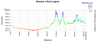
05/ Thursday 13 May 2010 - Novara > Novi Ligure - 162 km
Another plain stage which starts in Novara and proposes two short climbs at the end of the stage: Avolasca (409 m) and Castellania (368 m). The stage ends with a local circuit around the finish city: Novi Ligure.Below you'll find the time- and route schedule, the stage profile and the route on Google Maps for this stage. Click on each of the images to open them.


06/ Friday 14 May 2010 - Fidenza > Marina di Carrara - 172 km
The first hilly stage will start in Fidenza and let the riders climb the Passo del Brattello (altitude 946 m), the Passo del Cucco (520 m), Spolverina and Bedizzano. The finish will be after the descent of the last one in Marina di Carrara.Below you'll find the time- and route schedule, the stage profile and the route on Google Maps for this stage. Click on each of the images to open them.


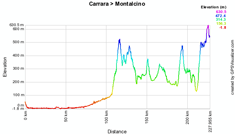
07/ Saturday 15 May 2010 - Carrara > Montalcino - 222 km
The start of the second hilly stage will also be in Carrara for a relatively flat stage start until kilometer 106 where the climb of the Volterra (altitude : 532 m, maximum gradient of 9% for an average of 4.7%) starts. The riders will than arrive in the more hilly half of the stage with after the Volterra the climbs of the Passo del Rospatoio (467 m, maximum gradient of 10% for an average of 4.7%) and the Poggio Civitella (585 m, maximum gradient of 16% for an average of 3.7%). A few kilometers after the top of the last one, the finish line will be painted on the road in Montalcino.For this stage, the feeding zone is in Roncolla and the intermediate sprint in Murlo.
UPDATE: due to falling rocks in Volterra, the first climb of the day at 117 kilometers from the start, the route of this stage has been slightly modified.
When the riders arrive at kilometer 102, the race continues directly to Roncolla (on the SR.439dir where the feeding zone is), without visiting Volterra. There will thus be no points to win for the King of the Mountains classification at that point since the top of the 3rd category climb will not be visited. From Roncolla the riders will continue on the initial route and the stage is thus reduced from 222 to 220 kilometer.
This change is correctly reflected in the time- and route schedule below but not in the stage profile and on the map.
Below you'll find the time- and route schedule, the stage profile and the route on Google Maps for this stage. Click on each of the images to open them.


CONTINUE READING AFTER THIS ADVERTISEMENT
08/ Sunday 16 May 2010 - Chianciano Terme > Monte Terminillo - 189 km
At the end of the first week, the climbers will finally get what they're waiting for with the first high mountain stage. However, they will really be happy only at the end of the stage, since after the start from the thermal city Chianciano Terme - apart from the Valico di Monte Nibbio (altitude : 544 m, maximum slope of 8% for an average of 3%) and the climb of Marmore (368 m, maximum slope of 9% for an average of 2.5%) - they will especially be interested by the climb to the mountain top finish at the top of the Monte Terminillo (1668 m). This is a 16.1 km climb at 7.3% on average for a 1168 meter height difference and 12% maximum in the first half of the climb.The feeding zone will be in Lugnano in Teverina and the intermediate sprint on the Via Di Vittorio in Terni.
Below you'll find the time- and route schedule, the stage profile and the route on Google Maps for this stage. Click on each of the images to open them.


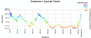
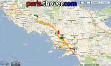
09/ Monday 17 May 2010 - Frosinone > Cava De' Tirreni - 187 km
After the first high mountain stage, back to some plain stages, including this one over 188 kilometers between Frosinone and Cava De' Tirreni. This stage which goes south towards the foot of the Italian boot will follow an almost completely flat route.The feed zone will be in Calvi Vecchia and the intermediate sprint in Caserta.
Below you'll find the time- and route schedule, the stage profile and the route on Google Maps for this stage. Click on each of the images to open them.

10/ Tuesday 18 May 2010 - Avellino > Bitonto - 230 km
This stage which crosses the country from west to east is another plain stage which, after its start from Avellino, does however propose a climb with an almost 500 meter height difference at the start of the stage followed by a descent to the foot of the climb of the Valico dell'Imbandina (altitude : 668 m, 383 m height difference, average climb of 3.8% with a maximum of 9%). This is followed by a flat part, a short climb and finally a descent of about 50 kilometers towards the finish line which will be drawn in Bitonto.The feeding zone will be just after Valico dell'Imbandina in Lavello and the intermediate sprint at less than 20 kilometers from the finish, in Molfetta.
Below you'll find the time- and route schedule, the stage profile and the route on Google Maps for this stage. Click on each of the images to open them.


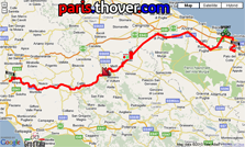
11/ Wednesday 19 May 2010 - Lucera > L'Aquila - 262 km
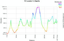
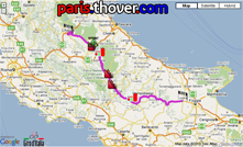
After a transfer to Lucera, this hilly stage is with its 262 kilometers the longest stage of this Tour of Italy.After the first half of the stage the riders will find a hilly road, the climb of the Rionero Sannitico (altitude : 1051 m with an average slope of 6.3% and a maximum of 10%) and the Roccaraso (1247 m with an average slope of 4.7% with a maximum of 10%). These are followed by a descent to the foot of the last climb of this stage, the Capo di Valle (746 m with an average slope of 5.8% and a maximum of 10%). About 40 kilometers further the finish line will be in L'Aquila, in the area of the earth quake on 6 April 2009 which took the lives of 307 people.
Below you'll find the time- and route schedule, the stage profile and the route on Google Maps for this stage. Click on each of the images to open them.

CONTINUE READING AFTER THIS ADVERTISEMENT
12/ Thursday 20 May 2010 - Città Sant'Angelo > Porto Recanati - 206 km
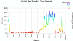
Another plain stage, over 206 kilometers, between Città Sant'Angelo and Porto Recanati, following the coast line for about 100 kilometers before getting back landwards to get to the climb of Macerata (altitude : 280 m) and the local circuit around the finish city which includes the climb of the Potenza Picena (188 m).The feeding zone will be in Porto San Giorgio and the intermediate sprint in Monte San Giusto.
Below you'll find the time- and route schedule, the stage profile and the route on Google Maps for this stage. Click on each of the images to open them.

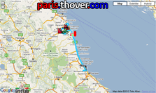
13/ Friday 21 May 2010 - Porto Recanati > Cesenatico - 223 km
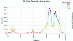
This hilly stage will also start from Porto Recanati and proposes two climbs in the second part of the stage: Perticara (altitude : 665 m) and Barbotto (514 m). After the descent of the second one, over 27 kilometers, a 16 kilometer flat part will lead the riders to the finish line in Cesenatico. This stage will also follow the coast line for a big part of the route.The feeding zone will be in Siligata and the intermediate sprint in Mercato Saraceno at 47 kilometers from the finish while the finish line will be drawn on the Piazza Marconi in Cesenatico.
Below you'll find the time- and route schedule, the stage profile and the route on Google Maps for this stage. Click on each of the images to open them.

14/ Saturday 22 May 2010 - Ferrara > Asolo - 205 km
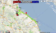
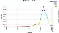
The return of the high mountain stages: a completely flat route between Ferrara and the finish city Asolo before a local circuit around this city which includes the climb of the impressive Monte Grappa (altitude : 1675 m) over a distance of 18,9 kilometers with a 1501 meter height difference and thus an average slope of 7,9% with 14% maximum in the second third of the climb.Below you'll find the time- and route schedule, the stage profile and the route on Google Maps for this stage. Click on each of the images to open them.

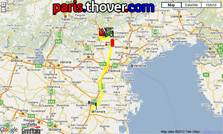
15/ Sunday 23 May 2010 - Mestre > Monte Zoncolan - 222 km
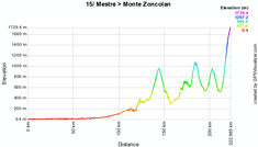
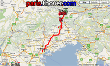
Before the second rest day, the riders will have to pass another quite difficult high mountains stage: starting from Mestre it includes, after a relatively flat route until the 100th kilometer, first of all the climb of the Sella Chianzutan (altitude : 955 m, average slope of 5.3% for a maximum of 9%) followed by a chain of the Passo Duron (1069 m, average slope of 9.8% for a maximum of 18%), the Sella Valcalda (958 m, average slope of 6.2% for a maximum of 12%) and finally the climb to the mountain top finish at the Monte Zoncolan (1730 m). The last one is 10,1 kilometers long and proposes with a 1200 meter height difference an average slope of 11,9% with parts at 22%, 20% and 18% maximum.The feeding zone will be in Spilimbergo and the intermediate sprint just before the climb of the Passo Duron in Paularo.
Below you'll find the time- and route schedule, the stage profile and the route on Google Maps for this stage. Click on each of the images to open them.

CONTINUE READING AFTER THIS ADVERTISEMENT
Monday 24 May 2010 - rest day
Before getting to the last and very difficult week, the riders will appreciate the second rest day after no less than 12 stages without any time to rest.16/ Tuesday 25 May 2010 - individual time trial - San Vigilio di Marebbe / St. Vigil > Plan de Corones / Kronplatz - 12.9 km
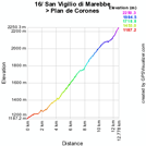
After this well deserved rest day it's time for the second individual time trial, this time climbing a mountain. Indeed, the riders will climb the Plan de Corones in an individual and timed effort over 12,9 km.To get to the top at 2273 meters altitude, they will climb a 1086 m height difference on an average slope of 8,5% including parts up to 20% and even 24%!
Below you'll find the time- and route schedule, the stage profile and the route on Google Maps for this stage. Click on each of the images to open them.

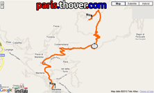
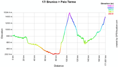
17/ Wednesday 26 May 2010 - Brunico / Bruneck > Peio Terme - 173 km
Between the start in Brunico (Bruneck) and the finish line the riders will find, after a first half of the stage going down, the climb of the Passo delle Palade over 18,9 kilometers, with an average slope of 6,6% (max. 16%) and a 1242 meter height difference to get to the altitude of 1523 meters before a descent to 723 meters and the start of the final and progressive climb to the mountain top finish at the Peio Terme (1393 m).This stage will take place in the north of Italy and its feeding zone will be in Vilpian while the intermediate sprint will be in Malè at 25 kilometers from the finish.
Below you'll find the time- and route schedule, the stage profile and the route on Google Maps for this stage. Click on each of the images to open them.

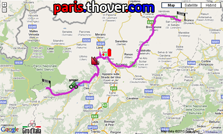
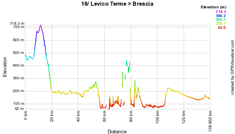
18/ Thursday 27 May 2010 - Levico Terme > Brescia - 140 km
Following the Lago di Garda, 67 kilometers after the start from Levico Terme, the riders will find a relatively flat route until the finish in Brescia 140 kilometers further. This is most probably the very last chance for sprinters to win a stage.In Toscolano-Maderno they can get some points for the classification by points in the intermediate sprint.
Below you'll find the time- and route schedule, the stage profile and the route on Google Maps for this stage. Click on each of the images to open them.

CONTINUE READING AFTER THIS ADVERTISEMENT
19/ Friday 28 May 2010 - Brescia > Aprica - 195 km
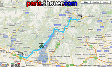
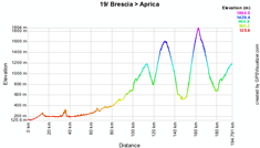
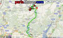
The next day the stage start will also be in Brescia. At the start of this stage, the Giro will remember the bomb attack Piazza della Loggia of 28 May 1974. After the start this stage will rapidly move to the Lago d'Iseo which the riders will follow between Iseo and Costa Volpino where they'll start the long climb (13,95 km with a 503 meter height difference, an average slope of 3,6% and 15% maximum) towards the finish in Aprica, for a first crossing of the finish line. Once they arrive in Aprica, the riders will continue north for a circuit which includes the climb towards Trivigno (11 km to climb 838 meters with 14% maximum) but especially the climb of the famous Passo del Mortirolo (12,8 km to get to an altitude of 1854 meters after having climbed 1317 meters on an average slope of 10,3% and a 18% maximum) before the descent to Edolo and another climb to the mountain top finish in Aprica.Below you'll find the time- and route schedule, the stage profile and the route on Google Maps for this stage. Click on each of the images to open them.

20/ Saturday 29 May 2010 - Bormio > Ponte di Legno - Tonale - 178 km
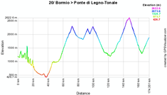
For this last high mountain stage, the Giro organisors will not spare the riders who have managed to get there. Indeed, with a circuit around the start city, Bormio, and a short visit to Switzerland, they managed to get one big and two smaller climbs in the circuit: first of all the climb of the Forcola di Livigno over 18 kilometers and a 1278 meter height difference (altitude : 2315 m, average slope: 7,1%, maximum slope: 13%) before the continuous climb of the smaller Passo di Eira (2211 m) and Passo di Foscagno (2291 m). After the descent to the start city Bormio, the climb to the rooftop of this Tour of Italy (Cima Coppi) starts, the Passo di Gavia over 24,9 kilometers and with its top at 2618 meters altitude. The height difference of this climb is 1399 meters and it thus has an average slope of 5,6% with a maximum slope at 14%. After the descent it's not yet finished because the riders will continue with the final climb of 11 kilometers to the mountain top finish at the Passo del Tonale (altitude : 1883 m, height difference 631 m, average slope 5,7% with a bit at 10%).Below you'll find the time- and route schedule, the stage profile and the route on Google Maps for this stage. Click on each of the images to open them.

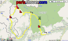
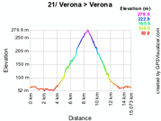
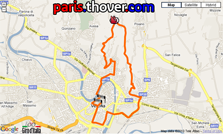
21/ Sunday 30 May 2010 - individual time trial - Verona > Verona - 15 km
After a transfer a 15,3 kilometer individual time trial in the city of Verona brings the end of this Giro d'Italia.After a start at the foot of the Palazzo della Gran Guardia on the Via Roma the riders will one by one follow the following route: Corso Porta Nuova (up to Porta Nuova) > Circonvallazione Raggio di Sole > Via del Fante > Via del Pallone > Via Francesco Torbido > Via Barana > Via Giovanni Francesco Caroto > Via Torricelle (5% climb towards Torricelle at 277 m altitude) > Via Santa Giuliana > Viale del Colli > Via Marsala > Via Ippolito Nievo > Lungadige Giacomo Matteotti > Ponte Vittoria > Corso Cavour > Via Roma and the finish on the Piazza Bra close to the Arena di Verona.
Below you'll find the time- and route schedule, the stage profile and the route on Google Maps for this stage. Click on each of the images to open them.

The Giro d'Italia 2010 route in Google Earth
You have now discovered all details of the different stages of this 93rd edition of the Giro d'Italia, including the time- and route schedules, the stage profiles and the route on Google Maps for each of the stages.If you would like to see the full route of the Giro d'Italia 2010, you can download the file below and open it in Google Earth.
> Download the Giro d'Italia 2010 route in Google Earth
This file will not only allow you to see the full route in Google Earth, but also to do a virtual fly-over over the route of one or more of the stages. To do so, you can of course use the default settings of Google Earth, but if you want to do a fly-over which really gives you the idea you were on your bike riding on the roads of the Giro d'Italia 2010, I recommend you the following settings: in the menu Tools > Options choose the tab Touring and fill in the following choices on that tab:
- Camera tilt angle : 80.0 degrees
- Camera range : 150.0 meters
- Speed : 500.0 (if this makes you feel dizzy or if your computer or Internet connection don't allow you to get clear images with these settings, you can try lowering the speed) door Thomas Vergouwen
Vond u dit artikel interessant? Laat het uw vrienden op Facebook weten door op de buttons hieronder te klikken!
3 comments | 22078 views
this publication is published in: Giro d Italia | Giro d'Italia 2010 | OpenStreetMap/Google Maps/Google Earth


 by marco1988 over
http://www.cyclisme-roltiss-over.com/article-le-parcours-du-giro-d-italia-2010-sur-google-maps-google-earth-et-les-itineraires-50023944.html
un bellissimo giro in perspettiva,speriamo che i corridori siano all'altezza e che per una volta non si debba parlare di doppaggio,i favoriti sono diversi spero che vinca un italiano ma comunque spero che sia il migliore a vincere.tilippu
http://www.cyclisme-roltiss-over.com/article-le-parcours-du-giro-d-italia-2010-sur-google-maps-google-earth-et-les-itineraires-horaires-50815918.html