We're still talking about Bradley Wiggins' victory in the Tour de France 2012 and the same Wiggins' victory in the time trial and Alexandre Vinokourov's victory in the road race of the Olympic Games in London and the cycling calendar already shows the start of the Tour of Spain, or Vuelta a España 2012 in its local language, for this Saturday!
In this article you'll find all details of the race route of this 3rd Grand Tour on the cycling calendar, on Google Maps/Google Earth but also with the time- and route schedules and the profiles of the Tour of Spain 2012.
As we already saw in January, the 2012 edition of the Vuelta completely ignores the south part of the country and the race doesn't go any further south than Madrid and is made up of a collection of back-and-forth stages in the north of the country. Let's have a look at each of the stages!
 ATTENTION: all the contents of this article are protected by the usual copyright and you are thus not allowed to use the contents or parts of it without my prior approval. This concerns all texts, images and KML files. The KML files can in no case be used without the velowire.com logo and a link to this site in addition to my prior approval for you to use it.
velowire.com has done every possible effort in order to trace the stages as precisely as possible, using mainly the information available on the official website. However, it's of course still possible that the race route is slightly different at some places. Therefore, use these informations where they come in handy, but ask locally to make sure you're at the right place to see the race come by!
The Vuelta a España 2012 race route on Google Maps
CONTINUE READING AFTER THIS ADVERTISEMENT
1/ Saturday 18 August 2012 - Pamplona > Pamplona - 16.5 km
The first stage of the Vuelta a España 2012 is as usual a team time trial, which is 16.5 kilometers long this time. A quite technical loop is waiting for the 22 participating teams in this 67th edition of the Tour of Spain in the streets of Pamplona.This race against the clock will take place at night and the first team will start at 7.03PM, 1 hour and 24 minutes later followed by the last team. The time it will take the teams to connect start and finish of this stage is estimated to be around 18 minutes.
Hereunder you'll find the time- and route schedules, the profile and the race route on Google Maps for this stage. Click on the images to open them.


2/ Sunday 19 August 2012 - Pamplona > Viana - 181.4 km
The first stage in line of this Tour of Spain 2012 will take place between Pamplona and Viana south-west of the city where the stage starts. In this stage, 181.4 kilometers long, the riders will find only one climb, the Alto de la Chapela (3rd), on the way back from Tafalla where the first intermediate sprint of this stage and of this Vuelta will take place. Their first loop ends a bit after this intermediate sprint and they than turn west towards the feeding zone in Enériz.They'll continue their trip towards Viana where the second intermediate sprint will be, just before the first crossing of the finish line. The stage ends with a 18 kilometer long loop around the finish city.
Hereunder you'll find the time- and route schedules, the profile and the race route on Google Maps for this stage. Click on the images to open them.


3/ Monday 20 August 2012 - Faustino V > Eibar (Arrate) - 155.3 km
From the start of this third stage, in Faustino V (Oion, just north of Logroño and close to the finish city of the previous stage), the riders will leave in western direction up to Laguardia where they'll continue north-east. After having climbed the Alto la Aldea (2nd), they'll turn north-west up to Ventas de Armentia where they again change direction, this time towards Vitoria-Gasteiz. On their road to this city they'll find the climb of the Puerto de Vitoria (3rd) and the feeding zone will be just north of this city.The stage ends with the climb of the Puerto de Campazar (3rd) and the two intermediate sprints which will be seperated by a few kilometers only, in Zaldibar and in Eibar, just before a last climb, the Alto de Arrate (1st) and the finish in Eibar (Arrate), 2 kilometers further.
Hereunder you'll find the time- and route schedules, the profile and the race route on Google Maps for this stage. Click on the images to open them.


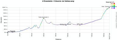
4/ Tuesday 21 August 2012 - Barakaldo > Estación de Valdezcaray - 160.6 km
After the start from Barakaldo, just west of the finish city of the previous stage, this stage will lead the peloton almost completely in opposite direction.In this trip to the south they'll find one climb, first category, the Puerto de Orduña, which has its top after almost 52 kilometers.
The feeding zone will be in Miranda de Ebro while the two intermediate sprints will again be in the last part of the stage, in Haro and south of Santo Domingo de la Calzada. This stage's finish will be in the Estación de Valdezcaray, after a 1st category climb of 13.4 kilometers with an average steepness of 5.2%.
Hereunder you'll find the time- and route schedules, the profile and the race route on Google Maps for this stage. Click on the images to open them.


CONTINUE READING AFTER THIS ADVERTISEMENT
5/ Wednesday 22 August 2012 - Logroño > Logroño - 168 km
The format of the 5th stage of the Vuelta a España 2012 is quite original for a Grand Tour because the start- and finish city are the same, Logroño, and this stage will take place on a 21 kilometer long circuit which the riders will do 8 times to come to a total distance of 168 kilometers.Just before the 3rd and just before the 5th crossing of the finish line, the riders will battle for an intermediate sprint, while the feeding zone will be at the same location, just before the 4th crossing of the finish line.
Hereunder you'll find the time- and route schedules, the profile and the race route on Google Maps for this stage. Click on the images to open them.


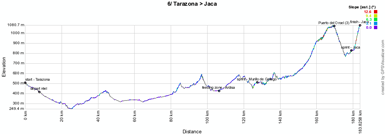
6/ Thursday 23 August 2012 - Tarazona > Jaca - 175.4 km
After a transfer of about 115 kilometers in south-eastern direction the riders will start the 6th stage in Tarazona and in this stage they'll find two 3rd category climbs, at the end of the stage (the second climb is the final climb towards the finish).The feeding zone will be in Ardisa, followed by the first intermediate sprint in Murillo de Gallego. At the end of the stage the riders will first climb the Puerto del Oroel (3rd), followed by the intermediate sprint in Jaca and the finish uphill, also on a 3rd category climb of 3.8 kilometers with an average steepness of 5.4% (with portions up to 14%) just outside this city, the Fuerte del Rapitán.
Hereunder you'll find the time- and route schedules, the profile and the race route on Google Maps for this stage. Click on the images to open them.


7/ Friday 24 August 2012 - Huesca > Alcañiz - Motorland Aragón - 164.2 km
The 7th stage of the Vuelta a España 2012 seems to be made for the sprinters because it doesn't contain any climb between Huesca and Alcañiz where the finish will be just outside the city on the circuit of Motorland Aragón.Hereunder you'll find the time- and route schedules, the profile and the race route on Google Maps for this stage. Click on the images to open them.


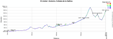
8/ Saturday 25 August 2012 - Lleida > Andorra - Collada de la Gallina - 174.7 km
After a transfer of about 120 kilometers north-east, the second weekend of this Vuelta a España 2012 will start in Lleida from where the riders will progressively climb to Andorra. They'll get their musettes close to Coll de Nargó and the first intermediate sprint will be close to La Seu d'Urgell.When they arrive in Andorra, they'll pass Andorra la Vella where a line will be drawn for the second intermediate sprint and after having turned left towards La Massana, they will take the brand new Dos Valires Tunnel to get directly to Encamp. Since this tunnel is not yet indicated on the map, I have drawn a straight line between the entrance and the exit of this tunnel to show the direction in which the riders will go. The profile which has been generated automatically will however remain incorrect since it uses the altitudes for the road which goes via the climb of the Serra d'Encamp.
From Encamp the map is correct again, back towards Andorra la Vella, but before the riders get there, they turn left to start the climb of the Alto de la Comella (2nd). They'll than get back on the road they already took in the opposite direction when they came to Andorra la Vella and finish this stage on the Collada de la Gallina (1st), a 7.2 km climb with an average steepness of 8%!
Hereunder you'll find the time- and route schedules, the profile and the race route on Google Maps for this stage. Click on the images to open them.


CONTINUE READING AFTER THIS ADVERTISEMENT
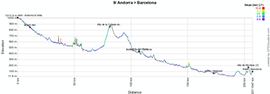
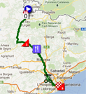
9/ Sunday 26 August 2012 - Andorra > Barcelona - 196.3 km
In contrast to what we usually see in the Tour de France, the Vuelta a España apparently doesn't care about putting some big mountain stages in the weekends of the race because the 9th stage on this Sunday will only contain two 3rd category climbs, the Collada de Clara in the first halve of the stage and the famous Alto de Montjuic in Barcelona at the end of the stage.The riders will thus connect Andorra with Barcelona with an intermediate sprint followed by the feeding zone in Cardona and the second intermediate sprint in Martorell.
Hereunder you'll find the time- and route schedules, the profile and the race route on Google Maps for this stage. Click on the images to open them.

R1/ Monday 27 August 2012 - rest day
After 9 stages, Monday 27 August will be the first rest day of this Vuelta a España 2012.10/ Tuesday 28 August 2012 - Pontearas > Sanxenxo - 190.0 km
After a huge transfer from the east to the west side of Spain, the riders will start the 10th stage in Pontearas, going towards Sanxenxo. To get there, they'll follow the coast line all the time. Indeed, after their trip to the coast close to Baiona - via the climb of the Alto de San Cosme - where they'll do a short round trip, they'll follow the coast roads around the two bays north of the city, around Pontevedra. Once they'll get to Sanxenxo, they'll go up the peninsula of O Grove to finally get back to Sanxenxo and cross the finish line once again, this time for the finish of the stage.Hereunder you'll find the time- and route schedules, the profile and the race route on Google Maps for this stage. Click on the images to open them.


11/ Wednesday 29 August 2012 - Cambados > Pontevedra - 39.4 km
For the 11th stage there's no need to go very far. Indeed, close to the previous day's finish, the start ramp will be installed in Cambados for an individual time trial including a 3rd category climb (the Alto Monte Castrove) which will finish after the descent towards Pontevedra.Hereunder you'll find the time- and route schedules, the profile and the race route on Google Maps for this stage. Click on the images to open them.


CONTINUE READING AFTER THIS ADVERTISEMENT
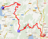
12/ Thursday 30 August 2012 - Vilagarcía de Arousa > Mirador de Ézaro - 190.5 km
From the start in Vilagarcía de Arousa this twelfth stage will first go landinwards to A Estrada and will than go back west towards the coast and after a visit of Ribeira the riders will find the feeding zone in northern direction. A bit further they'll again follow the coast line, towards the sprints in Noia and in Muros and they'll finally climb up to the finish in Dumbría.Indeed, this finish will take place on top of a third category climb, the Mirador de Ézaro.
Hereunder you'll find the time- and route schedules, the profile and the race route on Google Maps for this stage. Click on the images to open them.


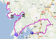
13/ Friday 31 August 2012 - Santiago de Compostela > Ferrol - 172.8 km
This thirteenth stage will start in Santiago de Compostela, the city which is usually known as pilgrimage, for 172.8 kilometers towards Ferrol. This stage does not contain any referenced climbs but one intermediate sprint will take place at the end of the first half of the stage, in A Laracha and another one in the final loop around the finish city, in Catabois.Hereunder you'll find the time- and route schedules, the profile and the race route on Google Maps for this stage. Click on the images to open them.


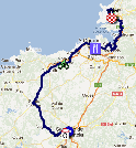
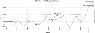
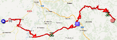
14/ Saturday 1st September 2012 - Palas de Rei > Puerto de Ancares - 149.2 km
This Saturday a short stage will be waiting for the riders. Short but not easy! It will start in Palas de Rei and several difficulties are part of this stage, starting with the Alto de Castro (3rd category), followed by the intermediate sprint of Sarria. The riders will continue their trip towards the Alto de Vilaesteva (2nd category), 9.5 kilometers long and with an average climb of 4.5%.At the foot of the climb of the Alto de O Lago (3rd category), the riders will pass through the feeding zone in Becerreá.
At the end of this stage, two first category climbs will be waiting for the riders: first of all the Alto Folgueiras de Aigas which is 9.7 kilometers long with an average climb of 6.7% going up to 10% at the start of the climb. And finally the climb towards the finish on the Puerto de Ancares, 9.5 kilometers long and with an average climb of 8.1% and a maximum of 12.8% and the steepest parts in the final part of the climb.
Hereunder you'll find the time- and route schedules, the profile and the race route on Google Maps for this stage. Click on the images to open them.

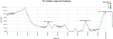
15/ Sunday 2 September 2012 - La Robla > Lagos de Covadonga - 186.5 km
The 15th stage is another high mountains stage, in a series of 3 in this Tour of Spain with the one the next day. This time the start will be in La Robla and the stage will go north to go find the coast line. Before the riders get there, they'll battle for the intermediate sprint in Mieres and will climb a 3rd category climb in Santo Emiliano.They won't spend much time close to the coast and when they go back land-inwards from Loroñe, they'll start a first category climb over 6.8 kilometers with a 570 meters height difference to get to the top of the Alto del Mirador del Fito which has an average steepness of 8.3%.
After the descent of this climb, the riders will find the second intermediate sprint in Cangas de Onis before they start the final climb towards Lagos de Covadonga which, with its 13.5 kilometers and an average steepness of 7% for a 950 meters height difference, is a hors category climb.
Hereunder you'll find the time- and route schedules, the profile and the race route on Google Maps for this stage. Click on the images to open them.

CONTINUE READING AFTER THIS ADVERTISEMENT
16/ Monday 3 September 2012 - Gijón > Valgrande-Pajares. Cuitunigru - 183.5 km
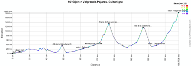
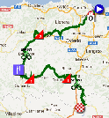
This Monday will start from Gijón on the coast for another mountain stage. It all starts easily with the Alto de la Cabruñana of the 3rd category which will be reached just before the 60 km mark of the stage.Once they descended this climb they'll first start a progressive climb via the sprint in Belmonte and the feeding zone in Almurfe before they really start the 10 kilometer long 1st category climb of the Puerto de San Lorenzo at 8.5% to reach the top at 1,350 meters.
This climb is immediately followed by another 1st category climb, the Alto de la Cobertoria which is a bit steeper, at 8.6%, and is 8 kilometers long.
From there, and after the sprint in Campomanes, they'll start the final climb, hors category, towards Valgrande-Pajares. With its 19.4 km and an average steepness of 6.9% it clearly merits its hors category status and could well lead to some important time differences at the finish of this stage!
Hereunder you'll find the time- and route schedules, the profile and the race route on Google Maps for this stage. Click on the images to open them.

R2/ Tuesday 4 September 2012 - rest day
After these 3 mountain stages, the riders of the Vuelta a España 2012 deseve another rest day before they start with the 5 final stages towards the final finish in Madrid.17/ Wednesday 5 September 2012 - Santander > Fuente Dé - 187.3 km
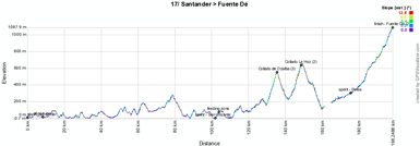
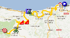
After a very long transfer after the previous stage and Tuesday's rest day, the 17th stage will start in Santander for a real zig-zag route towards Fuente Dé for a 187.3 km long stage. Despite the zig-zagging from the sea landinwards and the other way around, the first half of the stage - until the sprint and feeding zone in San Vincente de la Barquera - is quite flat. The second half contains two climbs and the final climb towards the finish: the Collado de Ozalba (3rd category) over a little bit less than 6 kilometers and with a 6.6% gradient and the Collado La Hoz (2nd category) over almost the same distance and a 7.6% gradient.These two climbs are followed by a sprint in Potes and the final climb towards Fuente Dé (2nd category, 17.3 km @ 3.9%).
Hereunder you'll find the time- and route schedules, the profile and the race route on Google Maps for this stage. Click on the images to open them.

18/ Thursday 6 September 2012 - Aguilar de Campoo > Valladolid - 204.5 km
The 18th stage is a long but almost flat stage between Aguilar de Campoo and Valladolid and is the stage which really starts the descent towards the final finish of the Vuelta a España 2012 in Madrid.The stage will follow quite big routes and the riders will find the feeding zone just after Palencia and two intermediate sprints, the first at the first crossing of the finish line in Valladolid and the second one in the local loop around that city, in Zaratán.
Hereunder you'll find the time- and route schedules, the profile and the race route on Google Maps for this stage. Click on the images to open them.


CONTINUE READING AFTER THIS ADVERTISEMENT
19/ Friday 7 September 2012 - Peñafiel > La Lastrilla - 178.4 km
The stage before the final weekend of the Vuelta a España 2012 again seems to be made for sprinters. Between Peñafiel and La Lastrilla, in the outskirts of Segovia, the riders won't find any difficulties. The two intermediate sprints will be in Villacastín and Los Angeles de Rafael.Hereunder you'll find the time- and route schedules, the profile and the race route on Google Maps for this stage. Click on the images to open them.


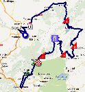
20/ Saturday 8 September 2012 - La Faisanera Golf. > Bola del Mundo - 170.7 km
The forelast stage of this Vuelta a España 2012 will probably still be quite an exciting stage. Indeed it contains no less than three 1st category and one 2nd category climb, in addition to the hors category final climb to the finish.After less than 40 kilometers from the start at the La Faisanera Golf in Segovia, the riders already reach the top of the first 1st category climb, the Puerto de Navafría and this climb is followed by the 2nd category Puerto de Canencia and two other 1st category climbs, the Puerto de la Morcuera and the Puerto de Cotos.
The final climb to Bola del Mundo, which was last climbed during the 2010 Vuelta, is 11.4 kilometers long with an average steepness of 8.6%.
Hereunder you'll find the time- and route schedules, the profile and the race route on Google Maps for this stage. Click on the images to open them.


21/ Sunday 9 September 2012 - Cercedilla > Madrid - 115 km
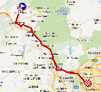
The final stage between Cercedilla and Madrid is as usual less difficult and quite a short stage. 115 kilometers between the two cities, including a 5.7 kilometer long circuit which will be done 9 times after the first crossing of the finish line (the profile and map below contain only one lap of the circuit after the first crossing of the finish line). When the riders cross the finish line for the tenth time, there will thus probably be a sprinter winning this stage and we'll also know who'll be the overall winner of this year's Tour of Spain !Hereunder you'll find the time- and route schedules, the profile and the race route on Google Maps for this stage. Click on the images to open them.


The Vuelta a España 2012 race route in Google Earth
Now all stages of the Tour of Spain 2012 have been publihsed on Google Maps, you can find here a KML file which will allow you to see the full race route of all stages in Google Earth and to do a virtual fly-over of all stages or one stage you'd select if you want to!In order to open the KML file in Google Earth, you can click on the image below:

Vond u dit artikel interessant? Laat het uw vrienden op Facebook weten door op de buttons hieronder te klikken!
18 comments | 31146 views
this publication is published in: Vuelta a España | Vuelta a España 2012 | OpenStreetMap/Google Maps/Google Earth


 by marco1988 over
L'étape arrivant en Andorre ne se termine pas au sommet de la Collada de la Gallina mais à peu près à mi-ascension, dans la localité de Canolic.
Cordialement
@Yas94, sur la carte elle ne se termine pas au sommet mais à une altitude de 1.550 mètres qui est celle indiquée par les organisateurs de la course (et encore, je pense que je l'ai fait arrêter quelques mètres trop tôt).
Par contre, comme indiqué dans l'article, je suis preneur du parcours exact précédent la montée précédente, depuis Andorre la Vieille.
Je connais pas la région mais en voyant l'altitude de l'arrivée à 1550m, comme vous, je me suis dit que ça ne pouvait être que dans ce patelin (infrastructures d'arrivée).
Concernant Andorre, si je lis bien le roadbook sur le site de la Vuelta =>
A partir de Santa Coloma d'Andorra, quitter la CG 1.
Puis prendre la très longue avinguda de Santa Coloma, enchainer avec l'avinguda del Princep Benlloch, passer devant la mairie d'Andorre-la-Vieille, suivre l'avenida Meritxell puis l'avinguda Carlemany jusqu'à entrer dans Escaldes-Engordany.
A un moment, tourner à gauche sur l'avinguda del Coprincep General de Gaulle puis monter sur avinguda del Pessembre jusqu'à joindre la route qui mène à La Massana. Redescendre dans Escaldes par l'avinguda Fiter i Rossell
Après c'est flou, je dirais reprendre l'Avinguda del Consell d'Europa, Carrer del Parnal, Carrer de Santa Anna et retour sur la place d'Escaldes-Engordany.
Pour finir, c'est facile : depuis la place d'Escaldes, tout droit par l'Avinguda de Miguel Mateu jusqu'au croisement avec la CG 2. Prendre à droite sur la carretera de Obac, puis prendre à gauche, au rond-point, sur la carretera d'Engolasters. Dernier croisement pour prendre à droite jusqu'au col de la Comella. A gauche, direction le lac d'Engolasters.
Ouf !
Seul hic, on parle d'un tunnel de 3 kilomètres dans Escaldes. A chercher à partir de la bifurcation depuis l'avinguda del Pessembre.
Bonjour, d'après ce que l'on peut voir pour l'arrivée en Andorre, ils arrivent par l'Av. Sta Coloma, puis l'Av. Meritxell, en passant le pont, poursuivent sur cette rue, SPRINT, Av. Carlemany, à gauche Av. Pessébre, Fiter Rossel, direction la vallée de La Massana en passant deux petits tunnels. Avant d'arriver à La Massana, ils vont prendre à droite un nouveau tunnel qui rejoint la vallée de l'Envalira entre Encamp et Escaldes. Ils descendent un peu pour attraper le rond point et à gauche direction La Comella. Après le col ils reviennent dans la vallée et à gauche direction la frontière Espagnole.....
J'ai fait un bout du parcours sur Openrunner qui doit pas être loin de la réalité.
http://www.openrunner.com/index.php?id=1899906
Le tunnel est tout neuf, il a été inauguré le 2 août 2012.....ils auraient dû l'ouvrir en 2010 mais retardés par un accident qui a coupé la vie à plusieurs ouvriers en 2009...
http://www.andorraexpat.com/andorra-opens-dos-valires-tunnel/
Merci à vous pour vos commentaires et notamment l'indication du tunnel des Dos Valires ! C'est effectivement ce tunnel qui sera emprunté et je viens donc de corriger la carte en conséquence. Le profil n'a pas été mis à jour puisque les informations d'altitude seraient dans tous les cas incorrects. En conséquence, ce tronçon est (et restera) incorrect sur le profil généré automatiquement pour cette étape.
Merci encore :-).
Pour le profil (d'après l'itinéraire détaillé du site de la Vuelta), ça monte tout le temps depuis le sprint d'Andorre (1030m) jusqu'au tunnel (1150m). A la sortie du tunnel, il y a une petite descente (1140m) jusqu'au rond point qui amène au Col de la Comella.......
Livre de route :
http://www.scribd.com/doc/103331282/Libro-de-Ruta-VE12
Where is the Google Earth file, i look every day for the promised file, but nothing yet, the Vuelta is almost finished. The small google maps sucks.
I'm with you JG - promises re. the KML Google Earth file were made months ago - trying to work with the embedded maps is an exercise in frustration.
I also find it difficult to understand why the KML Google Earth file is available for the World Ports Classic, yet we still don't have it for what is considered to be the third leg of the Grand Tours - the Vuelta.
In my opinion, priorities seem to be just a little mixed up.
@G Willems, the Google Earth file is now available in the English version of the article since 10.45PM (coming up in the French and Dutch versions in a few minutes).
I admit that my plan was to publish the complete Vuelta race route much earlier but unfortunately I haven't been able to do so. I'm not trying to justify this since I don't need to justify anything, but I'll explain it a little bit ... What you might not have understood is that this website is run as a non for profit website which takes a huge amount of time to be kept up-to-date with all the information you can find on it. What you might not know either is that it is run by one single person with a full time job next to it and a personal life as well. In the past few weeks I've been quite busy and during one whole week I haven't been able to make any progress on this since I was working in the Tour Poitou-Charentes!
@will smith: what you say is wrong. The text in the article read As soon as all stages of the Tour of Spain 2012 will be ready in Google Maps, you'll find here a KML file which will allow you to see the full race route of all stages in Google Earth. This promise was made at the first publication of the article, on August 17th and was kept as is and lived up to. August 17th is less than 3 weeks ago, so you could have talked about "weeks ago" but "months ago" is simply not true, in addition to the fact that the promise was lived up to.
Furthermore you indicate you don't understand why the KML Google Earth file is available for the World Ports Classic and not for the Vuelta and you seem to understand this was a question of priorities. What you apparently don't realise is the amount of work which represents the creation of one stage in Google Maps/Google Earth. It takes several hours, depending on the quality of information provided by the organisor of the race.
Generally speaking, the information provided by the organisor of the World Ports Classic was of better quality and easier to use than the information provided by the organisor of the Vuelta. Furthermore, the World Ports Cycling Classic was only two stages and thus much easier to create than the Vuelta which is 21 stages. I never provide the KML file of a stage race before all stages are ready: since Google Maps and Google Earth use a very resistent cache, this would cause trouble in getting the updated file with new stages to each of the users of it.
If you'd really been in need of opening one of the stages in Google Earth before I provided the full KML file, you'd have been looking around a bit and would have found a way to open them one by one anyway ...
Finally, I provide these maps since I know many people find them useful. However, it should be an obligation for race organisors to provide detailed maps like these. Why would all the pressure be put on a single person who doesn't even win any money with it?
I hope you both think about this a bit and realise that your comments as posted above, without any consideration of the work which is provided for free here, can hurt a bit and would've merited a re-read before posting!
No hard feelings though ...
Tu n'as pas à te justifier Thomas. C'est déjà beaucoup ce que tu fais.
Een compliment voor al je werk is zeker op zijn plaats!
Merci Yas94, le couteau suisse :-).
@jan : bedankt :-)
Contador a gagné la Vuellta