Sunday 03 June 2018 at 01h51
This Sunday 3 June, the 70th edition of the Critérium du Dauphiné starts in Valence. 153 riders will get to start the race with a solo effort for the prologue of the 2018 edition of the race and 7 other stages will be awaiting them afterwards. Over a total of 958.6 kilometers, they'll see that especially the second half of the week will be decisive in this race, with important mountain parts in the stages.
In this article you'll find the maps, profiles and time- and route schedule of each of these stages, the maps of course being on Google Maps/Google Earth as you're used to find on velowire.com!
THe Critérium du Dauphiné 2018's race route on Google Maps
Let's now have a look at the different stages one by one:CONTINUE READING AFTER THIS ADVERTISEMENT
P/ Sunday 3 June 2018 - Valence > Valence - 6.6 km
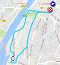
It'll all start with a prologue in the streets of Valence and it'll be short and almost a full loop.Indeed, after the start in the Avenue Sadi Carnot, each rider will follow the Avenue Félix Faure on the left side of the road and rather quickly they'll see their competitors on the way back. They'll turn right on the Boulevard Général de Gaulle and on to the Avenue Gambetta before the way out and the way back will get seperated when turning left on the Avenue Maurice Faure. The riders will follow the Avenue de Valensolles and the Boulevard de Crussol before they get on the Avenue de Provence and turn right on the Rue de Mauboule. On the roundabout the solo effort continues right on the Chemin de l'Epervière where the intermediate timing point will be.
This path will be followed all the way long, until they get on the D2007N / Avenue de Provence. Turning right on the Avenue Gambetta they'll get back on the race route in both directions up to the finish.
Hereunder you'll find the time- and route schedule, the profile and the race route on Google Maps for the prologue of the Critérium du Dauphiné 2018. Click on the images to open them.


1/ Monday 4 June 2018 - Valence > Saint-Just Saint-Rambert - 179 km
In the first half of this stage the riders will find the most important difficulties. Indeed, after the start in Valence it's even before the riders get to the kilometer 0 that they start the climb towards the top of the Col de Leyrisse (2nd category, 8.5 km at 4.5%) and after an additional climb and the descent, they'll already go on to the climb towards the Col de Désaignes (3rd category, 5 km at 4.5%) and the Côte de Saint-Agrève (3rd category, 6 km at 5%).The stage will go on with a progressive descent, with the feeding zone in Tence and a smaller climb, the Côte de Terrière (4th category, 1.6 km at 6.3%) followed by a descent towards the Loire valley before the Côte de la Croix de Marlet (4th category, 2.2 km at 4.7%). Just afterwards, the riders get on the final circuit of the race, which they'll do twice completely so they'll cross the finish line in Saint-Just Saint-Rambert three times. In this circuit they'll climb the Côte du Barrage de Grangent (4th category, 1.3 km at 4.5%) which they'll thus climb twice.
Hereunder you'll find the time- and route schedule, the profile and the race route on Google Maps for the 1st stage du Critérium du Dauphiné 2018. Click on the images to open them.


2/ Tuesday 5 June 2018 - Montbrison > Belleville - 181 km
The real difficulties of this 2nd stage starting in Montbrison will be in the second half of the stage, starting with the Col de Cambuse (3rd category, 5 km at 4.6%) and, after the feeding zone in Lamure-sur-Azergues, the Col de la Croix de Marchampt (3rd category, 4.9 km at 5.2%) and the smaller Côte de Régnié-Durette (4th category, 1.4 km at 5.4%) before they'll find two climbs following up on each other, the Col de Crie (3rd category, 4.9 km at 4.3%) and the Col du Fût d'Avenas (3rd category, 3.8 km at 6%). What remains is the descent towards the finish in Belleville.Hereunder you'll find the time- and route schedule, the profile and the race route on Google Maps for the 2nd stage du Critérium du Dauphiné 2018. Click on the images to open them.


3/ Wednesday 6 June 2018 - Pont-de-Vaux > Louhans-Châteaurenaud - team time trial - 35 km
The third stage will be a team time trial between Pont-de-Vaux and Louhans-Châteaurenaud on a completely flat race route and an intermediate timing point will be in Romenay.Hereunder you'll find the time- and route schedule, the profile and the race route on Google Maps for the 3rd stage du Critérium du Dauphiné 2018. Click on the images to open them.


CONTINUE READING AFTER THIS ADVERTISEMENT
4/ Thursday 7 June 2018 - Chazey-sur-Ain > Lans-en-Vercors - 181 km
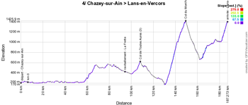
The 50 first kilometers of this stage after the start in Chazey-sur-Ain will be completely flat and the stage will remain without difficulties until just before the feeding zone in La Frette. Atfer about one hundred kilometers in the race, the riders will get on the first difficulty of this stage, the Col de Toutes Aures (3rd category, 2.5 km at 5.1%) and while riding towards the Natural Regional Park of the Vercors, they'll still have the Col du Mont Noir, first difficulty of the outside category of this race, to climb (17.5 km at 6.9%). After a descent they'll start the final climb, towards the finish in Lans-en-Vercors (2nd category, 4.8 km at 7.5%).Hereunder you'll find the time- and route schedule, the profile and the race route on Google Maps for the 4th stage du Critérium du Dauphiné 2018. Click on the images to open them.


Si vous le souhaitez, vous pouvez regarder en vidéo la montée du Mont Noir avec la vidéo Kinomap de Nicolas Raybaud :
5/ Friday 8 June 2018 - Grenoble > Valmorel - 130 km
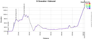
After the start in Grenoble, this 5th stage of the Critérium du Dauphiné 2018 will immediately start off with a 2nd category climb, the Côte de Naysord (3.7 km at 8.5%) and rapidly afterwards, the riders will climb the Col des Mouillés, of the 2nd category as well (3.8 km at 7.2%). After the descent about 80 kilometers without any difficulties will follow, before the final climb towards the finish, a outside category climb towards Valmorel (12.7 km at 7%)!Hereunder you'll find the time- and route schedule, the profile and the race route on Google Maps for the 5th stage du Critérium du Dauphiné 2018. Click on the images to open them.


6/ Saturday 9 June 2018 - Frontenex > La Rosière (espace San Bernardo) - 110 km
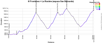
The last weekend of the Critérium du Dauphiné 2018 will offer two short but explosive stages to the riders, starting with the one on Saturday, with 110 kilometers starting in Frontenex. No less than 3 difficulties during this stage, before the final climb, starting with two outside category climbs, the Montée de Bisanne (12.4 km at 8.1%) and the Col du Pré (12.6 km at 7.6%), followed by the climb towards the Cormet de Roselend (2nd category, 5.7 km at 6.4%). The descent will immediately go on in the final climb towards the finish on top of La Rosière (1st category, 17.6 km at 5.8%).Hereunder you'll find the time- and route schedule, the profile and the race route on Google Maps for the 6th stage du Critérium du Dauphiné 2018. Click on the images to open them.


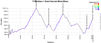
7/ Sunday 10 June 2018 - Moûtiers > Saint-Gervais Mont-Blanc - 136 km
The weekend and the race will end off with another short but explosive stage, starting in Moûtiers. Very quickly, the riders will start the climb towards the Cormet de Roselend (1st category, 19 km at 6%) which descent will immediately go on in the easier climb of the Côte de la Route des Villes (3rd category, 3.2 km at 5.9%).A short descent will bring the race to the foot of the Col des Saisies (1st category, 15.1 km at 6.4%). After a long descente and a visit of Megève, Combloux and Domancy, there will still be two climbs following up on each other, the short but difficult Côte des Amerands (1st category, 2.7 km at 11.2%) and the final climb of the 1st category towards Saint-Gervais Mont Blanc (Montée du Bettex, 7 km at 7.7%).
That's where we'll know who will be the last rider to wear the yellow and blue jersey and who'll win the race!
Hereunder you'll find the time- and route schedule, the profile and the race route on Google Maps for the 7th stage du Critérium du Dauphiné 2018. Click on the images to open them.


The Critérium du Dauphiné 2018's race route in Google Earth
You have discovered the race route of the stages of the Critérium du Dauphiné 2018 on Google Maps above, and their stage profile and time- and route schedule. If you'd like to see the full race route of the Critérium du Dauphiné 2018 at once or if you'd like to do a virtual fly-over over one or more of these stages for example, you can find a link below to download the Critérium du Dauphiné 2018's race route in Google Earth, thanks to the use of a KML file:>> Download the Critérium du Dauphiné 2018's race route in Google Earth

Vond u dit artikel interessant? Laat het uw vrienden op Facebook weten door op de buttons hieronder te klikken!
6 comments | 12327 views
this publication is published in: Criterium du Dauphiné | OpenStreetMap/Google Maps/Google Earth


 by marco1988 over
bonjour où peut t'on se procurer la liste des couruers engagés sur le "DAUPHINE....?
Amitiés Cyclistes
merci
Partvelo59
Bonjour @Patrick,
La liste des partants est accessible sur la fiche de la course, tout comme les résultats des étapes qui sont publiés au fur et à mesure.
Bonjour Thomas,
l'étape 5 ne pourra pas pas emprunter le pont entre Grignon et Albertville pour traverser l'Isère (le pont a explosé il y a quelques semaines). ASO n'a pas encore indiqué le nouveau parcours, qui pourrait passer par le pont de Gilly.
Bonjour, et bravo pour la qualité de votre site et de ses infos.
Quand je veux télécharger le parcours pour GE, j'ai le message "Le téléchargement ne peut être engagé car une erreur inconnue est survenue".
Avez-vous une explication/une solution; merci par avance.
Navigateur Firefox
Bingo35
Re bonjour.
Le pb est dû a un pb de sécurité pour short.tover.com.
La connexion sécurisée est refusée car déclarée non fiable.
Il faut créer une exception de sécurité pour que le téléchargement s'effectue.
Bonjour @Bingo35,
Merci d'avoir signalé ce problème. Le certificat de short.thover.com était effectivement expiré depuis le 30 mai et pour une raison que j'ignore celui-ci n'avait pas été renouvellé automatiquement.
Je viens de faire le nécessaire et le téléchargement du fichier KML devrait donc désormais à nouveau être possible sans action particulière :).