Now we're getting closer to the start of the Tour de France 2019, as usual, velowire.com allows you to discover all the tiny details of the race route of the 106th edition of the Grande Boucle, with all the routes drawn on interactive maps with Open Street Maps/Google Earth.
With the information available in this publication, you'll get to know all the routes, the visited cities and villages and it will thus allow you to prepare your visit of the race if you're among one of the 12 million people watching the race on the side of the road, or simply better understand the race if you're not one of these happy "few"!
Some preliminary information ...
Let's start with some elements you should take into account before you discover in detail all the stages of the Tour de France 2019:- as for any contents published on velowire.com, copying or in any other way reproducing these contents is strictly forbidden, as explained at the copyright page. Please respect these rights, if were it alone out of respect for the time it takes to prepare these contents!
- the stage profiles have been generated automatically based on the altitude informations which are known for the places where the race comes by; it might thus be incorrect at some locations (especially for tunnels and so on), but the general profile is correct!
-
The programme of the Grand start of the Tour de France 2019
Here are the dates and information to keep in mind for this Grand start of the Tour de France 2019:While in Brussels during this Grand start, your recommended transport method would be the metro or tramway or your bike of course!
The Tour de France 2019 race route on Open Street Maps
Let's now no longer wait to discover all the details of the Tour de France 2019 race route, stage by stage:CONTINUE READING AFTER THIS ADVERTISEMENT
1/ Saturday 6 July 2019 - Brussels (BE) > Brussels (BE) - 194.5 km
The first stage of the Tour de France 2019 will honour Eddy Merckx, 5 times winner of the Tour de France. Indeed, early in the stage the riders will, after the start from Brussels, visit Molenbeek-Saint-Jean and Anderlecht, two football clubs he loves while, on their way back to Brussels, Tervuren and Woluwe-Saint-Pierre will remind of the history of this big Belgian champion, who grew up in Woluwe but who also took his first Yellow Jersey of his career there, while he lived in Tervuren in 1969 ...Apart from that, the riders will find on their route during this stage the climb of the Mur de Grammont at km 43.5, and they will go on south till Charleroi before they'll get on one cobbled stones section, the Thiméon section (1,900 m long). They'll also have the very first intermediate sprint of the race in Les Bons Villers and will pass at the foot of the Butte du Lion (the battle field of Napoleon's forces in Waterloo) before going back north towards Brussels where the finish will be in the Avenue du Parc Royal.
Hereunder you'll find the time- and route schedule, the stage profile and the race route on Open Street Maps for this stage. Click on the images to open them.


- start : the start will take place on the Place Royale in Brussels; the riders will go on to the Grand-Place where the official start ceremony of the 106th edition of the Tour de France will take place and after a 5 minutes stop, they'll go on to the km 0
- climbs : Mur de Grammont (3rd category) at km 43.5 - 1.2 km @ 7.8% and Bosberg (4th category) at km 47.5 - 1 km @ 6.7%
- intermediate sprint : Les Bons Villers
- finish : Domaine Royal de Laeken in Brussels
- visited departments : Brussels-Capitale from km 0 till km 1.5 and from km 181.5 till km 194.5, Vlaams Brabant (Brabant Flamand) from km 7.5 till km 22 and at km 48 and from km 52 till km 61.5 and from km 162.5 till km 181, Oost-Vlaanderen (Flandre-Orientale) from km 25 till km 47.5 and at km 49.5, Hainaut from km 62 till km 125, Brabant Wallon from km 127.5 till km 158.5
- main cities : Brussels, Geraardsbergen (Grammont), Charleroi and Waterloo
2/ Sunday 9 July 2019 - Brussels (BE) > Brussels (BE) - team time trial - 27.6 km
This second stage of the Tour de France 2019 will be a team time trial, over a distance of 27.6 kilometers. The start will be in front of the Palais Royal in Brussels and the image at the finish of each team will show the famous Atomium, which was built for the Universal Exposition in 1958, in the background.While the victory of the first stage is most probably for a sprinter, who will thus have the occasion to wear the first Yellow Jersey of this year in which we celebrate it's 100 years of existance, it is well possible that the leader's jersey for the general classification will change shoulders after this second stage if that rider is not part of a team with good time trial riders who manage to win this timed race.
Speaking of timing, there will be two intermediate timing points, at the Bois de la Cambre (Ter Kamerenbos) and at the Boulevard Léopold III.
Hereunder you'll find the time- and route schedule, the stage profile and the race route on Open Street Maps for this stage. Click on the images to open them.


- start : in Brussels the start platform will be set up in front of the Royal Palace in the Rue Lambermont
- climbs : non applicable
- intermediate sprint : non applicable
- finish : at the Atomium in Brussels (Boulevard du Centenaire [Eeuwfeestlaan])
- visited departments : Brussels-Capitale from km 0 till km 27.6
- main cities : Brussels
3/ Monday 8 July 2019 - Binche (BE) > Epernay - 215 km
The 3rd stage will start in Belgium, and more precisely in Binche, which is better known of the Binche - Chimay - Binche cycling race and of the Mémorial Franck Vandenbroucke, which pays a tribute to the sulfurous Belgian rider. In this same city, Amaury Sport Organisation (A.S.O.), the organisor of the Tour, also organised the start of the Flèche Wallonne, in 2013 and 2017.From Binche, the riders will go south to cross the border with France, rather quickly after the start, in Jeumont (km 12). They'll be off for a long stage of 215 kilometers in total, towards Epernay, which is more used to receive the Tour de France for stage starts (for example in 2010/2012/2014) than for stage finishes (only one time before, in 1963, at that time for the very first stage of the race, coming from Nogent-sur-Marne). Midway of the stage, the riders will find the intermediate sprint of this stage, in Dizy-le-Gros.
Before they get to Epernay, and after having visited the center of Reims, they'll still have 4 referenced climbs (because there are actually more but they are not all part of the King of the Mountains classifications) to do in the last 45 kilometers in the department Marne (Côte de Nanteuil-la-Forêt, Côte d'Hautvillers, Côte de Champillon and Côte de Mutigny which will be the Bonus Point of this stage), before the ramp up to the finish line!
One of them is thus the Bonus Point of this stage. The Bonus Points were introduced last year, at the Tour de France 2018, and they make their comeback this year but in a different way: they are now always on top of a climb. The Bonus Point, as we can read in the the rules of the Tour de France 2019, will attribute bonus seconds on the top of some climbs which are located at an important point of the race route. There's a total of 8 Bonus Points in the 3rd, 6th, 8th, 9th, 12th, 15th, 18th and 19th stages. These time bonuses are of 8, 5 and 2 seconds for the three first riders on top.
Hereunder you'll find the time- and route schedule, the stage profile and the race route on Open Street Maps for this stage. Click on the images to open them.


- start : Rue des Récollets in Binche
- climbs : Côte de Nanteuil-la-Forêt (4th category) at km 173 - 1.1 km @ 6.8%, Côte d'Hautvillers (3rd category) at km 185.5 - 900 m @ 10.5%, Côte de Champillon (3rd category) at km 190 - 1.8 km @ 6.6% and Côte de Mutigny (3rd category) at km 199 - 900 m @ 12.2%
- intermediate sprint : Dizy-le-Gros
- Bonus Point : Côte de Mutigny
- finish : Rue des Coteaux in Epernay
- visited departments : BE - Province de Hainaut from km 0 till km 10, FR - Nord (59) from km 12 till km 54.5, Aisne (02) from km 58.5 till km 102 and from km 106 till km 113.5 and from km 123 till km 124.5, Ardennes (08) at km 105 and at km 117 and at km 125.5, Marne (51) from km 130 till km 215
- main cities : Binche (BE), Fourmies, Hirson, Reims, Epernay
4/ Tuesday 9 July 2019 - Reims > Nancy - 213.5 km
The next day's start will still be in the Champagne department, in Reims to be more precise, the city which is actually more use to stage finishes then starts but this time it will see the peloton go off for the 4th stage.Direction east for this stage, towards Nancy, where the sprinters should most logically have the second occasion to take a stage win, at the end of the 1500 meters long straight line on the Boulevard d'Austrasie in front of the Matter stadium. The two 4th category climbs, at respectively 92.5 and 15 km from the finish, will probably not prevent them from sprinting for the victory!
Hereunder you'll find the time- and route schedule, the stage profile and the race route on Open Street Maps for this stage. Click on the images to open them.


- start : Rue de Mars in Reims ; km 0 on the D9 after 7.3 km
- climbs : Côte des Rosières (4th category) at km 121 - 1 km @ 7% and Côte de Maron (4th category) at km 198.5 - 3.2 km @ 5%
- intermediate sprint : Lérouville
- finish : Boulevard d'Austrasie in Nancy
- visited departments : Marne (51) from km 0 till km 86.5, Meuse (55) from km 91 till km 167.5, Meurthe-et-Moselle (54) from km 169.5 till km 213.5
- main cities : Reims, Châlons-en-Champagne, Bar-le-Duc, Commercy, Toul and Nancy
CONTINUE READING AFTER THIS ADVERTISEMENT
5/ Wednesday 11 July 2019 - Saint-Dié-des-Vosges > Colmar - 175.5 km
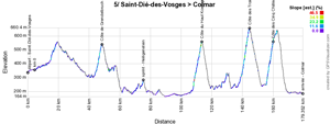
Never before, the Tour de France has been in Saint-Dié-des-Vosges but this will now be the case in 2019 for the start of the 5th stage, close to the Pont de la République.This stage which will take place in the Vosges mountain area and mainly in the Alsace, 100 years after the very first stage in Alsace in the history of the Tour, and will bring the riders to Colmar. To get there, they'll have to climb the Côte de Grendelbruch early in the stage, but more importantly in the second half of the stage they'll climb towards the castle on top of the Côte de Haut-Kœnigsbourg and closer to the finish they'll climb the Côte de Trois-Epis and the Côte des Cinq-Châteaux, followed by a very rapid descent towards the finish line.
Hereunder you'll find the time- and route schedule, the stage profile and the race route on Open Street Maps for this stage. Click on the images to open them.


- start : the start will be on the Place des Déportés / Place Saint-Martin in Saint-Dié-des-Vosges ; the km 0 will be on the D420 after 4.6 kilometers
- climbs : Côte de Grendelbruch (3rd category) at km 44 - 3.4 km @ 4.9%, Côte de Haut-Kœnigsbourg (2nd category) at km 109.5 - 5.9 km @ 5.9%, Côte des Trois-Epis (2nd category) at km 140.5 - 5 km @ 6.7%, Côte des Cinq Châteaux (3rd category) at km 156 - 4.6 km @ 6.1%
- intermediate sprint : Heiligenstein at km 71
- finish : Route de Strasbourg in Colmar
- visited departments : Vosges (88) from km 0 till km 15, Bas-Rhin (67) from km 15 till km 109.5, Haut-Rhin (68) from km 114 till km 175.5
- main cities : Saint-Dié-des-Vosges, Obernai, Sélestat and Colmar
6/ Thursday 12 July 2019 - Mulhouse > La Planche des Belles Filles - 160.5 km
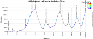
As in 2014 when the tenth stage took place between these same two start and finish cities, we'll see for this 6th stage a start in Mulhouse and a finish at La Planche des Belles Filles, the first mountain stage of this Tour de France 2019.The race route will however not be the same as in 2014 since the riders will find a combination of very difficult climbs with Le Markstein (winter and summer sports station) which goes on in the Grand Ballon and directly after the descent the Col du Hundsruck. A bit further they'll climb the famous Ballon d'Alsace.
At the foot of this climb, in Le Thillot, the race will get back on the race route which already brought them to La Planche des Belles Filles in 2014, via the Col des Croix and the Col des Chevrères which will also be the Bonus Point of this stage. The climb of La Planche des Belles Filles itself will this time be one kilometer longer, on a track which has been stabilised but not completely resurfaced and which contains parts which climb above 20%.
Hereunder you'll find the time- and route schedule, the stage profile and the race route on Open Street Maps for this stage. Click on the images to open them.


- start : Rue de l'Illberg in Mulhouse ; km 0 on the D19.1 after 10.2 km
- climbs : Le Markstein (1st category) at km 43.5 - 10.8 km @ 5.4%, Grand Ballon (3rd category) at km 50.5 - 1.3 km @ 9%, Col du Hundsruck (2nd category) at km 74 - 5.3 km @ 6.9%, Ballon d'Alsace (1st category) at km 105 - 11 km @ 5.8%, Col des Croix (3rd category) at km 123.5 - 3.3 km @ 6.1%, Col des Chevrères (2nd category) at km 141.5 which will also be the Bonus Point - 3.5 km @ 9.5% and the final climb to La Planche des Belles Filles (1st category) at km 160.5 - 7 km @ 8.7%
- intermediate sprint : Linthal at km 29
- Bonus Point : Col des Chevrères at km 141.5
- finish : La Planche des Belles Filles
- visited departments : Haut-Rhin (68) from km 0 till km 101.5, Territoire de Belfort (90) at km 103 and at km 105, Vosges (88) from km 106.5 till km 123.5, Haute-Saône (70) from km 127.5 till km 160.5
- main cities : Mulhouse, Guebwiller and La Planche des Belles Filles
7/ Friday 12 July 2019 - Belfort > Châlon-sur-Saône - 230 km
At the start in Belfort, where Eddy Merckx left wearing the Yellow Jersey (after having taken it the day before at the finish of the 6th stage on top of the Ballon d'Alsace) which he would never lose again until the finish in Paris, this is the longest stage of this [[Tour de France 2019]).A stage without any real difficulties (only 3 short climbs, two of the 4th and one of the 3rd category, in which a possible breakaway should thus expect the sprinters teams to chase behind them in order to have a bunch sprint at the finish of the stage in Chalon-sur-Saône.
Hereunder you'll find the time- and route schedule, the stage profile and the race route on Open Street Maps for this stage. Click on the images to open them.


- start : Rue du Docteur Charles-Fréry in Belfort ; km 0 on the D83, after 9 km
- climbs : Col de Ferrière (4th category) at km 37.5 - 2.7 km @ 4.6%, Côte de Chassagne-Saint-Denis (3rd category) at km 95.5 - 4.3 km @ 4.7% and Côte de Nans-sous-Sainte-Anne (4th category) at km 119.5 - 3.5 km @ 5.7%
- intermediate sprint : Mervans at km 196.5
- finish : Quai Saint Cosme in Châlon-sur-Saône
- visited departments : Territoire de Belfort (90) untill km 0, Haute-Saône (70) from km 0 till km 8.5, Doubs (25) from km 10 till km 119.5, Jura (39) from km 123.5 till km 172.5 and at km 176, rapid visit of the Saône-et-Loire (71) and later on from km 179 till km 230
- main cities : Belfort, L'Isle-sur-le-Doubs, Ornans, Arbois and Châlon-sur-Saône
8/ Saturday 13 July 2019 - Mâcon > Saint-Etienne - 200 km
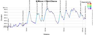
The 8th stage stage starting in Mâcon will be more hilly and after about 50 kilometers the riders will get on a road of "Croix" (corresponding to the names of the climbs they'll find there) with 4 and later on 2 other climbs.A pretty exhausting race route thus and just before the finish the riders will also climb the Côte de la Jaillière and its narrow roads before they cross the white line in Saint-Etienne close to the Geoffroy Guichard stadium after a total of 3750 meters uphill.
Hereunder you'll find the time- and route schedule, the stage profile and the race route on Open Street Maps for this stage. Click on the images to open them.


- start : Quai Lamartine in Mâcon ; the km 0 will be on the D89, after 7.3 km
- climbs : Col de la Croix Montmain (2nd category) at km 51 - 6.1 km @ 7%, Col de la Croix de Thel (2nd category) at km 71 - 4.1 km @ 8.1%, Col de la Croix Paquet (2nd category) at km 84.5 - 2.1 km @ 9.7%, Côte d'Affoux (3rd category) at km 97 - 8.5 km @ 4.5%, Côte de la Croix de Part (2nd category) at km 133 - 4.9 km @ 7.9%, Côte d'Aveize (2nd category) at km 148.5 - 5.2 km @ 6.4%, Côte de la Jaillère (3rd category, which will also be the Bonus Point) at km 187.5 - 1.9 km @ 7.9%
- intermediate sprint : Cercié-en-Beaujolais at km 33
- Bonus Point : Côte de la Jaillère at km 187.5
- finish : Rue Claude Verney Carron in Saint-Etienne
- visited departments : Saône-et-Loire (71) from km 0 till km 12.5 and from km 15.5 till km 17, Rhône (69) from km 13 till km 14 and from km 18.5 till km 162.5, Loire (42) from km 166 till km 200
- main cities : Mâcon, Crêches-sur-Saône, Régnié-Durette, Lamure-sur-Azergues, Tarare, Saint-Laurent-de-Chamousset, Saint-Symphorien-sur-Coise, Saint-Christo-en-Jarez and Saint-Etienne
CONTINUE READING AFTER THIS ADVERTISEMENT
9/ Sunday 14 July 2019 - Saint-Etienne > Brioude - 170.5 km
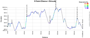
For the Sunday of the second weekend of the Tour de France 2019, national bank holiday, only one real climb will be on the programme after the start from Saint-Etienne, after about thirty kilometers already, the Mur d'Aurec-sur-Loire, of the first category, but the stage remains hilly untill the finish in Brioude, birth city of Romain Bardet, containing also two other climbs of the 3rd category.Hereunder you'll find the time- and route schedule, the stage profile and the race route on Open Street Maps for this stage. Click on the images to open them.

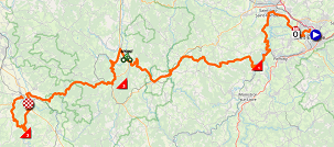
- start : Rue Paul et Pierre Guichard in Saint-Etienne ; the km 0 will be on the D8, after 9.8 km
- climbs : Mur d'Aurec-sur-Loire (1st category) at km 36.5 - 3.2 km @ 11%, Côte des Guillaumanches (3rd category) at km 106 - 7.8 km @ 4.1% and Côte de Saint-Just (3rd category which will also be the Bonus Point) at km 157.5 - 3.6 km @ 7.2%
- intermediate sprint : Arlanc at km 92
- Bonus Point : Côte de Saint-Just at km 157.5
- finish : Avenue Léon Blum in Brioude
- visited departments : Loire (42) from km 0 till km 27.5 and at km 37.5 and from km 43.5 till km 68, Haute-Loire (43) from km 29 till km 36.5 and from km 68.5 till km 79 and at km 102 and from km 106 till km 170.5, Puy-de-Dôme from km 83.5 till km 96.5 and at km 102.5
- main cities : Saint-Etienne, Saint-Just-Saint-Rambert, Craponne-sur-Arzon, Arlanc, La Chaise-Dieu, Saint-Didier-sur-Doulon and Brioude
10/ Monday 15 July 2019 - Saint-Flour > Albi - 217,5 km
Spontaneously no one might even have guessed it but there is a real history between Saint-Flour and the Yellow Jersey, which celebrates its 100 years of existence during this Tour de France 2019, especially for the French public. Indeed, this is where Thomas Voeckler took the leader's jersey of the general classification 8 years before after the 9th stage, and hold on to it until the end of the 18th stage, a period which made the French rider, who already wore the Yellow Jersey during 10 days in 2004, popular again.Hereunder you'll find the time- and route schedule, the stage profile and the race route on Open Street Maps for this stage. Click on the images to open them.

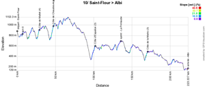
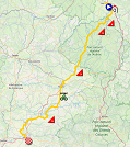
- start : Avenue des Orgues in Saint-Flour ; the km 0 will be on the D909, after 7.1 km
- climbs : Côte de Mallet (4th category) at km 22 - 2.2 km @ 5.2%, Côte de Chaudes-Aigues (3rd category) at km 40.5 - 3 km @ 6.6%, Côte d'Espalion (3rd category) at km 95.5 - 5.2 km @ 4.9% and Côte de la Malric (3rd category) at km 164.5 - 3.6 km @ 4.7%
- intermediate sprint : La Primaube at km 128.5
- finish : Place du Vigan in Albi
- visited departments : Cantal (15) from km 0 till km 46.5, Aveyron (12) from km 51.5 till km 166, Tarn (81) from km 169 till km 217.5
- main cities : Saint-Flour, Faverolles, Chaudes-Aigues, Lacalm, Laguiole, Espalion, Bozouls, Sébazac-Concourès, Rodez, La Primaube, Tanus, Carmaux and Albi
R1/ Tuesday 16 July 2019 - rest day in Albi
After this stage finish in Albi, the riders will enjoy the first rest day of this Tour de France 2019 the next day!No less than 10 stages without any moment of rest will have preceded this day. It's not the first time that the rest day is not on Monday but only on Tuesday (this was already the case for example in 2014 and in 2012 most recently, but also in 2008), but one thing is sure: the riders will be eagerly awaiting this day!
11/ Wednesday 17 July 2019 - Albi > Toulouse - 167 km
The 11th stage, the day after the rest day, will cross the departments of the Tarn (via the magnificent village of Cordes-sur-Ciel), of the Tarn-et-Garonne and the Haute-Garonne after a start in Albi, and this will be a sprinters stage with most probably a bunch finish in Toulouse!The riders will have to get up only two referenced climbs and these are located early in the stage and will thus most probably not prevent the sprinters from winning this stage. Well, that is, as long as they don't stop in Gaillac to enjoy the local wine instead of only doing the intermediate sprint ;-).
Hereunder you'll find the time- and route schedule, the stage profile and the race route on Open Street Maps for this stage. Click on the images to open them.


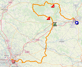
- start : Rue Hippolyte Savary in Albi ; km 0 on the D1, after 5.4 km
- climbs : Côte de Tonnac (3rd category) at km 32 - 3.6 km @ 4.9%, Côte de Castelnau-de-Montmirail (4th category) at km 77 - 2.5 km @ 3.8%
- intermediate sprint : Gaillac at km 87
- finish : Boulevard Lascrosses in Toulouse
- visited departments : Tarn (81) from km 0 till km 50.5 and from km 61 till km 125.5, Tarn-et-Garonne (82) from km 55 till km 57.5 and Haute-Garonne (31) from km 131.5 till km 167
- main cities : Albi, Cordes-sur-Ciel, Castelnau-de-Montmirail, Gaillac, Lavaur, Drémil-Lafage and Toulouse
CONTINUE READING AFTER THIS ADVERTISEMENT
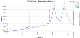
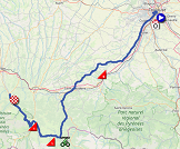
12/ Thursday 18 July 2019 - Toulouse > Bagnères-de-Bigorre - 209.5 km
While everyone, and especially the Média Pitchounes association, was dreaming of Tour stage start "at the foot of the towers" in Toulouse, in the popular area called Bagatelle, and while A.S.O. apparently wanted to try to make this dream come true, it'll only partly be the case in the end. Indeed, as Christian Prudhomme said during the presentation of the Tour de France 2019 race route, the start of this stage will take place "as close as possible to the Bagatelle area". More precisely, it'll be close to the Stadium, on the Ramier island, at one kilometer from Bagatelle, where the stage will go by before it gets to its km 0. The name of the Bagatelle area is thus shown proudly in the time- and route schedule, but this is not exactly what we could call "a Tour stage start at the foot of the towers" of this popular area ...This will be the first Pyrenean stage, which will start flat in the first half of the stage, up to Bagnères-de-Luchon where the Tour had a stage finish last year and where the riders will find the intermediate sprint of this stage this year. Things will get more difficult from there, with the climb of the Col de Peyresourde and, after a few kilometers in the plain area of Arreau, the Hourquette d'Ancizan, followed by a big descent towards the finish city, Bagnères-de-Bigorre.
Hereunder you'll find the time- and route schedule, the stage profile and the race route on Open Street Maps for this stage. Click on the images to open them.

- start : Stadium TFC / Allée Gabriel Biénès in Toulouse ; km 0 on the D15, after 11 km
- climbs : Côte de Montoulieu-Saint-Bernard (4th category) at km 62.5 - 1.7 km @ 5.2%, Col de Peyresourde (1st category) at km 146 - 13.2 km @ 7% and the Hourquette d'Ancizan (1st category, also the Bonus Point of this stage) at km 179 - 9.9 km @ 7.5%
- intermediate sprint : Bagnères-de-Luchon at km 130.5
- finish : Allée Jean Jaurès in Bagnères-de-Bigorre
- visited departments : Haute-Garonne (31) from km 0 till km 99 and at km 107.5 and from km 110.5 till km 146, Hautes-Pyrénées (65) from km 101.5 till km 104 and at km 109.5 and from km 146 till km 209.5
- main cities : Toulouse, Cugnaux, Muret, Saint-Gaudens, Bagnères-de-Luchon and Bagnères-de-Bigorre
13/ Friday 19 July 2019 - Pau > Pau - individual time trial - 27.2 km
On Friday 19 July 2019, it'll be the real celebration of the 100 years of the Yellow Jersey. On 19 July 1919 it was in Grenoble that Eugène Christophe took the very first Yellow Jersey. Grenoble is not on the race route of the Tour de France 2019 but A.S.O. wanted this day to be a day of celebrations in a mythical city for the Tour de France and for that there's probably nothing better than an individual time trial in the city of Pau which has seen the Tour 70 times before already before its comeback in 2019 for this stage.Looking at the profile of this time trial south of the city of Pau, which is not completely flat, with the climb towards the intermediate timing point in Cériset and to the one on the Côte d'Esquillot, this could - at this stage of the race - well be a stage which can influence the general classification and lead to some changes and maybe even a new Yellow Jersey wearer. On this celebration day of the 100 years of this symbol, the potential new wearer of the yellow jersey will be even happier to take over the lead!
The third intermediate timing point is south of Jurançon and from there, the riders will have another 5.3 kilometers to go before they cross the finish line in Pau one by one.
It'll also be on this race route that the women's race "La Course by le Tour" will be organised in 2019. Instead of what happened the previous years, it'll thus not take place the same day as the stage of the men's race but on 23 July 2019 when the Tour de France will already be in Nîmes! Still, the women will have to this track 5 times, for a total distance of around 135 kilometers.
Hereunder you'll find the time- and route schedule, the stage profile and the race route on Open Street Maps for this stage. Click on the images to open them.


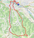
- start : Avenue Gaston Lacoste n Pau, at the foot of the Tour des Géants, the monument made of totems (one totem per year of the Tour) in the Bois-Louis, where there used to be a vélodrome, which was where the race finished at that time
- climbs : not applicable
- intermediate sprint : not applicable
- finish : Rue du Maquis du Béarn in Pau
- visited departments : Pyrénées-Atlantiques (64) from km 0 till km 27.2
- main cities : Pau, Gelos, Gan and Jurançon
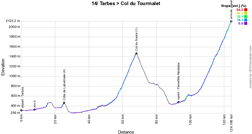
14/ Saturday 20 July 2019 - Tarbes > Tourmalet - 117.5 km
The second Pyrenean stage in line starting in Tarbes will be pretty short, with its 117.5 kilometers, but it's all about the two climbs: one in the middle of the stage, the Col du Soulor, and the final climb towards the Col du Tourmalet where the Tour de France 2019 will for the first time go above a 2000 meters altitude with the 2,115 meters of the Tourmalet.Even though the Tourmalet is the most climbed mountain in the history of the Tour, there have only been two stage finishes of a Tour de France stage on top of the Tourmalet before, in 1974 with Jean-Pierre Danguillaume being the winner and in 2010 with Andy Schleck as the winner, being congratulated by Danguillaume.
Hereunder you'll find the time- and route schedule, the stage profile and the race route on Open Street Maps for this stage. Click on the images to open them.

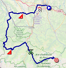
- start : Place Marcadieu / Rue François Mousis in Tarbes ; km 0 on the D93, after 7.9 km
- climbs : Côte de Labatmale (4th category) at km 18 - 1.4 km @ 6.7%, Col du Soulor (1st category) at km 60.5 - 11.9 km @ 7.8% and the finish on top of the Col du Tourmalet Barèges (outside category) at km 117.5 - 19 km @ 7.4%
- intermediate sprint : Pierrefitte-Nestalas at km 86
- finish : on top of the Col du Tourmalet Barèges
- visited departments : Hautes-Pyrénées (65) from km 0 till km 4 and from km 45 till km 117.5, Pyrénées-Atlantiques (64) from km 11.5 till km 42
- main cities : Tarbes, Argelès-Gazost, Pierrefitte-Nestalas and Luz-Saint-Sauveur
15/ Sunday 21 July 2019 - Limoux > Foix-Prat d'Albis - 185 km
After a transfer, the riders will be at the start of the 15th stage in Limoux, for a stage which actually goes back around, in western direction.Apart from the mountain top finish, 3 referenced climbs will be on the programme of this stage: the Col de Montségur and, after a few kilometers in the plain area of Tarascon-sur-Ariège, the Port de Lers and its irregular climb, which will rapidly be followed by the Mur de Péguère which was previously part of the Tour race route in 2012 and in 2017. For the first time, the finish will not be in the city of Foix itself, but on top of a climb just beside, at the Prat d'Albis, a site which is usually taken by free flights, mountain bikes and hikers at 1,205 meters high.
In total, this stage will have a 4,700 meters altitude gain.
Hereunder you'll find the time- and route schedule, the stage profile and the race route on Open Street Maps for this stage. Click on the images to open them.

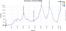
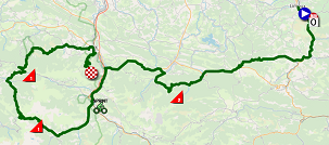
- start : Avenue Fabre d'Eglantine in Limoux ; km 0 on the D118, after 2.5 km
- climbs : Col de Montségur (2nd category) at km 60.5 - 6.8 km @ 6%, Port de Lers (1st category) at km 120.5 - 11.4 km @ 7%, Mur de Péguère (1st category, which will also be the Bonus Point of this stage) and the finish on Prat d'Albis above Foix (1st category) at km 185 - 11.8 km @ 6.9%
- intermediate sprint : Tarascon-sur-Ariège at km 93.5
- finish : Prat d'Albis, after a 11.8 km climb at 6.9%
- visited departments : Aude (11) from km 0 till km 39, Ariège (09) from km 42 till km 185
- main cities : Limoux, Tarascon-sur-Ariège and Foix
CONTINUE READING AFTER THIS ADVERTISEMENT
R2/ Monday 22 July 2019 - Nîmes
After this 15th stage, another rest day will be awaiting the riders and they'll be able to enjoy it after a short transfer towards Nîmes!16/ Tuesday 23 July 2019 - Nîmes > Nîmes - 177 km
The race route of this stage shows something which is quite rare in the Tour de France. Indeed, it'll be a stage in line which will start in Nîmes and finish ... in Nîmes as well.This loop stage will be completely in the Gard department. After the start in Nîmes the riders will quickly get onto the Pont-du-Gard, which is an exceptional privilege because this bridge is normally no longer open to traffic.
Most logically this will be a sprinters stage, even though they should pay attention to the wind because there will be about fifteen kilometers close to Uzès where they will be in a completely open area, as potential victims of the wind.
Hereunder you'll find the time- and route schedule, the stage profile and the race route on Open Street Maps for this stage. Click on the images to open them.


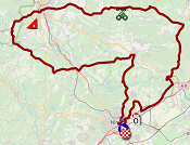
- start : Square du 11 Novembre 1918 in Nîmes ; km 0 on the D127, after 5.6 km
- climbs : Côte de Saint-Jean-du-Pin (4th category) at km 96 - 1.8 km @ 4.2%
- intermediate sprint : Vallérargues at km 65
- finish : Avenue Président Salvadore Allende in Nîmes
- visited departments : Gard (30) from km 0 au 177
- main cities : Nîmes, Alès and Uzès
17/ Wednesday 24 July 2019 - Pont-du-Gard > Gap - 200 km
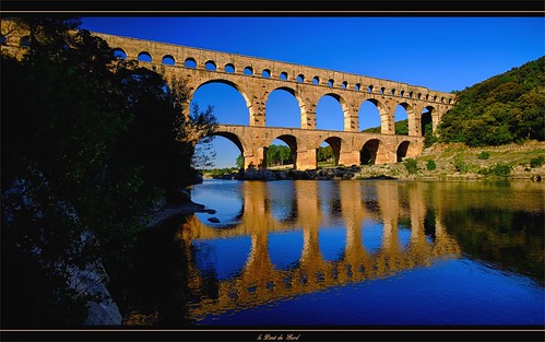
The start of the 17th stage will again be have the Pont-du-Gard - part of the World Heritage list - as its backdrop, like when the riders passed by during the stage which started in Nîmes the day before.
This will be a transition stage which will visit the antique theater of Orange and Vaison-la-Romaine where the riders will find the intermediate sprint. A part from a short climb at mid-stage, the riders will find the climb of the Col de la Sentinelle at less than 10 km from the finish, before they'll fight for victory in Gap.
Hereunder you'll find the time- and route schedule, the stage profile and the race route on Open Street Maps for this stage. Click on the images to open them.

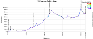
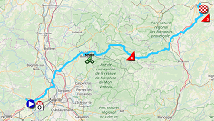
- start : Avenue du Pont-du-Gard at the Pont-du-Gard ; km 0 on the N100, after 7.7 km
- climbs : Côte de la Rochette-du-Buis (4th category) at km 104.5 - 2.3 km @ 6.2% and the Col de la Sentinelle (3rd category) at km 191.5 - 5.2 km @ 5.4%
- intermediate sprint : Vaison-la-Romaine at km 62
- finish : Avenue Maréchal Foch in Gap
- visited departments : Gard (30) from km 0 till km 21, Vaucluse (84) from km 32 till km 70, Drôme (26) from km 74.5 till km 125, Hautes-Alpes (05) from km 131.5 till km 163 and from km 179.5 till km 200, Alpes-de-Haute-Provence (04) from km 164.5 till km 174
- main cities : Pont-du-Gard, Orange, Vaison-la-Romaine and Gap
18/ Thursday 25 July 2019 - Embrun > Valloire - 208 km
Hereunder you'll find the time- and route schedule, the stage profile and the race route on Open Street Maps for this stage. Click on the images to open them.

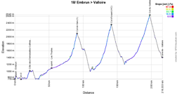

- start : Avenue des Acacias in Embrun ; km 0 on the N94, after 8.8 km
- climbs : Côte des Demoiselles Coifées (3rd category) at km 13 - 3.9 km @ 5.2%, Col de Vars (1st category) at km 82.5 - 9.3 km @ 7.5%, Col d'Izoard (outside category) at km 133 - 14.1 km @ 7.3% and Col du Galibier (outside category, which will also be the Bonus Point of this stage) at km 189 - 23 km @ 5.1%
- intermediate sprint : Les Thuiles at km 45
- finish : Avenue de la Vallée d'Or in Valloire
- visited departments : Hautes-Alpes (05) from km 0 till km 8.5 and from km 14 till km 20 and from km 84.5 till km 189, Alpes-de-Hautes-Provence (04) from km 10.5 till km 13 and from km 25.5 till km 82.5, Savoie (73) from km 193 till km 208
- main cities : Embrun, Briançon and Valloire
CONTINUE READING AFTER THIS ADVERTISEMENT
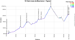
19/ Friday 26 July 2019 - Saint-Jean-de-Maurienne > Tignes - 126.5 km
After a visit of Saint-Michel-de-Maurienne and Modane, the road will go uphill for real and the riders will start the climb towards a ski station, the Montée d'Aussois, and after the descent the trip continues till Bonneval-sur-Arc where they'll attack the climb of the Col de l'Iseran, the highest mountain of the French Alps accessible by road, which hasn't been part of the Tour since 2007 and of which the last climb via this southern side took place in 1963. In 2019 it'll naturally be the rooftop of the Tour de France (souvenir Henri Desgrange) and it'll also be the Bonus Point of this stage!
After the descent of the Iseran down to Val d'Isère and after having followed the Lac du Chevril, the riders will not turn on the dam as usual, but will continue on and take a road which goes under the dam, and which was never taken before during the Tour de France, to get onto the climb towards Tignes where there has been only one other finish in the history of the Tour de France, in 2007.
Hereunder you'll find the time- and route schedule, the stage profile and the race route on Open Street Maps for this stage. Click on the images to open them.

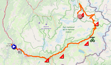
- start : Rue de la Libération in Saint-Jean-de-Maurienne ; km 0 on the D81, after 5 km
- climbs : Côte de Saint-André (3rd category) at km 25 - 3.1 km @ 6.8%, Montée d'Aussois (2nd category) at km 38 - 6.5 km @ 6.2%, Col de la Madeleine (3rd category) at km 63.5 - 3.9 km @ 5.6%, Col de l'Iseran (outside category, the rooftop of the Tour 2019 and also the Bonus Point of this stage) at km 89 - 12.9 km @ 7.5% and the Montée de Tignes at km 124.5 - 7.4 km @ 7%
- intermediate sprint : Bessans at km 68.5
- finish : Val Claret / Avenue de la Grande Motte in Tignes
- visited departments : Savoie (73) from km 0 till km 126.5
- main cities : Saint-Jean-de-Maurienne, Saint-Michel-de-Maurienne, Modane, Aussois, Val d'Isère and Tignes
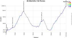
20/ Saturday 27 July 2019 - Albertville > Val Thorens - 130 km
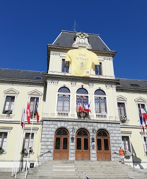 The forelast stage, the last of a triplet of Alps stages, will start in Albertville, where the Tour lastly already had a stage start in 2018 (11th stage, which was the stage where Geraint Thomas took over the lead in the general classification and never left the Yellow Jersey anymore), showing a hug yellow jersey with the text "Vive le Tour !" on the town hall at that time (see photo). Two times in a row thus that the Olympic city receives the Tour de France, where other cities sometimes desperately wait for the Grande Boucle to come by.
After the descent down to Bourg-Saint-Maurice Les Arcs and the visit of the valley until Mâcot, the riders will discover a new route and a new climb in the history of the Tour de France, the Côte de Longefoy, which will go on up to Notre-Dame-du-Pré (1,311 m) followed by the descent towards Moûtiers.
 The final climb of the Tour de France 2019 in the Alps will still be waiting for them at that time, a never ending climb of 33.4 kilometers towards Val Thorens, the highest station of Europe (2,365 m). This 3rd highest finish in the history of the Tour makes its comeback, 25 years after the unique previous visit in 1994.
This stage will also be the one which was chosen for the amateur race, the Etape du Tour, 6 days earlier, on 21 July 2019, with an altitude gain of 4,450 meters.
Hereunder you'll find the time- and route schedule, the stage profile and the race route on Open Street Maps for this stage. Click on the images to open them.


- start : Cours de l'Hôtel de Ville in Albertville
- climbs : Cormet de Roselend (1st category) at km 36 - 19.9 km @ 6%, Côte de Longefoy (2nd category) at km 75.5 - 6.6 km @ 6.5% and the final climb towards Val Thorens at km 130 - 33.4 km @ 5.5%
- intermediate sprint : Villard-sur-Doron at km 11.5
- finish : Val Thorens
- visited departments : Savoie (73) from km 0 till km 130
- main cities : Albertville, Bourg-Saint-Maurice, Moûtiers and Val Thorens
21/ Sunday 28 July 2019 - Rambouillet > Paris Champs-Elysées - 128 km
After the big transfer between Val Thorens and the parisian area, the last stage of the Tour de France 2019 will start in Rambouillet which will see the Tour come back after the last start which took place there in 2012.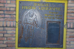 The visit of the Vallée de Chevreuse allows to award some final points for the King of the Mountains classification. In order to get to Paris and its famous Champs-Elysées, this stage will go through Issy-les-Moulineaux and thus not Malakoff which could have been a last honour to the 100 years of the Yellow Jersey. A missed occasion for the organisation of the Tour and the city of Malakoff, because the very first rider to wear the Yellow Jersey, Eugène Christophe, lived there and also worked for the city as a bike postman once he ended his career (there has just been a renovation of the commemoration monument this year; the photo shown here shows it before its renovation).
Anyway, the itinerary the riders will follow in Paris will be new anyway, coming by in front of the Eiffel Tower, the Assemblée Nationale at the Palais Bourbon, for the first fois in front of the Sénat at the Palais du Luxembourg, in front of the Palais de Justice on the Île de la Cité, before they get into the Cour Carrée du Louvre (!) and come by the famous pyramid of the Louvre which celebrates its 30 years anniversary this year, before they turn onto the rue de Rivoli and get back on the usual itinerary which brings them to the Place de la Concorde and the Champs-Elysées, the Place Charles de Gaulle / Place de l'Etoile and back on the Champs.
Hereunder you'll find the time- and route schedule, the stage profile and the race route on Open Street Maps for this stage. Click on the images to open them.


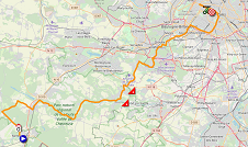
- start : Château de Rambouillet in Rambouillet ; km 0 on the D936, after 3 km
- climbs : Côte de Saint-Rémy-lès-Chevreuse (4th category) at km 34 - 1.3 km @ 6.1% and Côte de Châteaufort (4th category) at km 38 - 900 m @ 4.9%
- intermediate sprint : Paris, on the Champs-Elysées at km 89.5 just after the 3rd crossing of the finish line
- finish : Avenue des Champs-Elysées in Paris
- visited departments : Yvelines (78) from km 0 till km 38 and from km 39.5 till km 51.5, Essonne (91) at km 38, Hauts-de-Seine (92) from km 51.5 till km 59.5, Paris (75) from km 62 till km 128
- main cities : Rambouillet, Le Perray-en-Yvelines, Dampierre-en-Yvelines, Chevreuse, Saint-Rémy-lès-Chevreuse, Châteaufort, Les Loges-en-Joses, Jouy-en-Josas, Vélizy-Villacoublay, Meudon, Issy-les-Moulineaux and Paris
The Tour de France 2019 race route in Google Earth
Would you prefer to see the whole Tour de France 2019 race route on one single map? Or would you like to do a virtual fly-over over the race route of one or more of the stages of this 106th edition of the Tour de France? That's all possible, downloading the KMZ file (a zipped KML file, because of its big size) below and opening it with Google Earth! WARNING - copyright: despite the fact that this KMZ/KML file is provided to you for your own proper use, please bear in mind that it is strictly forbidden to reproduce the contents of this KMZ/KML file or of any other file (including maps, stage profiles, KML files and others) which make up the Tour de France 2019 race route. These contents are indeed protected by copyright and I thus ask you to respect the huge amount of time it takes to create these. This protection thus covers the reproduction of the maps and all other elements in any form which can be (as a map, a video flying over the maps or any other creation based on the contents published on velowire.com).
>> Download the race route of all Tour de France 2019 stages in Google Earth (KMZ file)

Vond u dit artikel interessant? Laat het uw vrienden op Facebook weten door op de buttons hieronder te klikken!
29 comments | 53324 views
this publication is published in: Tour de France | Tour de France 2019 | OpenStreetMap/Google Maps/Google Earth


 by marco1988 over
- opening of the Fan Park from 2PM till 8PM - place de la Brouckère - free entry - with games stands, BMX shows, educational workshops and live broadcast on a big screen; some activities and games can allow you to win Tour de France goodies (the Fan Park will also be open on Friday and Saturday from 10AM till 7PM and on Sunday from 11AM till 6PM)
- from 5.30PM till 7.15PM (free entry, see here for more information): Tour de France 2019 teams presentation on the Grand-Place, where Eddy Merckx got an ovation from the public which didn't fit on the characteristical place of the capital of Europe, in 1969 after his first out of 5 victories in the history of the Tour; this is also the place where the official start ceremony of the first stage will take place (the start location being upfront) and this place is thus indicated with a yellow flag on the Open Street Maps view further in this article.
The presentation on the Grand-Place will be preceded by a bike ride from the Place Royale, close to the start location of the first stage on Saturday and of the start of the team time trial on Sunday, and after the presentation the bike ride goes on and will end close to the Fan Park on the Place de Brouckère. You can find all this information in the map below.