After Liège-Bastogne-Liège, the UCI WorldTour 2011 will continue tomorrow in Switzerland, with the Tour de Romandie 2011.
This race is composed of 5 stage and a prologue with a total distance of almost 700 kilometers and contains -in addition to the prologue- a second individual time trial of 20.1 kilometers in the 4th stage.
In this article you'll find the Tour de Romandie 2011 race route on Google Maps, with the profile of each of the stages and the time- and route schedules.
In the 65th edition of the Tour de Romandie, last year's podium (Simon Špilak [Lampre-ISD] after Alejandro Valverde's victory got cancelled, Denis Menchov [Geox-TMC] and Michael Rogers [Team Sky]) were supposed to be at the start but unfortunately the latter is the victim of a virus and can thus not take the start in Martigny.
The Tour de Romandie 2011 race route on Google Maps, the stage profiles and the time- and route schedules
The parcours of this Tour de Romandie is not very demanding and the presence of two time trials could have a very important influence on this race, just like the time trial at the end of the week had in Paris-Nice 2011.Only one mountain stage finish is on the programme, the second day in the ski station of Leysin.
The director of the Tour de Romandie, Richard Chassot, understood that it's thanks to this lighter programme that some big names will participate in his race, some of them in preparation of the Giro d'Italia 2011: If we have such a good participation level, that's because we've made the Tour de Romandie easier. The good riders are ready to give everything they have but only as long as this doesn't have a bad influence on the rest of their season. We'll see whether this strategy will work out or weather the result of the Tour de Romandie 2011 is known beforehand and that Tony Martin (Team HTC-Highroad) will repeat his Paris-Nice 2011 victory ...
CONTINUE READING AFTER THIS ADVERTISEMENT
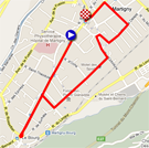
P/ Tuesday 26 April 2011 - prologue in Martigny - 3.5 km
The week will start tomorrow at the end of the afternoon with a short individual time trial in the city Martigny where the Tour de France 2009 had a stage start. A short but relatively technical parcours with a 360° turnaround on a roundabout and 8 other turns.The start of the first rider will be at 3.55PM and the last rider will start at 6.55PM with each rider starting every minute, except for the last 20 riders who will start every 2 minutes.
Below you'll find the time- and route schedule, the stage profile and the route on Google Maps for this stage. Click on each of the images to open them.


1/ Wednesday 27 April 2011 - Martigny > Leysin - 172.6 km
This first stage of the Tour de Romandie 2011 will have a first flat part, followed by a climb of the 2nd category, close to the Mont Pélerin, and the progressive climb towards the foot of the Col du Pillon of the 1st category of which the top is at a bit over 20 kilometers from the finish.The riders will dispute two sprints, in Semsales and in Le Rosex. The feeding zone will be in Neirivue. Leysin, where the finish line will be drawn on the Place Large, already had two stage finishes of the Tour de Romandie before, in 2002 and 2006. This year's finish will most probably not look like the one in 2002 when Alex Zülle won the stage, coming from Sierre, in the snow!
Below you'll find the time- and route schedule, the stage profile and the route on Google Maps for this stage. Click on each of the images to open them.


2/ Thursday 28 April 2011 - Romont > Romont - 171.8 km
The start and finish of this stage will be in the Rue de l'Eglise in Romont and the riders will cross the finish line no less than two times before the real finish of the stage. Indeed, this stage is composed of 3 loops around the city in the canton of Fribourg.The first loop will go north-east towards Neyruz where the riders will turn towards Onnens and Lentigny, Corserey, Chatonnaye and Rossens before they first come back to Romont where the riders will take the Route des Rayons to get back to the Rue de l'Eglise ... If any of the riders loses a spoke, he'll most probably be able to find a spare one there!
After the first crossing of the finish line, the 2nd loop will bring the riders south towards Bouloz for a short loop eastwards and going towards Oron. They'll than go back north via Montet and the first climb of the day, of the 2nd category, in Esmonts. After having crossed Siviriez they'll start the climb towards Dompierre (2nd category) before the feeding zone in Villarzel following by a new crossing of the finish line in Romont by following the end of the first loop.
The 3rd and last loop will go completely east towards Mézières, Fuyens, Orsonnens and Rossens where the riders will dispute the first sprint of the day before they cross the barrage of the Lac de la Gruyère and climb Le Gibloux (1st category) close to Sorens. From there, they'll go towards the finish in Romont after having disputed a second sprint in Mézières.
Below you'll find the time- and route schedule, the stage profile and the route on Google Maps for this stage. Click on each of the images to open them.


3/ Friday 29 April 2011 - Thierrens > Neuchâtel - 165.7 km
From the start in the Rue du Collège in Thierrens the parcours will go southwards to Cugy before going back north via Peney-le-Jorat and Mézières up to the feeding zone in Domdidier and than up to Murten before turning towards Erlach from where they'll follow the lake towards the finish line in Neuchâtel. At the first crossing of this city, the riders will battle for a sprint before continuing on a loop with the climb to Enges (1st category) which turns in Lamboing towards the climb of Lignières (2nd category) and the second sprint in Cressier. The riders will than go back towards the finish line.With this Tour de Romandie stage finish, the city Neuchâtel will celebrate its 1000th anniversary.
Below you'll find the time- and route schedule, the stage profile and the route on Google Maps for this stage. Click on each of the images to open them.


CONTINUE READING AFTER THIS ADVERTISEMENT
4/ Saturday 30 April 2011 - Aubonne > Signal de Bougy - 20.1 km
The 4th stage will be an individual time trial which starts in Aubonne and finishes in Signal de Bougy, 20.1 km and a visit of Lavigny, Saint-Livres, Bière (where the riders will turn to go back towards the finish zone), Saubraz and Gimel further. A perfect distance for a time trial specialist who can put his stamp, not only on this stage but also on the general classification!Below you'll find the time- and route schedule, the stage profile and the route on Google Maps for this stage. Click on each of the images to open them.


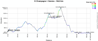
5/ Sunday 1st of May 2011 - Champagne > Genève - 164.6 km
This 5th and last stage will bring the riders back to Genève. The start will be 164.6 kilometers from there, in the city Champagne in the Vaud state. The city, which has some difficulties in finding the right name for its wines, will see the stage start in the Rue du Village, from where the riders will go towards Vallorbe and Cossonay before attacking the climb of the Col du Mollendruz of the first category. They'll than follow the Lac de Loux up to the feeding zone in Les Bioux.They'll battle for a sprint in Le Brassus before starting the climb of the Col du Marchairuz (1st category as well) and getting back to the Lac Léman via St-Georges, Gimel and Mont-sur-Rolle followed by Vinzel and Dully from where they'll follow the lake with a final sprint in Nyon. At the end of the lake, they'll find the city of Genève where the last finish will this time be on the other side of the lake, on the Quai Gustave-Ador after having crossed the Pont du Mont-Blanc.
Below you'll find the time- and route schedule, the stage profile and the route on Google Maps for this stage. Click on each of the images to open them.


The Tour de Romandie 2011 race route in Google Earth
Do you prefer to see the Tour de Romandie 2011 race route in Google Earth and thus for example do a virtual fly-over over the parcours of each of the stages? Download the KML file below to do so:
> Download the Tour de Romandie 2011 race route in Google Earth
The promotion movie of the Tour de Romandie 2011
Vond u dit artikel interessant? Laat het uw vrienden op Facebook weten door op de buttons hieronder te klikken!
no comments yet | 14709 views
this publication is published in: OpenStreetMap/Google Maps/Google Earth | Tour de Romandie


 by marco1988 over