Saturday 07 May 2011 at 00h53
Today, Saturday 7 May 2011, the Giro d'Italia 2011 will start close to Turin with a team time trial. The Corsa Rosa will almost completely stay in Italy with a short detour through Austria.
The Tour of Italy 2011 will finish in Milan on Sunday 29 May with an individual time trial.
In this article you can discover all details of the Giro d'Italia 2011 race route on Google Maps/Google Earth, and the time- and route schedule and profiles of each of the stages.
The Giro d'Italia 2011 in a few words
The 2011 Tour of Italy celebrates the 150th anniversary of the union of its host country (in 1861) and thus starts in Turin, the very first capital of Italy, and will cross a big part of the country visiting especially some historical places.The Giro d'Italia 2011 is built up of 21 stages of which 1 team time trial (Venaria Reale > Turin), 2 individual time trials (Belluno > Nevegal and Milan > Milan), 8 mountain stages, 6 hilly stages and only 4 flat stages! No less than 8 stages have a mountain top finish (including the first individual time trial).
We can thus easily say this is a mountaineous Giro d'Italia!
It all starts with a 21.5 km long team time trial from Venaria Reale to Turin, followed by a flat stage (from Alba to Parma) and 4 following hilly stages (during the 5th stage from Piombino to Orvieto the riders will again be on the strade bianche, the sand paths which brought some extra action to the Giro d'Italia 2010) and the two first mountain stages with a mountain top finish (on the Montevergine di Mercogliano and on the Etna which will be climbed twice from two different sides) with one flat stage in between.
After the first rest day three stages will follow, of which two are flat and one hilly, followed by 3 mountain stages, all three with a mountain top finish (Grossglockner in Austria, Monte Zoncolan and Gardeccia/Val di Fassa).
After the second rest day, the first individual time trial is planned. This will be a short uphill tie trial: 12.7 km between Belluno and Nevegal.
This will be followed by a mountain stage, a hilly stage and again two mountain stages, with mountain top finish, on Macugnaga and Sestrière, the last one after having climbed the non asphalted Colle delle Finestre!
The riders who manage to survive this very selective route will end this 94th edition of the Giro d'Italia with a 32.8 km long individual time trial around Milan (from the Piazza Castello to the Piazza del Duomo). That's where the fight for pink will end and the final pink jersey will be handed out to the winner of the Giro d'Italia 2011!
The Giro d'Italia 2011 race route on Google Maps
CONTINUE READING AFTER THIS ADVERTISEMENT
01/ Saturday 7 May 2011 - team time trial - Venaria Reale > Torino - 19.3 km
The very first stage will take place as a team time trial between Venaria Reale in the suburbs of Turin and the city of Turin over a distance of 19.3 km and an almost flat parcours.The first team will start at 3.50PM and the last team should have finished the 19.3 kilometers around 5.40PM. We'll than know the name of the first rider to wear the pink leader's jersey.
Below you can find the time- and route schedule , the profile and the parcours on Google Maps for this stage. Click on each of the images to open them.


02/ Sunday 8 May 2011 - Alba > Parma - 244 km
The second stage, first stage in line, will start in Alba and go through Alessandria and the feeding zone in Casteggio before visiting Piacenza and Fidenza and the sprint in Salsomaggiore Terme. The first climb of this Giro d'Italia will be Tabiano Castello (4th categorie). The riders will than continue towards the finish in Parma.The parcours of this stage is relatively flat.
Below you can find the time- and route schedule , the profile and the parcours on Google Maps for this stage. Click on each of the images to open them.


03/ Monday 9 May 2011 - Reggio Emilia > Rapallo - 173 km
The third stage will go from Reggio Emilia towards Rapallo, 173 kilometers further.After the start of this stage in Reggio Emilia, the riders will progressively climb to the highest point of this stage, the Passo del Bocco (3rd) before they descend towards the coast following a very technical descent. When they arrive on the coast, they'll sprint in Chiavari. Before the finish in Rapallo on the coast, they'll climb once more, to the top of the Madonna delle Grazie (4th).
Below you can find the time- and route schedule , the profile and the parcours on Google Maps for this stage. Click on each of the images to open them.


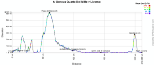
04/ Tuesday 10 May 2011 - Genova - Quarto dei Mille > Livorno - 216 km
The 4th stage of the Giro d'Italia 2011 follows the sea side from Quarto dei Mille to Livorno over 216 kilometers.At the start of the stage the riders will do a few short climbs before they arrive on top of the Passo del Bracco (3rd) after 62 kilometers. The rest of the stage is slightly downhill up to Livorno. A final loop will allow them to go find the last climb, in Castellacio (4th), of which the top will be attained after 200 kilometers. The finish line will be in Livorno after the descent of this last climb.
In this stage the feeding zone will be in Ceparana and the sprint on the coast in Lido di Camaiore.
Below you can find the time- and route schedule , the profile and the parcours on Google Maps for this stage. Click on each of the images to open them.


CONTINUE READING AFTER THIS ADVERTISEMENT
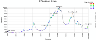
05/ Wednesday 11 May 2011 - Piombino > Orvieto - 191 km
This stage will bring back the strades bianchi or tratto sterrato in the final 40 kilometers between Piombino and Orvieto. This stage goes landwards to get to the climbs of Saragiolo (3rd) and of the Croce di Fighine (3rd) and to a final short climb close to the finish in Orvieto.The first dirt road section is uphill up to 15% towards the Croce di Fighine followed by a very technical descent, mainly on dirt roads as well. The second section is quite short and slightly uphill, while the third section is 9.5 kilometers long, mainly downhill.
Below you can find the time- and route schedule , the profile and the parcours on Google Maps for this stage. Click on each of the images to open them.


06/ Thursday 12 May 2011 - Orvieto > Fiuggi - 216 km
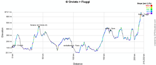
The 6th stage of the Giro d'Italia 2011 is one of the rare stages (there are only two of them) which start in the same city as where the race finished the day before, in this case in Orvieto. From this city, the riders go southwards, turning around Rome towards the finish in Fiuggi Terme. While the stage is quite hilly as a whole up until the finish (in the last 50 kilometers the riders will climb 630 meters), there's only one climb which awards points for the King of the Mountains classification of this Tour of Italy: the one in Soriano nel Cimino (4th).The feeding zone is in Fiano Romano and the intermediate sprint in Cave.
Below you can find the time- and route schedule , the profile and the parcours on Google Maps for this stage. Click on each of the images to open them.


07/ Friday 13 May 2011 - Maddaloni > Montevergine di Mercogliano - 110 km
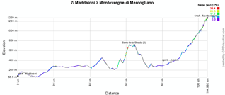
This Friday 13th will see the shortest stage of the Giro d'Italia 2011: most probably RCS, the organisor of the Giro d'Italia, didn't decide to make it so short for any superstitious riders. Indeed, this stage from Maddaloni to Montevergine di Mercogliano contains two big climbs: one which has its summit at 66 kilometers from the start, the Serra della Strada (2nd) and the final climb to Montevergine di Mercogliano (2nd). Between the two is a short climb which makes that there's no rest point in this stage.In this stage there won't be any feeding zone. The intermediate sprint will be in Avellino.
The finish in Montevergine di Mercogliano is the first mountain top finish out of a series of 8 in this Giro d'Italia 2011.
Below you can find the time- and route schedule , the profile and the parcours on Google Maps for this stage. Click on each of the images to open them.


08/ Saturday 14 May 2011 - Sapri > Tropea - 217 km
It's quite surprising for a Saturday to have a completely flat stage as the 8th stage, between Sapri and Tropea. This stage follows the coast line over 217 kilometers towards the foot of Italy.The feeding zone will be in Paola and the sprint close to the finish, in Vibo Valentia Marina.
Below you can find the time- and route schedule , the profile and the parcours on Google Maps for this stage. Click on each of the images to open them.


CONTINUE READING AFTER THIS ADVERTISEMENT
09/ Sunday 15 May 2011 - Messina > Etna - 169 km
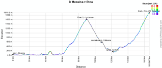
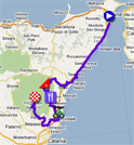
This Sunday's stage however is a stage as we could expect for a weekend (yes, that's important for TV spectators!) with the double climb of the Etna from two different sides ... well, that's how we'll call it because it's of course impossible to go to the top of the Etna. The first climb will be up to 1,631 meter and will be reached after 90 kilometers from the start in Messina while the finish will be on the other side of the volcano at 1,892 meters.Below you can find the time- and route schedule , the profile and the parcours on Google Maps for this stage. Click on each of the images to open them.

10/ Tuesday 17 May 2011 - Termoli > Teramo - 159 km
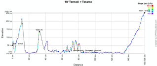
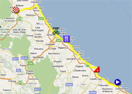
After the first rest day, this 10th stage is almost completely flat and follows the coast line: from the start in Termoli the riders will climb only a few hills including the climb of Vasto. When they leave the coast after 130 kilometers and go west they'll start a progressive climb to the finish in Teramo (almost +250 meters over 25 kilometers).Below you can find the time- and route schedule , the profile and the parcours on Google Maps for this stage. Click on each of the images to open them.

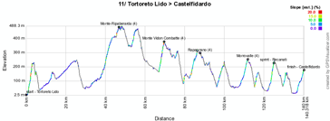
11/ Wednesday 18 May 2011 - Tortoreto Lido > Castelfidardo - 144 km
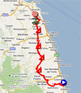
The 11th stage is a middle mountain stage which contains numerous hills of which 4 award points for the King of the Mountains classification, in the 4th category: Monte di Ripaberarda, Monte Vidon Combatte, Rapagnano and Morrovalle. 144 kilometers separate the start in Tortoreto Lido from the finish in Castelfidardo.Below you can find the time- and route schedule , the profile and the parcours on Google Maps for this stage. Click on each of the images to open them.

12/ Thursday 19 May 2011 - Castelfidardo > Ravenna - 184 km
Yet another stage following the coast line for an almost completely flat stage ... over 171 kilometers from Castelfidardo to Ravenna. When they arrive close to the finish, the riders will go coastwards to Punta Marina before turning back to the city center of Ravenna. The feeding zone will be in Cattolica and the sprint in Cesenatico.Below you can find the time- and route schedule , the profile and the parcours on Google Maps for this stage. Click on each of the images to open them.


CONTINUE READING AFTER THIS ADVERTISEMENT
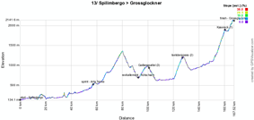
13/ Friday 20 May 2011 - Spilimbergo > Grossglockner - 167 km
The 13th stage is another mountain stage with mountain top finish, this time half on Italian soil and half on Austrian soil. From the start in Spilimbergo the riders immediately start to climb towards the Passo di Monte Croce Carmico (1,336 m) which seperates the two countries. Its top will be reached after about 80 kilometers.After the descent this stage's profile will be all but flat (with the Iselbergpass among others) but the real final climb starts at about 10 kilometers from the finish line for a mountain top finish on the Grossglockner (Kasereck, 2,137 m).
Below you can find the time- and route schedule , the profile and the parcours on Google Maps for this stage. Click on each of the images to open them.


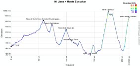
14/ Saturday 21 May 2011 - Lienz > Monte Zoncolan - 210 km
This second of three mountain stages in row is very difficult. After the start from Lienz in Austria the riders first climb the Passo di Monte Croce Comelico (1,636 m) and after its descent they will immediately continue with the Passo di Sant'Antonio (1,476 m) and the Passo della Mauria (1,298 m). After a hilly part of the stage they'll arrive in Ovaro where they'll start the climb of the Monte Crostis (1,982 m, 10.1% average and going up to a maximum of 18%) before returning to Ovaro to start the final climb of the famous Monte Zoncolan (1,730 m, a 1,200 meter climb over 10.1 km) this time.Below you can find the time- and route schedule , the profile and the parcours on Google Maps for this stage. Click on each of the images to open them.

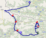
15/ Sunday 22 May 2011 - Conegliano > Gardeccia/Val di Fassa - 230 km
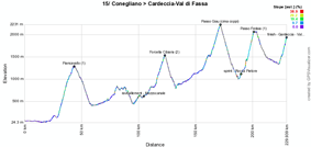
Last from a series of mountain stages with mountain top finish, the one between Conegliano and Gardeccia/Val di Fassa 230 kilometers further. 230 kilometers with the climb of Piancavallo (1,259 m), Forcella Cibiana (1,530 m), the Passo di Giau which will be the Giro d'Italia 2011 roof top (cima coppi) with its 2,236 meters, and the Passo Fedaia (2,057 m) for the final climb.The feeding zone will be in Mezzocanale and the sprint in Rocca Pietore.
Below you can find the time- and route schedule , the profile and the parcours on Google Maps for this stage. Click on each of the images to open them.

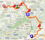
16/ Tuesday 24 May 2011 - individual time trial - Belluno > Nevegal - 12.7 km
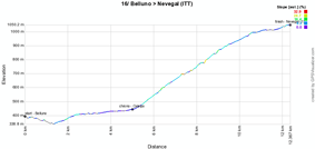
After the second rest day there's a short but difficult time trial. It will have a mountain top finish. After the start from the Piazza Martiri in Belluno the individual effort will start with a short descent to the easy start of the climb (2.9% over 3.5 km) followed by the heavy part of the climb: 4.4 km with an average steepness of 10.3% but including parts up to 14%. The end of this time trial is still uphill but a bit less steep than the previous part (an average of 4.8% in the last 3 kilometers).The last rider should finish the climb at around 5.15PM.
Below you can find the time- and route schedule , the profile and the parcours on Google Maps for this stage. Click on each of the images to open them.

CONTINUE READING AFTER THIS ADVERTISEMENT
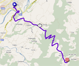
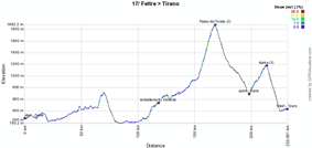
17/ Wednesday 25 May 2011 - Feltre > Tirano - 230 km
This 17th stage was planned to run between Feltre and Sondrio but for security reasons it was shortened to 230 kilometers and will finish in Tirano.It's a high mountain stage with the climbs of the Passo del Tonale (1.883 m, 2nd category), which has its summit after about 166 kilometers, and Aprica (1.173 m, 3rd category). After the descent from Aprica, the riders will go to the finish in Tirano.
Below you can find the time- and route schedule , the profile and the parcours on Google Maps for this stage. Click on each of the images to open them.

18/ Thursday 26 May 2011 - Morbegno > San Pellegrino Terme - 151 km
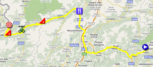
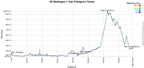
After the start from Morbegno the riders will follow the Como lake for a long time, where the Giro di Lombardia takes place every year, during this stage, before they go off towards Bergamo and to the Passo di Ganda (1,059 m, 2nd) climb followed by a descent to the finish in San Pellegrino Terme.The first part of the stage is flat up to the feeding zone in Ponte San Pietro and the sprint in Bergamo.
Below you can find the time- and route schedule , the profile and the parcours on Google Maps for this stage. Click on each of the images to open them.

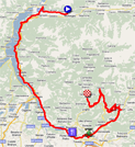
19/ Friday 27 May 2011 - Bergamo > Macugnaga - 209 km
After the start from Bergamo, this stage lets the riders pass north of Milan and than up towards Varese and the climb of the Mottarone (1,341 m, 1st) and after a flat part the final climb to the finish in Macugnaga (1,358 m, 3rd).Below you can find the time- and route schedule , the profile and the parcours on Google Maps for this stage. Click on each of the images to open them.


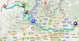
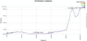
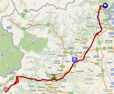
20/ Saturday 28 May 2011 - Verbania > Sestrière - 242 km
After the start from Verbania this forelast stage's route is almost completely flat but at the end of the stage it all gets a bit more complicated. After 196 kilometers the riders will start the climb of the Colle delle Finestre (2,178 m, +1,694 meters over 18.5 km) and the descent of this mountain will immediately be followed by the final climb towards Sestrière (2,035 m) where the riders of the Tour de France 2011 will also pass during the Gap > Pinerolo stage.Below you can find the time- and route schedule , the profile and the parcours on Google Maps for this stage. Click on each of the images to open them.

CONTINUE READING AFTER THIS ADVERTISEMENT
21/ Sunday 29 May 2011 - individual time trial - Milano > Milano - 26 km
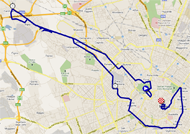
UPDATE: the route of this last stage has been modified; below you'll find the final version!As usual, the Giro d'Italia 2011 will finish with an individual time trial, this time in the streets of Milan. The riders will start in Fiera Milano and will go west up to Cerchiate before going back to Milan where their individual effort will continue with a loop around the city center towards the finish, Piazza Duomo. This stage's profile is completely flat.
Below you can find the time- and route schedule , the profile and the parcours on Google Maps for this stage. Click on each of the images to open them.


The Giro d'Italia 2011 race route in Google Earth
You've just discovered all details of the stages of this 94th edition of the Giro d'Italia with the time- and route schedules and the profiles of the stages and for each of them the parcours on Google Maps.If you'd like to check out the full race route of the Giro d'Italia 2011, you can download the KML file below to open it in Google Earth.
>> Download the Giro d'Italia 2011 race route in Google Earth
This file will not only allow you to see the full route in Google Earth, but also to do a virtual fly-over over the route of one or more of the stages. To do so, you can of course use the default settings of Google Earth, but if you want to do a fly-over which really gives you the idea you were on your bike riding on the roads of the Giro d'Italia 2011, I recommend you the following settings: in the menu Tools > Options choose the tab Touring and fill in the following choices on that tab:
- Camera tilt angle : 80.0 degrees
- Camera range : 150.0 meters
- Speed : 500.0 (if this makes you feel dizzy or if your computer or Internet connection don't allow you to get clear images with these settings, you can try lowering the speed) door Thomas Vergouwen
Vond u dit artikel interessant? Laat het uw vrienden op Facebook weten door op de buttons hieronder te klikken!
4 comments | 30099 views
this publication is published in: Giro d Italia | Giro d'Italia 2011 | OpenStreetMap/Google Maps/Google Earth


 by marco1988 over
Bravo et MERCI pour ce site Web trèa intéressant et rempli d'informations très utiles pour les amateurs de cyclo.
Aurons-nous la chance de pouvoir visionner le Tour de France 2011 comme celui du Giro actuellement ?
Pierre Mailhiot,
Québec, Canada
Skype: veloman9
Bonjour Véloman,
Merci pour ces compliments qui font toujours plaisir :-). Effectivement, comme d'habitude je m'attaque bientôt également à la préparation de la carte Google Maps du Tour de France 2011. Par contre, c'est pas mal de boulot, donc ça peut prendre encore un peu de temps avant que je puisse la publier ... Dans tous les cas, ce sera fait avant le départ du Tour !
Sportivement,
Thomas
Est-il possible de ''zoomer'' la carte du parcours de chacune des étapes ?
Ça serait bien en cliquant dessus la carte de nous amener directement dans l'app. de Google Maps.
Merci.
Le fonctionnement est le même que sur Google Maps. En ouvrant la carte d'une étape il suffit donc ensuite de double-cliquer sur la carte pour zoomer dessus ou d'utiliser le + et le - en haut à gauche pour zoomer ou dézoomer.