Monday 25 June 2012 at 00h25
initially published on 15 June at 9.05AM, updated on 19 June at 1.10AM and on 25 June at 0.25AM
In two weeks from now, the Tour de France 2012 will start in Belgium and more precisely in Liège. You already discovered the race route of the first stages on Google Maps/Google Earth and this article allows you to discover the race route of all stages, the profiles of the stages, the time and route schedules, but also detailed information about the exact start (fictive start and km 0) and finish places, sprints, et cetera ... but also the itineraries the riders will follow between the start and the km 0 of each of the stages.Finally, you'll find for each stage some additional information for example about the departments which are visited by stage, the characteristics of the finish line and information about the climbs.
The Tour de France 2012 race route on Google Maps
 ATTENTION: all the contents of this article are protected by the usual copyright and you are thus not allowed to use the contents or parts of it without my prior approval. This concerns all texts, images and KML files. The KML files can in no case be used without the velowire.com logo and a link to this site in addition to my prior approval for you to use it.
velowire.com has done every possible effort in order to trace the stages as precisely as possible, using mainly the detailed informations about starts, finishes and sprints available in the roadbook and not accessible to the public. However, it's of course still possible that the race route is slightly different when crossing one of the cities or villages on the race route. Therefore, use these informations where they come in handy, but ask locally to make sure you're at the right place to see the race come by!
CONTINUE READING AFTER THIS ADVERTISEMENT
P/ Saturday 30 June 2012 - Liège > Liège - 6,4 km
The Grand Départ of the Tour de France 2012 will take place in Belgium, in the Province of Liège and it'll all start with a 6.4 kilometer long prologue in the city Liège, which already received the Tour de France 10 times before!Before that, a before Tour programme will take place in Liège (in italic the events which are accessible to the public):
- Wednesday 27 June 2012
> 1.30PM: inauguration and opening of the Avant Tour Village at the Foire Internationale de Liège (FIL), Quai de Wallonie
> 2PM till 8PM: opening of the Permanence in the Country Hall, Complexe sportif et de spectacles Bois-Saint-Jean and of the press center at the same place (until 21PM) - Thursday 28 June 2012
> 9AM till 8PM: opening of the Permanence and the press center (till 10PM)
> 5.30PM: general team briefing (Directeurs sportifs and riders)
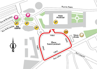 > 18h30 : team presentations of the Tour de France 2012 in front of the Palais Provincial, Place Saint-Lambert
~~ when the riders get of the presentation podium and in order to allow the public to see the riders of the Tour, the teams -accompanied by a selection of cars of the advertising caravan- will do a lap of a circuit around the Place Saint-Lambert - Friday 29 June 2012
> 9AM till 8PM: opening of the Permanence and the press center (till 10PM)
> 10.30AM/11.30AM/1.30PM/2PM/2.30PM/4.30PM/5PM/6PM: several meetings for the different actors of the Tour
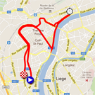
The prologue of the Tour de France 2012 on Saturday 30 June 2012 will almost form a circuit following the Avenue Rogier, the Boulevard d'Avroy, the Boulevard de la Sauvenière, the Rue de l'Université, the Place du 20 Août, the Quai Paul van Hoegaerden, the Quai Roosevelt, the Quai sur Meuse, the Quai de la Ribuée, the Quai de la Goffe, the Rue de la Cité, the Rue Léopold, Place Saint-Lambert, the Rue Joffre and finally again the Boulevard de la Sauvenière and the Boulevard d'Avroy.
With a total distance of 6.4 kilometers and with the big number of turns in the race route, it's pretty likely that a real time trial specialist will win this prologue and thus take the first yellow jersey. Therefore, it's not really surprising that in the official roadbook of the Tour de France 2012 one of the pages about this stage shows a photo of Fabian Cancellara (Radioshack-Nissan) on the same race route of this prologue in the Tour de France 2004 which he won back than.
Hereunder you'll find the time and route schedule, the profile and the race route on Google Maps for this stage. Click on each of the images to open them.


- the informations about the start of this stage:
- advertising caravan parking: Foire Internationale de Liège (FIL); crossing the finish line between 12PM and 12.25PM
- start: Parc d'Avroy. The riders will start every minute from the start ramp in the Avenue Rogier. First start: 2PM. Last start: 5.17PM - departments visited during this stage:
This stage will take place in Liège in Belgium, in the Province of Liège. - the informations about the finish of this stage:
- the finish line will be drawn in the Boulevard d'Avroy at the end of a final straight line of 100 meters and its width is 5.5 meters
- the press room will be in the Country Hall, Complexe Bois-Saint-Jean at 8 km from the finish (shuttle buses)
1/ Sunday 1 July 2012 - Liège > Seraing - 198 km
The first stage of the Tour de France 2012, 198 kilometers long, almost makes a loop, between Liège and Seraing. Five 4th category climbs will be part of this stage.After the start in Liège, the riders will go south-east via Chaudfontaine and Theux, on the roads which are close to those of Liège-Bastogne-Liège. They'll get to the first difficulty of this 99th edition of the Grande Boucle, the Côte de Cokafaigne (4th category), which will rapidly be followed by the Côte de Francorchamps (4th category).
Just after Malmedy they'll continue their trip to the west and climb the Côte de Lierneux (4th category) and find the feeding zone in Baraque de Fraiture, followed by the sprint in Erezée.
In Hotton they'll again turn north via the climb of the Côte de Barvaux (4th category) and than get to the finish by following the Meuse river in Seraing where they'll finish uphill (4th category).
Hereunder you'll find the time and route schedule, the profile and the race route on Google Maps for this stage. Click on each of the images to open them.


- the informations about the start of this stage:
- advertising caravan parking: Foire Internationale de Liège (FIL); crossing the finish line between 10.20AM and 10.45AM
- riders sign-in: from 10.55AM till 11.55AM
- start: Parc d'Avroy
- itinerary from the start to the km 0: 1.8 km via the Avenue Rogier, Boulevard d'Avroy, Rue Pont d'Avroy, Rue de la Cathédrale, Rue Léopold, Place Saint-Lambert where the official start ceremony will take place at 12.10PM
followed by 7.4 km via Rue Joffre, Boulevard de la Sauvenière, Boulevard d'Avroy, Quai de Rome, Pont de Fragnée, Square Gramme, Pont de Fétinne, Quai des Ardennes, N633, N30, Rue de la Station, Boulevard de Beaufraipont, N61
- km 0: 12h35 on the N61, at 7.4 km from the place where the official start ceremony takes place - departments visited during this stage:
This stage will take place in Belgium, in the Province of Liège (from km 0 till km 71, from km 84 till km 94 and from km 152.5 till km 198) and in the Province de Luxembourg (from km 73.5 till km 83 and from km 95.5 till km 149). - the sprint and the climbs of this stage
- the sprint will take place in Erezée just before a turn right, in the Rue du Général Borlon towards the Rue des Combattants
- the climbs of this stage:
> Côte de Cokafainge - 4th category - km 42 - 2.9 km at 5.1%
> Côte de Francorchamps - 4th category - km 49 - 1.1 km at 6.4%
> Côte de Lierneux - 4th category - km 94 - 2.1 km at 5.1%
> Côte de Barvaux - 4th category - km 139 - 1.6 km at 4.2%
> Côte de Seraing - 4th category - km 198 (finish) - 2.4 km at 4.7% - the informations about the finish of this stage:
- the finish line will be drawn in the Avenue du Centenaire at the end of a final straight line of 300 meters and its width is 6 meters, after a 2.4 km climb at 4,7%
- the press room will be in the Country Hall, Complexe Bois-Saint-Jean at 1 km from the finish (shuttle buses)
2/ Monday 2 July 2012 - Visé > Tournai - 207.5 km
The 2nd stage is the last stage which will be entirely in Belgium, from east to west, via Namur and the climb of the Côte de la Citadelle where the finish of the Grand Prix de Wallonie usually takes place.Hereunder you'll find the time and route schedule, the profile and the race route on Google Maps for this stage. Click on each of the images to open them.


- the informations about the start of this stage:
- advertising caravan parking: Rue de la Fontaine, Avenue Albert 1er, Avenue des Combatttants; crossing the finish line between 10.50AM and 11.15AM
- riders sign-in: from 11.25AM till 12.25PM
- start: Place Reine Astrid at 12.35PM
- itinerary from the start to the km 0: Avenue du Pont, Avenue Franklin Roosevelt, N618, OUPEYE, Square Roi Baudouin
- km 0: 12h40 on the N618, at 2 km from the start place - departments visited during this stage:
This stage will take place in Belgium, in the Province de Liège (from km 0 till km 57.5), in the Province de Namur (from km 61.5 till km 106), in the Province du Brabant Wallon (from km 112 till km 125) and in the Province de Hainaut (from km 110 till km 112 and from km 137 till km 207,5). - the sprint and the climbs of this stage
- the sprint will take place in Soignies on the Chaussée de Lessines
- the climbs of this stage:
> Côte de la Citadelle de Namur - 4th category - km 82.5 - 2.1 km at 4.5% - the informations about the finish of this stage:
- the finish line will be drawn in the Boulevard Bara at the end of a final straight line of 400 meters and its width is 7 meters
- the press room will be in the Hall des Sports close to the finish line
3/ Tuesday 3 July 2012 - Orchies > Boulogne-sur-Mer - 197 km
From the start of this very first stage in France, in Orchies, the riders will go north-west up to Estaires where they'll turn west. After having passed the feeding zone in Thérouanne, they'll get in the Boulonnais hill area. The sprint in Senlecques brings them to the different climbs of this stage (see details below) which will bring the riders zig-zagging to the finish in Boulogne-sur-Mer.The stage will end with a 700 meter long climb at 7,4% and it's thus probible that this stage will not end in a bunch sprint.
Hereunder you'll find the time and route schedule, the profile and the race route on Google Maps for this stage. Click on each of the images to open them.


- the informations about the start of this stage:
- advertising caravan parking: Zone de l'Europe; crossing the finish line between 10.45AM and 11.10AM
- riders sign-in: from 11.20 till 12.20PM
- start: Rue du Maréchal de Lattre de Tassigny at 12.30PM
- itinerary from the start to the km 0: Rue du Maréchal de Lattre de Tassigny, Rue Germain Delettrez, Rue Warocquier Rempart, Rue de la Poterne, Rue Claude Jean, Rue Charles Flon, D953, BEUVRY-LA-FORÊT, Rue Albert Ricquier, D953, D126, Rue Jules Plus
- km 0: 12h40 on the D126, at 4.4 km from the start place - departments visited during this stage:
This stage will cross the departments Nord (from km 0 till km 46.5 and from km 54.5 till km 64.5) and Nord-Pas-de-Calais (from km 50 till km 53 and from km 66 till km 197). - the sprint and the climbs of this stage
- the sprint will take place in Senlecques on the Chaussée Brunehaut, just after the crossing with the Rue du Bois de Senlecques
- the climbs of this stage:
> Côte de l'Éperche - 4th category - km 132 - 700 m at 6.9%
> Côte de Mont Violette - 3rd category - km 163,5 - 1 km at 9.2%
> Côte de Herquelingue - 4th category - km 181 - 1.7 km at 5.8%
> Côte de Quéhen - 4th category - km 185 - 1.4 km at 5.9%
> Côte de Mont Lambert - 3rd category - km 190.5 - 1.3 km at 8.4%
> Côte de Boulogne-sur-Mer - 4th category - km 197 (finish) - 700 meters at 7.4% - the informations about the finish of this stage:
- the finish line will be drawn in the Boulevard Eurvin at the end of a final straight line of 250 meters and its width is 6.5 meters, after a 700 m long climb at 7.4%
- the press room will be in the Stade de la Libération close to the finish line
CONTINUE READING AFTER THIS ADVERTISEMENT
4/ Wednesday 4 July 2012 - Abbeville > Rouen - 214.5 km
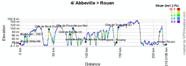
After the start in Abbeville, the peloton first goes to Le Tréport where they'll get on the coast line. From there, they'll have to pay attention to the wind with the risk of the peloton splitting up in different groups because they'll follow the coast line for no less than 40 kilometers, until Fécamp where they'll battle for the intermediate sprint.Going slightly landinwards the riders will climb three 4th category hills in this coastal part and after the sprint a last 4th category climb will be waiting for them. The finish in Rouen will be hidden gradient uphill.
Hereunder you'll find the time and route schedule, the profile and the race route on Google Maps for this stage. Click on each of the images to open them.


- the informations about the start of this stage:
- advertising caravan parking: former beet storage depot (former sugar factory Tereos); crossing the finish line between 10.25AM and 10.50AM
- riders sign-in: from 11.00AM till 12.00PM
- start: Boulevard Vauban at 12.10PM
- itinerary from the start to the km 0: Boulevard Vauban, Place de la Marne, Rue Saint-Gilles, Rue du Maréchal Foch, Place Max Lejeune, Rue du Pont aux Brouettes, Rue Saint-Vulfran, Place Bonaparte, Pont de Talance, Rue Jean Jaurès, Pont de la Gare, Boulevard Voltaire, D925, CAMBRON
- km 0: 12.25PM on the D925, at 6.4 km from the start place - departments visited during this stage:
This stage will cross the departments Somme (from km 0 till km 25.5 and at km 31.5) and Seine-Maritime (around km 29.5 and from km 33.5 till km 214.5). - the sprint and the climbs of this stage
- the sprint will take place in Fécamp in the Rue Gustave Couturier, just after the Stade
- the climbs of this stage:
> Côte du Mont Huon - 4th category - km 38 - 2.1 km at 4.1%
> Côte de Dieppe - 4th category - km 69 - 1.8 km at 3.9%
> Côte de Pourville-sur-Mer - 4th category - km 74 - 1.9 km at 4.4%
> Côte de Toussaint - 4th category - km 143 - 1.9 km at 4.5% - the informations about the finish of this stage:
- the finish line will be drawn in the Quai Jean Moulin at the end of a final straight line of 750 meters and its width is 6.5 meters
- the press room will be in the premises of the Conseil Général de Seine-Maritime close to the finish
5/ Thursday 5 July 2012 - Rouen > Saint-Quentin - 196.5 km
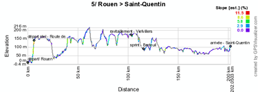
The 5th stage of the Tour de France 2012 is a real transition stage and a pure stage for sprinters with its completely flat profile which ends in a light uphill gradient flat.The race route between Rouen and Saint-Quentin is relatively direct with the feeding zone de ravitaillement in Viefvillers and the sprint in Bréteuil halfway in the stage.
Hereunder you'll find the time and route schedule, the profile and the race route on Google Maps for this stage. Click on each of the images to open them.


- the informations about the start of this stage:
- advertising caravan parking: Quai Cavelier de la Salle; crossing the finish line between 10.45AM and 11.10AM
- riders sign-in: from 11.20AM at 12.20PM
- start: Quai Jean Moulin at 12.30PM
- itinerary from the start to the km 0: Rue Saint-Sever, Cours Clemenceau, Place Carnot, Avenue Champlain, Pont Pierre Corneille, Quai Pierre Corneille, Quai de la Bourse, Rue Jeanne d'Arc, Rue Jean Lecanuet, Place du Général de Gaulle, Rue des Faulx, Rue Armand Carrel, Rue Martainville, Place du Canada, Boulevard Gambetta, Avenue Aristide Briand, Route de Bonsecourt, D6014, BONSECOURS, D914
- km 0: 12.45PM on the D914, at 6.8 km from the start place - departments visited during this stage:
This stage will cross the departments Seine-Maritime (from km 0 till km 12.5 and from km 54 till km 62), Eure (from km 14.5 till km 48.5), Oise (from km 73 till km 122), Somme (from km 127.5 till km 174) and Aisne (from km 179 till km 196.5). - the sprint and the climbs of this stage
- the sprint will take place in Breteuil in the Rue de Crèvecoeur just before the crossing with the Avenue du Général Frère
- the climbs of this stage:
no difficulties referenced in this stage - the informations about the finish of this stage:
- the finish line will be drawn in the Boulevard Gambetta at the end of a final straight line of 130 meters (last turn at 1.3 km) and its width is 6.5 meters
- the press room will be in the Palais des Sports Pierre Ratte close to the finish
6/ Friday 6 July 2012 - Épernay > Metz - 207,5 km
Another sprinters stage between Épernay and Metz on this Friday 6 July. Indeed, the short Côte de Buxières climb at 63 kilometers from the finish will not prevent the sprinters team to get in position for a bunch sprint finish.Hereunder you'll find the time and route schedule, the profile and the race route on Google Maps for this stage. Click on each of the images to open them.

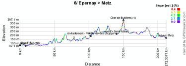

- the informations about the start of this stage:
- advertising caravan parking: Square Raoul Chandon; crossing the finish line between 10.30AM and 10.55AM
- riders sign-in: from 11.05AM till 12.05PM
- start: Place de la République at 12.15PM
- itinerary from the start to the km 0: Rue du Général Leclerc, Rue Saint-Martin, Place Auban-Moët, Place Léon Bourgeois, Boulevard de la Motte, Place Mendès France, Rue Jean Moët, Place de la République, Avenue de Champagne, D3, CHOUILLY, D9
- km 0: 12h30 on the D9, at 7.7 km from the start place - departments visited during this stage:
This stage will cross the departments Marne (from km 0 till km 78), Meuse (from km 82.5 till km 165.5), Meurthe-et-Moselle (from km 170.5 till km 179) and Moselle (from km 183.5 till km 207.5). - the sprint and the climbs of this stage
- the sprint will take place in Saint-Mihiel in the Avenue de la 40ème Division
- the climbs of this stage:
> Côte de Buxières - 4th category - km 145 - 2.7 km at 3.8% - the informations about the finish of this stage:
- the finish line will be drawn in the Avenue Louis le Débonnaire at the end of a final straight line of 700 meters and its width is 6.5 meters
- the press room will be in the Arènes close to the finish
7/ Saturday 7 July 2012 - Tomblaine > La Planche des Belles Filles - 199 km
For the start of this second weekend of the Tour de France 2012, ASO prepared a big show with this 7th stage. After the start from Tomblaine close to Nancy, the stage starts flat until Grandvillers. Even though the Col de Grosse Pierre of the 3rd category is only 3.1 km long, the progressive climb already starts there, over about 35 kilometers. The Col du Mont Fourche only seems a very short climb compared to this first difficulty of the day but the real firework will wait for the finish, at La Planche des Belles Filles. Indeed, this plateau above Plancher-les-Mines will be reached after a 5.9 km climb at 8,5% average but looking at the profile of the climb, we see that it starts with a 13% part and ends, after a short flatter part, with 300 meters at 14% average and with a 60 meter part at 20%.The question is whether we'll see, as ASO hopes, the first real explanations between the guys of the general classification on top of this climb? If that's the case, we'll know whether the investments necessary to prepare this spot for the finish were worth the money!
Hereunder you'll find the time and route schedule, the profile and the race route on Google Maps for this stage. Click on each of the images to open them.

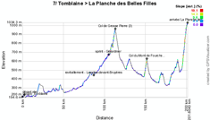

- the informations about the start of this stage:
- advertising caravan parking: Aéroport de Nancy-Essey; crossing the finish line between 10.25AM and 10.50AM
- riders sign-in: from 11.00AM till 12.00PM
- start: Avenue de la Paix at 12.10PM
- itinerary from the start to the km 0: Avenue de la Paix, Boulevard Henri Barbusse, Rue du 11 Novembre, Boulevard Tolstoï, Chemin du Bois de la Dame, D2B
- km 0: 12h15 on the D2B, at 1.9 km from the start place - departments visited during this stage:
This stage will cross the departments Meurthe-en-Moselle (from km 0 till km 50), Vosges (from km 51.5 till km 150.5) and Haute-Saône (from km 153.5 till km 199). - the sprint and the climbs of this stage
- the sprint will take place in Gérardmer in the Rue Charles de Gaulle, just before the zig-zag in the city via the Rue Carnot, Boulevard Kelsch / Boulevard Adolphe Garnier, Rue Lucienne and the D486
- the climbs of this stage:
> Col de Grosse Pierre - 3rd category - km 112 - 3.1 km at 6.4%
> Col du Mont de Fourche - 3rd category - km 150.5 - 3.1 km at 6.4%
> La Planche des Belles Filles - 1st category - km 199 (finish) - 5.9 km at 8.5% - the informations about the finish of this stage:
- the finish line will be drawn at La Planche des Belles Filles at the end of a final straight line of 250 meters and its width is 5.5 meters, after a 5.9 km long climb at 8,5% of which the last 300 meters are at 14% average and containing a 60 meters portion at 20%
- the press room will be in the Bâtiment Industriel, Route Départementale 4 - Champagney at 16 km from the finish while a press spot will be set up in the Salle des Fêtes de Plancher-les-Mines at 7 km from the finish
CONTINUE READING AFTER THIS ADVERTISEMENT
8/ Sunday 8 July 2012 - Belfort > Porrentruy (CH) - 157.5 km
Just like for the Liège > Seraing stage earlier in this Tour de France 2012, this 8th stage will almost not move around ... indeed, the direct distance between Belfort and Porrentruy in Switzerland is only 37 kilometers but via the Swiss Jura, the distance of this stage will reach 157.5 kilometers with no less than 7 difficulties being part of this stage.Hereunder you'll find the time and route schedule, the profile and the race route on Google Maps for this stage. Click on each of the images to open them.

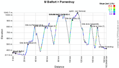

- the informations about the start of this stage:
- advertising caravan parking: Rue Louis Aragon and Rue Xavier Bauer; crossing the finish line between 11.15AM and 11.40AM
- riders sign-in: from 11.50AM till 12.50PM
- start: Marché Fréry/Rue Georges Clemenceau at 1PM
- itinerary from the start to the km 0: Rue Georges Clemenceau, Place Yitzhak Rabin, Faubourg des Ancêtres, Faubourg de Montbéliard, Boulevard Richelieu, Avenue du Général de Gaulle, Rue de Danjoutin, D23, DANJOUTIN, Rue du Bosmont, Rue des Anciens Combattants, Rue du Docteur Fréry, Rue du Docteur Jacquot, Place Roosevelt, Pont on the Savoureuse, Rue du Général de Gaulle, D19, Route de Montbéliard, BOTANS
- km 0: 1.15PM on the D19, at 6.4 km from the start place - departments visited during this stage:
This stage will cross the departments Territoire de Belfort (from km 0 till km 4) and Doubs (from km 6.5 till km 64) in France and in Switzerland the Canton du Jura (from km 68 till km 107 and from km 119 till km 157.5) and the Canton du Berne (from km 109.5 till km 112.5). - the sprint and the climbs of this stage
- the sprint will take place in Les Genevez in Switzerland at the entry of the village
- the climbs of this stage:
> Côte de Bondeval - 4th category - km 20 - 4.4 km at 3.9%
> Côte du Passage de la Douleur - 3rd category - km 32 - 3.8 km at 6.4%
> Côte de Maison-Rouge - 2nd category - km 50 - 7.9 km at 5%
> Côte de Saignelégier - 2nd category - km 73 - 7.8 km at 6.1%
> Côte de Saulcy - 2nd category - km 97 - 4.6 km at 8.6%
> Côte de la Caquerelle - 2nd category - km 130.5 - 4.3 km at 7.6%
> Col de la Croix - 1st category - km 141.5 - 3.7 km at 9.2% - the informations about the finish of this stage:
- the finish line will be drawn in the Route de Courtedoux at the end of a final straight line of 700 meters and its width is 6 meters
- the press room will be in a tent at the former airport of Porrentruy next to the finish line
9/ Monday 9 July 2012 - Arc-et-Senans > Besançon - ITT - 41.5 km
The detour in Switzerland will finally be pretty short because for this individual time trial, the riders turn back to France for the start in Arc-et-Senans, where they'll start in front of the Saline Royale, which will definitely make this start magic!They'll than be off for an individual effort over 41.5 kilometers towards Besançon on a pretty flat race route.
Hereunder you'll find the time and route schedule, the profile and the race route on Google Maps for this stage. Click on each of the images to open them.

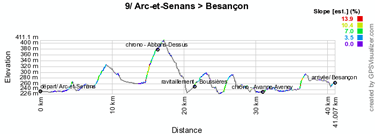
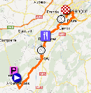
- the informations about the start of this stage:
- advertising caravan parking: cycling lanes and parking spots in the woods of Chaux; crossing the finish line between 8.40AM and 9.05AM
- starts: Esplanade de la Saline Royale with riders starting every 2 minutes and every 3 minutes for the last 20 riders
> start of the first rider: 9.45AM (finish: 10.37AM)
> start of the last rider: 4.39PM (finish: 5.31PM) - the informations about the finish of this stage:
- the finish line will be drawn in the Boulevard Ouest at the end of a final straight line of 100 meters (last turn at 400 meters) and its width is 5.5 meters
- the press room will be in Micropolis, in the middle of the last turn of the race route
R1/ Tuesday 10 July 2012 - rest day in Mâcon
After 9 stages, Tuesday 10 July will be the first rest day of this Tour de France 2012.- the press room will be at the Cité de l'Entreprise, 200 Boulevard de la Résistance in Mâcon and will be open from 11AM till 9PM
10/ Wednesday 11 July 2012 - Mâcon > Bellegarde-sur-Valserine - 194.5 km
After the start from Mâcon, the peloton descends via Saint-Didier-sur-Chalaronne to Saint-Trivier-sur-Moignans, the city wher the Mavic is located (the company which does the neutral race support in all races organised by ASO). That's where the riders will join the race route of the 5th stage of the Critérium du Dauphiné 2012 recently won by Brad Wiggins, which they'll than follow up to Injoux over 153 kilometers via the Côte de Corlier, the Col du Grand Colombier (too far from the finish to have a real influence on the stage result) and the Col de Richemond. In Injoux we turned right to go down back to Rumilly in the Critérium du Dauphiné, but in the Tour de France we'll continue straight to the finish in Bellegarde-sur-Valserine.Hereunder you'll find the time and route schedule, the profile and the race route on Google Maps for this stage. Click on each of the images to open them.

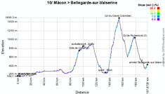

- the informations about the start of this stage:
- advertising caravan parking: Avenue Édouard Herriot; crossing the finish line between 10.30AM and 10.55AM
- riders sign-in: from 11.05AM till 12.05PM
- start: Esplanade Lamartine at 12.15PM
- itinerary from the start to the km 0: Quai Lamartine, Place Poissonnière, Rue Sigorgne, Rue de la Barre, Rue de l'Héritan, Rue du 11 Novembre 1918, Cours Moreau, Rue du 28 June 1944, Quai Jean Jaurès, Pont de Saint-Laurent, SAINT-LAURENT-SUR-SAÔNE, Route du Pont Vert, D51
- km 0: 12.25PM on the D51, at 4.2 km from the start place - departments visited during this stage:
This stage will cross the departments Saône-et-Loire (start) and Ain (km 4 till km 194.5). - the sprint and the climbs of this stage
- the sprint will take place in Béon close to the Luyrieu area
- the climbs of this stage:
> Côte de Corlier - 2nd category - km 90 - 6.4 km at 5.5%
> Col du Grand Colombier - hors category - km 151.5 - 17.4 km at 7.1%
> Col de Richemond - 3rd category - km 174 - 7.2 km at 5% - the informations about the finish of this stage:
- the finish line will be drawn in the Avenue Saint-Exupéry at the end of a final straight line of 280 meters (last turn at 1.2 km) and its width is 6 meters
- the press room will be in the Lycée Saint-Exupéry close to the finish
CONTINUE READING AFTER THIS ADVERTISEMENT
11/ Wednesday 12 July 2012 - Albertville > La Toussuire - Les Sybelles - 148 km
This 11th stage will be a real mountain stage with 2 hors category climbs (the Col de la Madeleine and the Col de la Croix de Fer) and a mountain top finish in La Toussuire (1st category).The start from Albertville starts flat, over 14.5 kilometers up to Feissons-sur-Isère where the climb of the Col de la Madeleine starts over 25.3 kilometers and with an average slope of 6.2% (of which some parts at 9.5%). After the descent there will be a quiet moment over about ten kilometers, up to the sprint in Saint-Etienne-de-Cuines where the 22.4 kilometer long climb of the Col de la Croix de Fer starts (6.9% average and with one bit at 10%). Its descent will continue in the Col du Mollard (2nd category) which will be followed by the final climb towarss La Toussuire (18 kilometers at 6.1%) of which the first part will be the most difficult.
Hereunder you'll find the time and route schedule, the profile and the race route on Google Maps for this stage. Click on each of the images to open them.

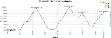

- the informations about the finish of this stage:
- advertising caravan parking: Parc du Nant Pottier; crossing the finish line between 11.20AM and 11.45AM
- riders sign-in: from 11.55AM till 12.55PM
- start: Parc Olympique / Avenue Joseph Fontanet at 1.05PM
- itinerary from the start to the km 0: Avenue Joseph Fontanet, Rue Commandant Dubois, Rue Docteur Jean-Baptiste Mathias, Place Commandant Bulle, Rue de la République, Place de la Liberté, Rue Bugeaud, Quai des Allobroges, Pont des Adoubes, Place Charles Albert, Avenue de Tarentaise, Route de Tours, D990
- km 0: 1.20PM on the D990, at 6.3 km from the start place - departments visited during this stage:
This stage will cross the department Savoie (from km 0 to km 148). - the sprint and the climbs of this stage
- the sprint will take place in Saint-Etienne-de-Cuines in the Avenue de la Gare just after the riders passed the cemetery
- the climbs of this stage:
> Col de la Madeleine - hors category - km 40 - 25.3 km at 6.2%
> Col de la Croix de Fer - hors category - km 93 - 22.4 km at 6.9%
> Col du Mollard - 2nd category - km 113 - 5.7 km at 6.8%
> La Toussuire - 1st category - km 148 (finish) - 18 km at 6.1% - the informations about the finish of this stage:
- the finish line will be drawn on the Rue des Fondeurs at the end of a final straight line of 160 meters and its width is 6 meters, after a final 18 km climb at 6.1%
- the press room will be in a tent in La Toussuire close to the finish line
12/ Friday 13 July 2012 - Saint-Jean-de-Maurienne > Annonay Davézieux - 226 km
For the superstitious riders in the Tour de France 2012 peloton, this 12nd stage is probably not the one they'll pick from the roadbook since it will take place on Friday 13 July, between Saint-Jean-de-Maurienne and Davézieux close to Annonay.This stage has quite a particular profile with two 1st category climbs early in the stage (the Col de Grand Cucheron and the Col du Granier) followed by about 140 kilometers which contain only a 3rd category climb at 19 kilometers from the finish, the Côte d'Ardoix. This almost seems to be a perfect stage for Jérémy Roy for a long lasting breakaway to be started in one of the two climbs early in the stage ...
Hereunder you'll find the time and route schedule, the profile and the race route on Google Maps for this stage. Click on each of the images to open them.

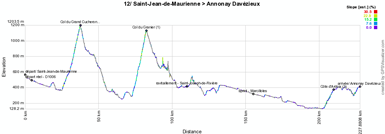
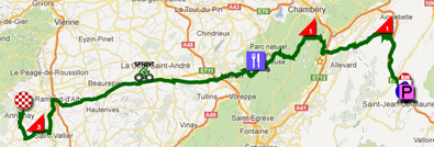
- the informations about the finish of this stage:
- advertising caravan parking: just like in 2006, the advertising caravan parking will be on the Quai de l'Arvan; crossing the finish line between 9.15AM and 9.40AM
- riders sign-in: from 9.50AM till 10.50AM
- start: Place Fodéré / Rue de la Libération at 11.00AM
- itinerary from the start to the km 0: Rue de la Libération, D906, D1006
- km 0: 11.10AM on the D1006, at 3.6 km from the start place - departments visited during this stage:
This stage will cross the departments Savoie (from km 0 to km 54 and from km 80.5 to km 89.5), Isère (from km 61 to km 74 and from km 90 to km 159.5), Drôme (from km 167 to km 193.5) and finally the Ardèche (from km 194.5 to km 226). - the sprint and the climbs of this stage
- the sprint will take place in Marcilloles in the Avenue des Alpes at the crossing with the Chemin des Contaminés
- the climbs of this stage:
> Col du Grand Cucheron - 1st category - km 34 - 12.5 km at 6.5%
> Col du Granier - 1st category - km 80.5 - 9.7 km at 8.6%
> Côte d'Ardoix - 3rd category - km 207.5 - 5.9 km at 3.4% - the informations about the finish of this stage:
- the finish line will be drawn on the Rue de la Lombardière at the end of a final straight line of 400 meters and its width is 6 meters
- the press room will be at the Espace Montgolfier at 1.3 km from the finish
13/ Saturday 14 July 2012 - Saint-Paul-Trois-Châteaux > Le Cap d'Agde - 217 km
This stage will be made for sprinters ... who manage to get over a small climb! (if they've managed to make it through the previous stages, this is most probably the case). Indeed, it might seem surprising for a Saturday and even more since it's on the 14th of July (national bank holiday in France), but this stage shows an almost completely flat profile between Saint-Paul-Trois-Châteaux and Le Cap d'Agde. An access to the Cap d'Agde via Sète allows the race to climb the Mont Saint-Clair (3rd category) by crossing the city from north-east to south-west and continue along the Etang de Thau towards the finish in Le Cap d'Agde.Hereunder you'll find the time and route schedule, the profile and the race route on Google Maps for this stage. Click on each of the images to open them.


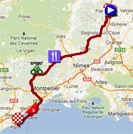
- the informations about the finish of this stage:
- advertising caravan parking: Parking Saint-Paul 2003 and omnisports terrain; crossing the finish line between 9.45AM and 10.10AM
- riders sign-in: from 10.35AM till 11.35AM
- start: Le Courreau at 11.45AM
- itinerary from the start to the km 0: le Courreau, Place de la Libération, Avenue du Général de Gaulle, Avenue des Côteaux du Tricastin, D59, Route de Pierrelatte, PIERRELATTE (près), D59
- km 0: 11.55AM on the D59, at 5.5 km from the start place - departments visited during this stage:
This stage will cross the departments Drôme (from km 0 to km 1.5), Vaucluse (from km 7 to km 14), Gard (from km 17 to km 104.5) and Hérault (from km 109 to km 217). - the sprint and the climbs of this stage
- the sprint will take place in Mas-de-Londres just before the entrance of the village on the Route de Saint-Mathieu
- the climbs of this stage:
> Mont Saint-Clair - 3rd category - km 194 - 1.6 km at 10.2% - the informations about the finish of this stage:
- the finish line will be drawn on the Rond-Point du Bon Accueil at the end of a final straight line of 200 meters and its width is 6.5 meters
- the press room will be in the Centre International de Tennis at 400 m from the finish
14/ Sunday 15 July 2012 - Limoux > Foix - 191 km
While the first half of this stage after the start from Limoux is relatively flat (except from the Col du Portel of the 2nd category), the second half contains two first category climbs: the Port de Lers and the Col de Péguère which is so steep in the last 4 kilometers that ASO calls it the Mur de Péguère. From there, the riders are only fourty kilometers separated from the finish in Foix, where they enter from the north after a detour via Saint-Jean-de-Verges.Hereunder you'll find the time and route schedule, the profile and the race route on Google Maps for this stage. Click on each of the images to open them.


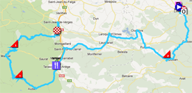
- the informations about the finish of this stage:
- advertising caravan parking: Place d'Aude; crossing the finish line between 10.35AM and 11.00AM
- riders sign-in: from 11.10AM till 12.10PM
- start: Esplanade François Mitterrand / Avenue Fabre d'Eglantine at 12.20PM
- itinerary from the start to the km 0: Avenue Fabre d'Églantine, Avenue de Catalogne, D118
- km 0: 12.25PM on the D118, at 2.6 km from the start place - departments visited during this stage:
This stage will cross the departments Aude (from km 0 to km 55.5) and Ariège (from km 60 to km 191). - the sprint and the climbs of this stage
- the sprint will take place in Tarascon-sur-Ariège in the Avenue Victor Pilhes, just after having passed the town hall
- the climbs of this stage:
> Col du Portel - 2nd category - km 30 - 5.3 km at 6.3%
> Port de Lers - 1st category - km 126.5 - 11.4 km at 7%
> Mur de Péguère - 1st category - km 152.5 - 9.3 km at 7.9% - the informations about the finish of this stage:
- the finish line will be drawn in the Allées de Villote at the end of a final straight line of 290 meters and its width is 6.5 meters
- the press room will be in the covered Tennis court and in a tent in the Complexe Sportif de l'Ayroule at 1.5 km from the finish
CONTINUE READING AFTER THIS ADVERTISEMENT
15/ Monday 16 July 2012 - Samatan > Pau - 158.5 km
Not far from Toulouse, in Samatan the riders will start this 15th stage over a 158.5 kilometer long distance towards Pau. At the end of this stage, 3 climbs in the 3rd and 4th category will bring some animation in this stage but apart from that it seems to be made for sprinters.Hereunder you'll find the time and route schedule, the profile and the race route on Google Maps for this stage. Click on each of the images to open them.


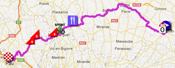
- the informations about the finish of this stage:
- advertising caravan parking: parking de l'Enclos de l'Hôpital; crossing the finish line between 11.55AM and 12.20PM
- riders sign-in: from 12.30PM till 1.30PM
- start: Place des Cordeliers / Avenue de Lombez at 1.40PM
- itinerary from the start to the km 0: Avenue de Lombez, D39, LOMBEZ, Boulevard des Pyrénées, Avenue des Trois Rois, D626
- km 0: 1.50PM on the D626, at 3.7 km from the start place - departments visited during this stage:
This stage will cross the departments Gers (from km 0 to km 89.5), Hautes-Pyrénées (from km 101.5 to km 110.5) and Pyrénées-Atlantiques (from km 114 to km 158.5). - the sprint and the climbs of this stage
- the sprint will take place in Maubourguet at the end of the Avenue d'Auch just beforn a right turn towards the Rue du Régiment de Bigorre
- the climbs of this stage:
> Côte de Lahitte-Toupière - 4th category - km 107 - 2.1 km at 5.3%
> Côte de Simacourbe - 3rd category - km 123,5 - 1.9 km at 6.3%
> Côte de Monassut-Audiracq - 4th category - km 129 - 1.5 km at 5.4% - the informations about the finish of this stage:
- the finish line will be drawn on the Place de Verdun (Rue du Maquis Le Béarn) at the end of a final straight line of 600 meters and its width is 8.5 meters
- the press room will be in the Palais Beaumont at 1.5 km from the finish
R2/ Tuesday 17 July 2012 - rest day in Pau
After 15 stages, the peloton once again stays in Pau on this Tuesday 17 July for the second rest day of this Tour de France 2012.- - the press room will be in the Palais Beaumont, Allée Alfred de Musset in Pau and will be open from 11.00AM till 9.00PM
16/ Wednesday 18 July 2012 - Pau > Bagnères-de-Luchon - 197 km
This 16th stage allows immediately after the rest day to go on with a high mountain stage in the Pyrenees. Indeed, during this stage, which will start in Pau, the riders will climb no less than two hors category and two first category climbs, all of them being mountains which have made the history of the Tour de France: the Col d'Aubisque (HC), the Col du Tourmalet (HC), the Col d'Aspin (1st category) and the Col de Peyresourde (1st category).These referenced climbs together represent 57.3 kilometers of climbing out of the 197 which is the total number of kilometers for this stage. The top of the Col de Peyresourde being at 16.5 kilometers from the finish and the finish in Bagnères-de-Luchon being at the bottom of the descent, it is well possible that the rider which starts the descent first wins the stage if his time gap is sufficient.
Hereunder you'll find the time and route schedule, the profile and the race route on Google Maps for this stage. Click on each of the images to open them.


- the informations about the start of this stage:
- advertising caravan parking: Stade du Hameau; crossing the finish line between 9.20AM and 9.45AM
- riders sign-in: from 9.55AM till 10.55AM
- start: Palais Beaumont / Boulevard des Pyrénées at 11.05AM
- itinerary from the start to the km 0: Boulevard des Pyrénées, Rue Adoue, Rue Henri IV, Rue Sully, Rue Bordenave d'Abère, Place Gramont, Rue de Liège, Rue Bordelongue, Place de Verdun, Rue du Maquis de Béarn, Rue Bayard, Avenue du 18e Régiment d'Infanterie, Avenue Gaston Phoebus, JURANÇON, Avenue des Vallées, Rue du Colonel Gloxin, Rue Jacques Terrier, Rue du 14 July, Avenue Henri IV, N134
- km 0: 11.20AM on the N134, at 6.8 km from the start - departments visited during this stage:
This stage will cross the departments Pyrénées-Atlantiques (from km 0 to km 53,5), Hautes-Pyrénées (from km 63 to km 181,5) and the Haute-Garonne (from km 187 to km 197). - the sprint and the climbs of this stage
- the sprint will take place in Bielle close to l'Ayguelade (where the camping is)
- the climbs of this stage:
> Col d'Aubisque - hors category - km 53.5 - 16.4 km at 7.1%
> Col du Tourmalet (Souvenir Jacques Goddet) - hors category - km 120.5 - 19 km at 7.4%
> Col d'Aspin - 1st category - km 150.5 - 12.4 km at 4.8%
> Col de Peyresourde - 1st category - km 181.5 - 9.5 km at 6.7% - the informations about the finish of this stage:
- the finish line will be drawn in the Boulevard Edmond Rostand at the end of a final straight line of 180 meters and its width is 6 meters
- the press room will be in the Lycée Edmond Rostand and in the Gymnase at 600 m from the finish
17/ Thursday 19 July 2012 - Bagnères-de-Luchon > Peyragudes - 143.5 km
While many teams will have slept just on the other side of the border, in Spain, this 17th stage will start in the city where the previous stage ended, Bagnères-de-Luchon. This stage will almost do a loop since the riders will come to a point at only 25 kilometers from there while going to the finish line which will be drawn in the Peyragudes station. In the mean time they'll have climbed a mountain of first, 2nd and 3rd category, plus the Port de Balès which is hors category and the final climb towards Peyragudes which is referenced as 1st category at 1 kilometer from the finish line (the final kilometer is flat).Just like for La Planche des Belles Filles, the finish in Peyragudes will use a completely new route which gives a more direct access to the station than the one which existed before and which will be less exposed to the risk of becoming unaccessible in the winter.
Hereunder you'll find the time and route schedule, the profile and the race route on Google Maps for this stage. Click on each of the images to open them.


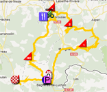
- the informations about the start of this stage:
- advertising caravan parking: Boulevard Dardenne / Place Lezat / Boulevard Edmond Rostand; crossing the finish line between 11.10AM and 11.35AM
- riders sign-in: from 11.45AM till 12.45PM
- start: Allées d'Étigny at 12.55PM
- itinerary from the start to the km 0: Allées d'Étigny, Place Joffre, Avenue Carnot, Avenue Foch, Rue Alexander Fleming, Rue Clément Ader, Rue Louis Aragon, D125
- km 0: 1.00PM on the D125, at 2.9 km from the start - departments visited during this stage:
This stage will cross the departments Haute-Garonne (from km 0 to km 79 and from km 117.5 to km 137) and the Hautes-Pyrénées (from km 81 to km 111.5 and from km 139.5 to km 143.5). - the sprint and the climbs of this stage
- the sprint will take place in Loures-Barouse on the Rue Nationale (not far from the Côte de Burs)
- the climbs of this stage:
> Col de Menté - 1st category - km 27.5 - 9.3 km at 9.1%
> Col des Ares - 2nd category - km 55.5 - 6 km at 5.3%
> Côte de Burs - 3rd category - km 76 - 1.2 km at 7.6%
> Port de Balès - hors category - km 111.5 - 11.7 km at 7.7%
> Peyragudes - 1st category - km 142.5 - 15.4 km at 5.1% - the informations about the finish of this stage:
- the finish line will be drawn on the Plateforme Privilège at the end of a final straight line of 80 meters and its width is 6 meters
- the press room will be in the Lycée Edmond Rostand and in the Gymnase in Bagnères-de-Luchon at 17 km from the finish
CONTINUE READING AFTER THIS ADVERTISEMENT
18/ Friday 20 July 2012 - Blagnac > Brive-la-Gaillarde - 222.5 km
After a long transfer (remember, on 11 October 2011 already, I called the Tour de France 2012 a Tour made of transfers and I indicated that 162 kilometers separate Peyragudes from Blagnac!), the riders will start this forelast stage in line in Blagnac. This will be a transition stage which allows to get a little bit more up north and it will allow a sprinter of probably even more a puncher to add a stage of the Tour to his palmarès at the finish in Brive-la-Gaillarde!Hereunder you'll find the time and route schedule, the profile and the race route on Google Maps for this stage. Click on each of the images to open them.


- the informations about the start of this stage:
- advertising caravan parking: Avenue du Parc; crossing the finish line between 9.20AM and 9h45AM
- riders sign-in: from 9.55AM till 10.55AM
- start: Parc des Ramiers / Rue Jean Moulin at 11.05AM
- itinerary from the start to the km 0: Rue Jean Moulin, Chemin des Ramiers, Rue Paul Valéry, Chemin de Barrieu, Rue François Carrière, Vieux chemin de Grenade, Rue Henri Matisse, Route de Grenade, Avenue Georges Brassens, Avenue George Sand, Avenue d'Andromède, Avenue d'Aéroconstellation, Rue André Beteille, D824, D902, D2
- km 0: 11.20AM on the D2, at 8.4 km from the start - departments visited during this stage:
This stage will cross the departments Haute-Garonne (from km 0 to km 10.5), Tarn-et-Garonne (from km 21 to km 81.5), Lot (from km 84 to km 193) and Corrèze (from km 196.5 to km 222.5). - the sprint and the climbs of this stage
- the sprint will take place in Cahors on the Boulevard Léon Gambetta, which is slightly uphill
- the climbs of this stage:
> Côte de Saint-Georges - 3rd category - km 67.5 - 1 km at 10.3%
> Côte de Cahors - 4th category - km 117.5 - 1 km at 7.8%
> Côte de Souillac - 4th category - km 180.5 - 2.2 km at 4.7%
> Côte de Lissac-sur-Couze - 4th category - km 212.5 - 1.9 km at 5.7% - the informations about the finish of this stage:
- the finish line will be drawn in the Avenue Léo Lagrange at the end of a final straight line of 600 meters and its width is 6.5 meters
- the press room will be at the Espace Derichebourg close to the finish
19/ Saturday 21 July 2012 - Bonneval > Chartres - 53.5 km
After another long transfer, the riders of the Tour de France 2012 and its followers will have come close to Paris for a long individual time trial between Bonneval and Chartres. Over such a distance, the time gaps might become quite important and this forelast stage might thus still be able to influence the general classification, depending on the existing gaps before this stage, the riders being placed at the top of the classification and their performances in an individual timed effort. The race route is quite flat so it'll definitely not be the stage profile which will make the difference!Hereunder you'll find the time and route schedule, the profile and the race route on Google Maps for this stage. Click on each of the images to open them.


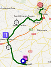
- the informations about the start of this stage:
- advertising caravan parking: Rue Saint-Gilles / Rue de la Croix Bougot; crossing the finish line between 9.25AM and 9.50AM
- start: Rue de la Résistance; the riders will leave every 2 minutes, except for the last ones who will leave every 3 minutes; first start: 10.35AM / last start: 4.33PM
- intermediate timing points: Mézières-au-Perche and Bailleau-le-Pin / feeding zone: Illiers-Combray - visited department:
This stage will cross the department Eure-et-Loire (from km 0 to km 53.5). - the informations about the finish of this stage:
- the finish line will be drawn in the Avenue Jean Mermoz at the end of a final straight line of 90 meters and its width is 5.5 meters
- the press room will be in the Halle Jean Cochet close to the finish
20/ Sunday 22 July 2012 - Rambouillet > Paris - Champs-Elysées - 120 km
This last stage is always a festive stage, with no real sportive interest. This will probably be the same during the 63 kilometers which separate Rambouillet from Paris and which will be completed with 6 kilometers until the circuit, followed by 9 crossings of the finish line to come to a total distance of 120 kilometers.Hereunder you'll find the time and route schedule, the profile and the race route on Google Maps for this stage. Click on each of the images to open them.


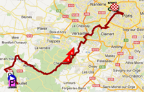
- the informations about the start of this stage:
- advertising caravan parking: Centre commercial Carrefour Market; crossing the finish line between 12PM and 12.30PM
- riders sign-in: from 12.50PM till 13.50PM
- start: Place Félix Faure / Rue Chasles at 2PM
- itinerary from the start to the km 0: Rue Chasles, Rue Sadi Carnot, Rue Gambetta, Rue Potocki, Rue de Penthièvre, Rue du Général de Gaulle, Place René Masson, Allée ouest du parc du Château, Rue Raymond Poincaré, Rue de la Motte, Rond-point du Souvenir Français, Place du 501e RCC, Rue de Groussay, D936
- km 0: 14h10 on the D936, at 4.2 km from the start - departments visited during this stage:
This stage will cross the departments Yvelines (from km 0 to km 39 and from km 43 to km 52.5), Essonne (around km 40.5), Hauts-de-Seine (from km 53 to km 61.5) and Paris (from km 63 to km 120). - the sprint and the climbs of this stage
- the sprint will take place in Paris on the heights of the Champs-Elysées
- the climbs of this stage:
> Côte de Saint-Rémy-lès-Chevreuse - 4th category - km 36.5 - 1.1 km at 6.7%
> Côte de Châteaufort - 4th category - km 40.5 - 900 m at 4.5% - the informations about the finish of this stage:
- the finish line will be drawn in the Avenue des Champs-Elysées at the end of a final straight line of 400 meters and its width is 9 meters
- the press room will be at the Hôtel Concorde La Fayette (where all riders will spend the night as well), 3 Place du Général Koenig, 75017 Paris at 4 km from the finish line
The race route of the Tour de France 2012 in Google Earth
Would you like to see all stages of the Tour de France 2012 in one view? Good news! You can! Indeed, you can download the KML file below and open it in Google Earth.>> Download the race route of the Tour de France 2012 in Google Earth
 ATTENTION: all the contents of this article are protected by the usual copyright and you are thus not allowed to use the contents or parts of it without my prior approval. This concerns all texts, images and KML files. The KML files can in no case be used without the velowire.com logo and a link to this site in addition to my prior approval for you to use it.
This file will not only allow you to see all stages at once in Google Earth but also to do a virtual fly-over of one or more of the stages. door Thomas Vergouwen
Vond u dit artikel interessant? Laat het uw vrienden op Facebook weten door op de buttons hieronder te klikken!
25 comments | 145523 views
this publication is published in: Tour de France | Tour de France 2012 | OpenStreetMap/Google Maps/Google Earth


 by marco1988 over
Y a certaines classifications de cols qui m'intriguent :
- Le col de la Croix, classé en 1C alors qu'un 2C aurait été plus approprié (Menté, Péguère et Granier, ayant un pourcentage similaire sur 9 km, sont aussi en 1C)
- La côte de Corlier que j'aurais aussi mis en 3C (tout comme le col des Ares, qui est moins haut, plus court, à peine moins raide et pourtant c'est un 2C depuis longtemps). Et j'aurais à la limite mis le Richemond en 2C.
Sinon en général les classifications sont bonnes, et le Grand Colombier qui devient la 36ème ascension Hors Catégorie de l'histoire du Tour, et le premier HC du Jura. C'est aussi le premier HC hors des Alpes et des Pyrénées depuis que le Puy de Dôme ne peut plus accueillir le Tour ! (Si on considère que le Ventoux fait partie des Alpes).
D'ailleurs, en parlant du Jura, je crois que le Mont du Chat serait aussi un HC, au vu de ses pourcentages et de sa longueur.
A l'attention de Linkinito: le grand colombier se trouve dans l'ain et le mont du chat en savoie, tout les deux en région rhone alpes alors que le jura se trouve en region franche comté.
Cordialement,
Pierre
Pierre, je parlais du Jura en tant que massif montagneux, et non en tant que département !
Le Mont du Chat et le Grand Colombier, malgré leur proximité évidente avec les Alpes, font bel et bien partie de la chaîne de montagnes du Jura, comme l'atteste Wikipédia. Ils sont juste situés à son extrême Sud :)
Bonjour à tous.Si vous voulez voir tous les détails du parcours,alors rendez vous sur: letour.fr Cordialment Martin
Heb vorige zaterdag de slotklim naar La Planche des Belles Filles gereden!
Dat wordt echt een spektakel klim. Denk inderdaad dat op het gloednieuwe asfalt aldaar de eerste klappen kunnen gaan vallen.
Een nieuwe asfaltlaag op La Planche was daar echt wel nodig. Zeer lastig. Boven is er evenwel NIETS, helemaal niets ! Gewoon een grote asfaltparking, beet je vergelijkbaar met Hautacam. Voor de toeschouwers wordt het drummen.
J'habite Liège et je suis encore très impatient à l'idée que le tour démarre encore une fois d'ici !!
Bonjour
Je suis allé faire un tour du côté du final de l'étape de la Planche des Belles Filles (du col de la Chevestraye à l'arrivée)
- la descente (environ 2 km) est rapide dans sa première partie, plus technique dans la seconde
- dans le village de Plancher les Mines : les décos et panneaux d'interdiction fleurissent, la route a été entièrement rénovée dans les deux-tiers du village
- dans la montée : une grosse moitié de la route a été refaite ; attention il sera impossible de se garer dans la montée, des navettes gratuites sont mises en place par le CG 70, il faut aller voir leur site
J'ai fait quelques photos de la montée et de l'arrivée, si cela vous intéresse je peux les mettre en ligne si cela ne dérange pas Thomas
j'ai reconnu également (là c'est plutôt pour les faiseurs de parcours) la montée de Belfahy : les dernières rampes sont terribles (un vrai mur à plus de 20 %, mais la route est parfois dégradée et il y pousse de l'herbe (si si..), le col des Chevrères : mis à part vers le haut où il y a quelques trous, la route est plutôt bonne et les pourcentages parfois vertigineux (un passage à 21 %, dur même en voiture !)
Ah pour finir, j'avais une question Thomas : sauriez-vous à quelle heure ouvre le village-départ à Belfort, si cela est comme d'habitude marqué dans le road-book (le départ est à dix minutes à pied de chez moi : le top !)
Bonne journée
Keen designers/bike enthusiasts should check out Team Sky's tee-shirt competition for a chance to see your design worn by the team's riders in the Tour De France: http://www.teamsky.com/article/0,27290,17545_7769478,00.html
@ Tony : Le Village-départ de Belfort (8ème étape) installé Place de la République, ouvrira ses portes à 10H.
Merci Thomas
Digne de nos parcours avec cependant beaucoup plus de détails et de travails surtout . J'admire le travail produit , et pas que ici mais sur tout le site ...
Je n'arrive pas à voir le parcours sur Google Earth..
Je clique sur le lien mais rien ne s'affiche..
Pour Rambouillet : Rue Sadi Carnot au lieu de la rue de l'embarcadère et la voie communale des gardes/Allée ouest du parc du Château au lieu de la rue Raymond Poincaré
Pour Paris : le circuit passe par l'intérieur de la place de la concorde et utilise le quai des tuileries au lieu de la voie Georges Pompidou.
Bonjour à tous !
Au cas où vous ne l'auriez pas encore rémarqué, les informations détaillées sur toutes les étapes sont maintenant publiées dans cet article.
@marty (#4) : tu as de l'humour, faut l'avouer ... maintenant je pense que les internautes voient aussi bien que nous tous que toutes les informations qui figurent ci-dessus ne sont pas disponibles sur letour.fr.
@Tomguiss (#7) : on se croisera peut-être en fin de semaine alors ;-).
@Tony (#8) : ici vous ne pouvez pas publier des photos ; si vous pensez qu'elles sont intéressantes pour publication ici, n'hésitez pas à me les faire parvenir par mail à info @ velowire.com. Sinon, je confirme la réponse de seb36, c'est d'ailleurs un peu grâce à moi qu'il a pu vous répondre ;-).
@hju (#12) : vous avez installé Google Earth ? Vous indiquez bien que vous souhaitez ouvrir le fichier avec Google Earth ? Je l'ai testé hier soir chez moi et ça fonctionne correctement. Le fichier que vous téléchargez est tout petit, afin de permettre une ouverture rapide dans Google Earth. Néanmoins, le fichier avec toutes les données est grand (1,5 Mo). Il faut donc laisser à Google Earth un peu de temps pour récupérer toutes les données (normalement il y a une icône "répertoire connecté" qui s'affiche avec une petite boule qui se balade en-dessous.
@yves : OK pour Rambouillet, c'est corrigé. Pour Paris, même si c'est effectivement vrai (là où la ligne est tracée les coureurs passeront sur mes pieds à la Place de la Concorde puisqu'il y a les cars VIP à cet endroit), je n'avais pas réussi à le faire dessiner automatiquement par l'outil que j'utilise et j'avais la flemme de corriger. Je l'ai toujours et comme ça n'apporte pas grand chose comme information, je vais le laisser comme ça ...
Bon Tour à tous !
Bonjour, Pour une fois,les organisateurs du Tour ont mit des cotes(deux) dans la derniere étape mais...à plus de 60 km. de l'arrivée au Champs Elysées donc cet étape sera enervante a voir.Ce serait pas mal et plus interessant d'arrivé à Monmartre.Qu'en pensez vous?Salutations. Martin
Marty,
Le problème, c'est qu'à Montmartre, il n'y aurait pas la place de faire l'arrivée du Tour. Et puis ce serait moins clinquant qu'une arrivée sur les Champs-Élysées. Beaucoup disent ici que le seul moyen de rendre l'étape parisienne intéressante, serait de la mettre en CLM individuel comme en 1989.
@Thomas, bonjour merci pour la réponse.
En fait tout est réglé. Il fallait que j'attende une petite minute pour que le parcours s'affiche ;)
Bonne idée,Linkinito Marty
@hju : c'est rassurant. En effet, selon le débit de la connexion Internet ça peut prendre un petit peu de temps puisque le fichier à charger contient quand même pas mal d'infos.
Nouveau site web pour le Tour de France : http://www.letour.fr/le-tour/2012/fr/
Merci Thomas de nous faire partager tout cela !!
Bon Tour 2012 ....
Depuis deux jours, Google Earth, a fait l'actualisation du parcours du Tour 2012, sur le lien qui figure sur votre fichier que j'avais déjà téléchargé, et tout a coup l’information a disparu.
Quand j’essaie de télécharger à nouveau le parcours, le fichier arrive vide.
Par le moment, comme j’avais les 4 premières étapes téléchargées, j’ai l’information jusqu’a mercredi 3 juillet, mais plus au delà j’en ai rien.
Est-ce qu’il y a aucun problème avec le fichier complet?
Merci, Thomas
Merci pour toute ces infos !! Excellents, encore merci
Résolu. Il avait un problème avec le routeur
Un énorme merci pour le tracé des étapes sur google earth, c'est génial.